A couple of days of visiting having crossed into Serbia but not a real walk – some interesting visits so worth a mention.
The 18th May started with crossing into Serbia and visiting Mileseva, a 13th C orthodox monastery, known for its depiction of the white Angel visiting the grave of Christ.
Next we continued on until we reached Sirogojno an open air museum of typical 19th C wooden buildings that would typically be grouped to represent family life. Some are also set aside for accommodation.
Having visited a knitting museum with some wonderful designs we drove to Mokra Gora- wet mountain where we were catching a train. The track once ran from Sarajevo to Belgrade but has for the last twenty years been restructured as a 15 kilometre length of track which travels steeply up the mountain in a figure of eight through 22 tunnels and covering an actual distance of only 3.5 km! On the way back we stopped to take photos.
Our night’s sleep was to be spent at a wooden village constructed by the director Emir Kusturica for the film ‘Life is a Miracle’
The next day 20th we set off for Sarajevo – the capital of Bosnia Herzegovina. We stopped first at Visegrad which is on the Drina River – a UNESCO World Heritage Site – built by the Turks and mention in literature as well as seeing atrocities in the most recent war.
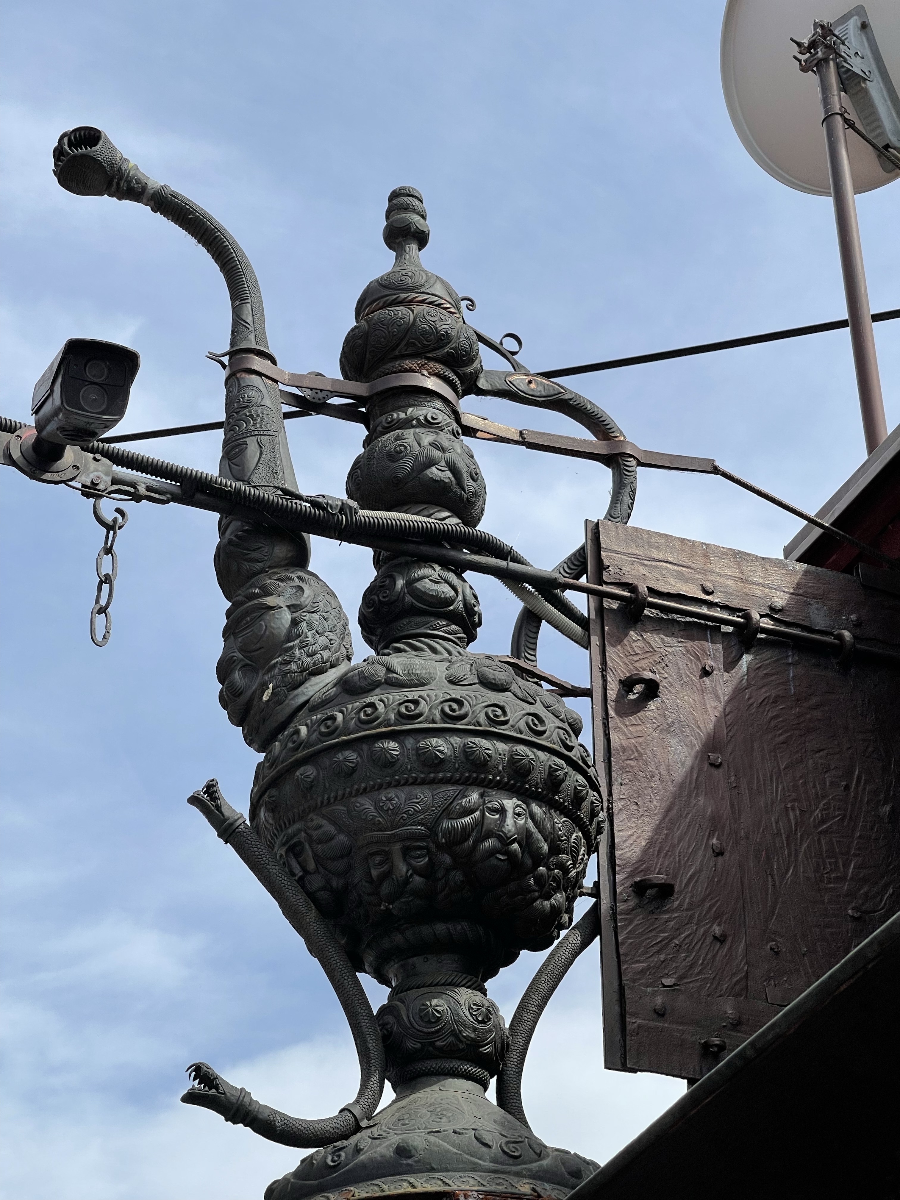
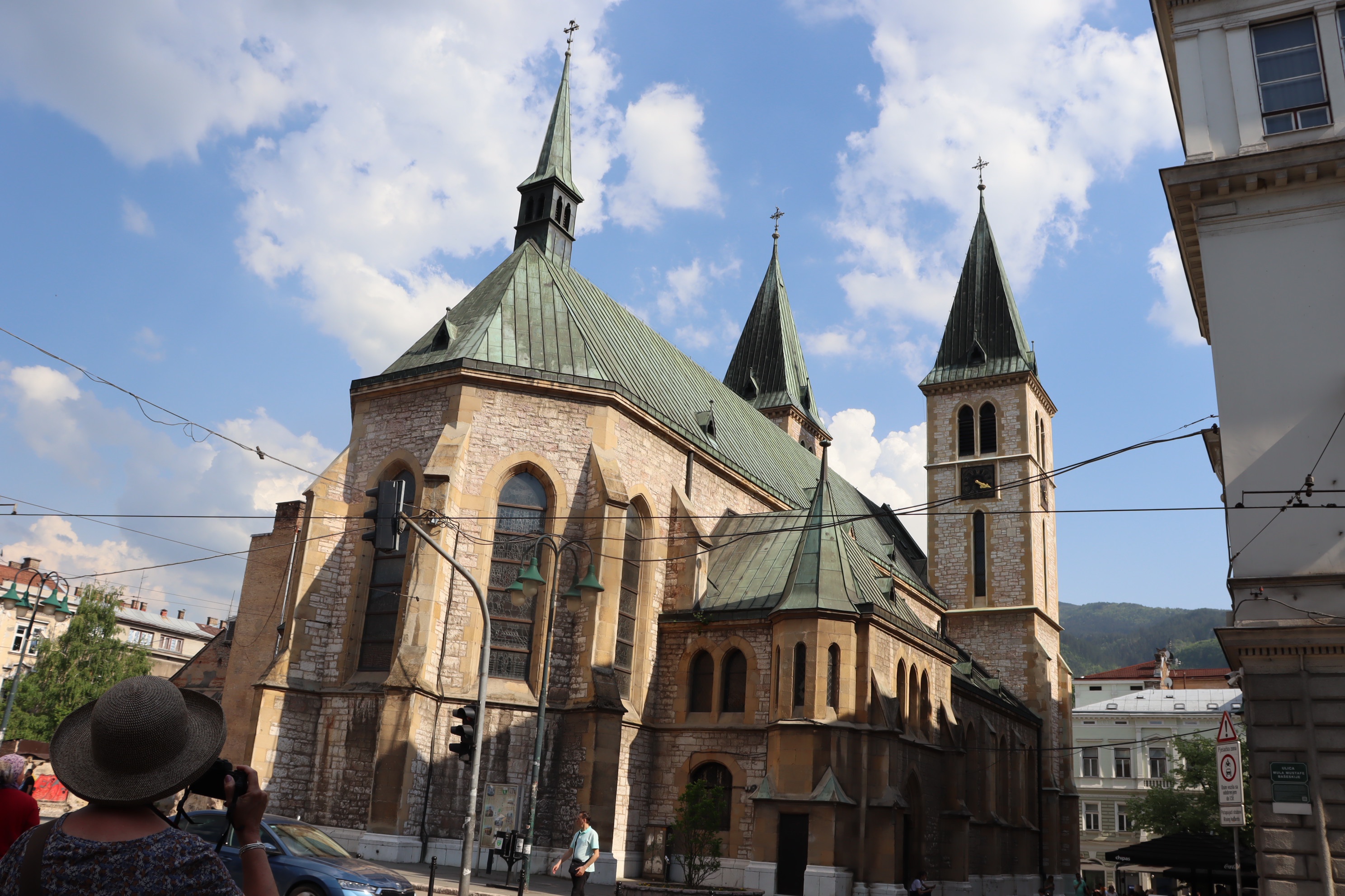
Arriving in Sarajevo we firstly followed a walking tour which took us to important sites. Again an old city that has a real mix of religious beliefs. As the city started there was one mosque for each 40 houses. There are still many to see although we did not go into any. We were taken down the street of the copper workers where we could see examples of coffee pots and other typical Bosnian tableware. We were able to see the City Hall which had been badly damaged during the war in the early 90’s but since repaired. We also visited the Roman Catholic Cathedral and the main Serbian Orthodox Church. Before the Second World War there was also a Jewish Community most of whom had fled originally from Spain and Portugal.
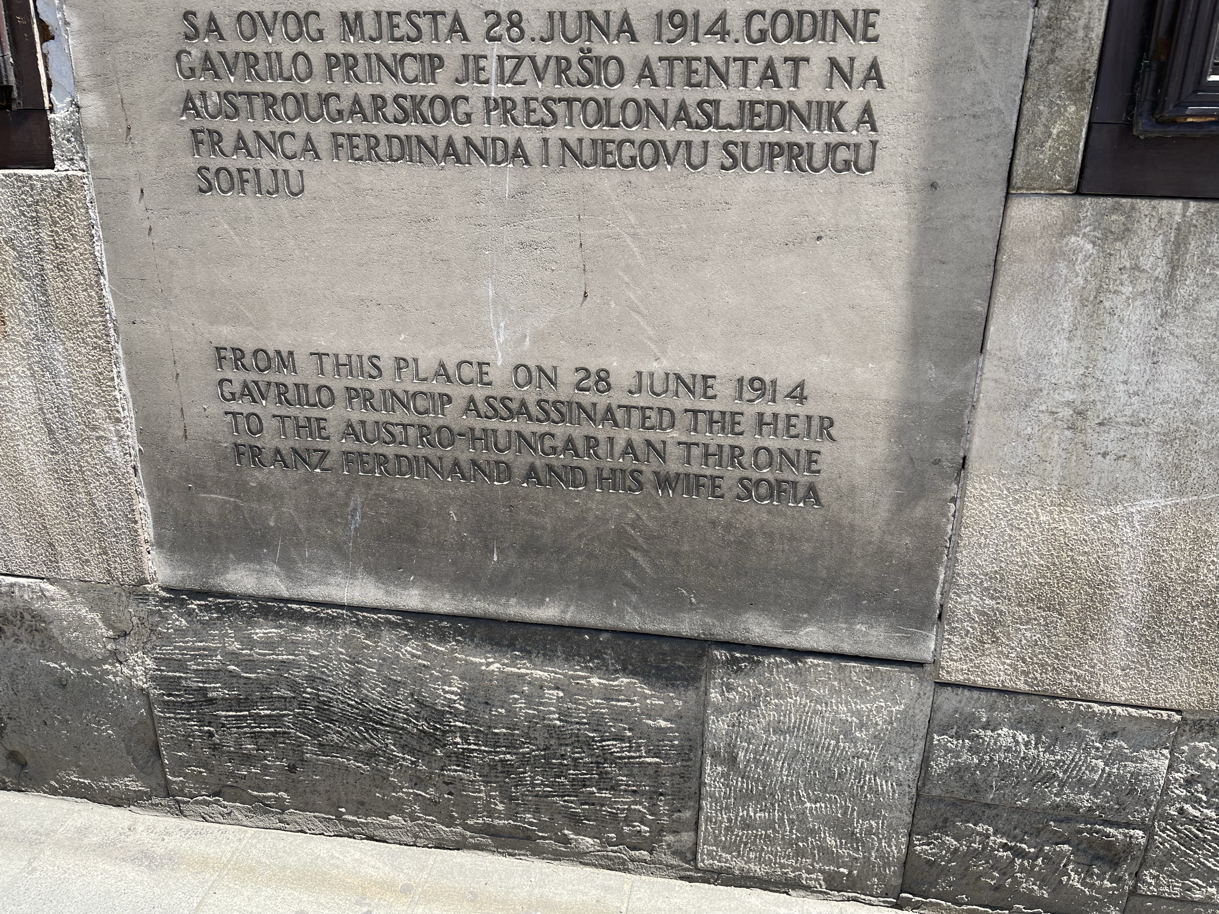
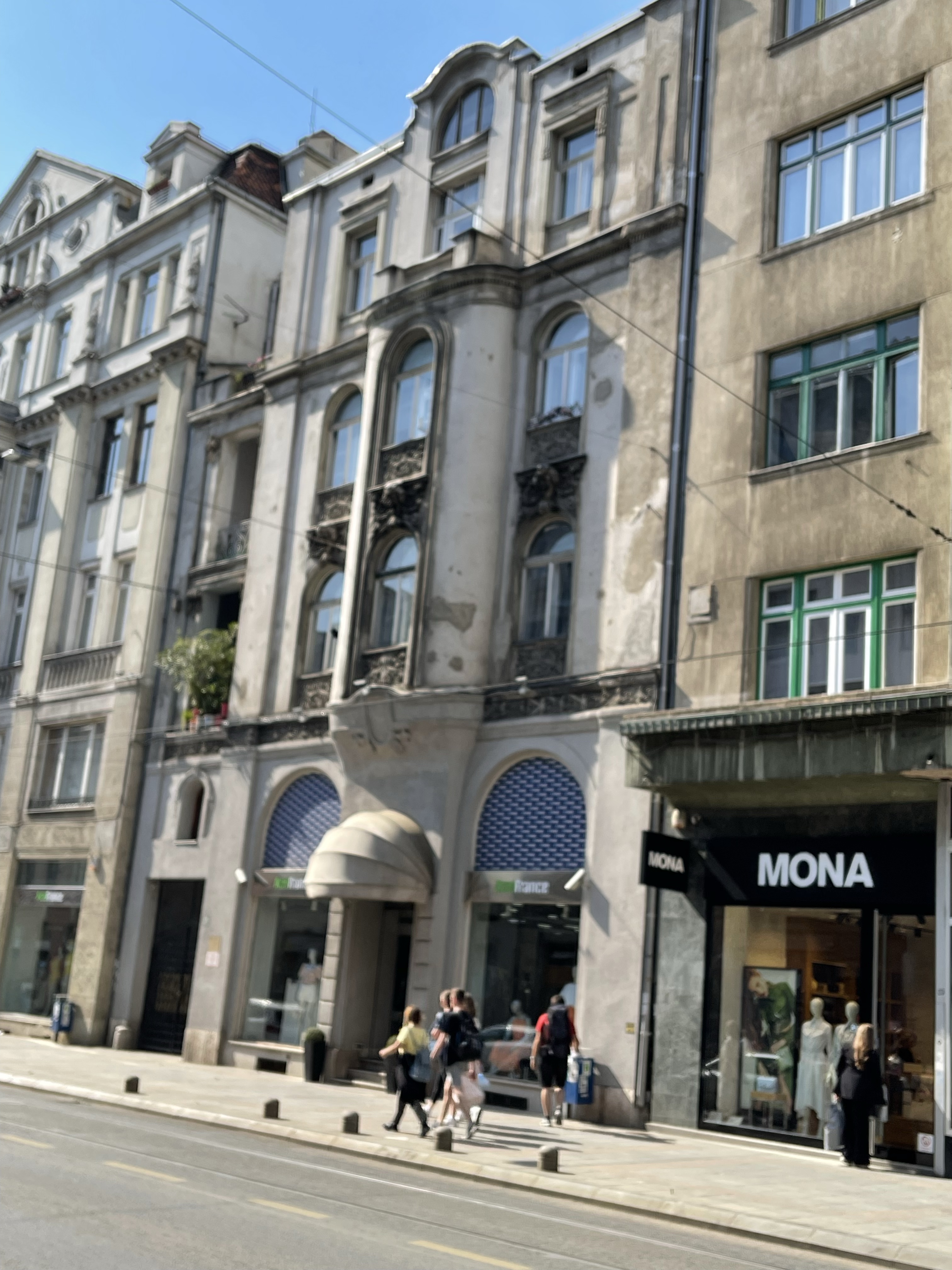
Another special site was the point next to the river where Arch Duke Ferdinand was shot in June 1914, prompting the start of the First World War. We also saw the divide between East and West – the influence of the Ottoman Empire in the oldest part of the city and then the Art Nouveau architecture influenced by the Austro Hungarian Empire. For all these countries an ever changing influence.
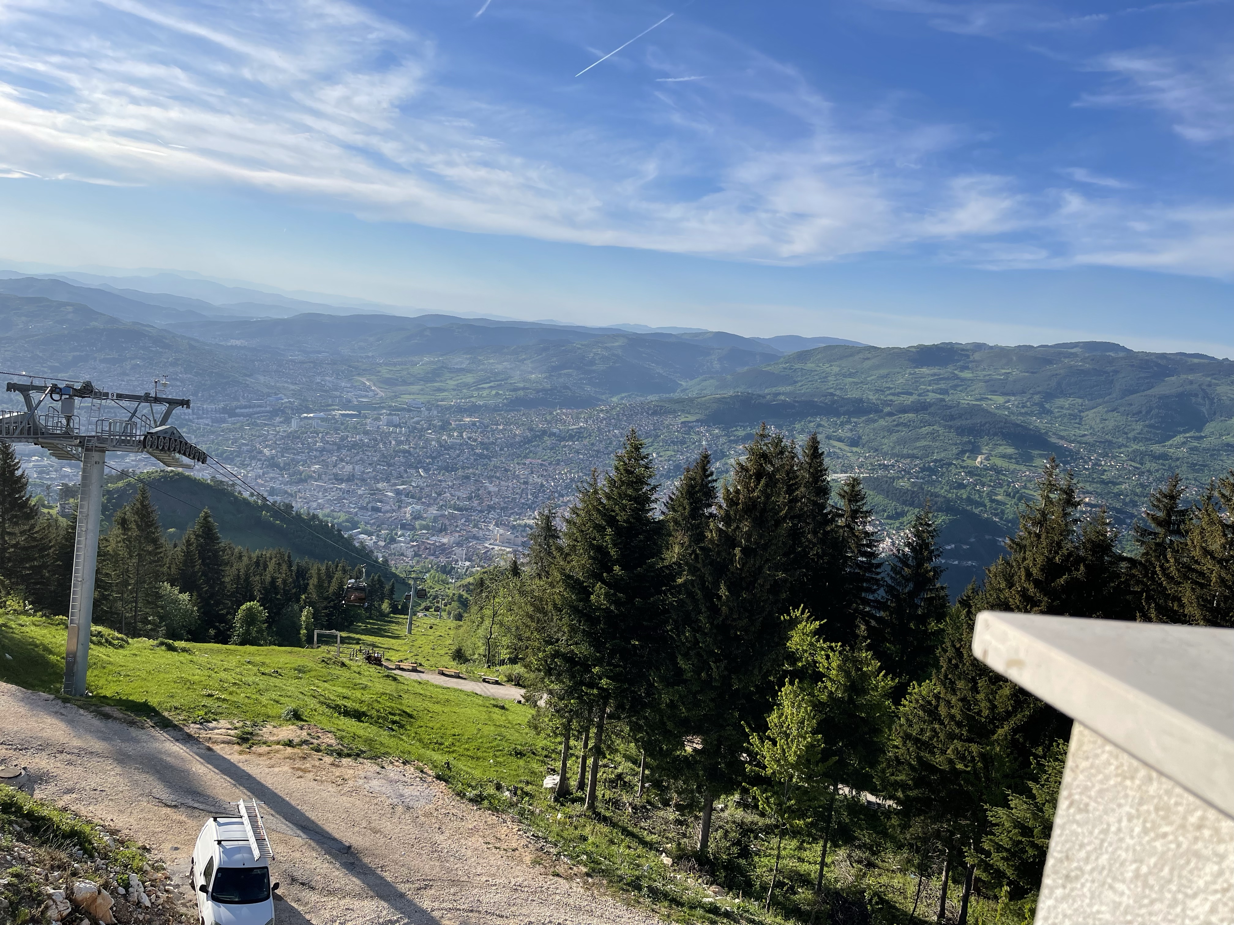
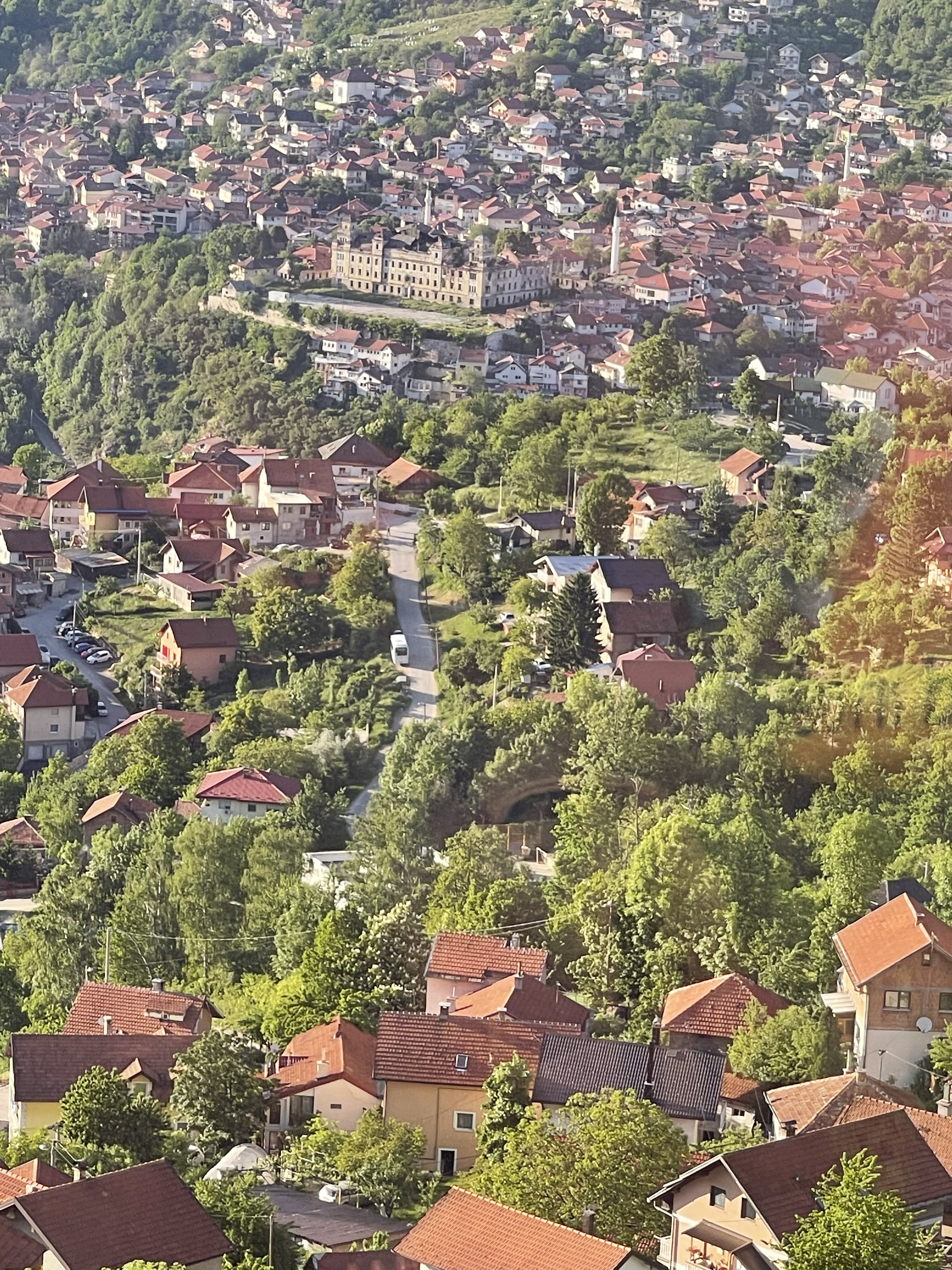
The tour finished about 16.30 and some were keen to set off back to the hotel. There was an arrangement to meet by the water fountain at 19.00 so myself and a fellow member of the group, Jackie, decided to go up on the cable car to the mountain which was used for the bob sleigh during the 1984 Winter Olympics. So we retraced our footsteps from the end of the tour and set off, we hoped in the right direction! A long ride up taking about 15 minutes, with ever revealing views over the city. We didn’t explore further than the terrace cafe, a cup of tea and a cookie! When we asked for tea we were presented with a basket of tea bags, of every flavour imaginable and we had to choose, took a while to find black tea! No milk in evidence! On the way down, quite a phenomenon – we could hear bird song through the gondola and crickets!
Meeting some of the others by the water fountain, we set of for a meal, we found somewhere who kindly rearranged tables out on the street for the eight of us present and we were well looked after. A steep climb up to the hotel to end our evening. Of the 9 km covered that day at least 7.5 must have been in Sarajevo.
So still in Sarajevo and again covered about 6km but a very varied day with many stop off points so definitely walking for a purpose rather than the purpose just being the walk!
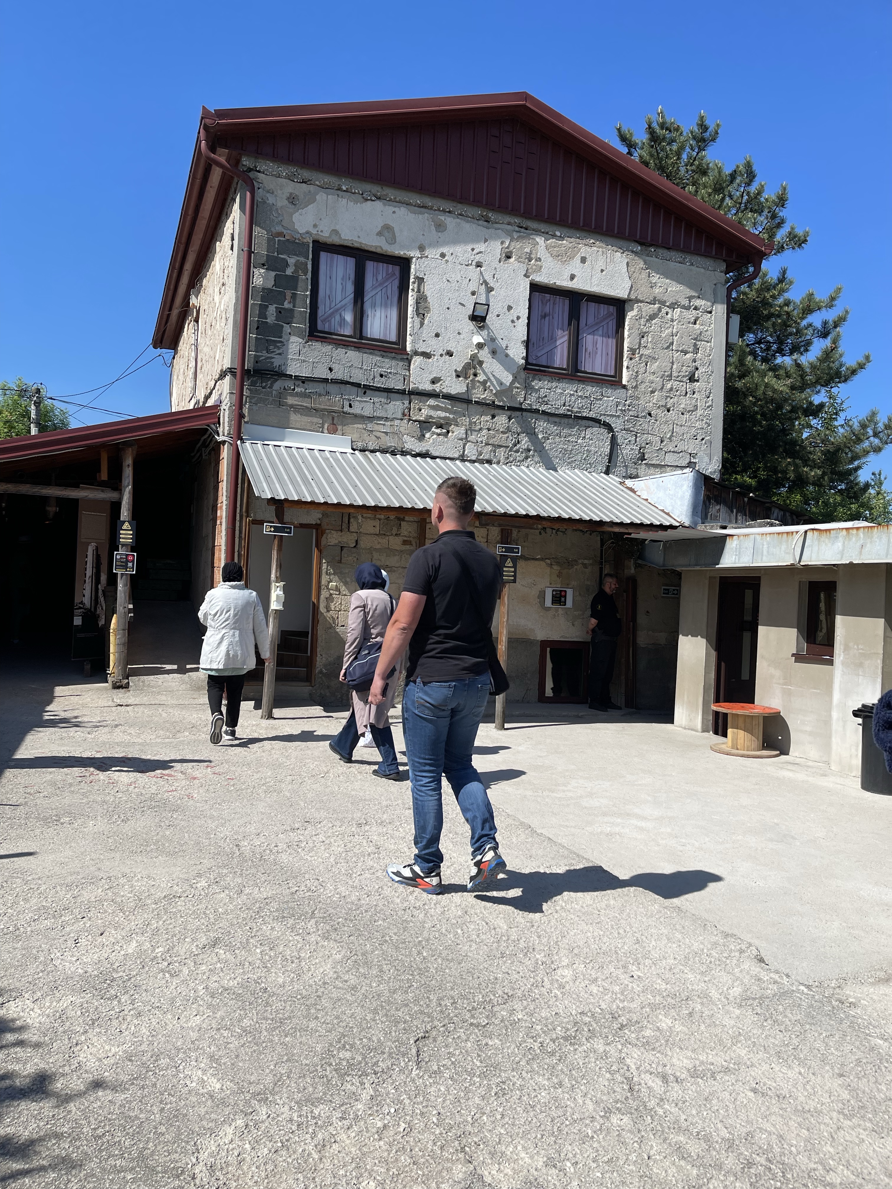
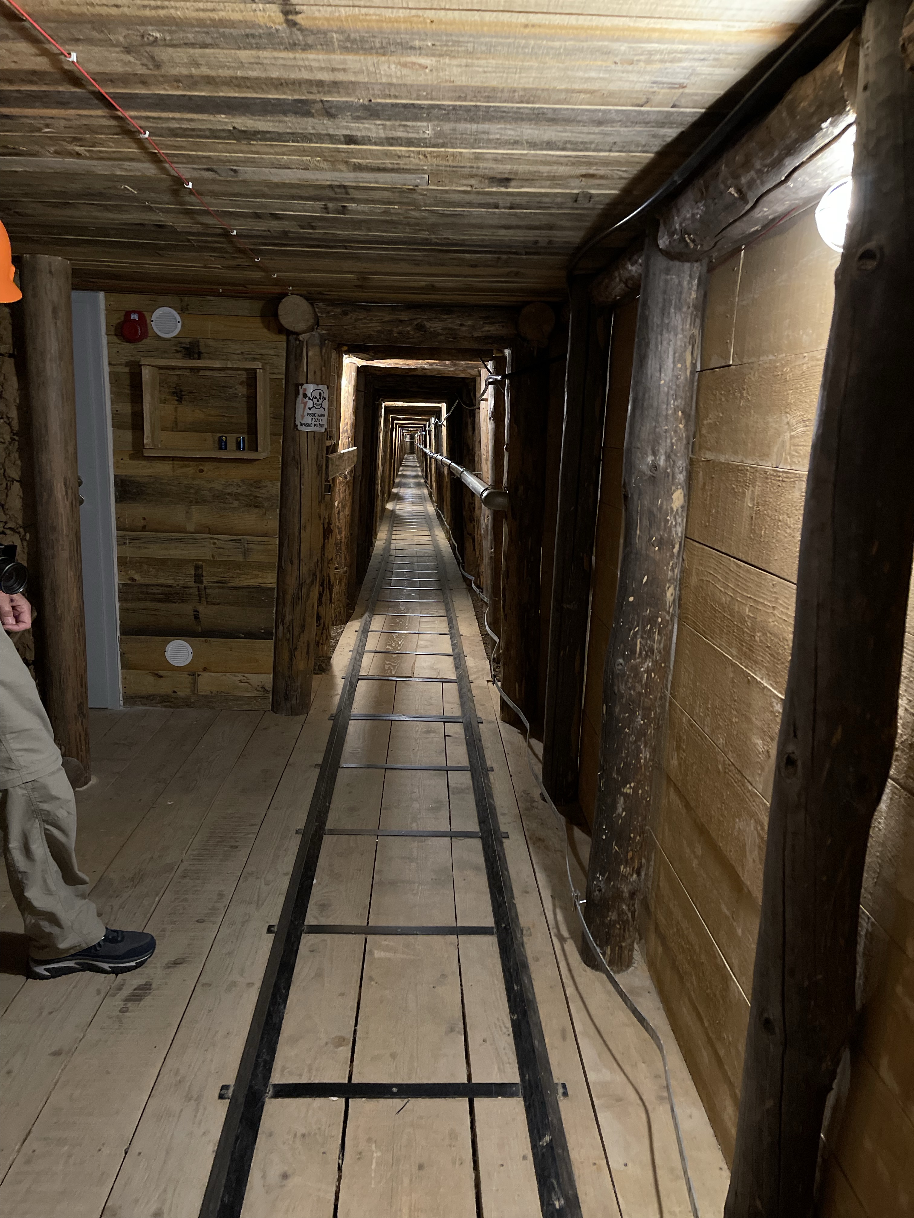
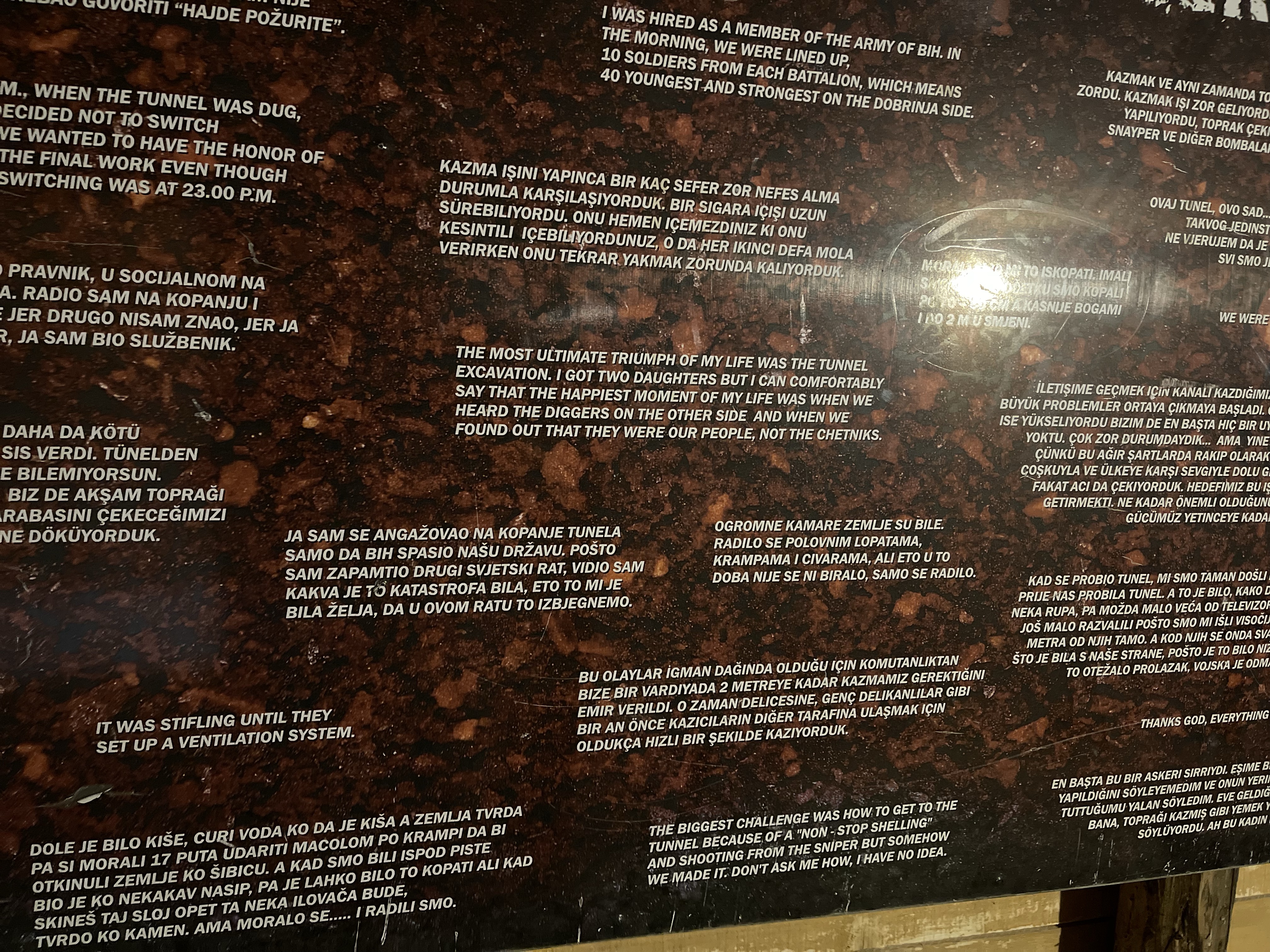
During the last Balkan War, Sarajevo was under siege for four years, often lacking in water, electricity and food supplies. Being surrounded by mountains it was in direct line of fire from missiles and snipers from the Serbian forces. They had no means of getting injured out of the city or supplies in – until they built a tunnel. This led from a house in the outskirts and ran under the airport runway to an area further outside the city. So our first stop was the section of the tunnel that has been maintained and the museum. In this part of the city you are very aware of billet holes and damage from shelling.
It is emphasised that this tunnel symbolises hope and life. Many people supported others they probably did not know and risked their lives due to a determination to continue to live.
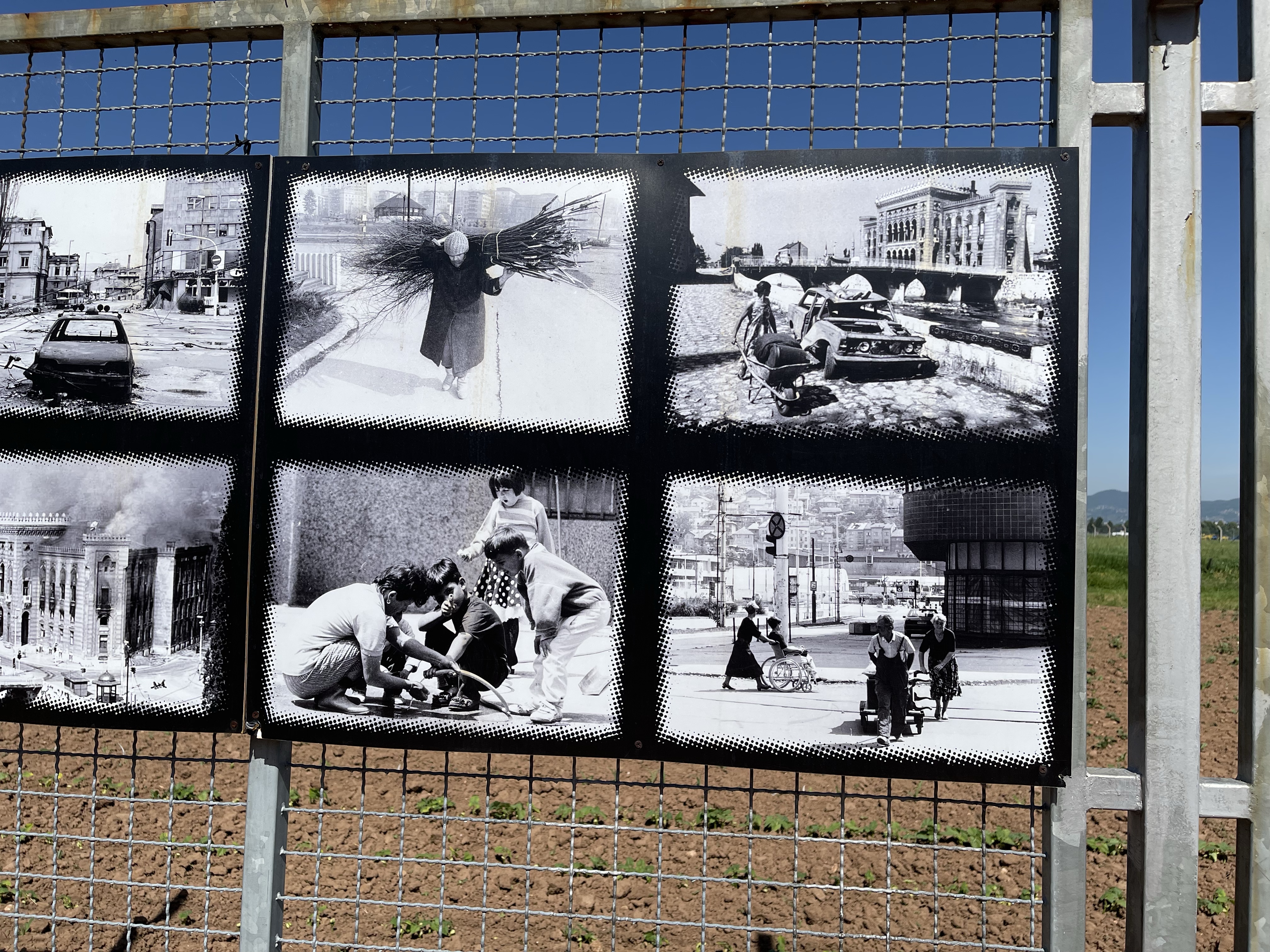
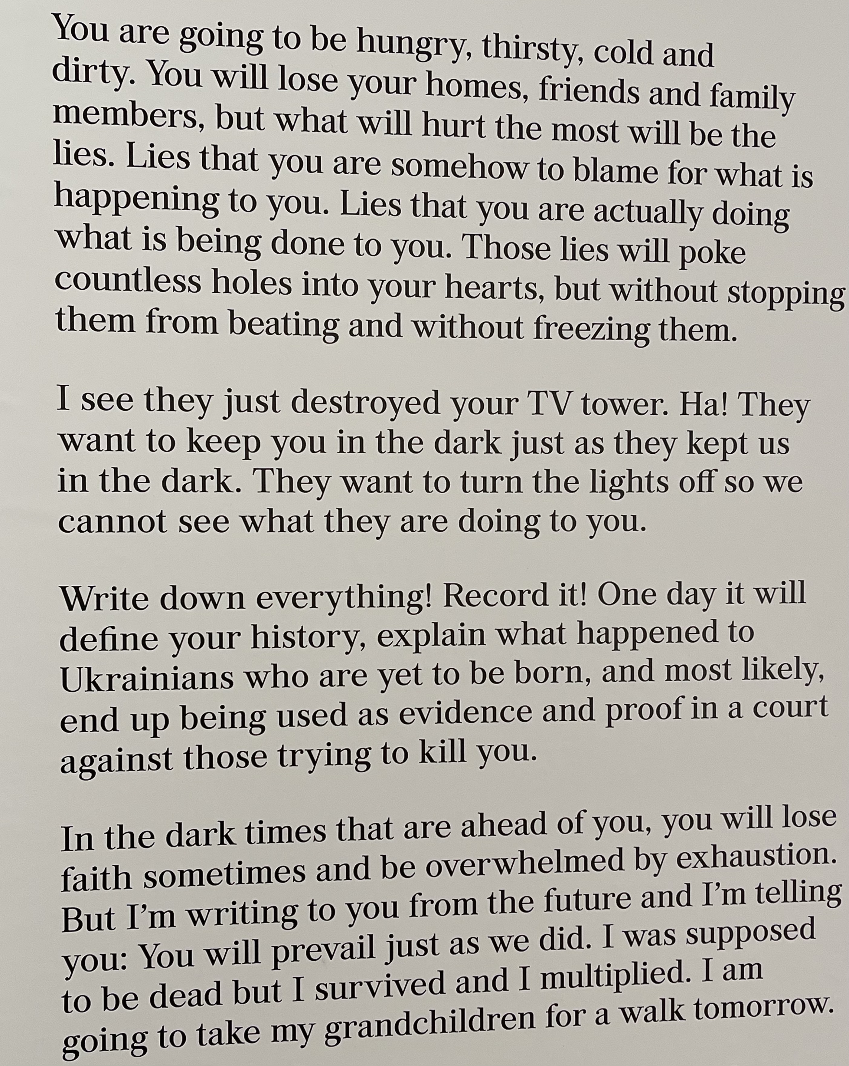
We returned towards the city in the Taxi and asked to be dropped at the National Museum. This gave us an insight into the more ancient city and the time when it was part of the Roman Empire – the area nearest the coast – now Croatia – was called Dalmatia, hence still referred to as the Dalmatian Coast. Some interesting objects and information plus a small botanic garden and a temporary exhibition of photographs from war areas. This included Northern Ireland, the Balkans, Cambodia and a postscript on Ukraine. This included the most moving letter written to the people of Ukraine.
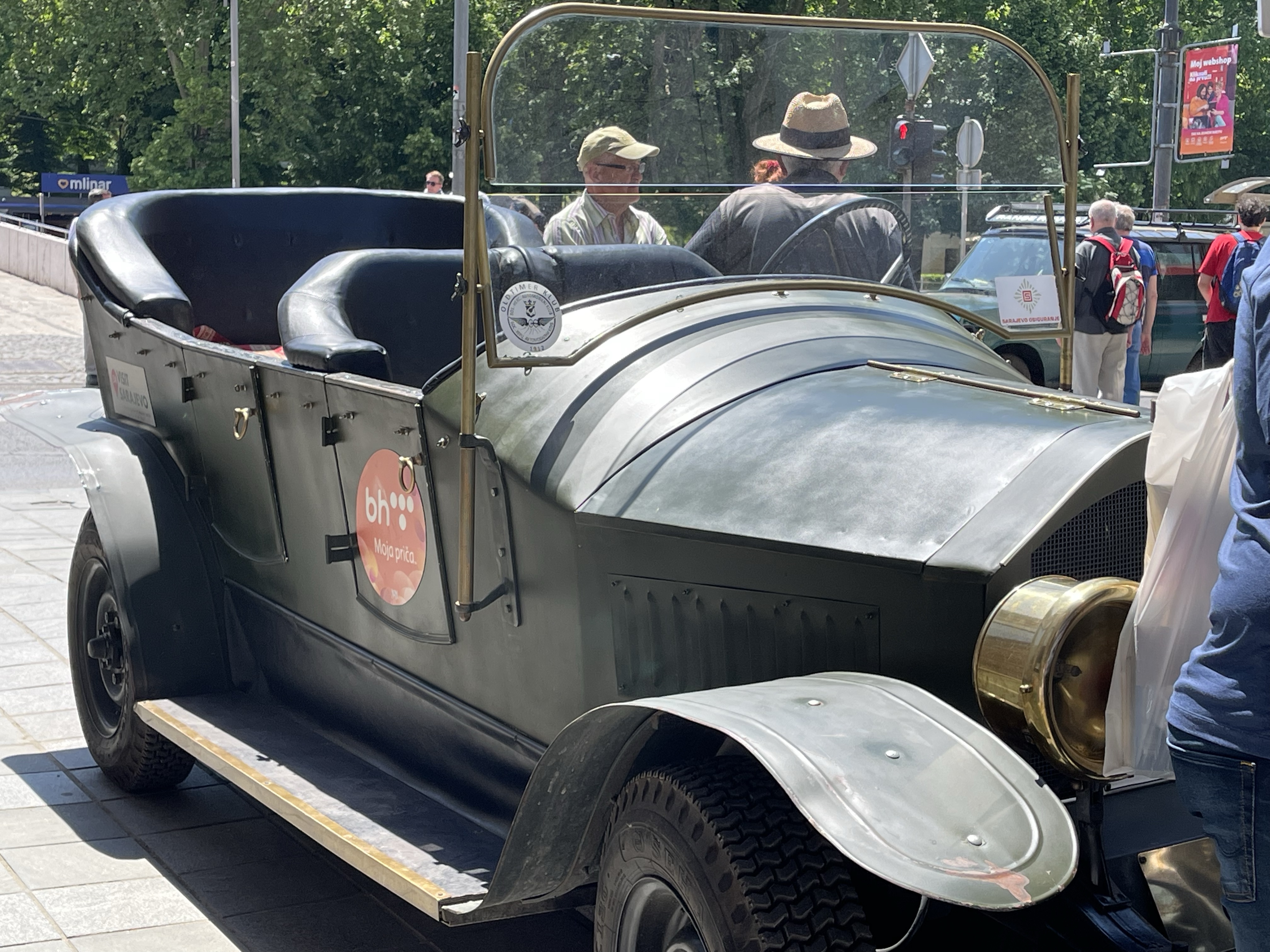
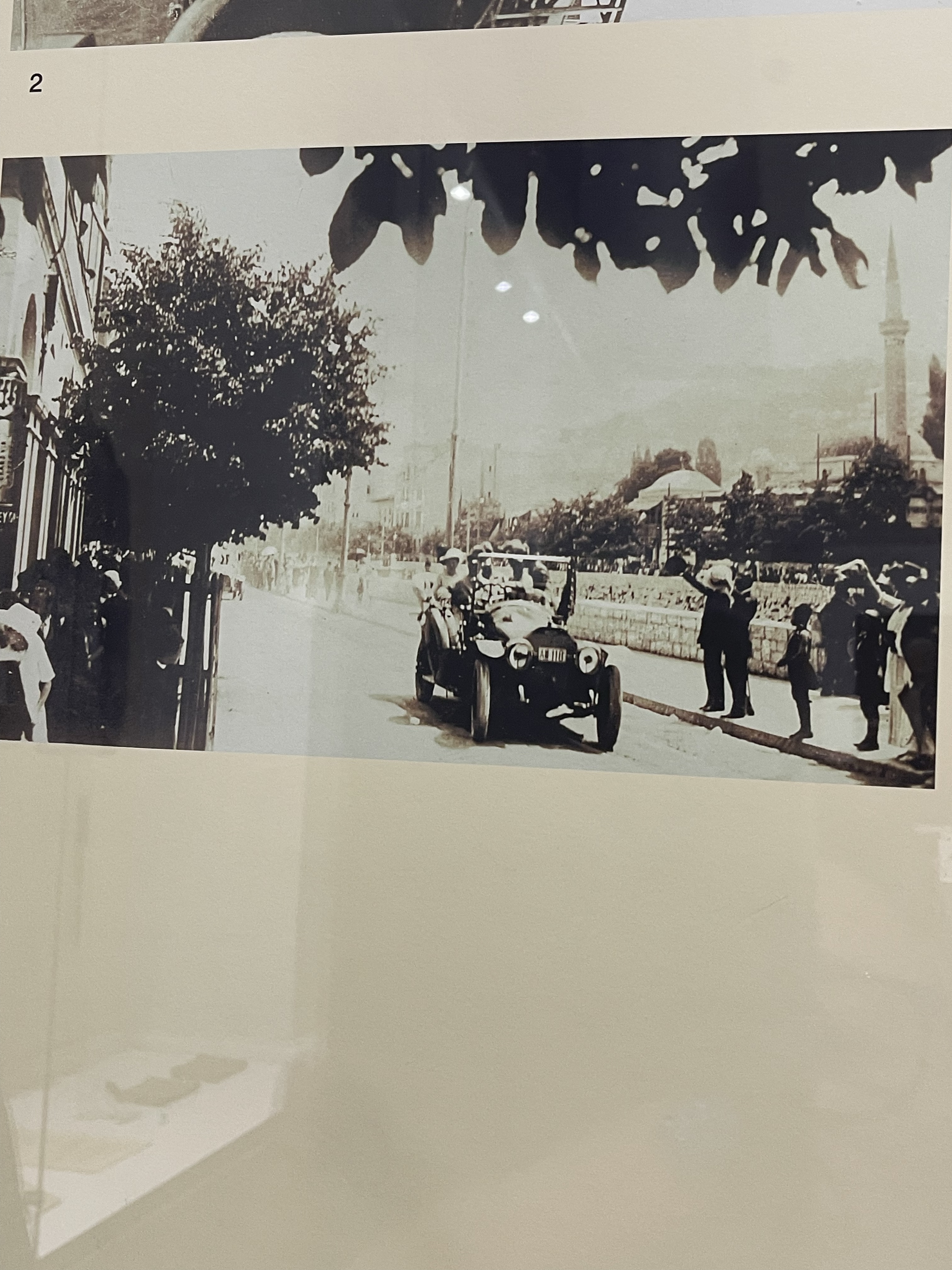
For the next part of the adventure, Jackie and I caught a tram towards the city, eventually sorting out how to pay for the experience and managed to get off, with the help of a local, almost next to the Arch Duke Franz Ferdinand Museum. A quite iconic story involving dissidents, a bomb/ grenade being thrown back out of the royal car by the Duke before carrying on to his meeting. He had hoped to visit his now injured translator in hospital but couldn’t make his Czech driver understand so returned on the pre planned route, where the assign lay in wait. Shots kill the Duke, his wife Sophia and their driver – two months later the first world war started.
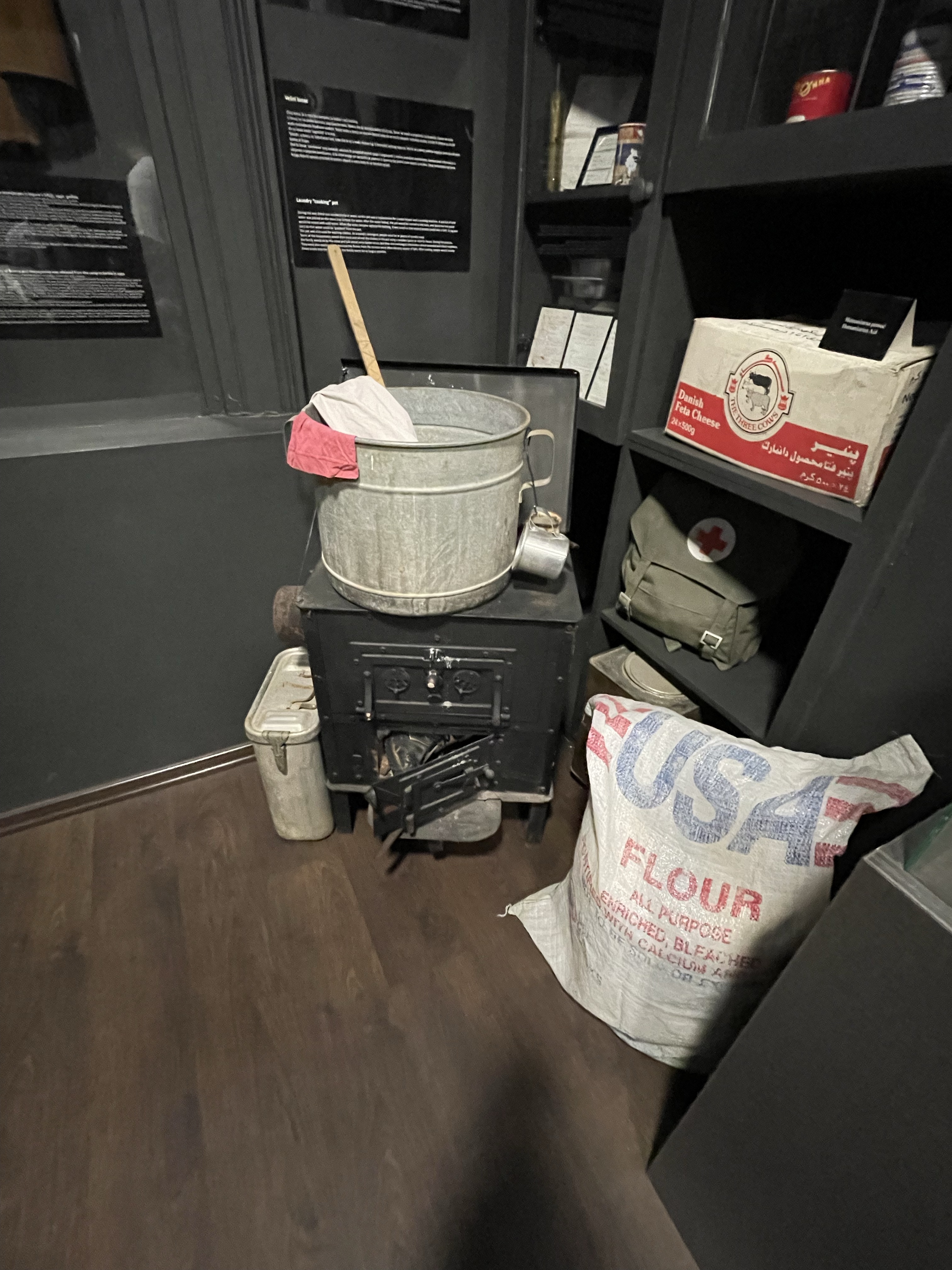
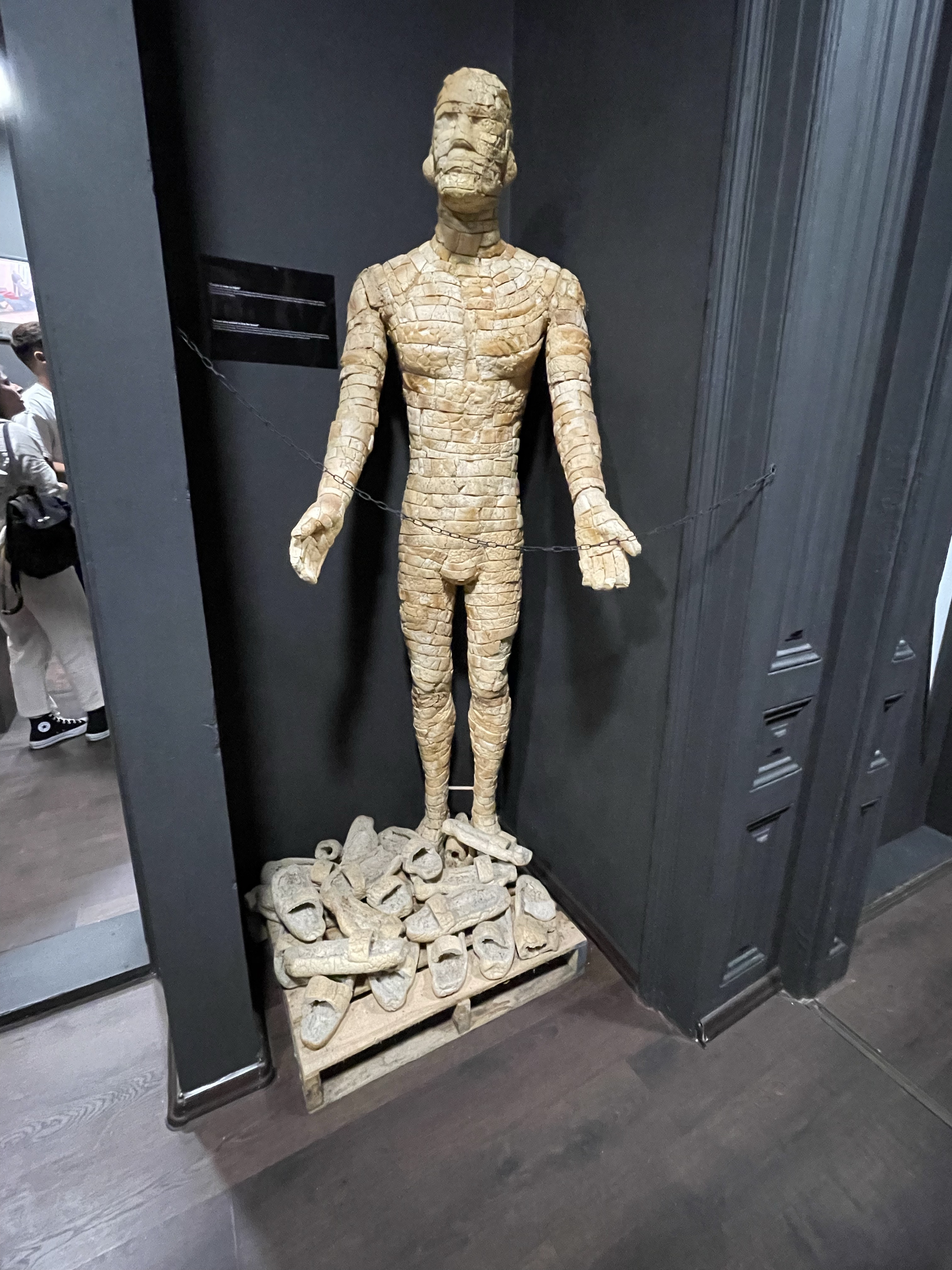
After a quick lunch we choose to walk to the ‘Museum of crimes Against Humanity & Genocide 1992 – 1995’.
A well put together exhibition, with many interesting stories and artefacts, a slightly gruelling experience but one that went just a little further in trying to piece together an understanding of the situation. The map showing the different religious preferences in each country was also helpful.
Improvisation was obviously very important at this time, even when food parcels were dropped. Food also features in this sculpture, made entirely of bread!
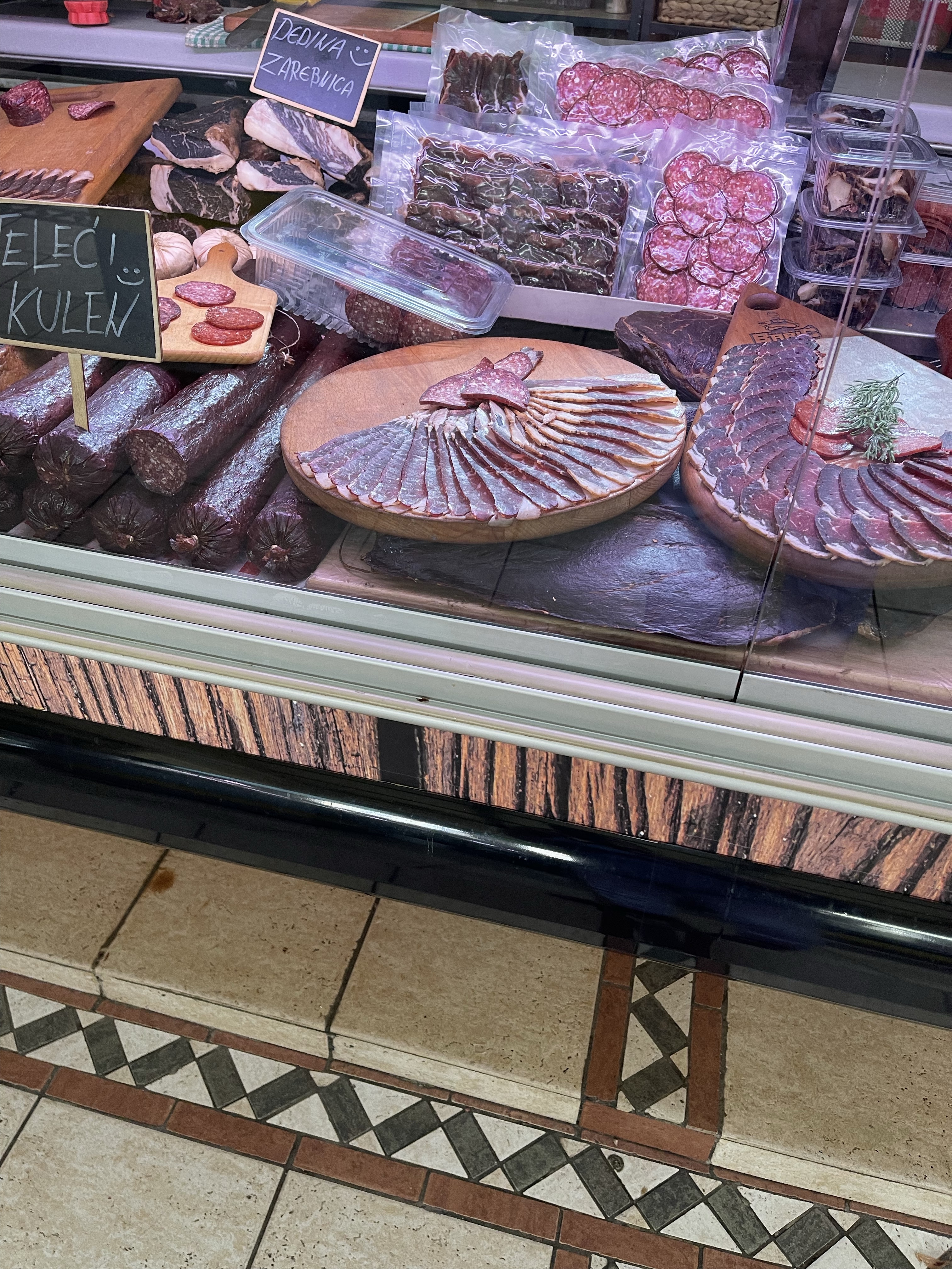
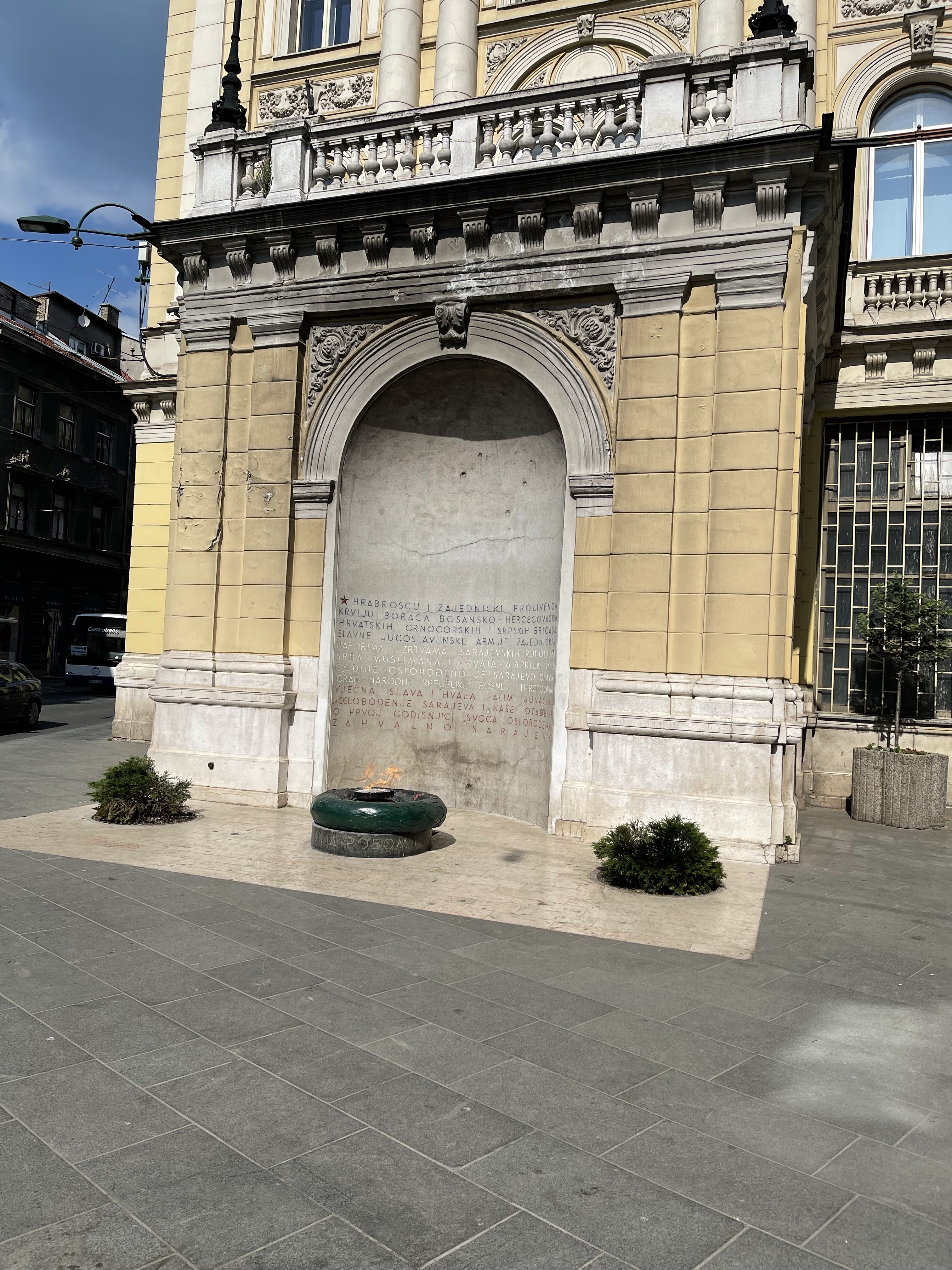
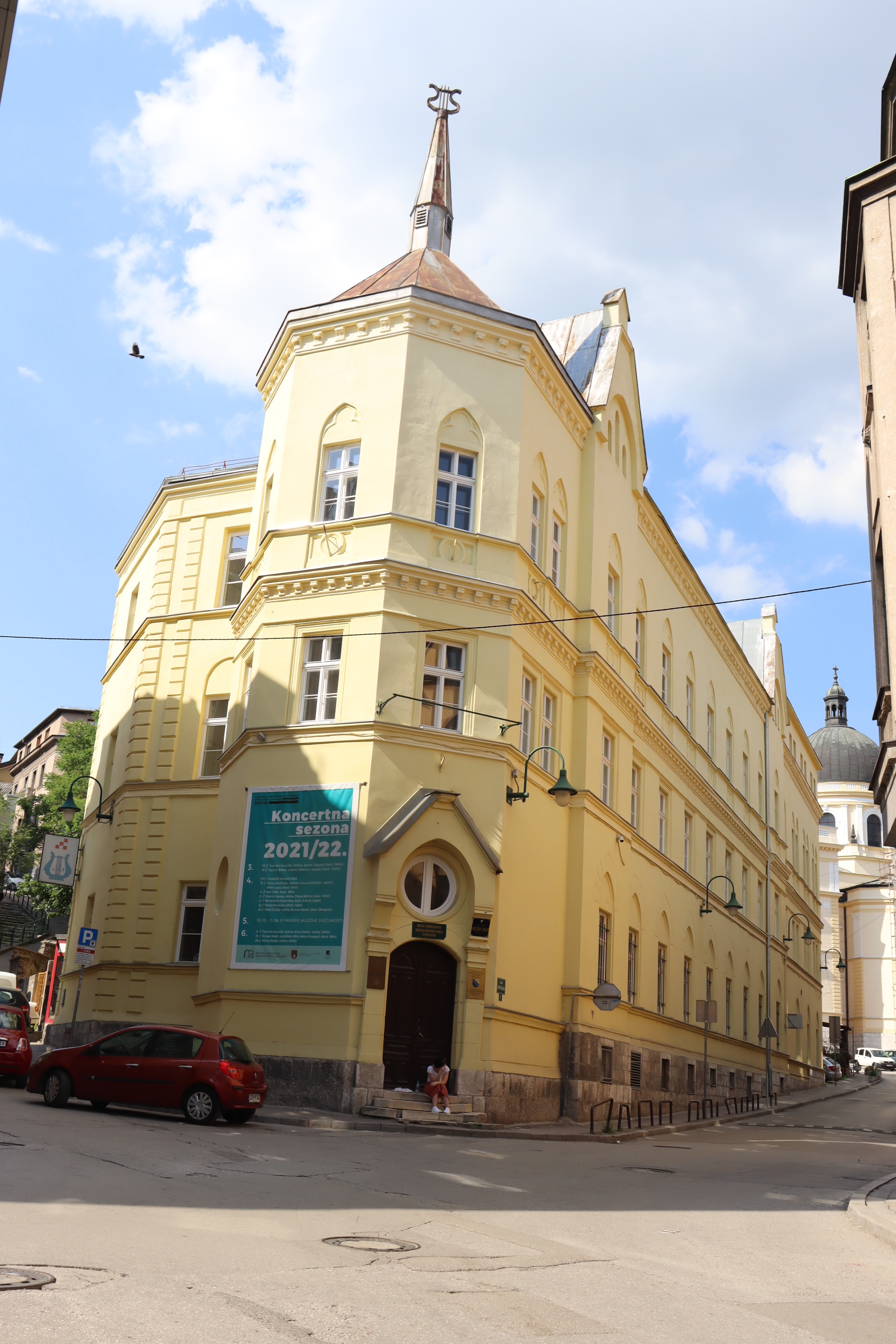
Now for some more restful ventures. Firstly the Catholic Cathedral and then into an area developed during the time of the Austro Hungarian Empire. Here as well as seeing some magnificent architecture, we also saw the Eternal Flame, the City Market and then the open air market. We spotted the concert hall and then walked passed the Bosniak Institute. Bosniaks is the name given to the Bosnian Muslims. Time for a drink!
Our next stop was the Serbian Orthodox Church. As we entered we could here chanting and singing -male. After a while the doors through to the altar opened and the priest emerged swinging an incense burner. There was something calming and mesmerising standing there observing the highly painted frescos that covered the ceiling and walls.
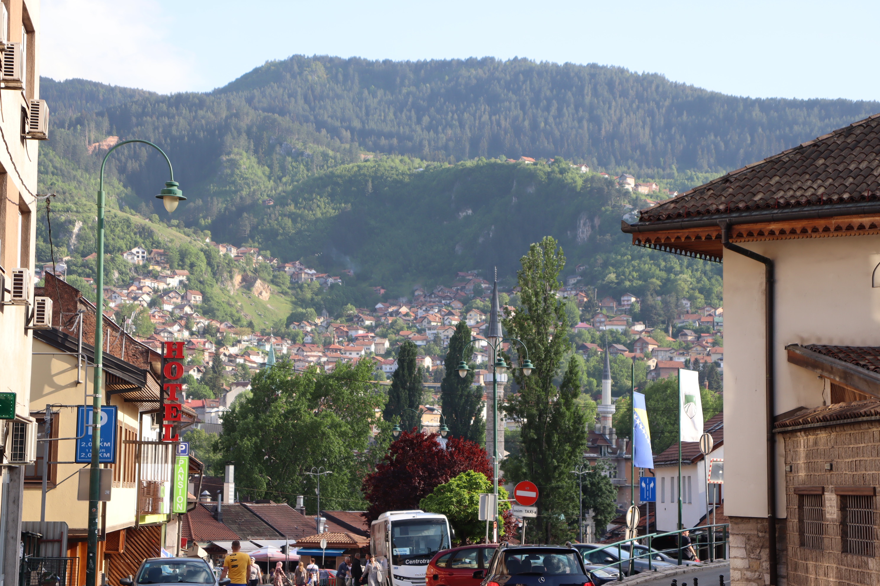
Time to walk back through the length of the old city – many of the streets are named after the craftsmen that worked in the area. We are looking for the copper ware street that we were taken to the day before. It proves harder to find than we initially thought – we did find the street of book binders on the way! After eventually finding the street amongst a maze of small lanes it was time to walk back passed the ‘Sebilj’, the correct name for the water fountain. Then back up the long hill to our hotel. The one advantage is that the view back to the city is good! Quite a full day but very worthwhile.
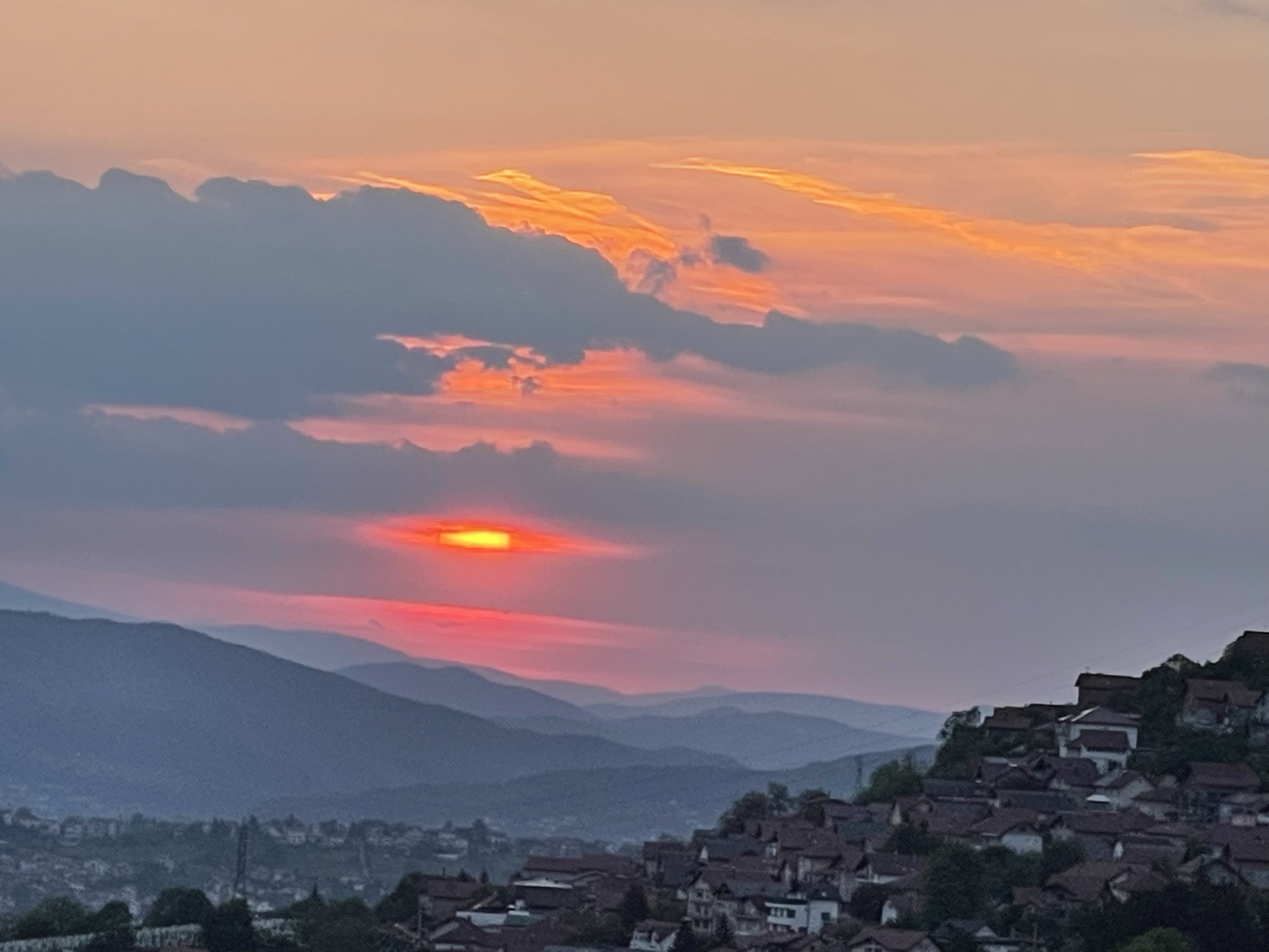
Oh, and a restaurant with a view over the city for our evening meal and a rather splendid sunset.
So today was a very mixed day which ended quite late with an actual walk. Before that we had visited a 13th century Orthodox monastery at Moraca and then driven alongside an extremely impressive gorge as we followed the Tara River. We stopped to look at the very impressive Djurdjevica Tara Bridge.
Having arrived at Zabljak which is in the mountains between the Tara and Piva canyons we drove to the edge of the Durmitor National Park in order to start our walk. We walked up through a thick forest towards the waters of Crno Jezero – Black Lake, this is one of many glacial lakes in the area, helping to feed the local rivers.
The edge of the lake is quite sandy and it becomes obvious that the water is quite low when we look to our left and see a weir which currently has no water running through it but can at other times serve as a useful overflow. Our path takes us right around the edge of the lake and then up onto a path at the edge of the wood. Although we are walking on an undulating woodland track we are very aware of rocky outcrops on our right.
On the far side we can see waterfalls coming down from the mountains and into the lake, we’ve already been told we can’t do the whole walk round the lake which is a bit disappointing. The walk is pleasant and we continue on, a couple of people have already turned back and then we see a couple of anxious walkers which ask if we have seen the owner of a lost dog? Somebody thought they had and explained where, so we carried on and came across a gathering based around a dog – looking like a husky, stuck up on a crag, clearly unable to get down. Various people were trying to help. After a while we decided we couldn’t really help further so carried on. I should say our group had an old golden Labrador that had adopted us beside the lake.
Two more of the group were lost at the dog incident so fewer of us continued. The going was getting a little more tricky with rocks as well as tree roots. Michael our leader suggested we go back but some of us persuaded him that we should continue round until we came to the first waterfall – there were more than the two we could see- as the lake curved around to the right and formed the ‘small lake’.
Not everyone went on but we continued until we did reach the first place where a waterfall ran across the path, formed from melt waters. Then sadly we did have to turn back round.
The light was wonderful over the lake and it was a bit disappointing not to have been able to go further. It would have been good to have been able to start going round the other way but unfortunately we had started later than expected.
We were really pleased to find the dog, it’s rescuers and the owners as we got back to the start of the lakeside path. The dog had gone of for an adventure in the morning and had been lost since 10 am! Not a husky, something much more complicated but white and fluffy and very relieved to be back with his owner!
We did take a slightly higher path towards the end of the lake and were able to observe a sculpture which hadn’t been as well defined from the other direction. On our left was a ‘Go Ape’ like course which we hadn’t noticed before.
So back down the track to the car park. The dog that had followed our group all the way spotted somebody going towards the lake on a bicycle, and changed allegiances! Not a very long walk at 5.66 km but my only option! And very enjoyable.
Two distinct parts to my walking today but I’m going to put them together. The first part was in Budva, a town the other side of the mountains to Kotor and very much thought of as part of the Montenegrin Riviera with some of the best beaches on the Adriatic coast.
This was an old town nestled next to the new, still being built town. The first part to explore was the citadel which looked over the sea and was part of the fortifications against Turkish invasion.
The citadel exhibited models of old ships and had an extensive library as well as some impressive views and flowers.
A walk around the city walls enabled views down into gardens and over houses as well as out to sea. The lookout post were a significant design and you could imagine guards diligently observing from these.
Budva plike many old towns had narrow streets with tall buildings many of which were palatial. Significant squares such as Poet’s square and the churches, one Catholic and one Orthodox had a mosaic and frescoes accordingly.
Next to walk around the headland to a Sandy beach and dip my feet into the Adriatic Sea, unfortunately I’m not really a swimmer. Rather beautiful statue on the way and a look back at the mainland. The rock strata at this point is also rather dramatic.
After burning the bottoms of my feet on very hot sand we returned to the town to lunch- this part of my day’s walk was 3.6 km – and so back to the coach for our next stop on the edge of the Skadar Lake in Virpazar. This lake stretches into Albania and also forms part of a Nature reserve . Unfortunately we had all declined a boat trip probably as it was offered just after we had already been on one and we were both hot and tired!
There was also suppose to be walking but we were not actually offered any routes. Talking to locals we discovered there was a castle and a monastery close by, so two of us decided to take a walk. It was along a tarmac road but was better than sitting in a cafe for too many hours! The castle had good historic information including eight different types of wind that blow across the lake and that there were springs, thought at one time to be eyes in the lake. The castle was also being used as a wine museum and event rooms.
Having come back down from the castle we continued along the road and then say a turning to the Right which indicated historic buildings. We walked quite a distance along this road but still nothing. Having set a goal of some buildings on a far corner. No luck! No monastery and the side track that went to the village below which we thought could be an alternative return room was not to be as we were chased off by two dogs. Oh well – so we had to return the same!
Some excellent flowers and views over the lake as well as walking 5km and seeing a tortoise beginning to make it’s way across the road.
Having returned back to the village we noticed the war memorial which is quite impressive.
This is not a walking holiday so completing at least some walks is a bit of an endeavour!
Back to Kotor today so the same walk down the promenade towards the end of the fiord before diverting off by the park, for the old town. A different entrance today and the whole group going together. We are going to start by climbing part the way up the old town wall.
The fortifications have been in place for a long time, this city has been occupied by the Venetians, invaded by the Turkish and has a rich religious heritage of both Roman Catholic and Orthodox. Outside the city wall by the entrance we are taking are outside swimming areas, from the past, adjacent to the river.
There are many steep streets and we quickly go to the start of the climb up to the section of the wall that goes up the side of the mountain. We start climbing up and at each view point more and more of the town is visible.
We are heading for a church which forms part of the wall and some of us climb up past it. I’m tempted to go up to the top of the wall but somehow don’t allow myself to do that, convincing myself the climb back down will be difficult – which it didn’t turn out to be! Felt a bit cross with myself !
They were great views and an abundance of different wild flowers. One member of the group did continue. Now to come down and explore the old city. A maritime museum and the cathedral were on my list, as well as just exploring the various streets. Rather bizarrely I never found the square where I had had a beer the day before!! I did find some excellent pizza!
Round every corner you can look up and the mountains soar above you. Some of the buildings are really large and would have been palaces when built. Many have stone verandas, mostly above the main door and like so many old towns there are cats in abundance.
In all I had walked over 5.6km before we caught a boat to visit an island in the middle of the fiord and then another village, so more walking round, a very hot day but a rather special place.
So after a night staying in Bloc hotel in Gatwick airport I arrived at Dubrovnik airport and was met by my taxi pick up. Slightly surprised to see that I was the only one on the tour from that flight.
We started our journey which straight away took us into the mountains and I was immediately struck by the number of cypress trees. It wasn’t long before we reached the border so having just had my passport stamped in Croatia I had to be stamped out and stamped into Montenegro.
The road continued round the edge of a series of mountains, always with the sea below and it was frustrating not to be able to take any photos. We are driving along the side of a fiord. We arrive at Dobrota and I meet the guide and find my room. Others are arriving at various times during the day and it’s unclear if we are meeting that evening or not.
After a short sleep I decide to go out for a walk but am stalled by the most torrential rain, thunder and lightning- which does eventually stop. I keep checking from my balcony. Michael our guide has suggested I might wish to go down to the water and stroll either way.
Having recommended the bakery up the road to my left I try that for a snack and then cut back down to the water. Mountains behind and mountains in front and to the side. I am heading towards the head of the fiord.
The road has a cycle track but not a footpath but luckily isn’t very busy and soon turns into a promenade which is heading towards Kotor, the main town. I pass cafes and restaurants and come across a park which I’m not allowed to enter as it is preparing for a triathlon event the next day.
I continue along to the head of this bay where there is a port but also being aware of parts of the old city walls going up the side of the mountain and of a fortified wall very close to the port. I decide to cross and see! Through an arch and I was in a different world – the old town.
I decided not to explore this too much as it was my next mornings excursion but just try and take a route parallel to the main road and re-emerge at the next gate- having had a small beer in a beautiful little square!
I continued my walk by returning by the water passed the passageway to my hotel and explore in the other direction. An impressive church on a corner and some smart looking houses, villas and a few restaurants. I was aware of the time and that there was now an agreement to meet at 7pm, so back to the hotel.
My exploratory stroll turned into 7km so worthy of note. We did walk almost back to Kotor in the evening to find a restaurant so my total for the day was much more.
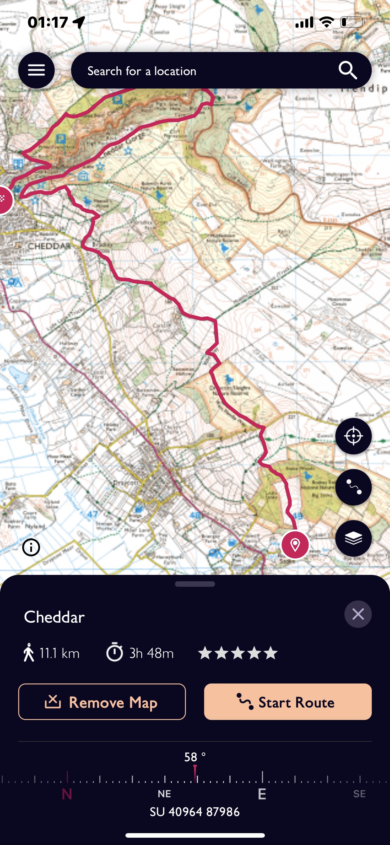
Back with SPR again today but with me leading the walk, advertised as Cheddar. I had offered to do this as I had walked around the top of the gorge several times with groups of children. Whilst preparing I realised that the route was little more than 5km so not really far enough. Steve had said that the route was entirely up to me but suggested he had walked around the reservoir when he wanted to extend it. That didn’t appeal so I started exploring possibilities of starting south of Cheddar and using part of the West Mendip Way.
There were several ways we could approach this but I decided not to make my final decision until I was certain who I would be leading. It turned out to be Boo and Jenny and they are both good walkers.
Having arrived at Cheddar I asked Jane to drive right up through the gorge and back to give us a better understanding of where we would be later. We then headed down towards Wells and pulled off the main road at Rodney Stoke. We went up a side road a short distance and Jane was able to drop us exactly where I had planned to start the walk. Jane headed back for the car park in Cheddar and we went straight up hill into a beautiful grassy meadow enclosed on three sides by woodland and a chorus of bird song. To our right the woods form part of an International Nature Reserve. The white flowers of hawthorn trees stand our against the intense bright greens of the deciduous trees.
As we cut through the wood at the top of the field we are met with a slight aroma and then an abundance of wild garlic, creating a carpet under the trees.
Over the brow of the hill and across an open stretch and we can see the hillside dip down sharply in front of us, there is a road hidden from our view. The West Mendip Way joins us from the right and we cross the road and up into another nature reserve ‘Draycott Sleights’. We are following a stony track which has impressive trees along one side, almost like the entrance to a big house but we can’t see any evidence of one. A quick snack too as we rise up another hill and then the path begins to have a more downward slope.
I spot an orchid on the track and then we realise we are in a field of them. Pyramidal orchids but two different colours.
There are good views across to the reservoir and just down below – a beautiful English rural scene.
The path continues along the escarpment, sometimes up and more often down. It will takes us all the way towards Cheddar where we will part company from it as we make our bid to go up on to the southerly spur above the gorge. From a distance we can see a heavily wooded area which must be hiding our path. In the end not too difficult to spot and we climb the path up through the wood – popping out by the lookout tower, just before Jacob’s Ladder. This is my usual way on to the top but it is now only accessible as part of the cave visiting package. Lunch calls and we sit on a grassy slope by the path.
A bit further a long I point out some good viewing points, much less nerve racking than taking two children at a time to look! We can look out and see the reservoir again and then over to the other side of the gorge.
I had forgotten quite how rocky it was on this side and much more up than I recall – perhaps making sure that 30 + children are okay takes your mind off of the uphill. We walk past the spot where we often sat and had a biscuit, wrote a poem and had a drink – no need today, and then we start the descent for real to meet the road at the top of the gorge. we are treated to a display of bluebells in the wood, they still look fresher than some.
They have done quite a lot of woodland maintenance and I had forgotten how long the section is before the diagonal path descends to the road. Jenny is striding on using two sticks, she skies and finds the action quite natural. I give in and get one of mine out. I’m concerned that she doesn’t go straight on at the last point as it is very steep but fortunately a combination of my calling out to her and logs across the path averts that situation. A quick drink at the road side we have a short section to walk before our path goes steeply up to the right – not quite the last up!
The path goes up and then turns at almost a right angle and we are met with steps – now these can be helpful or rather a nuisance depending on the height of the steps and the length of your stride. Writing that reminds me that earlier in the day after our snack we had played around with double paces to a hundred metres, twice in fact because Boo forgot to actual count the first time!!
After a couple of lots of steps we are on a flatter section for a while and it is possible to see back over to the side we first walked on. Both agreed that driving up first helped give some perspective to what they were seeing.
A bit of a lull and a grassy meadow before the harsh reality of a steep climb back down through a wooded area with stones and tree roots a plenty. Paths created and destroyed by water running down hill over time. The path comes out amidst an array of tea shops and deli stores. I’ve rung Jane and she meets us just before Boo and Jenny declare an interest in the Cider shop. We did all try and they did purchase and so it was on to the ‘only Cheddar made in Cheddar Cheese shop – where I indulged as well. From there it was back to the car park and then finding out way home – much harder navigation!
We all enjoyed our day, we’re all tired, which is how you should feel after a decent days walking and it was a great place to lead my first walk where I created the route a little further from home. Still only 11km but the ascent and descent more than made up for that!
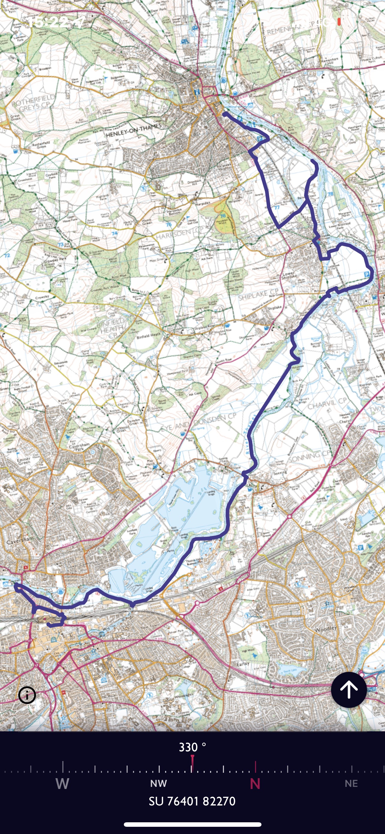
Another stretch of the Thames today, it could take quite a long time to reach 187 miles! Having finished at Caversham Bridge, Reading on my last stretch, I was back to Reading station and down to the river. A different way out of the station so a little confusing at first but I soon found some landmarks from my last visit! There are a proliferation of swans at the start of my walk!
One advantage of doing the Thames Path is that the navigation is very straight forward! I notice a ‘boat’ moored on the far side of the river – rather looking as if it had seen better days. Definitely a candidate for the ‘In need of’ series of paintings! Many of the house boats have adopted bits of land beside the river and there are many different things stowed along the way. One enterprising person obviously created from old pallets!
The water cuts in and there is a large bridge to cross with an extended route up and down. Steps and a slope for cycles of which there are plenty this morning , along with dog walkers.
I’m aware of large lakes which form a body of water alongside the Thames and I’m slightly surprised that I can’t see them from my side. Maps can’t tell you how high hedges are!
Along the way I see signs of late spring, not only in the form of flowers but also the next generation. I’ve always loved the interplay between trees and water and the way the roots spread out but also cling to the bank.
As I approach Sonning I’m aware of the Blue Coat School behind fences to my right and there is work happening to improve the side of the river bank. The bridge comes into view round the corner and I note from the map that I will cross this and walk on the other bank, back in Oxfordshire after my temporary visit to Berkshire.
The horse chestnuts are in full bloom everywhere and I’m pleased to spot a lone example on the other bank with red flower spikes. I also spot a heron quietly preening itself , rather different from the very noisy geese that really do honk! More quiet and graceful are the great crested grebe, I love watching them up end and dive down, never knowing where they will reappear.
I stop for my lunch on a bench next to Shiplake College -an Independent school for boys. A few conversations about rowing could be overheard in that slightly upper class loud voice one might expect in such an establishment!
The next landmark is Shiplake Lock. I used to visit Shiplake as a child, one of my dad’s aunts lived there with her five children – all younger than my dad. I remember enjoying trying to ride a bike, I was never allowed to have one of my own! Across the river is Wargrave and another aunt. Somewhere nearby was my Great-grandmother’s cottage, demolished to build a road! I do remember it, very small with a lean to kitchen and a big garden with a pig sty at the bottom. And of course an Earth closet – toilet- a double seater- I think one for adults and one for children but it ‘s a long time ago. Not far away is Twyford where my gran lived for many years and my Uncle John, my dad’s younger brother, still lives. He must nearly be 94! I stop at the lock.
Earlier in my walk I met a couple who enquired if I was going to Henley, to which I replied I replied yes and they pointed out that the bridge over the weirs at Marsh lock was closed and they had had to make a long diversion. They were on their very last stretch of the Thames path, they had walked for four days on this occasion but had completed it but by bit, over four years.
I checked out this information with the lock keeper who indicated that he thought there should be a signed alternative through the fields. He also told me that there was a path by the river even though the signed route cut up onto a road and the western side of the village – I took the river.
Up to the station and passed the Chiltern way crossover- this had been pointed out by the couple previously as a way to go. Rather stupidly I didn’t just go that way and stubbornly continued even after a sign saying a particular bridge was closed. I continued on next to the river and met someone on a bike, I asked if she had got through and she said no. She had had to turn round and was now late. I had thought I should be able to go round the lock and weirs by a road but apparently it was blocked off just before that.
So I had to turn round and go along the Chiltern Way and down a main road to Henley. Not a pleasant experience, quite narrow verges and lots of traffic. As I neared the town I decided to take a side road, almost parallel and get to the train station that way. It was going to take just over an hour to get back to Didcot so I was trying to catch the 14.57 train, as I had to pick someone up from Blewbury. Time was running away with me and I was having to walk very fast, unfortunately although my path took me along the top of the river meadow, I was at the back of the station – with no way in. As I got to the entrance the train pulled out. – so nearly caught it- a 30 minute wait until the next one !
Henley is just a small branch line with trains coming backwards and forwards to Twyford. So I had to change there and again at Reading. Still the meadow was attractive with lots of buttercups! 15.5 kilometres today but it did seem longer!
Quite an adventure today – and rather a long one. I left home at 04.20 and got back at 23.20 – obviously not all walking but rather a lot of journeying! My ultimate destination was Lundy Island which is off the North Devon Coast. Two minibuses going from SPR today and first of all a long drive down to Ilfracombe.
So many good memories of Ilfracombe – starting in November 1996 when we all went to devise a residential trip for Year 5 and 6. First actual trip was in June 1997, staying in The Youth Hostel, which no longer exists. As I arrive in the harbour car park at 08.45 there is a really comfortable feel of familiarity, the harbour, Raparee Cove – a place of fun and BBQS and the familiar signs for boat trips.
Our boat sails at 10.00 but we have to collect our tickets at 09.15. Some exciting photos on display indicate that we should see good scenery. There are an interesting array of cottages, etc to let but apparently none are available until 2023.
We eventual set sail , luckily it is quite calm but I hadn’t realised it took 2 hours. The boat is quite crowded and my seat is not in the sun so another layer was needed! As we leave Ilfracombe we can see into the cove so often visited and the grassy slopes above where we sometimes played volleyball.
As I look up I can see the regency building and the end of terrace that was once the hostel and the window to room 4 which overlooked the harbour- well I would have been foolish not to nominate it for myself! And I also think of Mike Marshall my ex chair of governors who helped two or three times – probably quite out of his comfort zone but good value. Sadly he died a few months ago.
Although 2 hours seems a long time it is quite a good antidote to a very busy and stressful week in London where circumstances didn’t give me the opportunity to actually go for a walk as I had hoped.
There are people on the boat going to stay, some doing conservation work and others to observe wild life. About three quarters of the we way across, great excitement as dolphins are sighted. I can see their fins that look black against the water AND THEN a small one comes right alongside the boat, undulating up and down and racing us – a magnificent view.
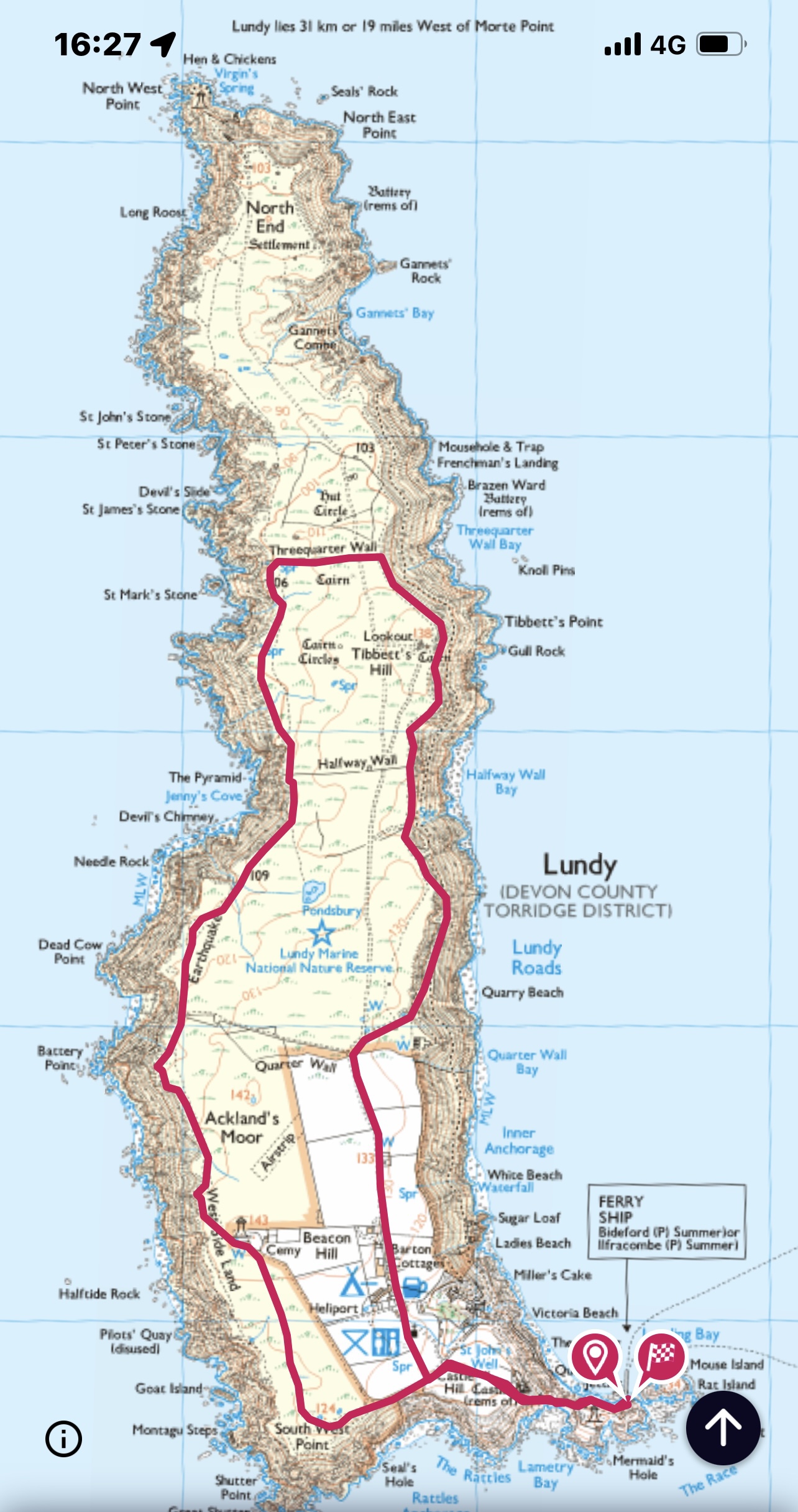
Soon the coast is in view and we can see the East side of the island. We will come into the harbour and will need to walk up a steep track before we can start our walk. The announcement says we need to board again at 16.00, so only 4 hours!
We decide we are going to get over to the west coast where hopefully we will see puffins. I have been advised that we won’t see much detail without binoculars! Some amazing rock formations along the coast and quite a few sheep.
A few flowers including some bluebells which only have three flowers on each stalk. We are nearing Jenny’s Cove where we hope to see Puffins, it’s by half way wall, we’ve already passed ‘quarter way wall’!
From a view overlooking some rocky outcrops we can see lots of birds flying in and out from the sea. We are able to spot some that are very small and have a very fast ‘wing flap’. These are the puffins, a couple of members of the group can see them through binoculars and we share them around. We can just spot the red of their beaks. Great to see them active but you would have to have very powerful lenses to see them as they are portrayed in commonly seen photos.
As we move further on there are lots of people sitting to watch the birds but strangely they are more difficult to see than where we viewed.
Next viewing – goats!
Two of us are feeling hungry so we stop to eat, a few went back to the village to get food at the pub and the others went on to three quarters wall! Having refuelled the two of us catch up with the others. Two more decide to stride out to the end of the island and the rest of us decide to follow the wall and then walk down the East coast.
The lichen is prolific on top of the wall and before we set off on the next part of the walk the sea mist starts to come in.
We wind our way down the east side and there are signs of quarrying and an abandoned house. As we meet the village we indulge in an ice cream but not the pub – no time! The church is quite dominating, and it’s soon time to wend our way back down towards the harbour.
Unfortunately we didn’t see the deer which were right at the end of the island. We did see a seal near the harbour, in the water on arrival and then basking on a rock on our return.
Certainly a place I’d come back too. A two night stay would be about right so you could really stop to enjoy rather than trying to see as much as you can but not wanting to take too long so as not to miss the boat!
So at half past 4 we set off again, a beautiful evening and still a calm sea. Back at 18.30 and then the return journey. I even broke my own rules of no Macdonald’s – no choice but I won’t make that mistake again. Just about 9 kilometres.
Travelling again today and this time to the Brecon Beacons, somewhere I haven’t been for a while. Last time I went up Pen y Fan it was with two friends / colleagues from school and we also camped for two nights near Brecon. We did use the rather basic route up from the Storey Arms!
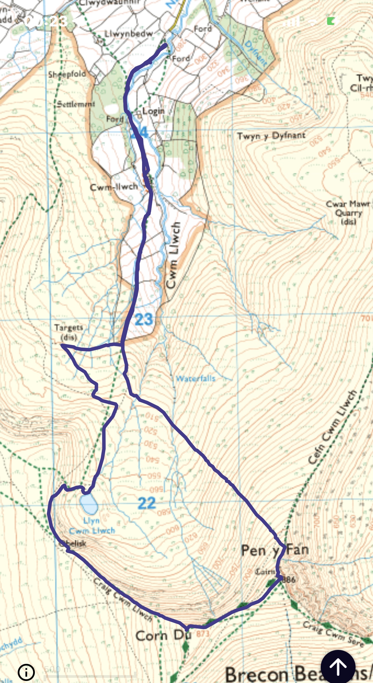
There is a group of us today – two men plus Boo, who has walked a lot in the past but not for a while, Betty who hasn’t ever walked up a mountain, Steve leading and myself. Having driven through Brecon itself we enter a maze of small roads and eventually come to an idyllic spot with some flat parking space next to a small river, north of the mountain range. Some people have started arriving and pitching tents for the bank holiday weekend.
To begin with it is quite a grassy track next to a pleasant stream but very soon our destination is apparent Corn Du and then further to the left Pen y Fan, two very distinct shaped mountains.
Once again we are really lucky with the weather and although I have put on my gillet, I don’t think I will need it for long. We come to a small gathering of buildings -Cwm -llwch and the path moves slightly up the hill on our right hand side. This is a superb example of a glacial valley and one which has many small streams starting on the hillside and leading down to the small river. Our destination has become even clearer and it does seem quite a long way off.
This is the first actual mountain I’ve climbed in the UK for several years and I do feel a sense of anticipation and excitement. Getting a little closer we veer off to our right to visit some World War 2 targets – planes would have swooped up the valley, taken aim and then gained height as they disappeared over the mountain range.
Our first stopping point was the lake Llyn Cwm Llwch, a great place for a quick snack and to view our future climb!
Huge numbers of tadpoles, clumps of black squirming bodies! Steve had already said he’d never swim in the lake because of leeches. As we arrived somebody was drying themselves off having been in and then whilst looking at tadpoles I spotted a leech – great excitement. A bit of a discussion about how or why they were / are used for medical reasons and it’s time for the next chunk of walking.
There are various ways up to the main path above our heads – it was a bit of a diversion to the lake but surely most would visit it! Steve decided he will lead Betty up first and asks me to lead the others up in five minutes. To my surprise he takes her up an exposed grassy slope, quite steep and I can see that she is very reluctant – she doesn’t like edges or heights very much- brave to climb a mountain for the first time at 73!
I decide on a route which is in slightly more of a shallow gully and has a bit of a dog leg in it which doesn’t create such a feeling of exposure. I haven’t used my skills of leading in mountains for many years but even when buried deep it is amazing that those things once learnt don’t actually go away. We meet the other two just as the path begins to curve round as it follows the ever steepening contours of the mountainside. Steve helps Betty up some steep rock steps and I’m pleased that my old agility in such situations is beginning to return.
Betty is not totally feeling it and as I’m walking beside her we set goals for the next short sections and before too long we are at the obelisk which marks the sad death of a little boy Tom Jones who went out looking for his dad and was lost for several days.
It’s quite a long haul up to the top of Corn Du which has a very flat top and although it is a wide path there is a very steep drop on our left which descends into the rounded head of the valley which we have ascended through. No pictures of this section must be something to do with the effort needed to actually climb the hill ! We have been out for over three hours at this point, although we did stop at the lake – I really would like my lunch but know I should do most of the climb first!
A good view back as we tackle the last stretch to our destination. Some wild horses to cheer us on our way.
The two men have reached the craggy outcrop below the summit and are waiting. I put in a plea to eat!!! And we all stop for lunch, we can see several other paths leading up to this ridge and there are several people ascending and a few going back to their cars parked below.
Standing on the top, which is remarkably warm the next peak in the range reveals itself – Cribyn.
I reflected on the only time I have had to make the decision to turn back due to the weather. Leading a group of 14-17 year olds We had come up the valley passed Cribyn and were due to do that first before the other main peaks and go back down the other side and swop minibuses, with a second group. There was some snow on the ground and it was beginning to snow more, we from our direction had the steepest and most difficult ascent to do first. I had to decide that it wasn’t possible and explain to my group why, and then descend and find a way round the bottom of the mountain to the bus. It’s such a pity the mobile phone hadn’t been invented – absolutely no way of letting the other group know what we had done!!
So refreshed, from our sandwiches, at last we take a few photos on the top and then set of along the ridge on the northern side of the peak. This is quite steep and rocky and whilst I didn’t need my poles on the way up I have decided that slipping on the way down is not a luxury I can afford myself. Pleased I made the choice. But before leaving just a little proof that I was there!
The ridge called Cefn Cwm Llwch is long and forms the side of this glacial scoop. I mistakenly think that we are are going to walk along it until we reach a slight dip and change of gradient but no !
Almost as soon as we have negotiated the rocky section and can start to stride out and relax we are taken straight off the side and down a very steep grassy slope. Well grass littered with a few rocks. Daunting not just because of it’s steepness but because we go down nearly 400 metres without any features. We just have a chance to look back and see what we have just come down before we set off.
I had been looking forward to striding out a bit! The two men set off and Boo was okay – reliving some of her youthful adventures. In my estimation this was a tough task for Betty so I indicated to Steve that I’d stay with her. Not a place to be left behind at the back the first time you’d climbed a mountain. Steve would have stayed but I could see he also wanted to make sure the two in front were okay.
Well Betty only slipped and rolled a couple of turns down the hill once. Nothing apparently hurt – she did have a very big jacket on which she had refused to take off – overheating can cause difficulties as well as being too cold! After a pause for breath and a couple of small stream crossings we reached the valley bottom.
I quite enjoyed the descent but personally would have gone a little further along the ridge even if it meant doubling back a bit.
After a short climb up the other side of this valley we meet the main path at the point we diverted to see the targets and all that is left for us to do is to head along this valley bottom and return to the van.
More campers settling in since this morning, some interesting designs of sleeping accommodation – a van with what looked like a tent on it’s roof?
Two young children come down a slope from there tent above and go towards the stream which is quite wide at this point. The little girl about six, turns back but her toddler brother continues and gets closer and closer to the water and tangled tree roots. I can’t help myself, I have to turn back a bit and call out to ask him if his mummy or daddy know he is here. No he says! I call up the hill and shout, the ‘dad’ says thank you and the ‘big sister’ is quickly dispatch to continue her supervision, which they clearly thought she was doing all along. I couldn’t just ignore the situation. And then we were back at the van!
A great days walking – pleased I coped with the up hill as well as I did – getting fitter. Reconfirmed I really do like being out on mountains. Not a huge distance 8. 69 km and we were out for 5 hours and 50 minutes which did include three breaks.