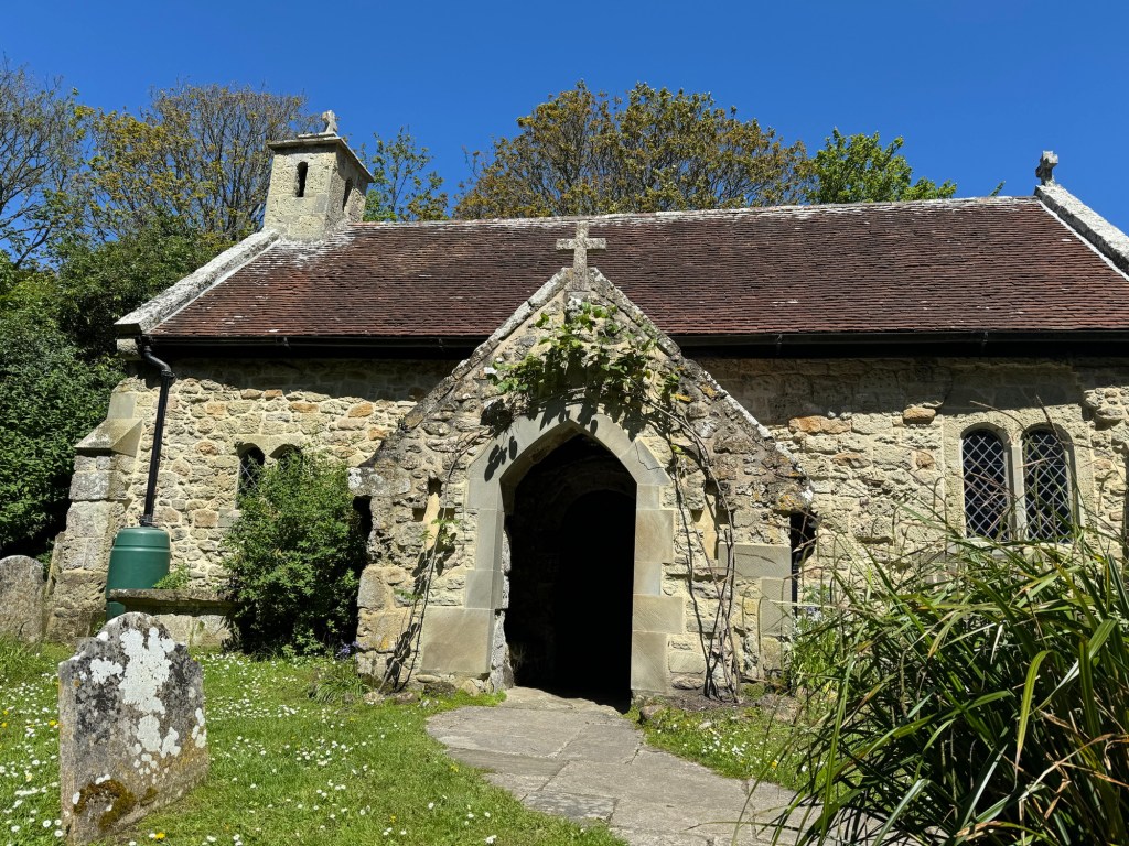
South Downs Way -24

Day 4 – July 8th

Having slept just a few metres from the path and chosen not to descend into the village of Cocking, a fair assumption might have been that I wouldn’t start this day with a hill! Wrong again.

The lady farmer had sold me a ham and cheese sandwich for my day and had provided a wide array of cereals and croissants for my breakfast so I set off well equipped.

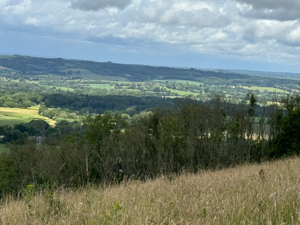
Good to look back and see the end of my walk last night, dipping down to the farm and a small industrial unit.

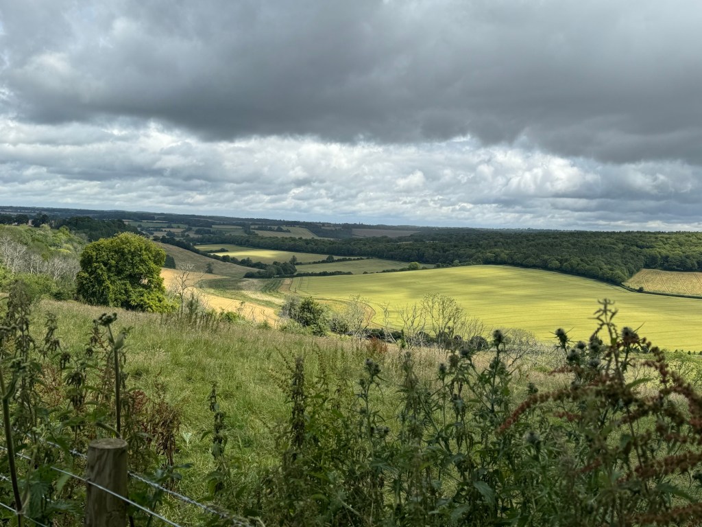
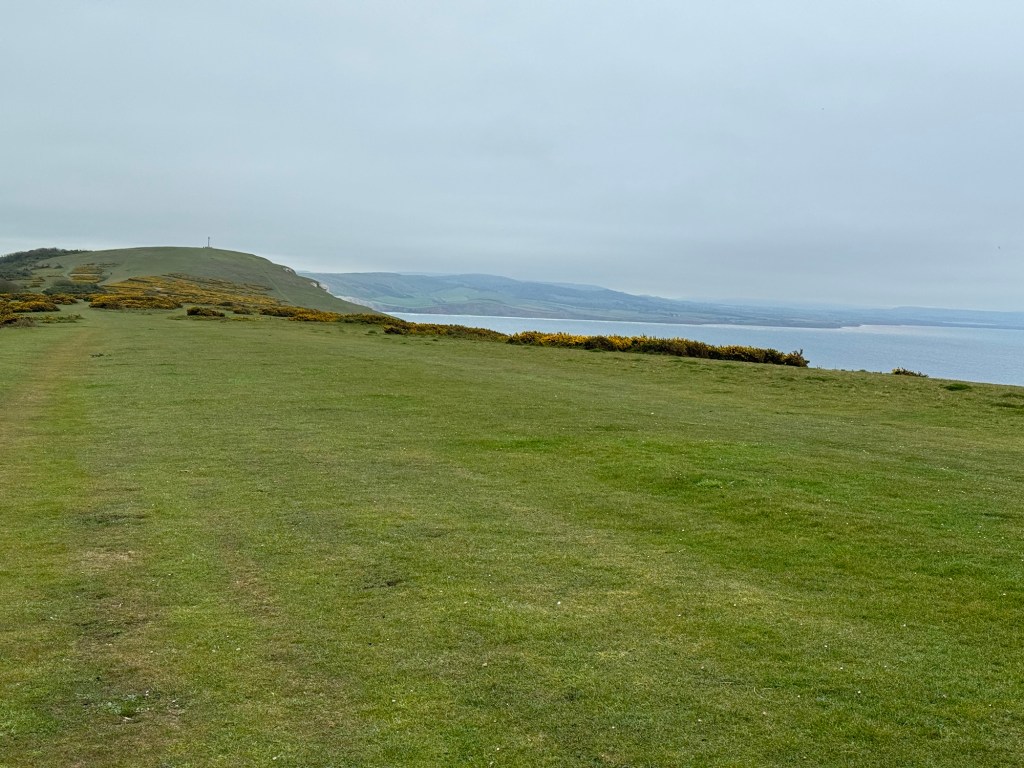
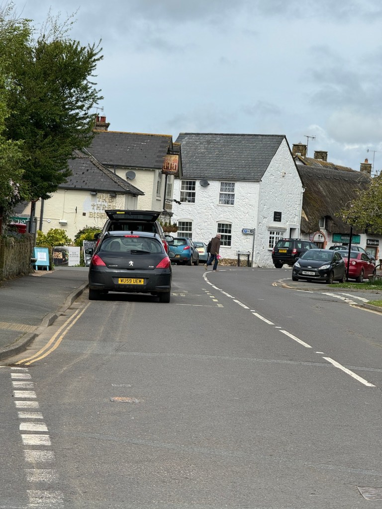
As I set off today Midhurst is to my left / north, the town of my secondary education. Down below me on the first part of my route today are places that were signposted and visited as a young person. I’m walking parallel to my route to and from school between Petworth and Midhurst. My more memorable view is that of the ridge of the South Downs, which today I’m walking along.

Walking helps provoke memories and I recall with slight amusement, the night, just after I had passed my driving test, aged 17 and a half, and I had borrowed my dad’s car. This was an Austin Cambridge – no power steering and he was out on duty as a policeman. I had visited a friend in Graffham , below my route along the ridge, very rural, no road markings and it became very foggy. My mum told me when I got home that he had phoned several times to see if I was home. No mobile phones back then so I was blissfully unaware of his concerns!

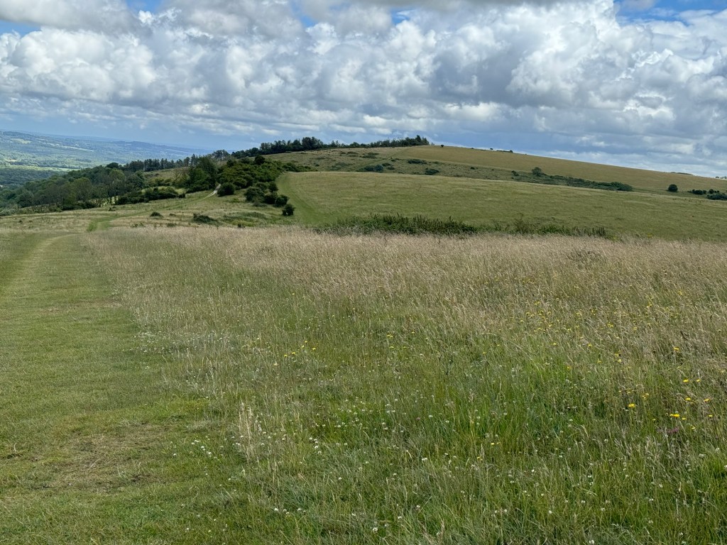
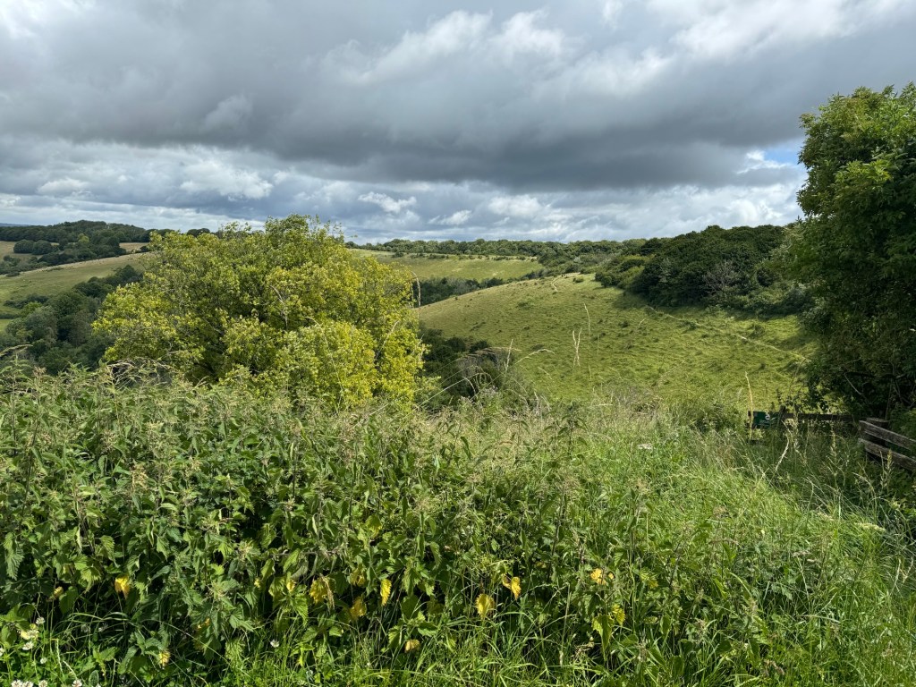
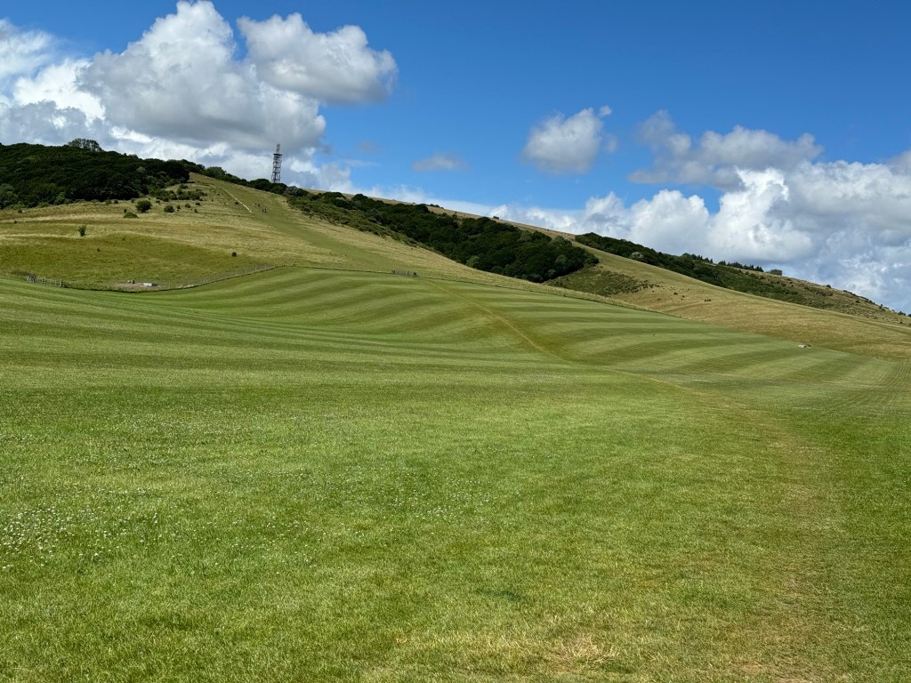
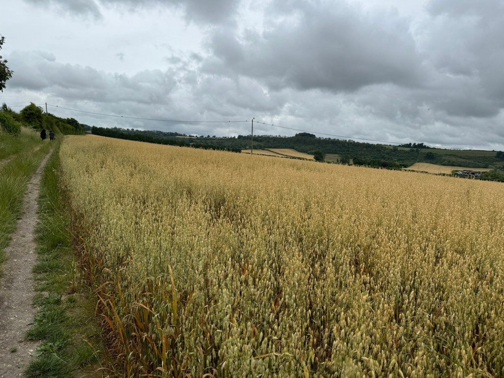
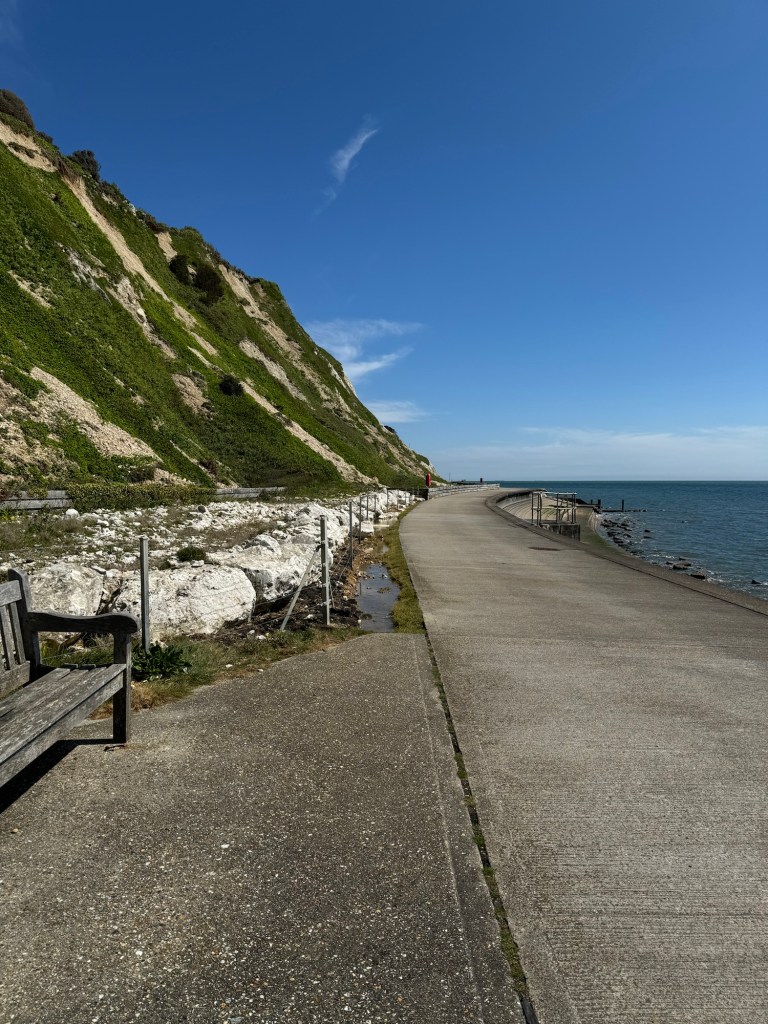
This high point along the ridge is quite blissful. Lots of tumuli and undisturbed grassy areas. I must admit I didn’t stray much as the long grass was still damp and I really didn’t want wet feet again.

Similar to the Ridgeway near where I now live, there is something special about walking somewhere where people travelled and lived thousands of years ago.

As I get closer to Duncton Down I do look out to see if I can spot Petworth but it remains hidden. I decide to phone my mum as this is the nearest I will get to her. She jokes about waving but suggests I probably won’t see her!

The path bears south of the steep Duncton Hill and crosses the road to Chichester – a journey travelled many times in the past. Down below me towards Barlavington I look out and think of the farm I worked on the summer before I went to college. Hard work, but fun. I started my day with cleaning out the cow yard after milking, then helped with harvest, drove tractors, moved irrigation pipes, moved calves and fed them. Learnt so much. I was allowed to eat my packed lunch in the farmer’s kitchen and he gave me real coffee but the rest was hard labour!

My path soon takes me across another road to Chichester – this time it’s a little older Stane Street which connects the Roman Villa at Bignor and the Roman town of Chichester, now a city.

There are so many walking routes now marked on the map. I have overlapped with the West Sussex Literacy Trail, the Monarch way has intersected – I’ve walked some of that in Oxfordshire – the route taken by King Charles when he was fleeing – I think. Then there is the Serpent Trail which I have walked some of and was to my north.

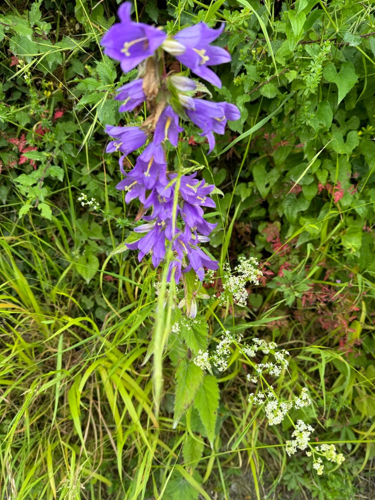
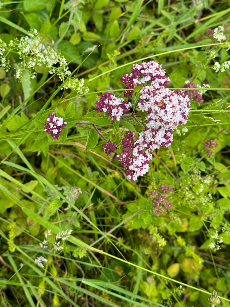
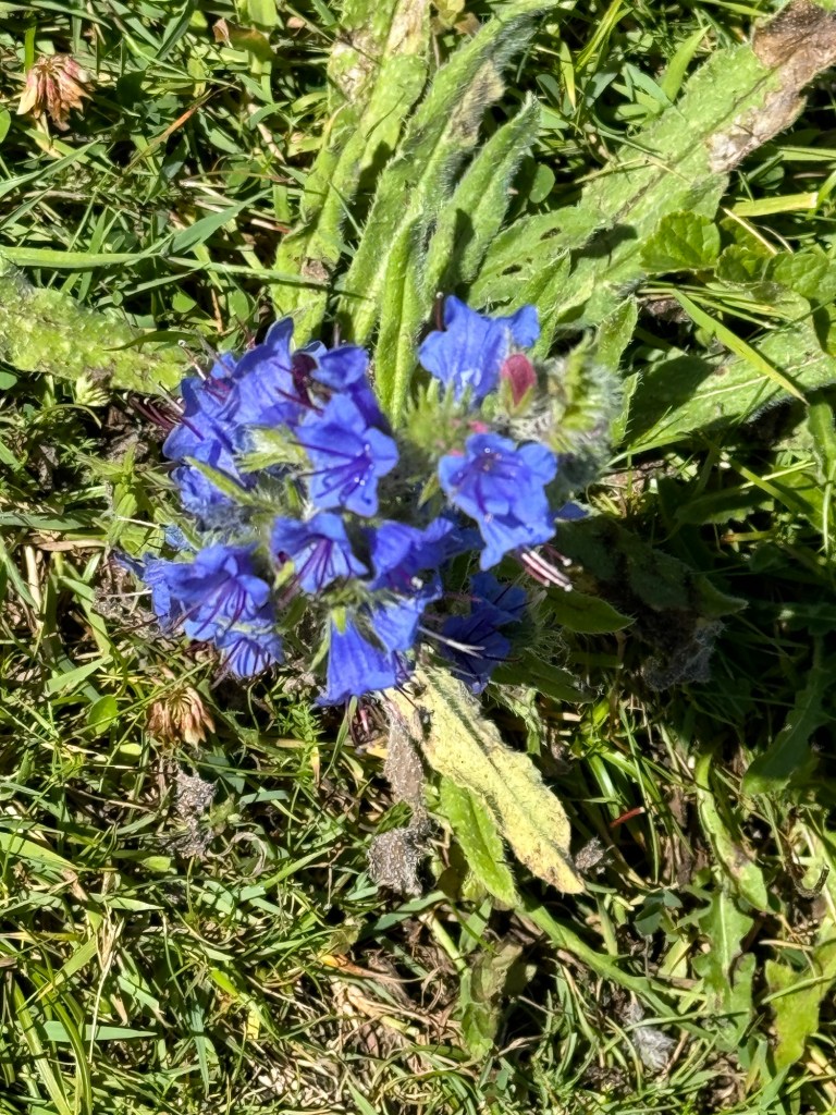
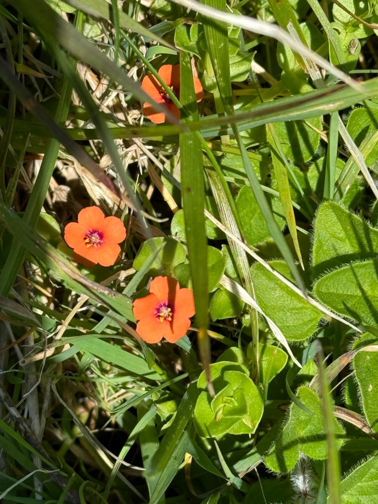
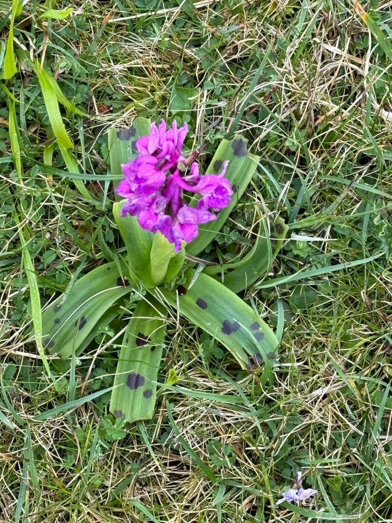
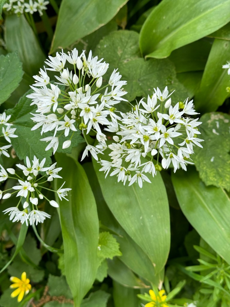
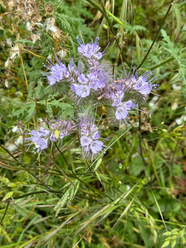
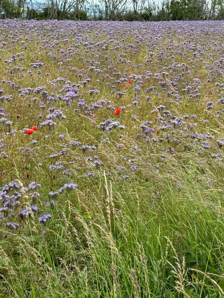
The mauve crop is very beautiful, I wonder if its purpose, like the Crimson Clover is to replace the nitrogen in the soil?

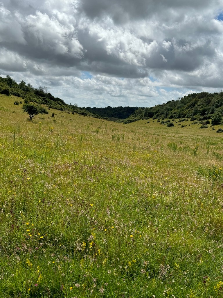
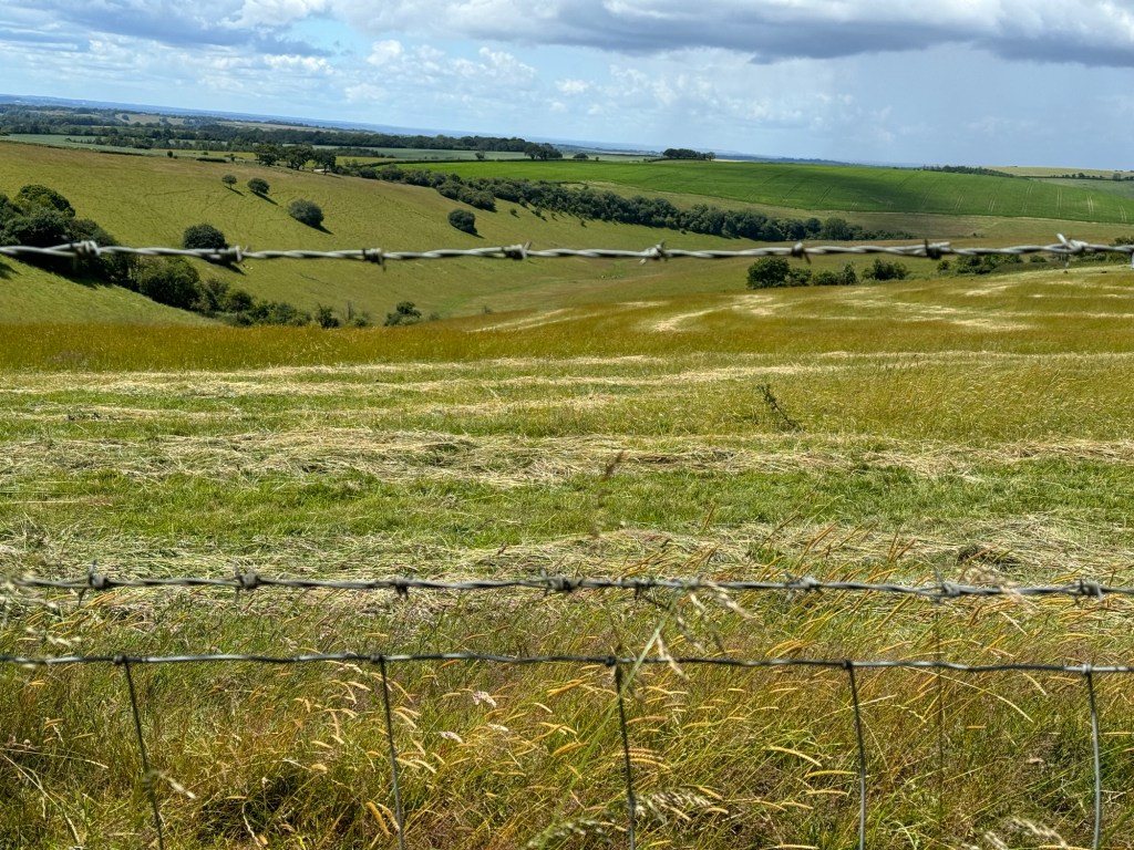
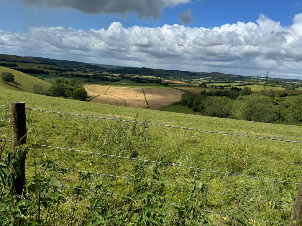
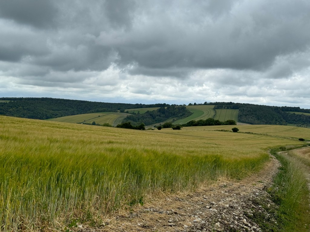
Before my trail begins to descend for the day, which it invariably seems to do there are more beautiful fields which really do show the chalky nature of the area.

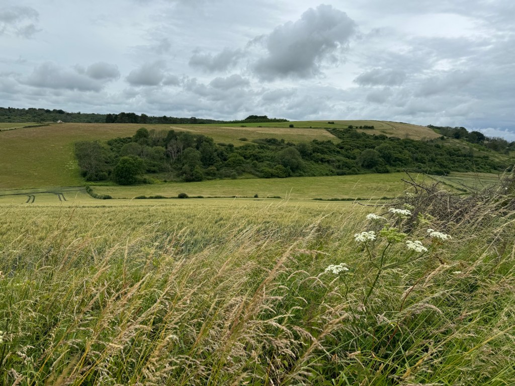
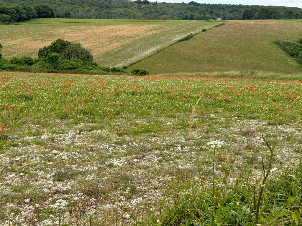
There are many of these little escarpments which have a layer of vegetation running along them.

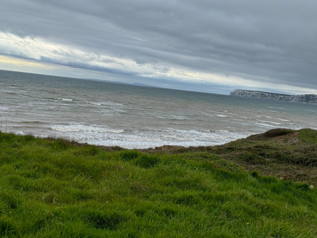
I am heading down towards the River Arun which flows passed Arundel, not to be visited today as my resting place for the night is in Amberley. I can see the chalk quarries as I approach.

During the day I have a couple of times seen a couple of older men with big packs, we have overlapped on a few occasions finding different stopping points. As I’m walking alongside the river I can see they are behind me again.

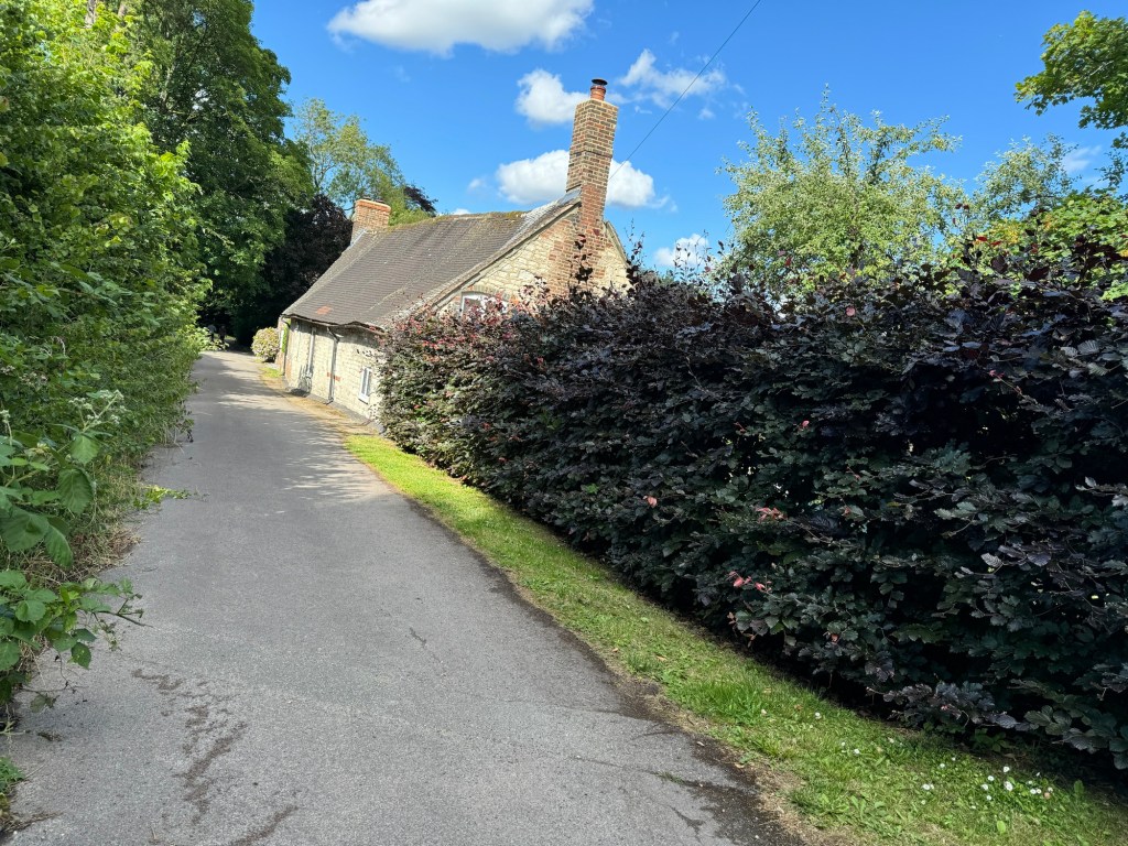
Having crossed the main road the signage points me up a lane towards the village, back up hill of course. As I’m walking passed a cottage a man and his companion stop gardening and speak to me. He asks if I’m doing the SDW, all the way and when I reply positively he asks to shake my hand. He’s done some long distance paths and we start discussing the OS app and walking poles. I hadn’t used mine in the first four days but perhaps Day 5 might be the time to start.

At the top of a steep hill the turning to the village and food and my bed went down to the left whilst the trail continued to the right. So I already knew what would face me at the start of the next day!

The Black Horse at Amberley was old but also of a high standard with a great room in an adjoining building. It was the ‘Muddy Stilleto 2024 winner’ – my evening meal was not cheap and the restaurant was packed considering it was a Monday – a very nice lamb pie.

On the next table were two Belgian ladies who had spotted me in the bar as I arrived – they too were doing the SDW but having their bags transported and having rest days.

Great bathroom with a heated towel rail- great when you need to wash socks and underwear!!

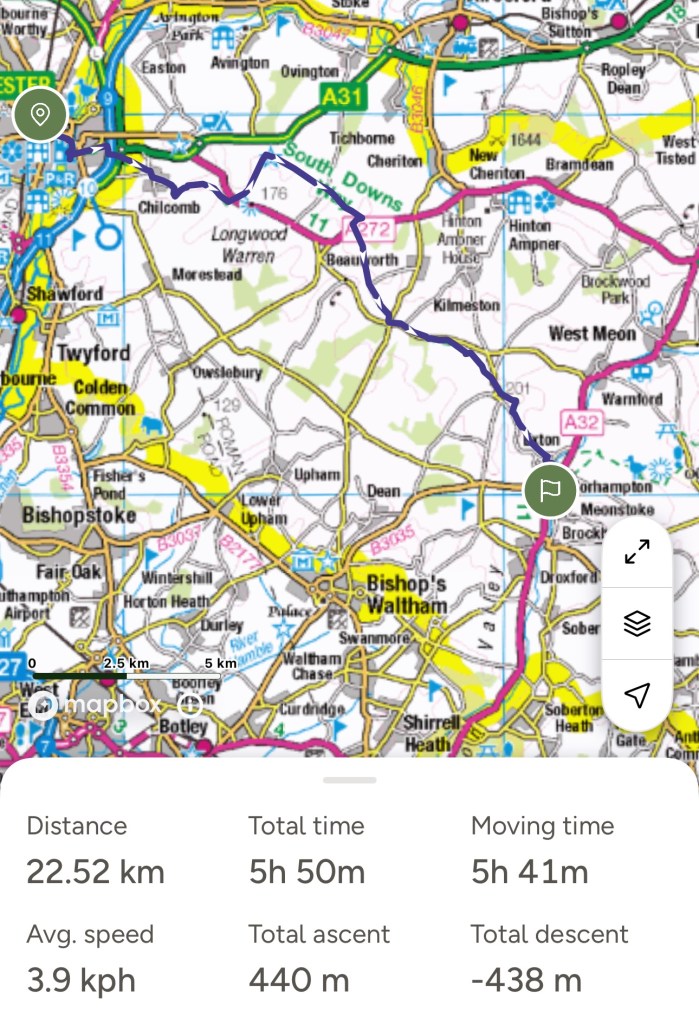
So just about 12 miles today, as the website had suggested.

South Downs Way -24

Day 3 – July 7th

Another comfortable night, I was apparently upgraded from the attic so I could have a shower. Nightingale Room – two cupboard doors – one with a loo and basin behind and the other with a shower cubicle, so the bath mat was on the bedroom carpet – could just say creative use of space. Chose to stick to just continental this morning as cooked would have cost extra! Bought a packed lunch from the pub as no alternative and then waited for the torrential rain to stop!

After a while it seemed to have paused so I set off. I’d been directed by the landlady to go between the church and pond and follow the footpath, which led to the Milky Way, and then joined the SDW. That way, same distance but avoided a steep uphill and a trudge along a road!

Didn’t pause for long, waterproof on and quite a downpour – wet grass, wet boots – again! I’d been looking forward to this section as the views were out over familiar places. Friends from school had lived in Totton and Elsted, camped as a guide at Stedham and can still remember the very dramatic thunderstorm one night. More recently walked at Woolbedding and then of course there is Midhurst itself.

Quite an on top of the world feel to start with today as the land falls steeply to the north but also away to the south. No straight lines though, plenty of swirls and dips. The chalk land flowers are becoming even more evident. Nature is so clever with complimentary colours. South Harting is nestled under the escarpment and Blackdown – the highest peak in Sussex, must be out there somewhere!

This section, as I approach Harting Hill has the whole texture and feel of what I remember from the South Downs as a child. Some wide grassy tracks, short grass and bits of chalk popping through and edged with wild flowers. The pyramidal orchids are abundant here, such a joy to see.

I wish I could remember where we came to in the sixth form and spotted musk orchids. I can still remember the xerophytic adaption of plants – daisies with their leaves flat to the grass- difficult to nibble but also cuts down on water loss as the stoma, tiny pores, are on the undersurface of the leaf. I also noticed along this section the way that plants and then shrubs had reclaimed land previously grazed, scrub land.

It did feel a bit fraudulent going round Beacon Hill, but it’s where the path is signed. I guess some of this is because most of the trail is intended for foot, bike and horse.

Not sure what I think of these distance reminders!

The meadow flowers and variety of species has me stopping too often but I am enjoying soaking it up.

I take a quick detour to see the ‘Devil’s Jumps’ above Treyford Hill. They are Bronze Age burial mounds, it’s just the thought of people inhabiting this area so many thousands of years ago.

After Didling Hill and Lynch Down the path begins to drop down to the main road between Midhurst and Chichester. I’m quite glad that tonight I’m not dropping down to the village of Cocking, but ‘glamping’ in a shepherd’s hut at a farm just across the road. The fence behind my abode is a couple of metres from the path!

Should have said the rain although very heavy didn’t last too long and I soon dried out and could take off my coat. Advertised as 11 miles it was just over 12 today. A great section.

South Downs Way -24

Day 2- July 6th

Awoke refreshed and came down to a cooked breakfast. Next to find a sandwich. A path from the side of the pub lead me through the churchyard and along to the village shop. First I passed a hive of activity on the village green where the fete was being set up. One lady invited me to stay and tried to tempt me by saying there would be burgers and cake – but I declined!

Sandwich purchased I walked back up to the temporary path – flooding apparently- having had a conversation with a local that had walked and cycled the path in her past.

So yesterday’s twelve miles was just over fourteen so I was interested to see how today’s thirteen miles would pan out. Again fantastic stretches of countryside with wonderful bowls and undulations. A theme that would continue throughout the trail was that accommodation in villages was down so the start of the next day was up.

One advantage of walking by yourself was that you are your own pacemaker, so if you have a slow stretch it doesn’t matter! Weather was good so enjoyable walking.

Love the colours of grasses when you have that real mix. Could oregano be the mystery crop?

Today took me up passed Old Winchester Hill – quite glad the route was very definitely signed around the bottom and continued to hug the contours as it went around this significant hill.

As I continued I noticed and increasing number of tumuli and earthworks marked on the map. Butser Hill was the next significant feature- I tempered when they first recreated a Stone Age/ Iron Age village there.

I decided not to go up to the cafe – I’d already had lunch and had plenty of water! Bumped into a Beaver/ cub trip! As I leave Butser I admire the sweep of the hill which brings me down to the A3 – and under it before I meet up with people, parking and signs for Queen Elizabeth Country Park.

The path takes me through woods and overlaps with the Shipwright’s trail – some of which I’ve walked near Liss. Quite near to Petersfield at this point, places familiar from my childhood.

My destination is Buriton and another pub! So a long stretch through the woods, the path coming out above Buriton. Do I turn left and go down a steep hill into the village or through some woods with old quarries- I chose the latter as I leave my signed path behind and contemplate which way I will go back up in the morning.

As I come into the village there is a change in architecture and chalk is being used as a building material plus a very scenic village pond to great me.

Arrived at the pub at 5pm but was tempted more by a beer than the football! Did watch most of the match including extra time and penalties so was a little late down for dinner. Some very good fish and chips tonight.

My route for today plus day 1 which I forgot to post – so just over 14 miles again.

South Downs Way 24

Day 1 -July 5th

Off to Winchester on the train and some hard navigation to actually find the start of the South Downs Way. A pleasant walk by a river before heading out of town.

Felt a bit of pressure today as I didn’t start until 12.30.

Once out of the city and over the M3 there were more open views and great walking conditions. However the skies did look a bit turbulent! After the village of Chilcombe and the edge of Cheesefoot Hill the landscape became much more interesting with a large bowl formed probably by glacial movement but now used as a festival site. However it was once used for Eisenhower to talk to American troops.

The predominant crop around here seemed to be oats and they did look very healthy considering the strange climate this summer.

I always like spotting Victorian post boxes. Not sure at that point I really wished to be reminded that I had 98.5 miles to go! Paths were good and well signed as I began to get used to my pack – it’s heaviness when just lifting it is well dissipated once it’s on my back.

The walls and houses are often showing the use of the local building material – flint. I have always enjoyed seeing the ranges of vernacular architecture.

Just after the ‘festival’ bowl was a wonderful avenue – clearly planted and would have been important at a certain time in history.

Up and over Gander Down and then quite a long stretch which was pleasant landscape but not much happening. Met two ladies who caught me up whilst I was trying to decide on the nature of a crop in a farmer’s field. They didn’t know either but one did recommend that the pizza was very good where I was staying the night- always good to have local information!

Beginning to see some good wild flowers – that are not the crop!

New shower proof jacket which started to be tested – luckily sufficient wind to dry it again. Next shower heavier but I managed to shelter under a tree- well nearly. Onward and eventually had to give in to the waterproof.

The SDW website allows 12 miles for the stretch to Exton. I done a little more than that as I hit this tucked away village, the path seemed to have alternatives , ‘temporary route’, lucky as that was where I was going to Meonstoke and my pub for the night. This village looked a little more lively.

I had said I might not arrive until seven but was there earlier but rather bedraggled.

Very comfortable bed, excellent pizza made to order and a very lively Friday night pub- talk of the village fete the next day – some excellent people watching.

I slept very well considering it had been the general election the day before. I had restrained myself and gone to bed at 1.30 and only woke up twice to check results! Not the ideal preparation for a long walk!

Isle of Wight Coastal Challenge 2024 – In conclusion and stats!

To start, the route for Day 6, omitted from the last post.

So, the big question was would I be able to carry a pack that was larger than my usual day sack and keep doing that for several days? I could have left out my hat and gloves but you never know!

Got my packing about right, change of clothes, wash stuff and a supply of fruit and nuts etc. Had a small flask for coffee and some bags if I needed to make it and a water bladder which I could fill each day. Although I took two poles I only used the second on a steep up hill climb for a short time, didn’t always use on at all.

All the distances were greater than expected so feel much more confident with the carrying greater weight for distance than when I set off and the rucksack – a ladies for 40 lite from Mountain Warehouse was very comfortable with a brilliant number of pockets.

My initial research was from the coastal Path website. A criticism would be no mention of path diversions and not even a link to the county council path closure site that I found once on route!

Distances were also quite a long way out. I decided to extend their Day 4 and shorten Day 5, in reality the two days combined were 5 miles longer than they suggested.

Foot passenger ferry from Portsmouth was good meaning a shorter walk could happen on the first day and although I wasn’t initially sure walking the path in an anti clockwise direction was good with highlights coming at the right moment.

I can therefore conclude that I feel I can tackle the South Downs Way without the added expense of paying for someone to transport my bags. It is a bit longer but most of the sections are reported to be shorter than those that I have just done. So now to plan when?

So the statistics ….

For each day – kilometres, miles, ascent, steps (I am very short so there are a lot!)

  • 13.69km, 8.51 miles, 250m ascent and 24,828 steps
  • 30 km, 18.64 miles, 437m ascent and 47,011 steps
  • 25.64 km, 15.93miles, 627m ascent and 41,902 steps
  • 22.34 km, 13.88 miles, 423m ascent and 38,988 steps
  • 12.96 km, 8.05 miles, 563m ascent and 22,966 steps
  • 21.8 km, 13.55 miles, 354m ascent and 36,558 steps

That’s a total of 126.43 km / 78.56 miles and a lot of steps!

Isle of Wight Coastal Challenge 2024 – Day 6

Sandown to Ryde- the final stretch. It’s strange the way that things look higher and insurmountable from a distance. Perhaps it was because of a ‘somewhat’ less taxing day previously but I set off with a little anxiety of whether meeting the ferry and therefore the train would all work out – silly really as this was only suppose to be a 12 mile stretch.

Fuelled by quite a good cooked breakfast I set off at about 9.15. I knew the Vegan cafe from the previous night wouldn’t be open and decided I’d have to chance my luck with lunch. ( I did smuggle a banana and pre packaged croissant, just in case).

For once the path kept to the route on the map and went right next to the sea at a low level either along a promenade of sorts or the road.

As the road veered away from the sea the path continued up wards from a car park still hugging the edge which was now becoming cliffs and started to skirt around Bembridge Hill. I also began to see the same markers as a few days previously, only this one said 79km!!!! Obviously an ‘ultra’ event. a Quick look back to see the last of these seaside towns.

I also met a few people coming down this slope with lanyards marking their event participation. As I progressed up this ridge I started to see a large number of people walking down in groups, coming in my direction. There were clearly two paths which converged further on and I decided to take the least populated!

I was feeling pleased with my choice and was heading for a gap in the hedge when two men came onto the horizon and started waving. Unclear as to what they wanted I continued, assuming they might be pointing for me to go across for the race. As I got closer it was apparent that one was in a blue coastguard ‘suit’. He came down to me and asked if I would divert as there was a gentleman have difficulties and he feared walkers going passed might ‘spook’ him. I obviously diverted my route, scrambled up a steep bank and came up to a car park which was clearly part of the walking/ running event.

A coastguard team were present and communicating by radio and there were four police cars parked up. So a walk along the road until I came to the spot where my path should have come out. Not sure what was happening but there were high white chalk cliffs at that point.

From the monument the path got more or less on track above the cliffs at the top of Culver Down. Not the same openness as a few days previously but through woods and round fields next to holiday home sites- as the paths narrowed the mud reappeared and increased!

A slip way/ road leading down to the beach with a sign saying private for use only by certain groups of people seemed vaguely familiar. My next clue was an information board in the wood telling me about Bembridge School and how it had been vacated in 1999. And then through the fence I spotted the climbing and abseiling wall which also had a zip wire and then the low ropes course.

It was the Kingswood site which I had taken groups to probably three times. I had instigated an outdoor activities weekend taking place in November – when it was cheap- and available to all four Year groups in Key Stage 2, so from 7 – 11 years old. As they had different sites around the country we rotated so that if you went all four years they got to go to different venues! A great success and in addition to the summer residential for all the year groups.

Quite hard work as we left school on a Friday morning and returned Monday tea time. Some brilliant parent helpers over the years and a few parents got there first weekend for years without children out of it!

Enough reminiscing still a considerable way to go! Luckily the competitors in the charity challenge weren’t sharing my muddy path.

Shortly after this point the path is diverted in land and is directed onto a road running through a housing area. This happens for several kilometres before reemerging just before Bembridge Lifeboat station which is actually at the end of a purpose built pier. Luckily there was a coffee shack and I drank a very good hot chocolate and bought a prawn sandwich to take away- you have to take your chances where you can find them! A rather large cardboard box – not what I was expecting – managed to get it into the top of the rucksack and continued.

After a short stretch close to the sea the path diverts in land again and comes out as the road turns to run around the harbour. A completely different feel, now walking along a pavement and the intermittent boats change to some very large house boats of varying designs. The path is also busy with walkers some of whom look rather weary and I’m walking against the flow. There’s a lot of bikes on the road as well.

The path takes a turn onto a side road and then a path – I’m about to go on a causeway and luckily the charity route doesn’t continue my way.

The path ends up on some scrubby land which looks as if it might have at some point been underwater and then across to a road and a path , and once again I find myself in land a bit from the sea as the route circumnavigates some holiday homes and a hotel complex which has many notices telling you it’s private land but isn’t looking very actively occupied.

At last the path rejoins the sea well almost and I walk down a slip way onto a sandy Seagrove Bay to eat my lunch. I discover that the knife and fork supplied with my sandwiches are useful for the plentiful salad and the most amazing sandwiches – the best £5.50 for a long time! A pure joy. Time to set off again mindful of the fact that ferries only leave once an hour.

In about a kilometre the path stopped wriggling around towards and away from the sea and stuck to a road or sea path all the way into Ryde. Sometimes by houses, through a park, the number of ice cream opportunities increasing. Not the prettiest of stretches and as I got closer more hotels, play areas etc as well as the railway. Evidence of good bus routes and I guess another way to do the coastal route would be to link to a central place to stay and get buses each day. The pier, my goal was visible from afar.

I really did want an ice cream but some long queues and I was weighing up timings. Checked the timetable and 15.45 or 16.45 – seemed silly to waste an hour for an ice cream! I’d almost forgotten how long the pier was. A ten minute walk at least and a slightly strange sensation on the wooden boards above the water with a train track and road running parallel, one on either side.

Managed to catch the 15.45 ferry before starting the train journey home. I always wanted to see Portsmouth, Woking and Basingstoke stations on my way to the familiarity of Reading and Didcot. Somehow even managed to catch a bus home and avoid a £35 taxi fare!

Mission complete!

Isle of Wight Coastal Challenge 2024 – Day 5?

Ventnor to Sandown- a shorter a walk today. Partly by purpose and partly due to not being able to find accommodation further on.

A slow start as I didn’t want to arrive at my final destination too early. Planned to go back down into Ventnor for a coffee and then continue around the coast – I should have known!

I set off almost backwards going diagonally down to the coast only to find I couldn’t turn right at the sea because that part of the path was blocked. So had to turn left, I wasn’t going to go back up the hill to circumnavigate this closure to turn round and have to reverse my route.

My luck was in a small coffee kiosk and a friendly local. Not surprisingly the path through to Shanklin was closed much of the way. She made a suggestion which was born out when I got to the coastal footpath diversion sign.

The walk before the diversion didn’t feel totally comfortable with several piles of chalk that had fallen and one tree whilst another toppled at the top with half its roots exposed.

The path up from the coast was quite steep and wound its way near some large houses and the edge of the village of Bonchurch. I passed and went inside the old church and then came across the current one – no wonder there was a sign asking for donations as they struggled with up keep in such a small parish! And then the route took a turn and a footpath sign between houses. Well more of a never ending staircase than a footpath. About 200 steps at least, a few twists and turns, no resting places, stone steps just up and up- luckily a handrail – I’m guessing some Victorian thought it would be a good idea when the area was in its seaside prime! This was basically up the cliff face, on the map it’s possible to see how close together the contour lines are placed.

The cafe owner had suggested walking along the road at the top of these steps but the redirection signs suggested crossing the road and going up to the top of the hill and then down the spur.

Having looked at the map I decided on a middle ground and could see no reason to walk up a very steep hill when I could just walk round the base!

Although the path was narrow it was well defined and I had the advantage of elevation and being able to look out to sea but without the unnecessary climb. Also spotted Scarlet Pimpernels which I haven’t seen for a while, a chalk loving plant. At Nansen Hill I was back on their recommended route and for about a kilometre the marked route was followed. Then another diversion this time through a buttercup field.

As the path dropped back to the cliff top again I got my first glimpse of Shanklin and Sandown.

It had taken longer than I imagined to reach this point and hunger was setting in. I was now on a road on the outskirts of the town and went rather wrong as the sign seemed to bear no resemblance to the map. I should have just believed it. Met two couples at this point both a little confused. Doubled back from my unnecessary exploration and followed a sign which seemed to take me even further from the sea an eventual turned into the Main Street of old Shanklin.

Plenty of pubs – I chose one that clearly did food and also looked quite busy. Hadn’t clocked the stag do until I saw the chap with a beard, veil and pink tutu! Still it was good quick service and I enjoyed my meal.

Onwards and a little closer to the sea front but with the coastal path staying above it. Past Shanklin Chine, a popular spot to visit. The coastal path stayed a little above the beach all the way along towards Sandown. I could see white cliffs in the distance which I knew would be part of the final day.

The beaches looked quite tempting but were virtually empty even though it was quite a warm day.

My accommodation – a B&B was not too far from the main part of Sandown- only 5 minutes this time. I had replied as to my time of arrival but no one there. Luckily a phone number on the door which I rang to be told my key was under a garden gnome near the front step. Room 6. No lights as I went in and having phoned again he explained they were on sensors, I did ask for a clue as to where Room 6 might be and did then managed to let myself in.

Decided I needed a beer so back down to the front to enjoy the sea and some sun before returning a different way and finding somewhere to eat for the evening – a vegan cafe which was very friendly and less than 5 minutes from my accommodation. So the 5 miles turned into about 8.5 and I managed to fill my day!

Isle of Wight Coastal Challenge 2024 – Day 4

Brighstone to Ventnor – only suppose to be 20 km/12 miles today – well that was planning at home before I discovered coastal footpath diversions!

Good start to the day as I immediately found the village shop and the means of getting some lunch!

I managed to find paths straight down from the village to the coastal path. Again next to red earth cliffs and further evidence of erosion. There are flags out, at regular intervals waymarking a charity event. 10 kms and then 9. To be continued…..

At Shepherd’s Chine there’s a cut up to the main road and luckily the overgrown verge has been trimmed – probably as it is part of the run/ walk route. The path turns back down a valley and then an interesting part of the path as it suddenly goes up some steep steps- even more notable as I can spot two people about to come down, with bicycles and a dog. They were following the charity route which their sons were about to complete.

A good stretch along the cliff tops again but very wet underfoot and quite a lot of lying water.

Near Chale there is the setup for the start of the event with lots of tents, pre pitched. Still not quite sure what the event will be but obviously very well organised.

The path has gone back up to the road and through the village, feeling hungry I spot a church- they usually have seats in the graveyard – I’m in luck and I have a tranquil view of the sea over the top of gravestones.

The path curs away from the main road and then back again, at least there are wide verges. The road wriggles past ‘Blackgang Chine’, from the sounds, a fun fare area. Luckily soon back to cliff tops , well almost. The ground drops away flattens out and has some habitation.

I am stopping to look at a lighthouse on this stretch of land, St Catherine’s. A young woman catches me up and asks what it is? I explain and she rushes on.

Near St Lawrence the path stays at the top as a diversion although I have met two people who apparently came through the closed path and said it was no worse than a lot of the Cornish coast. Even this top path comes to an end and starts to drop down really steeply, including some steps and a handrail in places.

A short respite along the road called the ‘Undercliff’, before more steep down hill. Eventually I’m back near the sea and the last stretch into Ventnor. Bizarrely my OS map seems to have stopped recording but I really did walk the last bit!

I’m staying in an apartment tonight and have no idea of whether there will be any milk, tea etc so decide on a cup of tea and Bakewell Tart by the sea front. Strange to be in a town.

Next to find my apartment. Ventnor is on a steep hill, so guess what I was near the top. So another 15 minutes to go. Opening the key safe was nearly the most challenging part of the day! The whole of the top floor of a large Victorian house. It would have been comfortable for four adults.

Notes told me that there was a Tesco Extra about 5 minutes away. Otherwise this part of the town had few facilities. Managed to sort an evening meal and a porridge pot for breakfast! And there was a washer / dryer and washing gels – so I took advantage.

Isle of Wight Coastal Challenge 2024 – Day 3

Yarmouth (actually Norton) to Brighstone.

Well yesterday involved lots of mud, lots of stiles and I only met two people all day apart from the lady in the supermarket! The two I met just told me I wasn’t far from Yarmouth but West Wight had lots of mud and landslides and with rain they weren’t sure how I’d manage by myself! Very reassuring note to go to sleep on!

No rain forecast for the day but as I set off need my waterproof as it was quite mizzly. A quick cut down to the coastal path and actually quite near the sea.

That didn’t last too long as the route cut in land towards a holiday park. Actually met some walkers who weren’t covered in mud but did tell me about some paths closed- again. Up on to a main road and down towards Colwell Bay. Signed on a different track to the one on the map but chatted to someone who said there was a good cafe in the bay.

Good but expensive, £4 for a black coffee, it was good and so were the loos!

I asked about the path closure and was told to divert round the back of a pill box and that plenty of people had walked that way. I followed my local instructions- doing well and then a huge clay and plant debris landslide across the path – bit like a promenade at this point. Evidence of foot prints and with the help of my pole I crossed this very slippery stretch. Managed to climb through the barrier at the other end.

Along a bit further and I can see another sign and a cafe. Advised that it was just the sea wall broken but I could also go up the adjacent steps and meet the path again at the top. As I approached the top of the path I should have come up I met with a group of walkers who had been doing the path over a couple of years and this was their last bit. I was able to fill them in on the closures and chatted for a bit.

On towards the needles peninsular, this bit looks good on the map. Over Headon Hill, avoiding Alum Bay Chine. Even before I saw a group of children being shouted at to line up I knew I didn’t wish to explore it. This route is a bit intense and with 14 miles at least to cover today there’s not much scope for going off piste.

A steep climb up and onto the top with a great view of the needles. The official path doesn’t go right out to them but I decided I had at least seen them. Great walking up on the top, grassy paths, wide open spaces and after turning back inland after the coast guard cottages, views in all directions.

It’s now also the Tennyson Trail and I can see the monument nearing. I’m met with a glorious site, my first orchids of the season, only common spotted ones but they were in abundance. What a treat!

The path in this section sticks close to the cliff edge usually with a field to the side. A few turns inland but mostly to navigate a cut into the land – a chine.

The cliffs here are now red mud and very fragile, huge clumps of earth and grass have subsided. I had an interesting experience with some cattle, heifers I think, who seemed very curious about me and avidly followed me along on their side of the fence!

A major diversion just as I was approaching Brighstone, which is where I was staying for the night, so quite useful really. I was quite glad to see the Three Bishops Inn but a more enjoyable day.

Isle of Wight Coastal challenge – Day 2

Cowes to Yarmouth.

Well that was certainly a challenging day! My phone charge ran out at 28 kilometres, as I was approaching Yarmouth and even though I tried to connect it to my power pack, the phone didn’t really appreciate the mix of charging and the rather persistent rain.

By the time I had shopped in the town and walked to my base for the night I had walked just short of 30 kilometres- further than I had anticipated.

The day started well in Cowes, the weather was fine and the route straightforward- well that didn’t last long. The Yacht club had rather traditional decoration.

Coastal footpath signage is distinct and well placed so it was a bit strange when I got to a path closed sign. A bit misleading as it was a section of permissive path. Probably wrongly I decided to continue! Some muddy patches but with recent looking footprints and then !!

The path has disappeared, slipped away, luckily not a drop to the sea. A bit too steep and deep up and down to keep my large back pack on and had to manually move it. With the help of one of my poles and some past scrambling skills I regained the path and continued on!

Two more minor path slips, poles,scrambling and knees all needed. At the far end an even more positive path closed barrier! Whoops!

Mud is at a premium and as paths narrowed the mud widened!

The path goes a long way in land and uses roads in places, especially as it goes around a military area. Major inlets of water also dictate the route. An interesting historical area at Newtown, which has not only a national nature reserve but a ‘town hall’ building – this is a NT site and was once a thriving harbour area until an invasion by the French in the 1300’s. It at one point had two MPs until it was declared a ‘rotten borough.’

I was looking forward to walking close to the sea and as I walked towards the estuary there was another path closed sign. I did walk a bit further and had something to eat and decided to look up closed paths on the internet. This one was to do with damaged board walks so I decided to turn round and try a different route.

More mud, still not really next to the coast and then a slight wrong turn – probably because it was not muddy. Realised my mistake and had to turn round – and it started to rain!

Eventually as the approach to Yarmouth is nearing I am at last by the sea.

My accommodation for the night is beyond the town. Yarmouth looks as if it could be interesting and worthy of a longer look – if it wasn’t raining and already late.

So some good things from the day – I was pleased to have met the challenge of my big pack for such a long distance. There was a wonderful selection of wild flowers.

Bad things – the mud and rain for several hours.

My accommodation was a very suitable one bedroom bungalow on a holiday home site.