Published before it should have been – so here is the rest!
Our path takes us towards Bolt Head and as we are looking out towards the sea before we change direction again we spy ponies on the horizon.
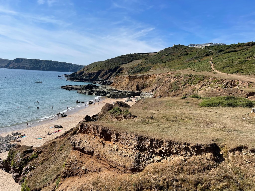
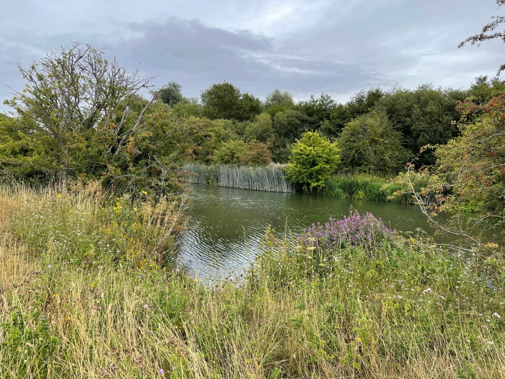
A steep climb down to Starhole bottom and then the most splendid view to a beach far below – not one we’ve ever been down to. One more easily reached by boat. We decide this is a good place for lunch and sit on the grass at the top of this cliff. There is a wire fence that protects anyone from falling over the cliff, with a small path and a battered piece of fence signalled by an abandoned straw hat! Probably not really meant to be there.
A mother and daughter approach with a golden retrieve but although the mother was game to try getting down to the beach, the teenager daughter obviously thought it was far too much trouble! Then a young couple venture over the top. Wish I and been more adventurous.
The path can be seen curving round the side of this rocky outcrop and having climbed back up to the track we were back on our way. We had walked this last section before but often from the other direction so we knew that this was a rocky section which would soon turn towards Salcombe.
The path having been very narrow then turns to a track which runs along the cliff side, diverting both up to Sharpitor and gardens and also down to South Sands. So from tranquility and wildness we were suddenly down into people, parking, ice creams and beach games. The path follows the road and moves on to North Sands where there are the remains of a castle and fort. Then we come to the town proper, when we get to the steps down to the foot ferry across the estuary our walk proper for the day is completed.
We do visit the town, do a bit of shopping, including ice cream! We check out where the bus will leave from and then go back to the ferry for a quick trip across and a short visit to the wonderful sunny cove. One of us goes in the sea and the other just foot dips! And then a very quick walk back to the bus and just manage the one we’d hoped to catch!
Not a long walk today just a little over 15 km but very enjoyable and getting a bus from Salcombe was far preferable than having the car. The liberation provided by catching the bus felt good.
A day on my own today and planning to do quite an epic walk. Much looking at bus timetables to help work out the direction of travel and timings of the last ferry as well. It will be a coastal walk again and although I have done a few stretches along this part of the south west coast path, I have never contemplated this whole stretch before. Again the map at the beginning to see the route .
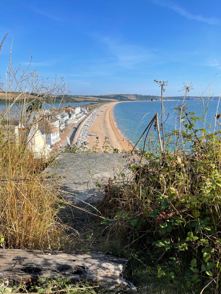
So having got off the bus at Tor Cross there is a steep climb up to start my walk. Steps and then a steep path, quickly there is a view over Tor Bay
Not a stretch of beach I have ever felt very comfortable about- it is where they practised the D-Day landings and not all those taking part survived the experience. The path moves away from the cliff edge and goes inland around a quarry area but it is then possible to look ahead and see the start of Beesands and an inland water area called Widdicombe Ley. Again not a beach area I have ever used, but I am pleased to find public toilets – well timed, when I do get down to the beach.
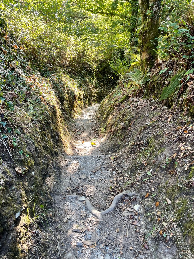
Before I drop down to the beach I can just see the lighthouse at Start Point which is the peninsula in the distance as the coast curves round. The way down to Beesands is along a wonderful holloway and I contemplate how many have passed this way before. Fisherman perhaps taking catches to Tor Cross – I wonder?
The sight of Start Point feels good as it is my first pointer of progress along this quite long route – still a way off but with the familiar air of somewhere visited before.
The path has stayed close to the edge as it goes towards Hall sands as I climb up some steps I’m met by a group of young people coming down who are obviously doing a D of E expedition. Three boys and one girl, she enquires if she can ask me some questions- they have to interview four / five people during their trip , I oblige, I continue, beginning to move upwards through the vegetation and knowing that it must reach the car park before the lighthouse. Really strange to approach somewhere on foot that I’ve been to many times by car!
This car park serves two major purposes – for those wishing to see the lighthouse and for those wanting to follow the path down to great Mattiscombe Sands which is perhaps just over a kilometre away. This is familiar territory and that’s a great feeling. We often used to walk down to the beach on one of our holiday days and if I got my way, which didn’t always happen we would walk back along the cliff path, which is the way I’m now about to go. I did persuade my children and their partners to go this way to the beach last year! The path sets off from the car park down the road to the lighthouse and is lined with a substantial wall on the sea side, probably useful as there is an extensive drop! A good place to look back and see how far I’d come and check on whether my pace was appropriate.
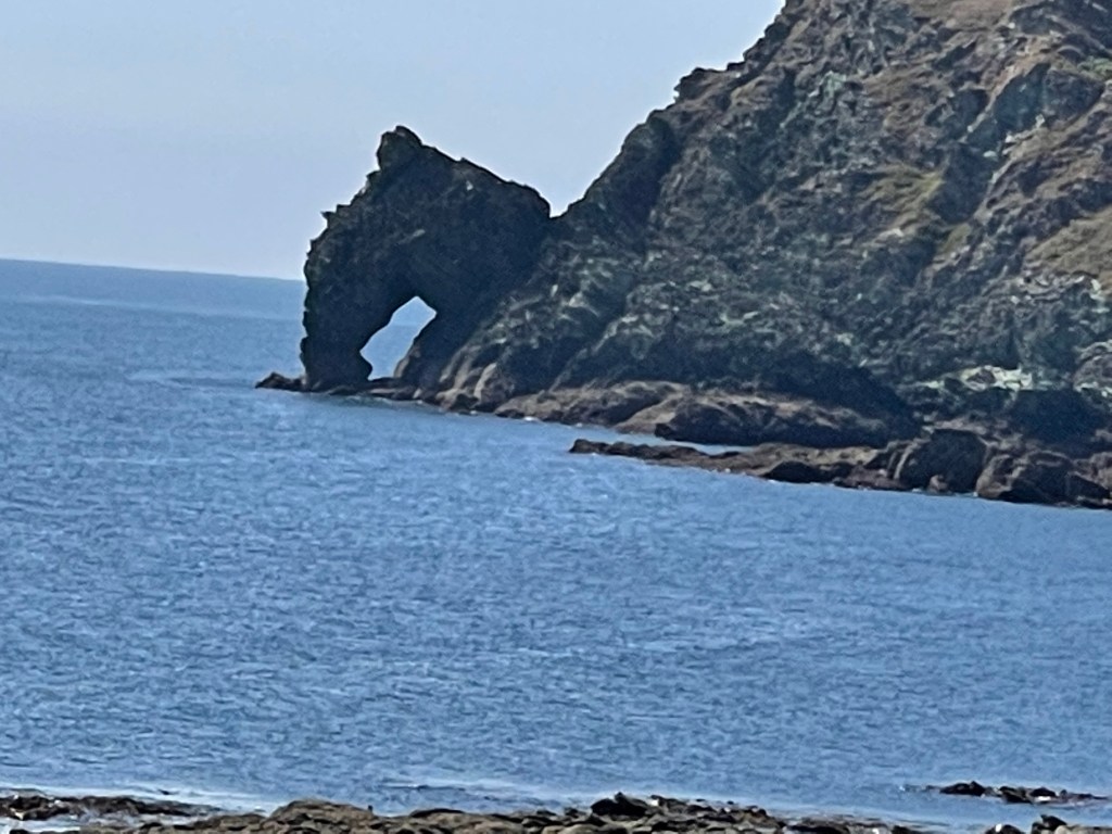
Quite quickly the path cuts diagonally away from the road and then goes steeply downward- a little unnerving as not much grip and a large expanse of nothingness in front of you – quite quickly it turns a little to the right and feels much more comfortable! This path, narrow in places and teetering along the land edge has wonderful views of rocky outcrops. I stop to photograph one of these and remember Jack clambering across to explore and also watching seals. I think I can see one out on the rocks but is this wishful thinking?
When the tide is right out there are sandy stretches between the rocks and deep rock pools to explore. I continue on round and one of my favourite beaches comes into view. I always enjoyed coming here when the children were younger, no distractions of ice creams or commercialism just sea, sand and a few rocks to explore. Many happy hours. I have decided that this will be my first stopping place for a snack and as the path bends round and splits in two I inadvertently take the upper path and have to double back to reach the wooden seat overlooking the beach. People already enjoying it and others about to start the steep climb down from the car park path.
I’ve walked bits of the next section before but only usually in short stretches. The path keeps close to the edge but is often quite shrubby and then around the edge of fields. It crosses little streams which are much drier than normal. And the next significant point is Lannacombe Beach, another delightful spot but with narrow roads leading down and minimal car parking only a good choice if you could set off early and the tides were in your favour!
From Lannacombe the path winds slightly up hill around the side of one hill before dipping into a small valley and then contouring round a much rockier outcrop- Woodcombe point. Here the path turns almost to a scramble in places and rather than the even tracks found for the last stretch this is somewhere where more concentration is needed.
Just before I started clambering I had met a family that obviously weren’t quite sure where they were but I was able to help and they decided it was probably time to turn back!
The scenery along this stretch is varied and again becomes reasonable walking. There are quite a few people out and about and it is one of those walks where you leapfrog certain people as you stop at different times. There is an older man , French I think from his accent, who I have seen a couple of times. The next significant point will be Prawle Point as it is there that I change direction.
This part of the path has a few more people, there is some parking to the south of East Prawle village. This is a village that is always busy with a pub which overflows with people who often spill onto the village green. The Pig’s Nose can be recommended.
As I get closer to the point and the coastguard cottages I am enjoying the play of colours and shapes contrasting the rocks and the cropped fields. People going down to a beach – not really sure there was one down here! Thought once it would be good to stay in the coastguard cottages but it never happened. There is a look out post on Prawle Point – had hoped there might be a loo amongst the few scattered buildings but, no!
Having rounded the corner I spotted something unusual, a very big yacht moored off of Elender Cove. As I stopped to look a runner came by and also commented, we were both surprised. He told me he was running in honour of his friend who used to organise a marathon walk from Tor Cross to Bantham, a bit further still than the previous day’s walk plus today. Unfortunately his friend had ended his life a fortnight before, jumping off of a cliff. I wished him luck.
A bit further on and with the yacht plus water shoot in fuller view and I met a lone solo female walker coming towards me. We stopped and chatted and discussed our routes – we both felt the large decadent vessel was incongruent with the surroundings. She advices me that there were some trick bits round the corner and we both went on our way. She had detoured down into Elender Cove and had had a quick swim but although very beautiful was restricted by the number of boats that had dropped anchor to take advantage of this wonderful little beach.
I met another couple above this beach area as we looked out at the yacht again. It was also towing platforms to lay on or dive off of. They clearly disapproved!!
As well as going over rocks the path contours round the edge of some steep ground- an exciting bit of coastline. The next place of familiarity will be Gara Rock beach – again a favourite. Approaching from this direction it is easy to see the track up to the hotel and car park – always a bit of a struggle at the end of the day. It used to be a really old fashioned hotel where some summers they sold ice creams, but then abandoned and now completely refurbished.
The headland from yesterday’s walk can now be seen very clearly and luckily my path up from the cliff above the beach cuts across the hill lower down. This is a section I love and have walked several times. It turns and cuts round Portlemouth Down and towards the estuary. A few rocky outcrops on this section but nothing too serious, I decide to take the coast path although there is one parallel and higher up along the edge of the downs- perhaps next time. So, past the beach far below with the sandbank at very low tide and Sunny Cove from the day before. Through woods – quite dark in there , had to remove my shades so as not to trip over any roots etc. Mill Bay car park and more importantly toilets are in sight, quite a relief. Coastal paths aren’t very good for having a ‘wild wee’! So to finish down the road to the ferry – not too long a queue and once over through Salcombe for the bus – via a ginger ice cream – well it would be wrong not to!
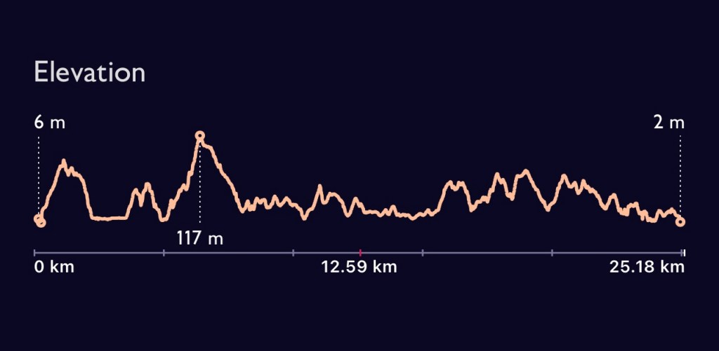
Having been worried about timings and making sure I had plenty of time before the last ferry I had plenty of time to spare and further indulged myself with a local lager at a new tap house in Kingsbridge just a couple of minutes from where I was staying and booked a table for my evening meal. A very satisfying day. I was out for 7.5 hrs walking and covered 27.53 kilometres. Perhaps the ascent / descent profile of the walk is the most revealing illustration of the terrain!
So a different part of the country for the next few days. Sometimes plans change and different opportunities arise.
A trip to the South Hams area of South Devon, an area I know well and have been visiting for thirty years. My younger son and his partner were attending a wedding at Thurlestone and he thought I might like to go down as well to walk. Plan A, Pete would drive my car there and back and I could take them to the wedding etc. Plan B, after Pete gets Covid is that Alex and I will travel down by train to Totnes and catch a bus to Kingsbridge, where we are staying for four nights. Never been to this area without a car!
Bonus, I can use my bus pass on that part of my journey- although fares were cheaper than in Oxfordshire. Accommodation good and a great meal to set us up for a walk together on the Friday.
After much scouring of bus timetables we caught a bus to Hope Cove and planned to walk the coastal path round to Salcombe, to catch a different bus back to Kingsbridge. Our accommodation was about three hundred metres from the bus station!!
So the bus dropped us at Inner Cove, not my favourite bit of beach but that wasn’t the point of today. Having crossed the water front, steps climb quickly up and then a steep path so that it’s not long before we can look downward.
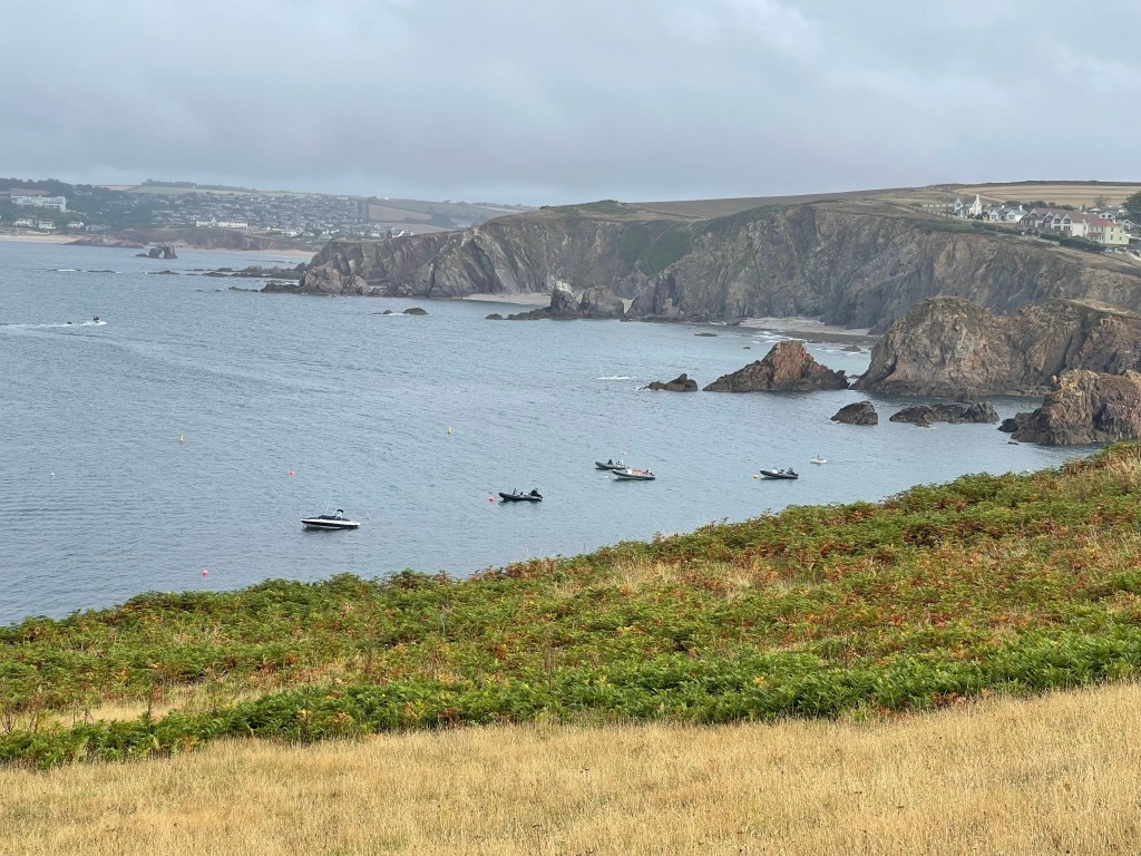
Not the sunniest of starts! We almost began to contemplate the completely unacceptable thought of putting on a cagoule but we stuck it out! We were still gaining height up to Bolt Tail and had a much clearer view back to Hope Cove. Was it rain or just sea mist – quite damp but still warm.
We stopped at the top as the path took a change of direction but decided not to go out to the headland but continue on the cliff path. Somebody out with their dog and then a runner coming towards us. Wouldn’t even acknowledge us – not quite the walkers code. We did stop by a rocky outcrop to have a quick drink and my eye was drawn to these succulents – having just bought some for my garden.
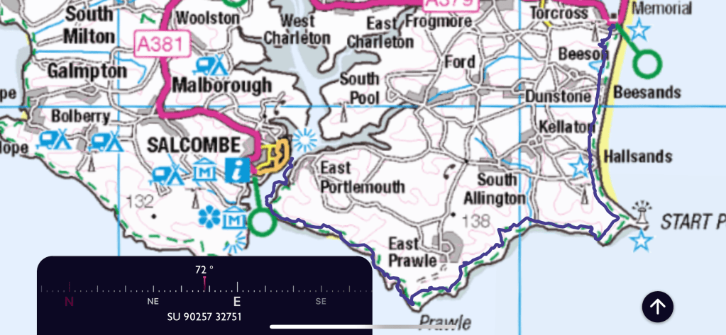
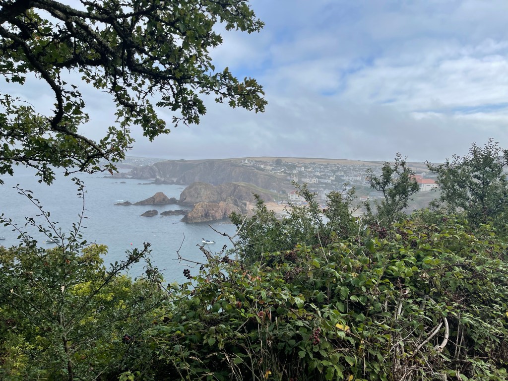
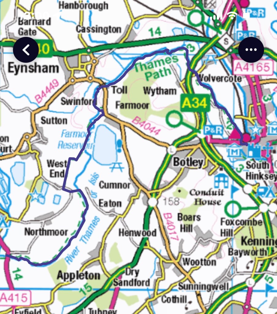
We climb up a grassy path and at a gateway there is a path leading steeply back down to Inner Hope. Alex used this on his run on the Sunday when he ran the reverse of our walk and on to Bantham for beach games as a follow up to the wedding on Saturday. A good place to insert the map to make more sense of the route.
A grassy area to our left and cliffs down on the right. Really surprised to see evidence of fires on the cliff side- notices suggest these are due to the extreme hot weather and that they might still be smoking.
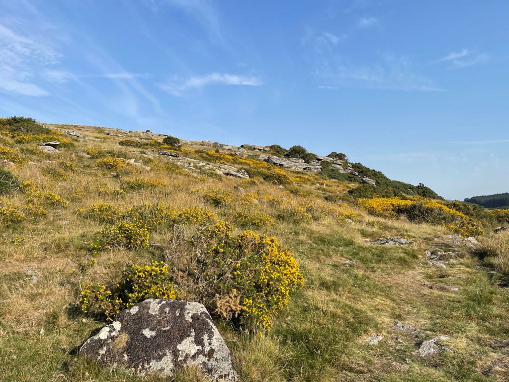
We are now on to Bolberry Down which is quite a popular area with parking at the far end. There wasn’t any coffee in Hope so we divert to a cafe next to some accommodation. Any interesting selection of holiday lets linked to a restaurant. I have mine put in my flask to drink along the way. I’m using my water reservoir again today.
The path winds itself up and down and there are some quite steep sections with undulations all around. The sea mist is still with us but the warmth indicates that the sun might break through.
Below is Soar Mill Cove, one of our favourite spots in the past. Visited last year when we discovered that we could no longer park by the hotel. We had had a slightly damp walk and a steep climb down to the beach from the parking near Soar. We met a few people approaching the beach as we took the path up and around – we had been this way on the way back last year and it had been a bit damp then as well. A stop by a rocky outcrop for a snack and coffee.
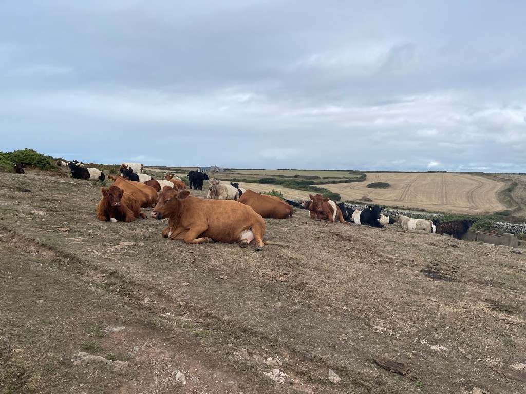
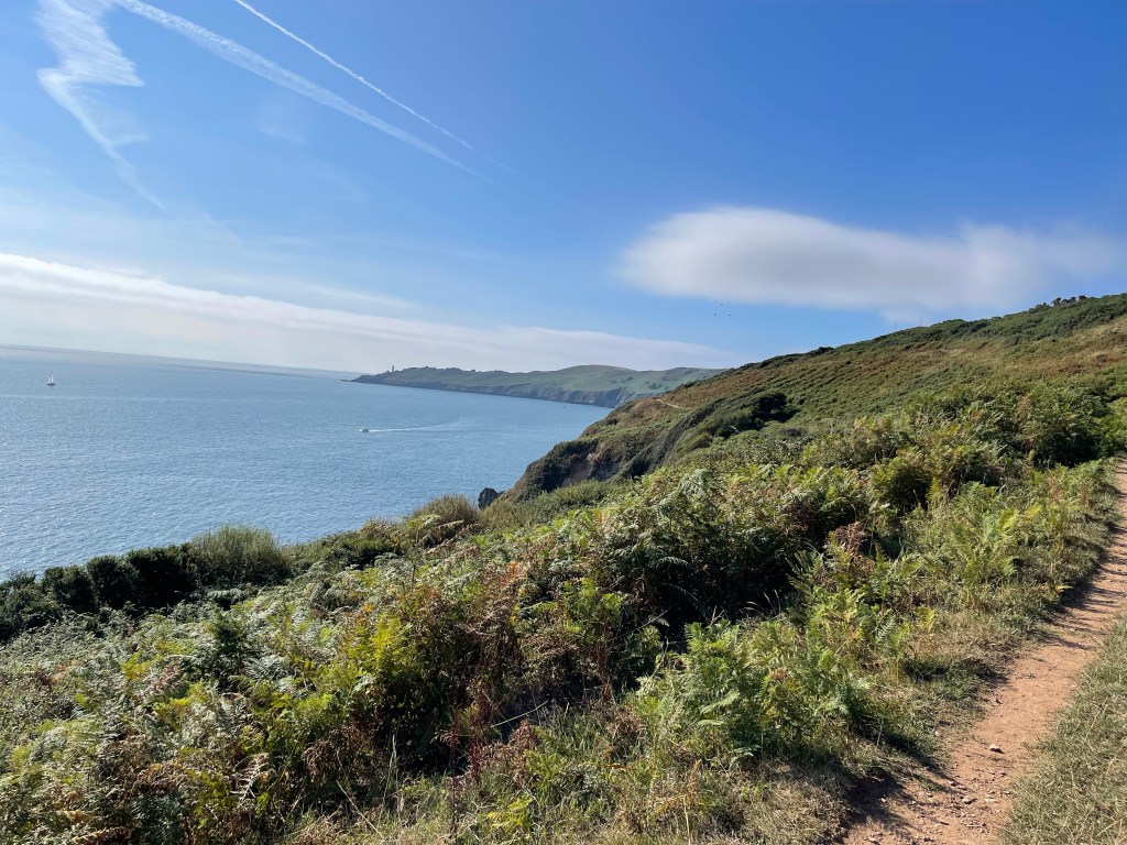
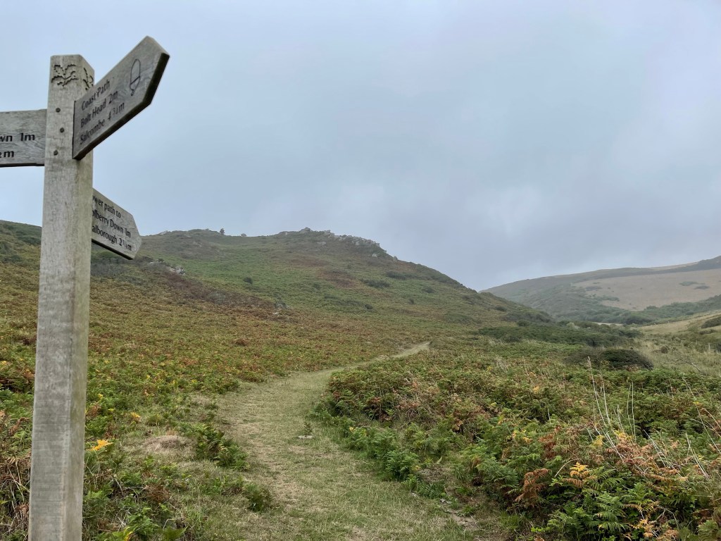
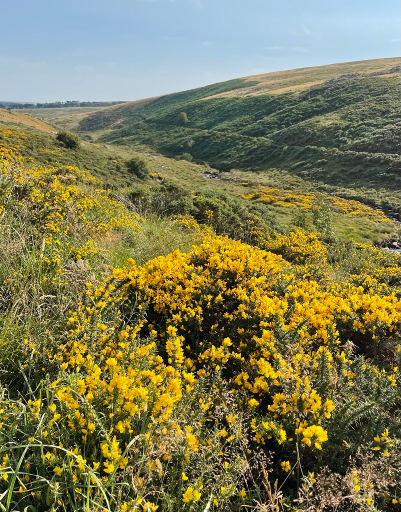
We are walking along the Warren towards Bolt Head and this is a slightly more desolate area. Still a bit murky – well the cows are sitting down!
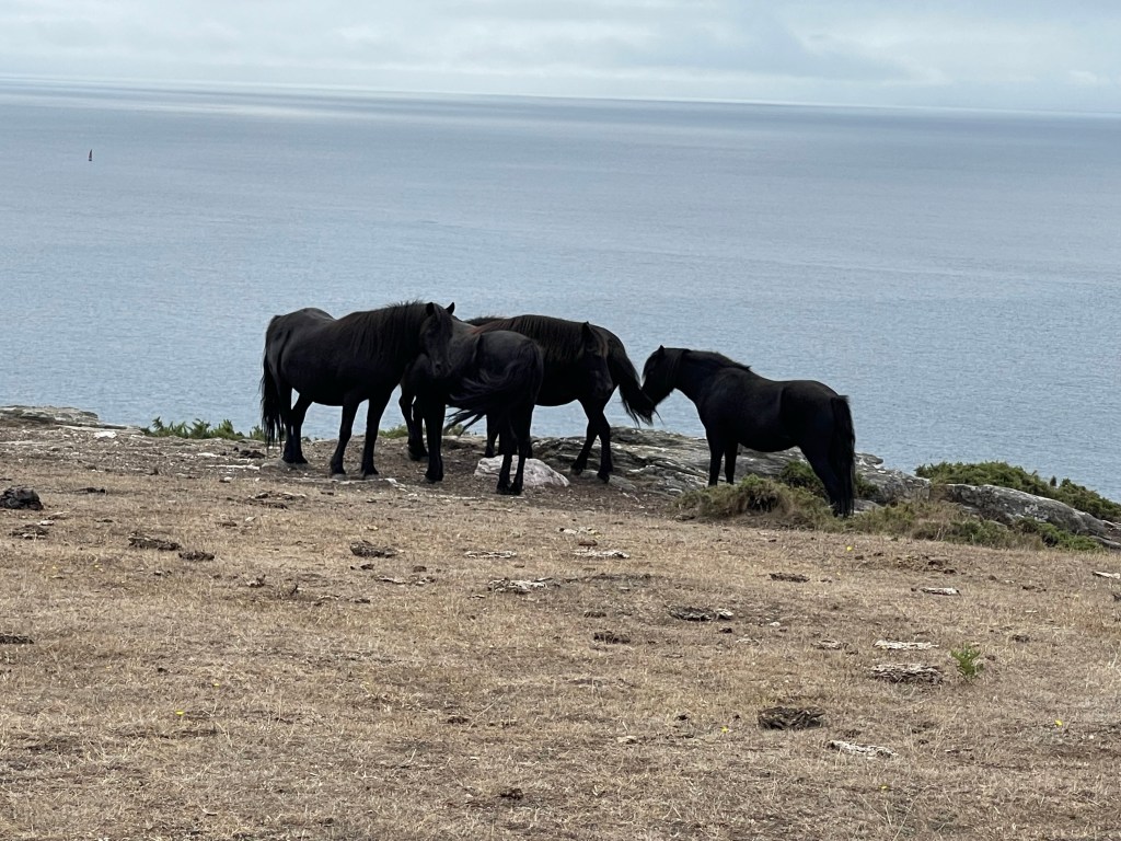
Our path takes us towards Bolt Head and as we are looking out towards the sea before we change direction again we spy ponies on the horizon.
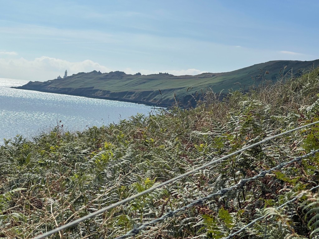
A steep climb down to Starhole bottom and then the most splendid view to a beach far below – not one we’ve ever been down to. One more easily reached by boat. We decide this is a good place for lunch and sit on the grass at the top of this cliff. There is a wire fence that protects anyone from falling over the cliff, with a small path and a battered piece of fence signalled by an abandoned straw hat! Probably not really meant to be there.
A mother and daughter approach with a golden retrieve but although the mother was game to try getting down to the beach, the teenager daughter obviously thought it was far too much trouble! Then a young couple venture over the top. Wish I had felt a little more adventurous!
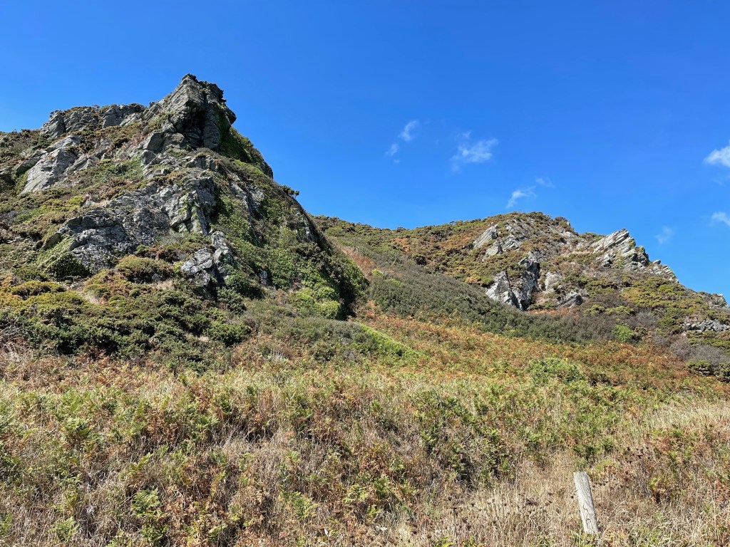
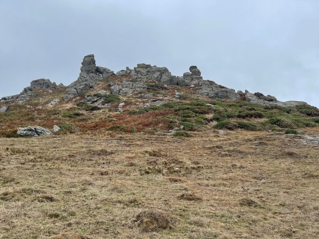
The path can be seen curving round the side of this rocky outcrop and having climbed back up to the track we were back on our way. We had walked this last section before but often from the other direction so we knew that this was a rocky section which would soon turn towards Salcombe.
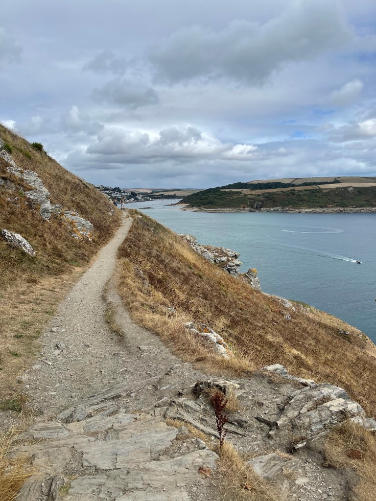
The path having been very narrow then turns to a track which runs along the cliff side, diverting both up to Sharpitor and gardens and also down to South Sands. So from tranquility and wildness we were suddenly down into people, parking, ice creams and beach games. The path follows the road and moves on to North Sands where there are the remains of a castle and fort. Then we come to the town proper, when we get to the steps down to the foot ferry across the estuary our walk proper for the day is completed.
We do visit the town, do a bit of shopping, including ice cream! We check out where the bus will leave from and then go back to the ferry for a quick trip across and a short visit to the wonderful sunny cove. One of us goes in the sea and the other just foot dips! And then a very quick walk back to the bus and just manage the one we’d hoped to catch!
Not a long walk today just a little over 15 km but very enjoyable and getting a bus from Salcombe was far preferable than having the car. The liberation provided by catching the bus felt good.
So having returned to New Bridge in the morning and returned Andreas to his group we set off again along the river – our target for today was Oxford. Not quite as far as the day before but still a long way to go. We are back on the north bank and there are quite a few fields with herds of cattle, a variety of breeds but quite a lot of rich tan brown colour, certainly looking in very good condition. We did help one father and son be brave enough to walk through them. Not sure how they got back again!
Cattle don’t worry me too much, I’m not complacent and I try not to get between cows and calves. suddenly remembered when I worked on a farm the summer before college and I had to move some young cattle down a road and into another field. The farmer had great faith in my capabilities!
So a few more boats, some moored up and just beginning to rise. We did set off quite early, 08.13 to be exact! Quite nice and cool to start our day and we made good progress. Our direction is quite different today as we are turning north east and then back down again to Oxford.
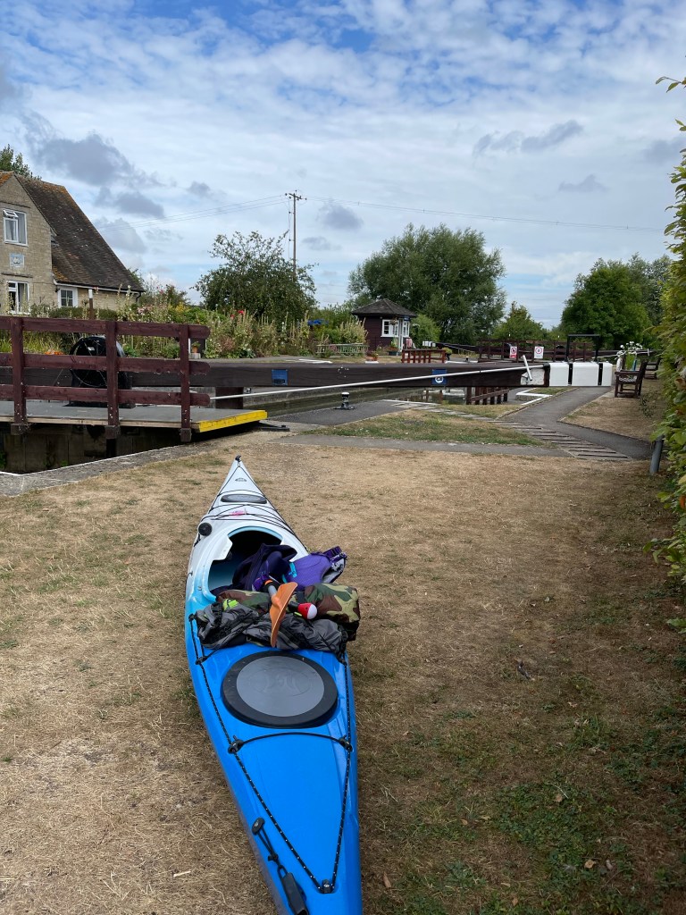
There are some very interesting extended back gardens coining down to the river. We look at the map to work out where they are, quite a long way from Appleton village but that is probably their address. We also note that there could be some good walks in that direction – there is one footbridge over the river and Fiona thinks she may have used it in the past. We soon reach our first lock – Northmoor.
Next significant place is Bablock Hythe a large pub which many years ago had a ferry across the river. It was a chain ferry, a flat bottomed boar with a chain which the boatman pulled the vessel across. Sadly not there anymore. I had walked down to the river from Cumnor and walked on the other bank last summer. Beyond the pub is a large caravan park and the path is forced to go round this.
Whilst we are contemplating the old crossing area our German group appears and I think they’re rather hoping the pub might be open.
So a section along a road and beside and around the caravan park, many of these are residential. This is a very extensive detour as we have to go further down a lane and across several fields before cutting back to the river. We are missing our companion! A farmer drives through trying to ensure his sheep have sufficient water, again very little to eat.
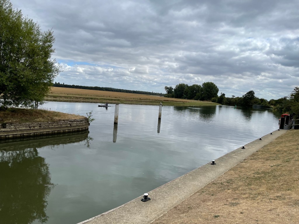
When we catch up with the river we are very aware that close to the opposite bank is Farmoor Reservoir, it seems strange that it is hidden away behind the bushes. The river does look good at this point.
The river doesn’t seem to be flowing so fast today. Yesterday we had seen several paddle boarders and at one point they were moving very fast , carried along by both the flow and the wind. Today we had seen more canoeists, in fact we had met two at the first lock where they had been finishing their breakfast and taking down their tent.
The river has some big meanders and the reservoir, a large egg shaped body of water fits within its curve. We are soon at Pinkhill Lock , somewhere it’s almost impossible to reach unless you are on water or foot. We meet our canoeists again, they have just lifted their canoes out of the water and we have stopped for a snack. They explain with the low level of water in the Thames that they are not allowed through the locks unless there are other boats.
We offer to help, with first boat I held a gate and with the second I took my turn carrying along the length of the lock. They still had to get them back into the water, but obviously that went well as they overtook us further along!
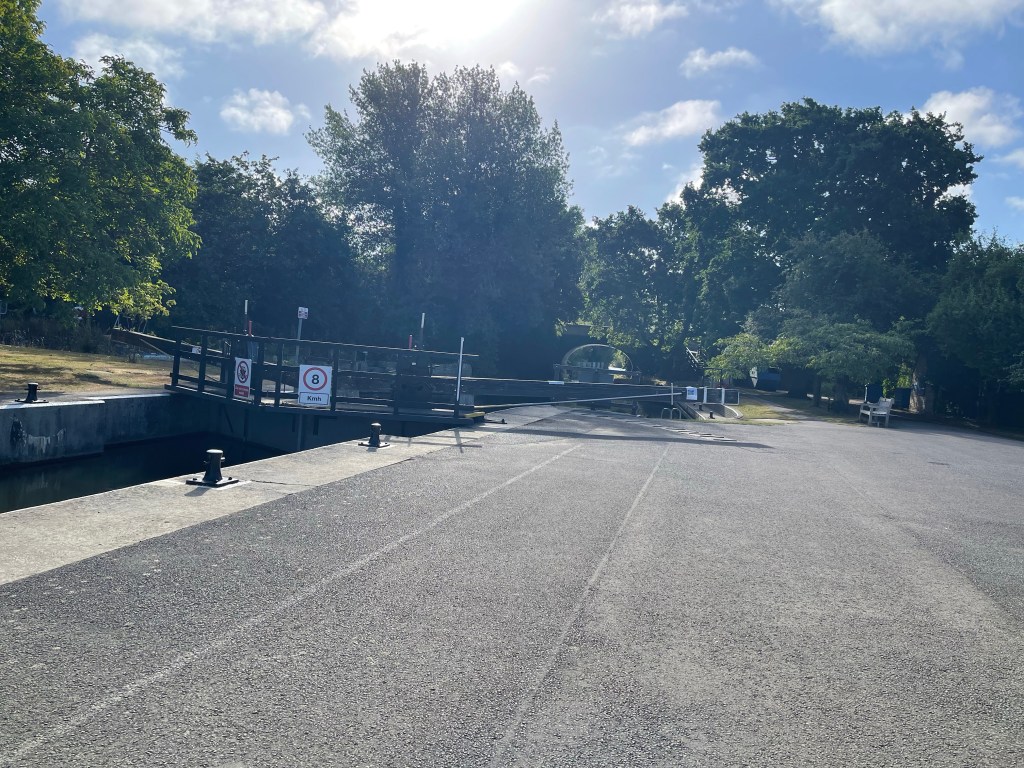
The lock is near the top end of the reservoir and the path soon diverts to the Oxford Road – linking the southern end of Oxford with Eynsham and crossing a toll bridge – we’re not quite there yet. Having walked beside the road for a short stretch – very strange after the tranquility – we turn back towards the river and through a boat yard, which also advertises a nail bar – well actually a container converted for the purpose. Very enterprising but not sure it would be my place of choice!
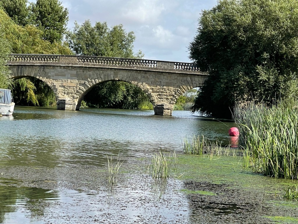
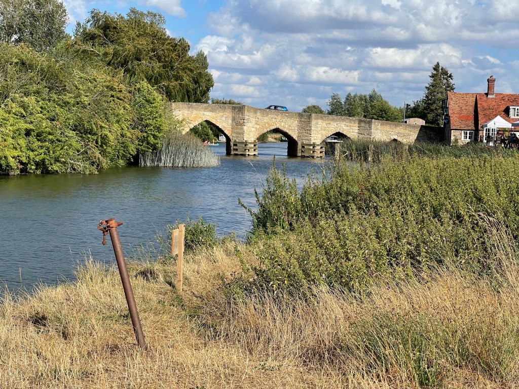
So at the lock we changed banks again and we are now on the lower side – bit strange as we are travelling in a northerly direction so we are actually on the east bank! Really tight wriggles so we all agree that a straight line is the obvious action! Then we spy the bridge, been over this quite a few times through the years, built around 1770 it is still a Toll bridge, 5 or 10p a journey – not sure how you pay since the pandemic.
This is a rather different landscape as we have a large hill to our right and the side of this is wooded for a great part – Wytham Woods is used by Oxford University for Ecological research and is connected with the Outdoor Centre that I support. The land adjoins and the later is able to use the edge of the woods for various activities. At another time in my past I used to visit a simple Woodman’s Cottage which was leased to the Guide Association for a peppercorn rent. Sadly now not used but this area of the wood was used for training of local regiments in the First World War and there are remains of trenches which are still used for educational purposes.
For a short distance after Swinford Lock our path coincides with the Oxford Greenbelt Way but quite quickly that diverts to the right along and around the wood whilst we stay on the river bank. The wood comes down to the edge in places so a more closed in terrain. We are then back in a more open area and farm land which is also linked with the university.
There has been an alert on the website that there may be a diversion along this stretch as work is being done to develop the link between the Thames and Seacourt Stream to ease the transition of fish from one to the other. There’s obviously some work taking place but no diversion and we ponder how you get fish to divert!! We have heard rumbling and traffic buzz for a while and as the Thames has changed direction once again we pass under the A34 as we travel south and it travels northward. We are very soon at Wolvercote Bridge and another classic pub The Trout. Remember taking a minibus full of children there one evening when staying at Hill End and having 15 lemonades in the garden! You could do a very good protracted pub crawl between Lechlade and Oxford – a thought for the future!!
Next to observe Godstow Abbey and Godstow Lock – a history board tells us more. We are now on the banks of the Thames as it moves towards the centre of Oxford. On the opposite bank is Port Meadow a vast area of common land where horses can be kept but are rounded up once a year by the Sheriff of Oxford. Also famous as part of the Thames that the author of Alice in Wonderland rowed along with three young girls, one of which was immortalised as Alice.
The spires of Oxford can just be seen in the distance as can sailing boats. This area is full of activity, walkers, families picnicking, enjoying the water. Never before have I seen this area looking so dry and the water so low. There is often flooding on the Meadow itself and this can make walking across it tricky at some times in the year.
There is quite a gathering near the back way into another iconic pub – The Perch and on reflection this looks like an important social gathering. Some people have started waiting at the edge of the river and the we see why. A bride and groom are being transported down the river and she waves to us!
Next the edge of a boatyard, the sailing club and a very steep rounded bridge. The river moves away from us for a while and we are on a causeway between it and a cut through.We are on the edge of Fiddler’s Island and then we’re back by the river. This path floods often in the winter and there are warning signs at either end of this section. We are back on the top side of the river and we reach a section where a footpath leads off under the railway line to join the Oxford Canal Path. We are walking along the back of some terraced houses with back gates leading on to the path. A few sandbags indicate that they can be in a precarious situation at times. One person is filling a bucket from the river and watering plants in her yard. Are you allowed to do that?
Soon we see the bridge which takes the road over the Thames into the centre of Oxford. We exit here to find our lift home but we will be back next month.
25 km today. This was the first time the other two had walked for four consecutive days and they rightly felt quite pleased that they had achieved this.
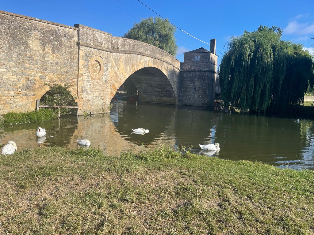
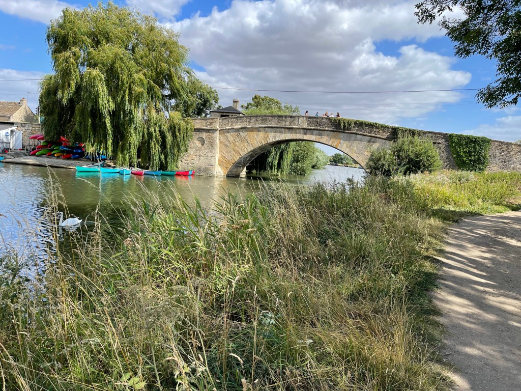
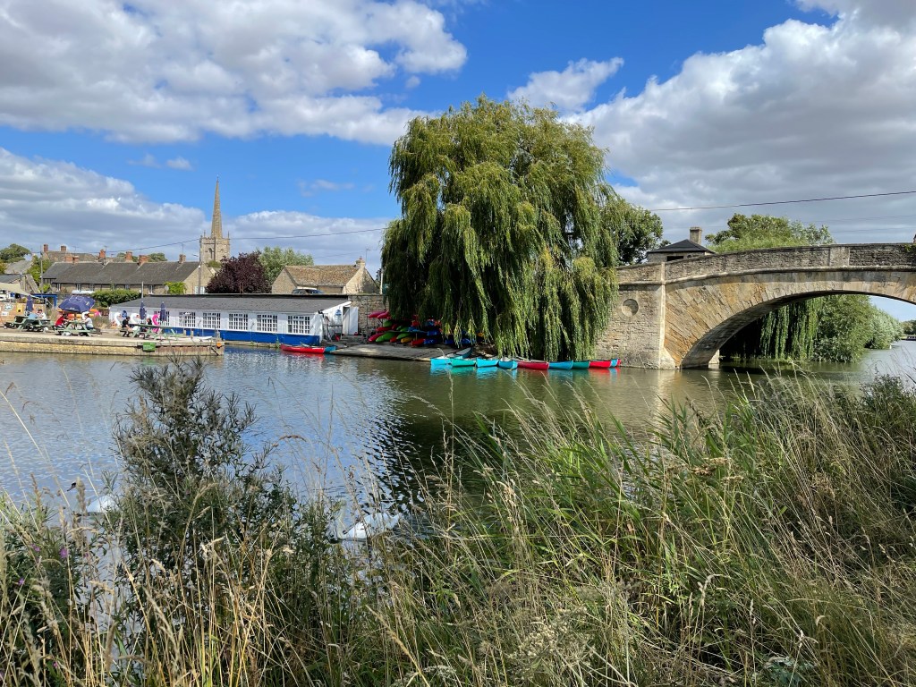
So the third day of this block of walking along the Thames Path and we are back at Lechlade for our start. Out of the town, over the bridge and then under and we are on our way. Back into Wiltshire for a short while. This stretch of the river as well as now being navigable is where the locks start and we will pass 6 today. The swans are out to greet us on this sunny morning as we look back at Halfpenny Bridge.
Very quickly we get to St John’s Lock and the Trout Inn, we had just come this way in the car not long before! Old Father Thames resides here but no activity on the lock yet.
The River Cole joins the Thames here, forming a border between Wiltshire and Oxfordshire, so we set foot in our home county. Not for long though, we soon cross back to the north bank and spend a last bit of time in Gloucestershire! It’s quite strange walking on the other side of the river quite close to the road that you came along to get to the start of the walk. A completely different perspective on a parking spot by the river that I’ve driven by so many times – perhaps next time I’ll stop and spend a while enjoying the river. I often remember the very wet winter when I had a slightly surreal journey along the road with the Thames flowing in all the fields and the road like a causeway through the middle!
Some cattle in some of these fields and the second lock of the day – Buscot. The river really does wriggle a lot at this point. One of the predominant flowering plants along this stretch in Himalayan Balsum – Policeman’s Helmets – an invasive species which grows very vigorously, but does make an attractive edge to the river bank.
Other flowers along the way today – water mint and purple loosestrife.
Having seen swans at the beginning of the walk it was not long before we found this family of quite mature cygnets.
Our path has run very close to Kelmscott Manor and a deviation to visit would have been good. This was once the home of William Morris and having closed during the pandemic it has recently been revitalised – a skilled craftsman his many designs which subtly depict nature are still very popular. https://en.m.wikipedia.org/wiki/William_Morris
The third of our locks is met quickly Grafton – not close to the village of the same name but joined by a track and easily accessible via this small roadway. These moorings were obviously popular and regularly used by their owners. Pot plants and decking as well as the picnic tables!
The river is gentle and does meander a lot and is not very busy at this point in our journey. Our next landmark is Radcot bridge which is apparently the oldest bridge over the River Thames. Built in around 1200 it was damaged in a battle in 1387 between two sides quite possibly disputing lands, this at the time formed a border between what was to become Oxfordshire and Berkshire, until that is when on 1st April 1974 this area became part of Oxfordshire. https://en.m.wikipedia.org/wiki/Battle_of_Radcot_Bridge
We are making good headway along our route, not meeting many people, we had seen the young couple once again the day before armed with sticks against the cows ! But so far today we hadn’t met either them or the German group. so next Radcot lock and we stop for something to eat. That’s four of the six today but all very quiet considering it is the weekend. We are back on the south bank again and will stay here for a while. We spot another family of swans, this time with six almost fully grown cygnets- quite an accomplishment.
Before we set off we meet up with the young couple who have overlapped our paths. They are American law graduates who are exploring this part of England before returning to start work. They still have their sticks and are finding it difficult to grasp that in England you can walk through a field of livestock, in fact they are finding the whole footpaths and ease off access very unusual! They are heading for Tadpole Bridge, not to far away and then a very short section the next day before going eventually to Oxford. Their luggage is being transported to various hostelries along the way.
Shortly after the lock we come to ‘Old Man’s Bridge’, a high wooden bridge which again linked Oxfordshire and Berkshire, Bampton is to the north. Richard and I had crossed this bridge on our way from Bampton , during a walk earlier in the year. This is an area crisscrossed with brooks but although possibly very wet for much of the year it may have been an important route for the movement of sheep during the ‘hay day’ of Cotswold sheep farming.
Richard and I muse over the fact that somewhere along this stretch we had to turn back because of a quagmire which Steve the SPR leader insisted on finding a way through! The river really does wriggle here and it’s much easier to walk in a straight line than pedantically follow it’s banks.
Next is Rushey’s Lock and we at last see some action, although most of these locks do have lock keepers, they all seem to have this weekend off. We have to cross the weir at this point and we are back on the north bank. Not too long and we are at Tadpole Bridge but alas no time to stop at the pub!
For a short while after the bridge we have a very different terrain.,Quite a squeaky route between the Willows. I have been following a Facebook group called Ridgeways and Ancient Trackways and a thought occurs to me that although this isn’t a conventional ancient route it would have been walked by many people in the past guiding their horses along the river. Fiona had researched the night before that salt used to be transported from Droitwich and then carried from Lechlade to London along the river. We are not that far from Cirencester an extremely important Roman town.
So if we only consider the transportation of salt and cheese plus wool my musings that many would have trod our path before us are probably very correct!
The river has widened a little but has much overhanging foliage. A vast empty flat landscape to our left but a few highlights.
We’ve just reached ‘Ten foot Bridge’ , obviously much wider than that so a bit of a strange name. We are taking a little break, Fiona has just finished exploring the bridge and we hear a large blast on the horn of a boat. We are on a bend and a very wide boat has come under the bridge rather quickly much to the dismay of the one coming in the other direction! And he managed to hit one of the posts and then his co pilot at the front of the boat had to duck away from the branches at the side of the river!!
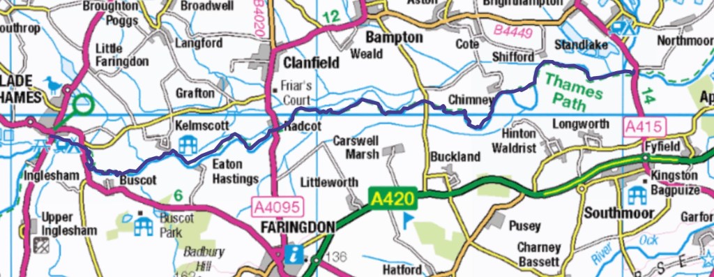
We now have Chimney Meadows beside us, an area of significant scientific interest with a large area of unspoilt grassland but with several water courses. A hide by the side of the path indicates for those patient enough that this would be a worthwhile spot.
Our next significant section is along Shifford Lock cut, a very straight area created to cut of a huge loop of river. About half way along and where we left the river on our Bampton walk we cross yet again and then pass over a weir. Strangely our path doesn’t actually go through lock number six although we are aware of it’s presence. We still have quite a long way to go until we reach our final destination for the day but it is not unpleasant and there has been some variety. The reeds along the river are magnificent in places.
We walk through one field with a flock of several hundred sheep and large lambs. They really are struggling to find anything to eat and we discuss the effects this will have on the late finishing of the lambs, the state of the ewes for next years lambing and the very sad state of the fields.
We’ve noticed some very big poplar trees just after the lock and wonder how long they have been growing, wonderful specimens.
Our journey has nearly ended ‘New Bridge comes into sight. Not so new though! We do settle down for a drink this time- well earned in the warm weather and after 29 kilometres.
Our story for the day does not however quite end here. Whilst taking refreshment the group we now know to be Germans arrived at the pub – ‘The Rose Revived’. There were 7 in total and the mum went in first whilst we chatted. Much distress she had booked beds for the night – only 6 had been available but she had assured herself that somehow they’d find her an extra bed. No such luck.
Quick discussion between ourselves – Richard in particular said he would sort it out – took phone numbers and assured them he’d be back. He had several thoughts. In the end the father stayed the night at his place and we returned him when we set off the next day!
So back to Cricklade to continue our journeying along the Thames. As we’d walked down to our lift the afternoon before I’d noticed a car park sign and possibly toilets. Hopeful, I directed Jane to this point to drop us off. I was correct, a useful start to the day and our path was almost opposite leading off from the Main Street. First a short walk through the edge of the town and as we met an old farmhouse a useful historical sign which amongst other information told of ‘Cricklade Cheese’ – in the past mature cheeses were dispatched down the river towards London. So we had discovered our first goods to be transported.
Having started our journey yesterday in Gloucestershire we are now in North Wiltshire and will be for most of the day. Round a corner we meet the illustrious Thames and it delights us not only with water but as if called on demand, two swans.
We are in a pleasant meadow with more notice boards about wildlife but we can hear an impending rumble from the A419- luckily there is an underpass for the Thames and foot travellers!
Nothing too dramatic happening at this point, just a gentle, peaceful, meandering, small river. Whilst the river doesn’t always travel west to east for consistency the lower or right hand bank will be referred to as the south side or lower side. For about half a kilometre after the road we are on this lower bank and then need to cross a bridge and for a short while change banks, and then back again. Not much bird song- should there be? Nothing remarkable just serenely beautiful.
Back on the southern bank near Water Eaton House we have an easy stretch along a very meandering river. A warm day so grateful for odd patches of shade. Again we are struck by the greeness close to the river, a rare sight this summer.
At Water Eaton our path takes us away from the river but not before we have looked over to more gravel pit lakes- visible this time. We enter this typical Cotswold village and meet a young couple taking a rest – we will meet them again. After the village we are on a track, some of the names are great – forty acre barn. This provokes a discussion as Richard was a farm manager – did this refer to the capacity for storage or just next to a forty acre plot? We are on Blackford Lane – was there a ford? We briefly touch the bank of the Thames before we are off on another track. Here we meet a father and daughter resting whilst mum has gone on and then come back- we decide after chatting that they are German, they too will also feature later over our four days. An abundance of autumn fruit along this path.
Having crossed over a small stream which flows into the Thames we meet our companion again and have sight of our first craft on the Thames.
We decide in is time to look out for a place to stop for lunch and having crossed over a wide stream joining the river we decide this will suffice. As we sit we can see really large dragonflies dipping to the river, so big you were almost left wondering if they were birds!
Great to be back by the river and our next stop will be Inglesham Church -St John the Baptist, built mostly from around 1205 there are also Saxon elements. In the 19th century William Morris the craftsman helped restore and preserve many of the wall paintings and carvings.
At this point the Thames Path until recently had to leave the river and follow the minor road where the only route then was to walk along the verge of the A361. Luckily for us there is now an alternative alongside the river for this last stretch of day 2.
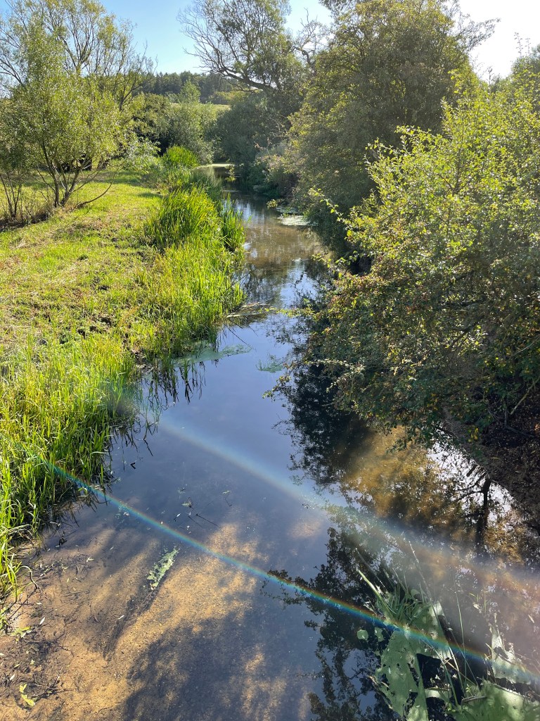
The plants and particularly the reeds along this penultimate stretch for today have been magnificent with a wide ranging palette.
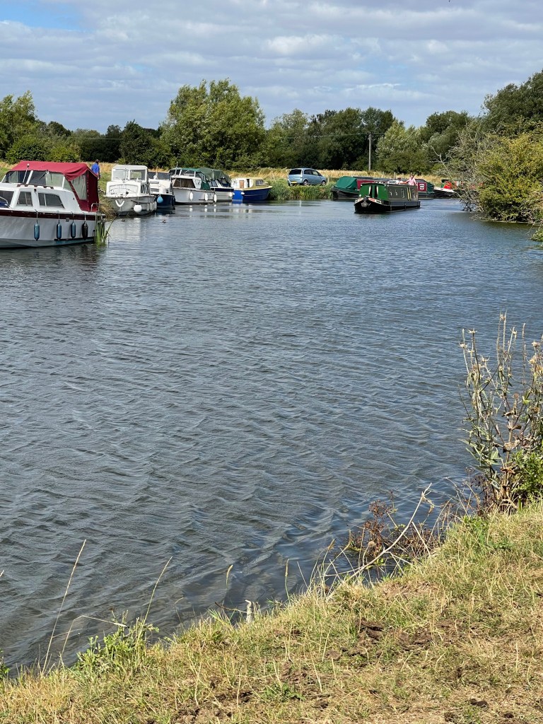
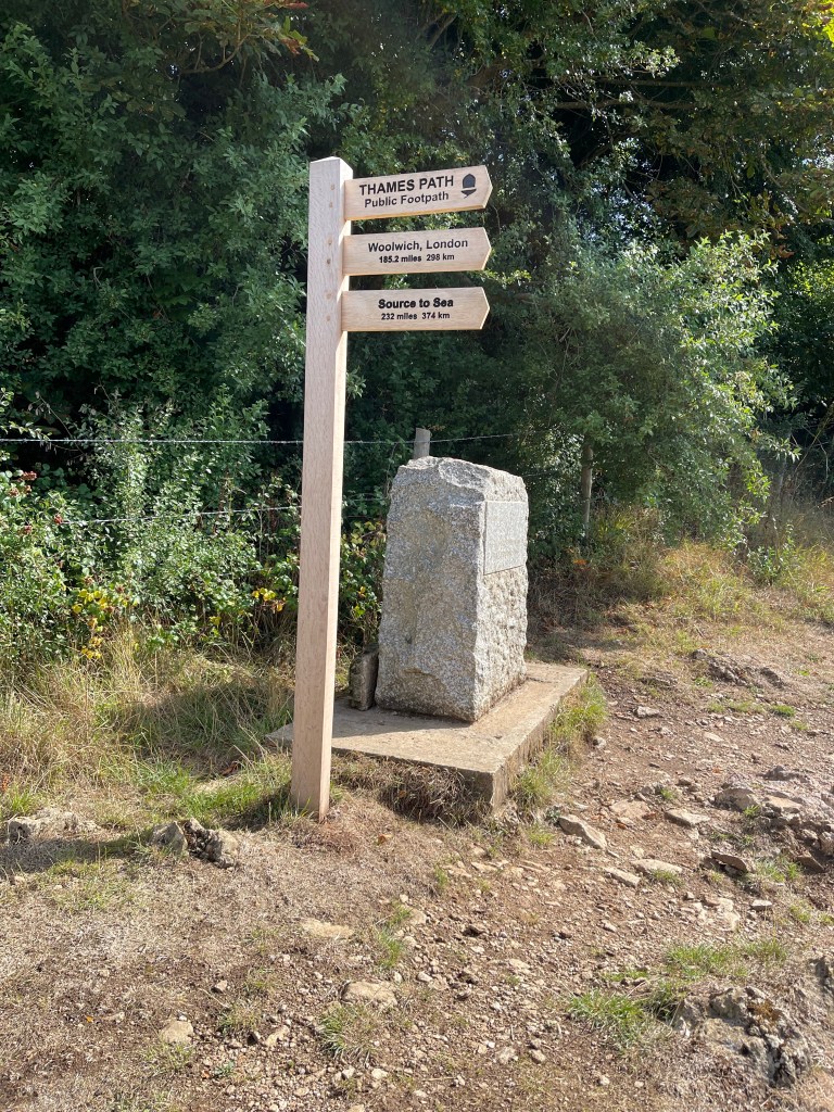
Round the corner everything changes we get to a point not far from Lechlade where the river turns as it is joined by the River Calne and the now abandoned Thames and Severn Canal – this was last used in 1927 and boats would have continued to Stroud. There’s an unusual lock keepers house at this point – it’s round and apparently the horses would have been kept on the lower floor. There isn’t a lock anymore but this is the point beyond which boats other than canoes of similar cannot travel, although it is used to turn. At one time this must have been a hive of activity. So now the river changes- it suddenly widens and we see a range of craft as we approach Lechlade- our destination for the day.
As we left the church and went back to the river we entered Gloucestershire again for a short distance. The border then goes through the middle of the river. So we’re back in Wilts but as we exit the river path and cross the old toll bridge- halfpenny bridge, with it’s hexagonal toll house we are once again back in Glos. Tomorrow we will visit another county- one closer to home!
This is the shortest day of the four just over 21km – tomorrow is much longer!
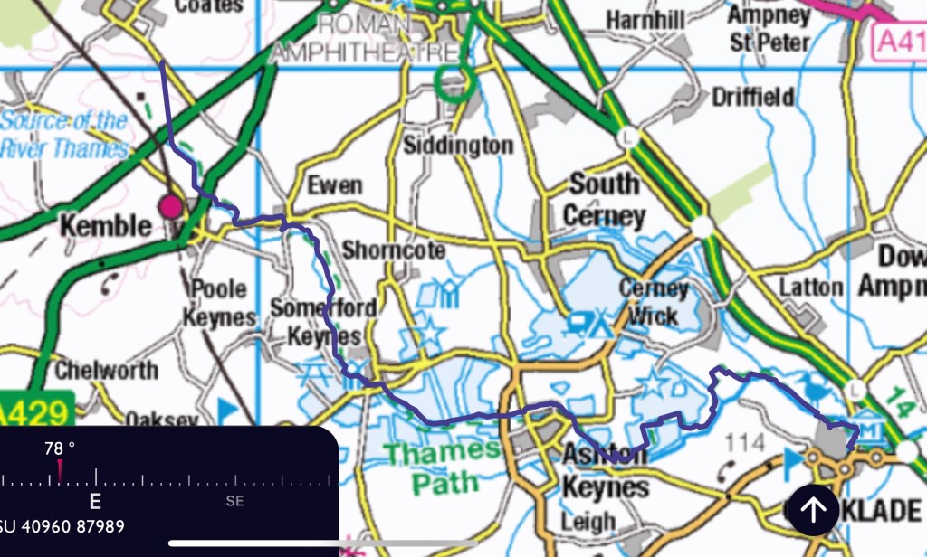
The start of a long distance path today . My proposal for the Thames Path was accepted by SPR and the plan is to complete the whole length before the end of the year. I’ve divided it up into four blocks – so this is the first day of the first block and we are setting off to find the source or the designated spot. There are only three of us as Betty our fourth person has unfortunately got Covid.
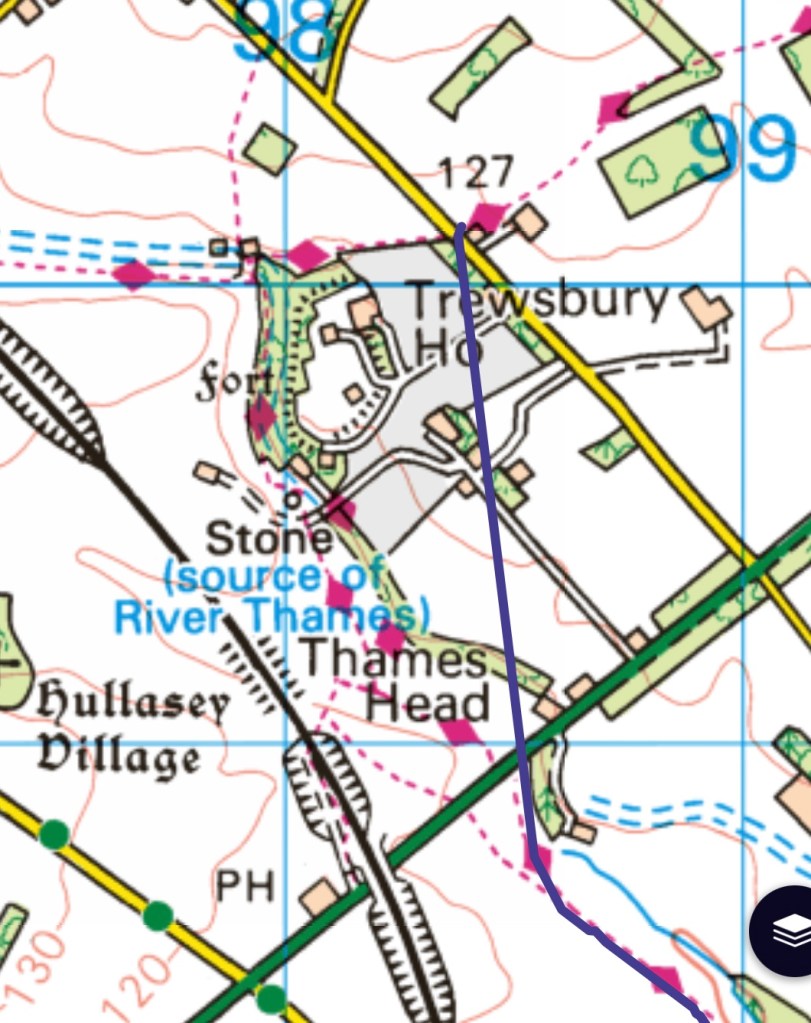
In order to approach the source without having to double back I decided to approach it from a side road off of the A433 which is actually a Roman Road out of Cirencester (Fosse Way) . To begin with we set off along the Monarch’s Way, the area of Trewsbury House is marked with two forts – intriguing. we walk alongside it and soon get to a cross roads where we turn onto the Wysis Way. Unfortunately my route didn’t record this first bit properly. Interestingly as we approach the source we are also near the route of the now disused Thames and Severn Canal, in fact during the day we will sometimes be on the Thames and Severn Way as well the Thames Path.
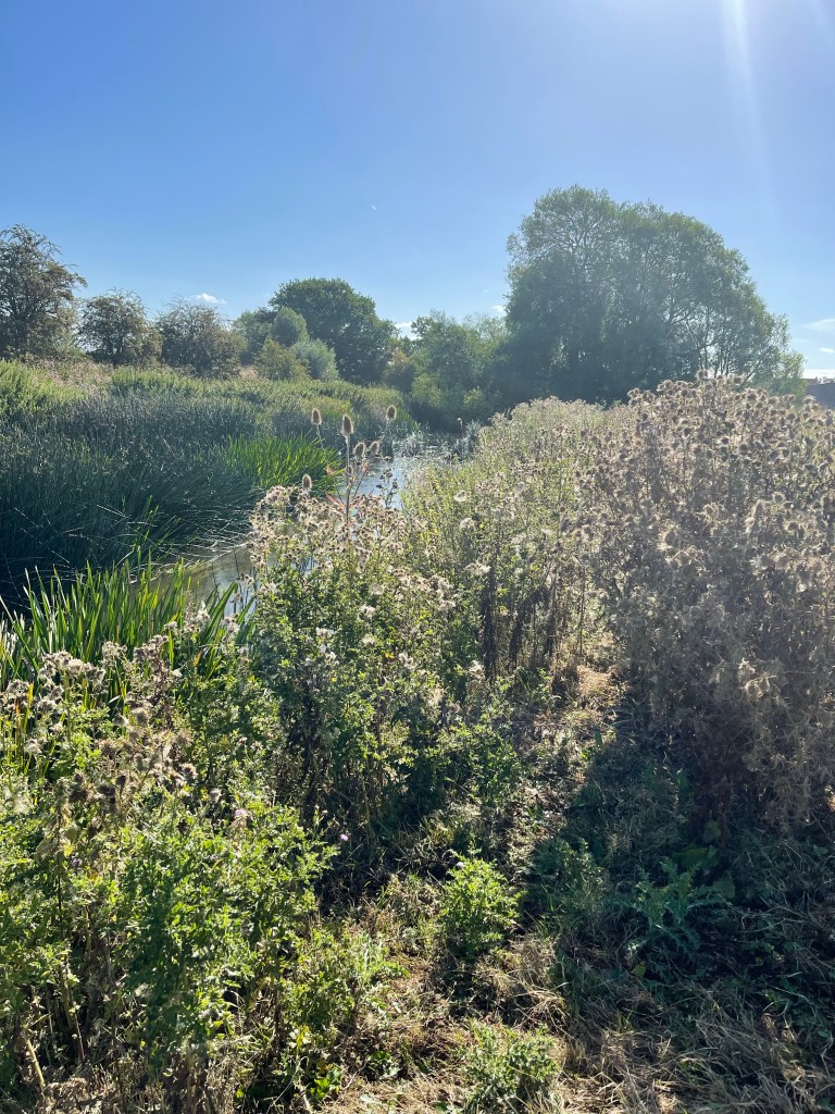
Great seed heads just before the source.
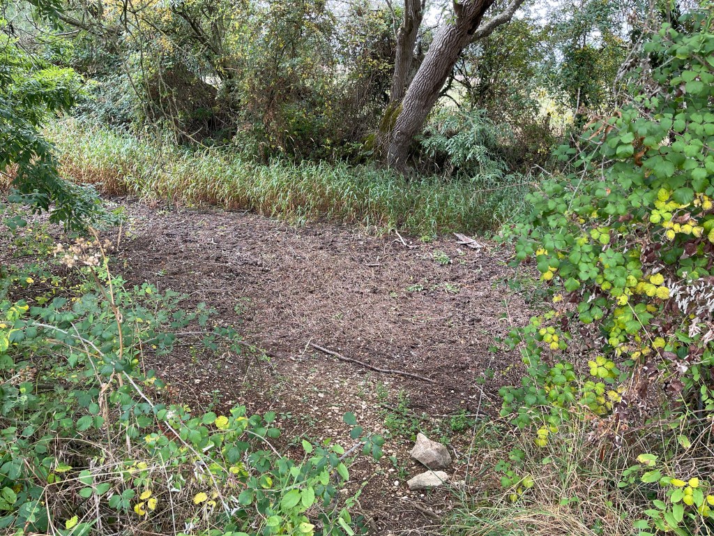
And now the source by alas no water – this was anticipated and well reported. We guessed that at some point there might have been a stream along this ditch area marked with longer grass.
We are now back to the A433 and we go across by a bridge with no water under it and then next to a stream bed which at some point must have had water.
The path really does wriggle around a fair bit and although quite well signposted a careful eye has to be kept out for the route. I also feel as leader I should be informing my companions of what to expect next or what to look out for. We haven’t exactly got a river to follow!!
A complex area with some evidence of the old canal, an existing railway line, an abandoned branch line between Cirencester and Kemble as well as the ‘pretend Thames or Isis’. Why two names? It’s ancient name was The Tamesis. Some literature suggests it can be called by either name until it is joined by the river Thame when the Isis name is dropped. Other commentaries suggest that it is the Thames to the north and south of Oxford but the Isis flows through the city!
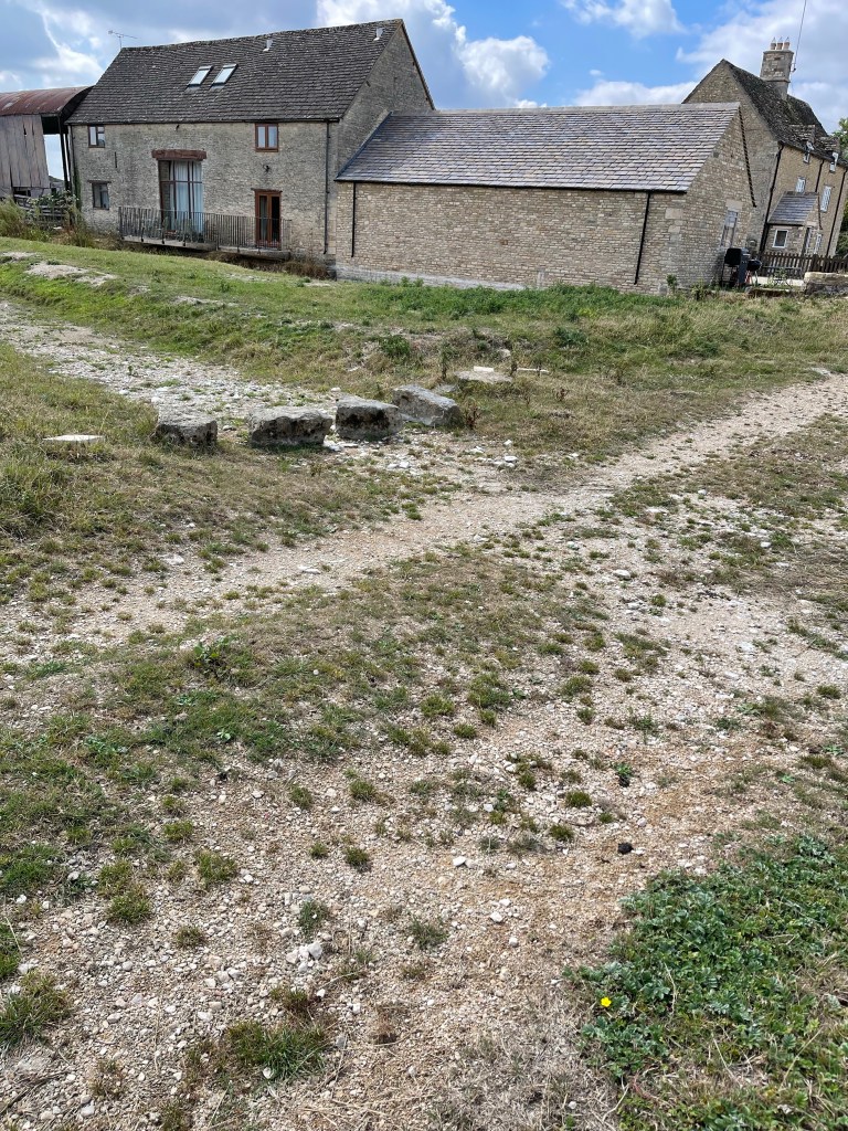
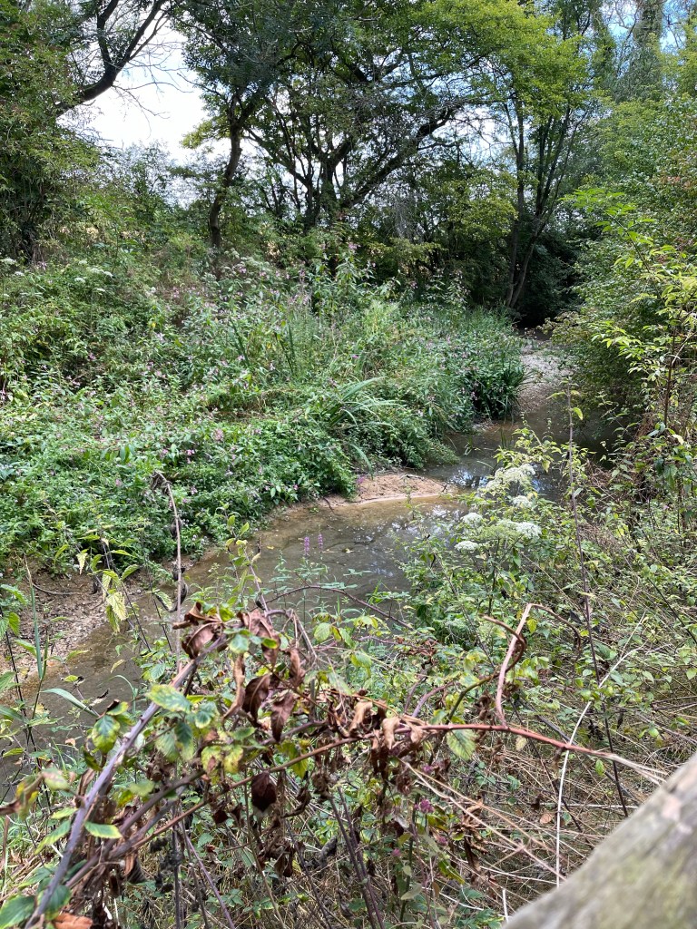
The path runs through the village of Ewen and then changes direction completely heading towards Somerford Keynes on the edge of the Cotswold Water Park – derived mostly from filled in gravel pits. Before we reach these vast areas of water we pass Upper Mill Farm and we can see evidence of a ford and stepping stones – just one element missing! After two hours we see a puddle – very exciting- we think it’s the Thames- could be another stream but we’re hopeful.
We are now in the water park although hedges screen us mostly from the lakes and there is little access. We’ve been looking for a lunch spot for a while and at Freeth’s Wood we spot a footpath crossing ours and we are hopeful for a way to sit next to a lake. No luck but we find a grassy patch for lunch and when we are nearly finished a family come along and decided to pick blackberries around us- we obviously had our invisibility cloaks on! There are some straight stretches with the bed showing clearly – very unsilted.
We spotted a few interesting trees in this area, one of which was a Whitebeam and the other with small cone like catkins -an Elm.
We carried on for a while longer seeing disappointingly little of the lakes until we got to Ashton Keynes , a very old and pretty village. Firstly passed an old Manor House and then on to the main village where there was water and it had been restrained between two walls as it flowed through the village. An elderly gentleman was repairing one of these walks. He indicated that there would have been a mill at the start of this area.
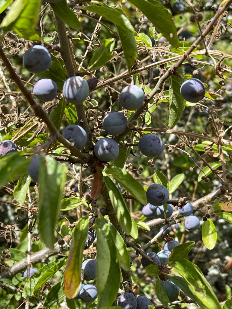
There were a lot of blackberries and sloes growing in the hedgerows and also just this one plant of Guilder Rose- I helped make jam from these berries during a bushcraft session at Hill End.
Having passed through the village we are back at another set of lakes, these are a bit more open and we can spot some water skying and here the chatter and laughter of children enjoying an activity. Our path takes us across some fields and away from the ‘river’, although it is possible to envisage it’s route due to the type of vegetation. We have noticed that it looks slightly more green in this area than at home.
As we get closer to Cricklade we are close again and the plant life certainly indicates the presence of water – even if it isn’t freely flowing. We also walk alongside North Meadow which is a National Nature Reserve – it is apparently the home to rate Fritillaries – that would be a splendid sight.
We approach the old town along the route of the old town walls and come in at the top of the Main Street looking out for Jane and our lift home.
Just over 22 km today but we managed to keep up a pace of 4 km per hour. Back home to return in the morning.
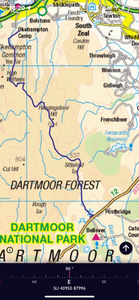
So having finished the previous day’s walk at Postbridge we were met and driven towards Princetown, where I thought we were staying. However it turns out our campsite was at Peter Tavy a rather small village nearer to Tavistock. Thanks to goggle I found us a pub to eat in( very good chicken curry) and then we went to the campsite to pitch my tent – Jane had already put their’s up. Shocked at how dirty my legs were from our walk – I was wearing cropped trousers and having pushed our way through gorse and areas that at times might be boggy, I felt quite grimy.
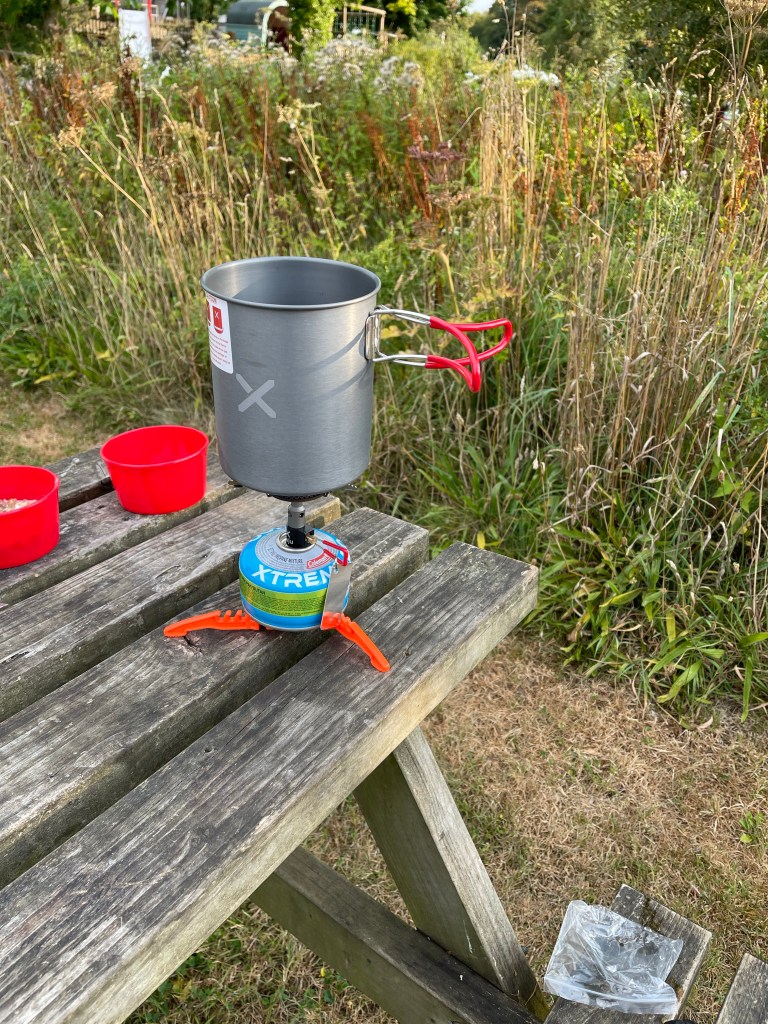
So after a surprisingly good night’s sleep we set off back to Princetown. A stop for Steve and Jane to buy breakfast – I’d already eaten my cereal and boiled water for tea- having bought a stove I needed to use it! I did buy a tea though. seemed quite warm again today – around 30 probably.
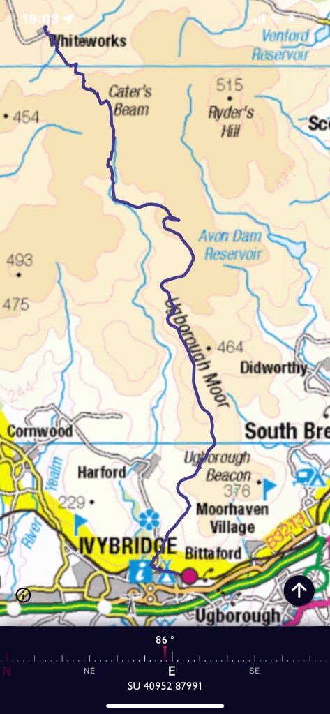
Steve decided to knock a few kilometres off the walk by having us start at Whiteworks an old Tin mine area and Jane dutifully drove us up the minor road to reach it. We started by exploring this area and then quickly found our path – for a short while! Steve pointed out where we were aiming for and then we crossed the edge of Foxtor Mire – luckily this was much drier than usual but still with hugely deep ruts between the tufts of grass and reeds. We were heading for Crane Hill area on a south easterly bearing. Well I only fell over once and took ages to be able to get up as feet were stuck down holes and nothing to lever on! Fortunately we didn’t find any snakes either !
So having fought our way across the mire we found a bit of a path and a cairn circle and the wall we had been aiming towards. Now to find a way across!
Having eventually found a way through the wall we climbed up a bit and found some rocks for a quick snack. Our first two kilometres of the day had taken over an hour!
We were now heading for the area around Cater’s Beam. I recorded our walk but used a paper map and compass. Having passed near to Crane Hill we found ourselves walking through Black Lane- a plaque at the end recorded how a passage way had been cut through the peat to ease the transportation of livestock across the moor. I spotted a post which I could locate on my map and on our route this is where we headed east to try to regain the path as indicated on the map. As can be seen this took us not quite far enough but definitely to path that had been used by others. Perhaps we gave up on our pacing too soon. I did have to point out that if Steve wanted me to follow his route- he was worried about snakes- then he had to wait a bit otherwise I couldn’t see where he had walked! !
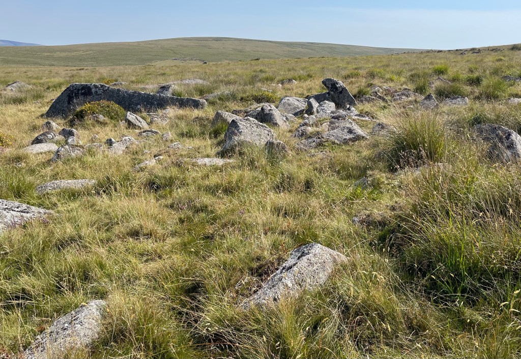
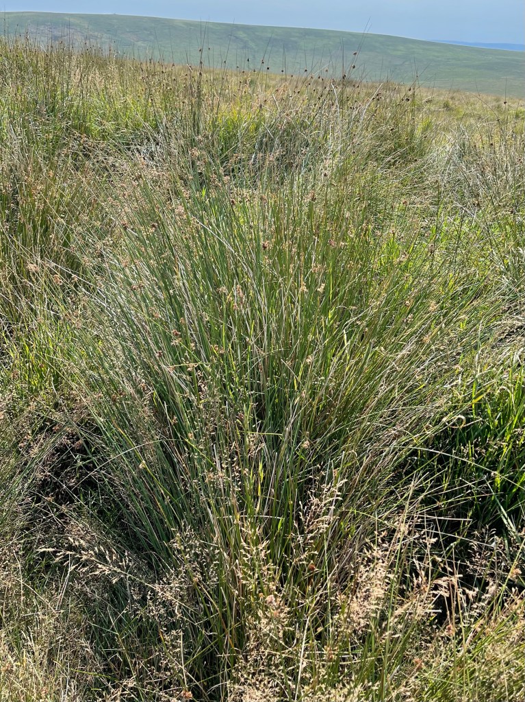
Again we are in areas of wide open spaces but no real Tors or distinctive markers in the landscape. We eventually find our way down going almost due south but slightly parallel to the marked path, perhaps if it had been less dry we would have been forced higher up the side of the hill. The streams in this vicinity are all the tributaries to the River Erme. We meet the course of the Abbot’s Way and take a turning to the east, somewhat pleased to leave behind the faint paths and rough ground we have been walking though. The next photo was taken later in the day but gives some indication of the terrain – Foxtor Mire was much more reedy.
We followed this along to Red Lake Ford where there were helpful stepping stones. I really struggled to get my balance to begin with and tried to look for an alternative crossing, to no avail. Back to the stones and a slightly different approach, a helping hand over the last big stretch and all done! Today was warmer than yesterday and it was good to stop for lunch – it had been quite a hard morning but we were nearly at the meeting with the Two Moors Way. The Erme Plains had obviously been an area of prehistoric settlement and I had hoped we would visit. Sadly no, our track was on the old dismantled tramway which once would have gone to the Tin Mines and the China Clay works.
Such a lot of archeology in this area and apart from a few boundary stones our path didn’t really overlap with this wonderful history. I made a note to myself that I really would like to try to follow the path that kept cutting across our route and find some of these remains. I think I had possibly seen some of this a long time ago when coming up from Wrangaton Golf Course. A disused pit which still had a good level of water had become a favoured spot for a herd of Belted Galloway beef cattle. More usually found in south west Scotland but suited to rough ground and moorlands. A poor photo as the brightness of the day was making photography challenging.
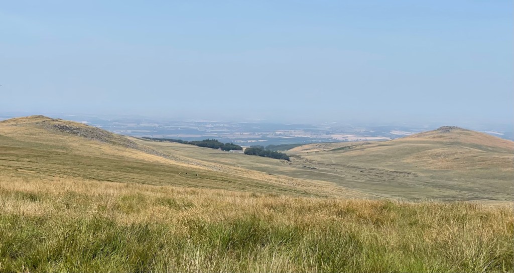
We stopped for water and a break as well, making quite good progress but still a fair way to go.The path continued to curve it’s way down hill, following contours as would have been necessary for it’s original purpose. After Piles Hill the area of civilisation below began to become apparent and then on the skyline Plymouth Sound appeared.
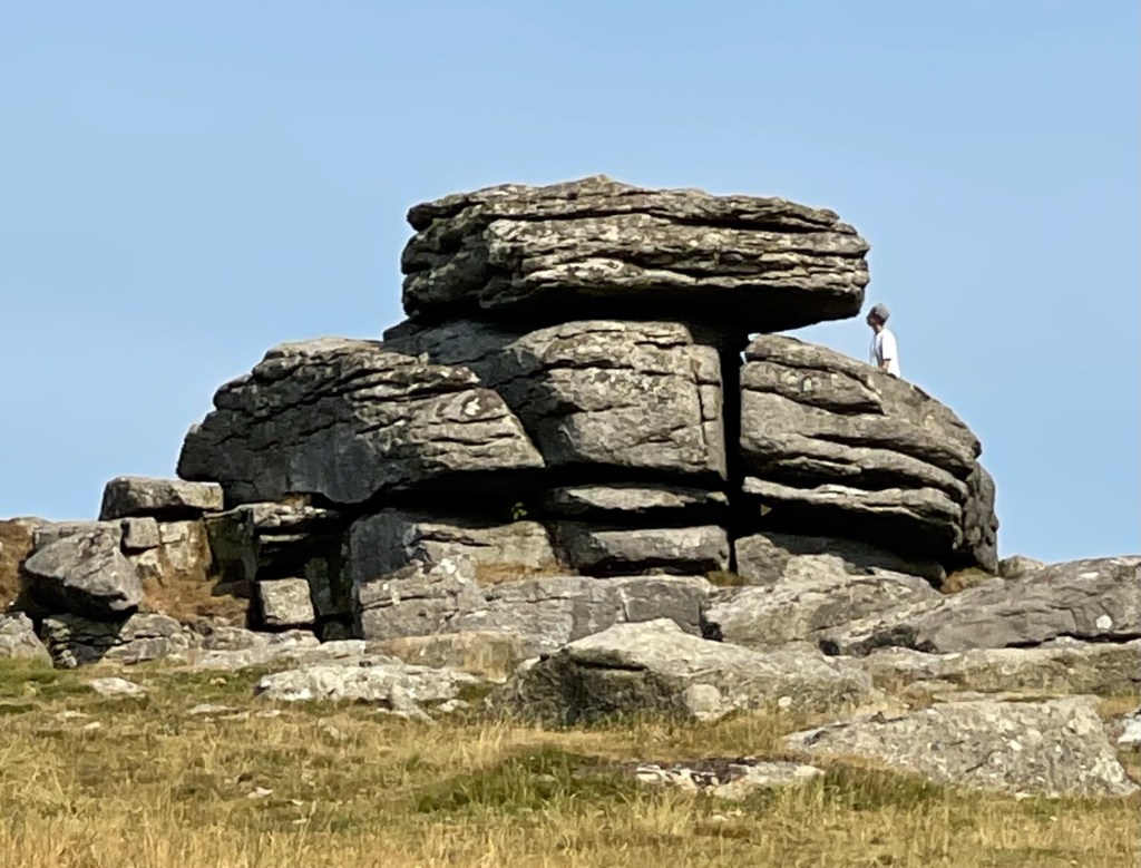
I felt quite frustrated at the lack of photographic opportunities and the ability to see what I was taking. Steve seemed a little thoughtful, perhaps about his birth place of Plymouth where he hadn’t been for a long time and I was a little way behind. I was determined to get some shots of a rock formation and when Hangershell Rock came into view I tried to capture it. It was being visited by others at the time but I did decide to go a little way up the path towards it to get a better view. Just hoped that it would be noticed that I wasn’t there at some point!
The track way which was quite stony in places continued on it’s way down but the Two Moors Way split off to the right as it approached the tree line above Ivy Bridge. The moorland stops at a wall which circuits the bottom of Western Beacon which is a large convex hill at the end of a spur starting much further in the north. It was quite an abrupt stop as our last three quarters of a kilometre had been across grass. So a gentle punctuation before a steep and difficult stony enclosed lane down towards the railway line and a metalled road into the edge of the town.
We finished our walk at the railway station where we were picked up so we didn’t quite get to the end of this long distance path which starts on Exmoor.
A distance of 23.76 km today and out for nearly 7 and a half hours. Although I had drunk quite a lot of water I had never felt really uncomfortable even though there was less breeze than the day before. So from backpacking to nothing to two good days walks, it has to be said that this was a worthwhile and good trip which still provided a sense of achievement and gave me an opportunity to practise some old skills which weren’t quite as rusty as I had thought!
This walk took place during one of the hottest parts of the summer. The plan was for a three day expedition with day 1 and 2 being separated by a wild camp on north Dartmoor, followed by a night on a campsite before walking across the southern moor.
This would have been my first time backpacking for over 40 years so in preparation I bought a lightweight one man tent, a smaller sleep mat, a small 2/3 season down sleeping bag – the one I usually use was in use, all that time ago – and it’s still good! I even bought a tiny stove and having held out against bladder water systems, I bought a 2.5 version. And of course a new 40 litre ladies fit rucksack.
So having equipped myself all that was left was to make sure I could carry this load. Having filled up the water I did an 8 kilometre circuit from home. Managed to walk quite quickly – 5 k an hour and really surprised myself. Having got a message that I need to carry at least 3.5 litres of water, I added the extra load. Packed my spare clothes, food and toothbrush! Round the circuit again and pleased that I still could keep up my pace- bit of a cheat as the second run was late afternoon and of course it was flat!
So having practised on Monday and Wednesday I planned an easy day for Thursday, knowing we were meeting up at 6 am. At about 7 pm I received a call to say that Stuart wasn’t feeling well and he was worried by the weather. Yes, I was still happy to go. At 9 pm another call, the other walker Phil had dropped out because he was worried by the weather. Needless to say I went to bed a little deflated that night. This was something I had really had to steal myself to do and now it wasn’t happening- quite a defeating feeling.
I wake the next morning feeling disheartened but not yet prepared to give up! Steve the leader had been cross about the waste of the campsite fees and I had noticed a walk planned on lDartmoor for later in the year. So decided there was no harm in sending a message suggesting a stay in the campsite on the Saturday as planned and a walk on the Sunday.
After a while got a reply suggesting a walk on Saturday and then again on Sunday. Leave at 7 am so Dartmoor was on again! Not with the full back packing kit but still plenty of water.
A drive to Okehampton which took longer than expected and then a turning onto the moor towards the army camp, feeling grateful that the track was going up hill. We started our walk at 11.45 setting off across a grassy track but soon joined a stony path. This is an area used for army training and as an artillery range, luckily not today. As soon as we start walking, although warm, there is a noticeable breeze so in fact very pleasant.
The track is going south east and then south and cuts round the side of a hill. The area is covered with rough grass and although obviously much drier than usual is not quite as dry looking as Oxfordshire. soon on our right Yes Tor strikes an interesting sculpture against the skyline.
It’s great to be out and walking especially as it nearly didn’t happen but the landscape could not be described as exciting. Somewhat desolate, remote and a wide landscape. Possible to look back at Okehampton and it makes you realise that we are at quite a high elevation.
We seem to be on tracks for quite a long time, apparently I’ve been spared some of the off track navigation that I might have been treated to if this section had taken two days. At the bottom of Okement Hill I feel excited that I might have found an old structure, on further investigation I’m disappointed to find it has a horrible metal front and is some sort of army look out post!!
As we turn and go up towards Hangingstone Hill we see a van parked – strange – and it is a South West Water Van which seems very strange positioning. There’s an observation post at the top and we decided to take a break to eat. To this point we haven’t seen anybody else, then in the distance and coming towards us a group of five – we are looking out over an area called Cranmer Pool – often very wet apparently. They have been measuring the water content of the Peat and had also done that the day before elsewhere. I guess if that gets too low it has an effect on all the streams that run off from the moor – well it explained the van!
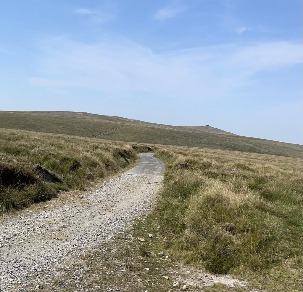
This is roughly the area where we would have camped, not quite as tufted as in some parts. We are nearly at the edge of the artillery range and this border is marked with posts. We have a wood to the east and we are navigating SSE, crossing through a ‘Peat Pass’ and down towards Little Varracombe. A bit of pacing needed. I have walls marked on my 1:25,000 map which Steve doesn’t have on his 1:50,000 – this causes some discussion. I feel we should aim for a wall junction under Sittaford Tor and after a bit of stream crossing – yes there is some water we reach the goal.
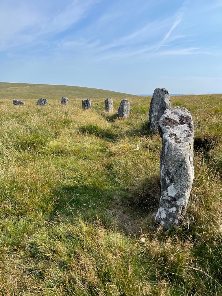
Between ourselves and the wood is a path which heads due south for several kilometres. No point in going backwards to find the start of this path – if it in fact exists! Hoping a bearing East should take us to our path , marked as a bridleway. A great surprise ‘The Grey Wethers Stone Circles’, restored but still exciting to see.
There’s a well defined path leading through the middle of the circles and this stays quite obvious for just over a kilometre, there’s a bit of a divide and we go left but then it’s decided that that’s not correct. We are going into a bit of a valley and I feel we should be on the left hand side of the valley but we are on the right. Steve decides he has found a path and I’m out voted – quite a lot of gorse creeping into the equation now! Very noticeable as the path gets narrower – I’m still not convinced but there are other people walking towards us on the same path. We cross a small stream and we are now on the side of a hill with the route of the East Dart River below us. Interestingly having tracked the route but not looked at the OS app whilst out – mostly because the sun was too bright – it shows we should have been higher up and on the other side- pleased with myself that I haven’t completely lost my ability to read the map and the landscape!
The plants are changing and we now have Heather as well as the vibrant gorse. The purple and yellow as complimentary colour look both overly vibrant but also comfortable together.
The path passes Hartland Tor before it opens out into a conventional looking field as we come down to Postbridge. This has been a great days walking and never too hot – the other two missed out! Finishing at 18.20, so out for six and a half hours – not bad seeing we had driven down as well.
We covered 22.84 km and managed to walk at 3.5 km ph – not particularly fast but when we weren’t on the tracks some of the walking was through very rough terrain.
Well having set out on a 50 different walk challenge in July 2021 in order to raise funds for http://www.batemans.org.uk, of which I am a trustee , here I am a year later.
My original idea was that walks had to be at least 5km, not a high aspiration but one I felt reasonable having had both hips replaced. Anyone who read the first 50 will know that these gradually became longer and I became more and more comfortable with going off an exploring by myself. Once I started writing I realised that this was something I missed since retirement where much of my day would have be centred around communication in one form or another.
I gave myself a tight challenge for the first 50- start 21/07 and finish by 30/9 – I did it and realised I wanted more. Not to raise funds but for the joy of walking and exploring, meeting new walking companions but also developing my own confidence.30 years ago I had been training guiders from all over UK to be able to take their Guides and Brownies out of doors in different situations. I’d lost many of those skills due to work and family but slowly the navigational skills, the understanding of the weather and your own capabilities were creeping back.
So the next 50, completed by the end of February and yet another 50! came about. I had wondered if I might manage to complete this last group by 1st July so I could say I had done it all in my 70th year but too many other commitments got in the way. However I did manage just before 21st July – completing in the heat on 19th!
What have I enjoyed most – probably exploring new places- Orkney and Madeira – quite a contrast. Good to walk by the sea in Devon, feeling fit enough to really explore in the Balkans. Going to places with SPR that I certainly wouldn’t drive to for a day! Really finding out about my local area, feeling quite ashamed that I hadn’t explored it more, loving the Ridgeway. Very much enjoying the Sussex / Surrey border with names from my childhood and beginning to feel very comfortable exploring that area. Perhaps lastly that I can still challenge myself – The Yorkshire Three Peaks is testament to this – 13 and half hours of walking, 26 miles and as the name says three peaks – which are very stretched out.
So what next – I don’t think I can stop. Whilst I have been slow to write up the last walks, I have enjoyed this process as well.
So ‘A further 50!’ Is about to to start, with a aim of the end of 2022.
Not very local walks unless it is very different or the group/ circumstances make it special but all being well some interesting challenges and places to come. Still trying to think ahead – South Downs Way has an appeal.
Thank you if you have been following all my blogs- some I’m sure are better than others but that’s the way of the world! Look out for where I’m going next!