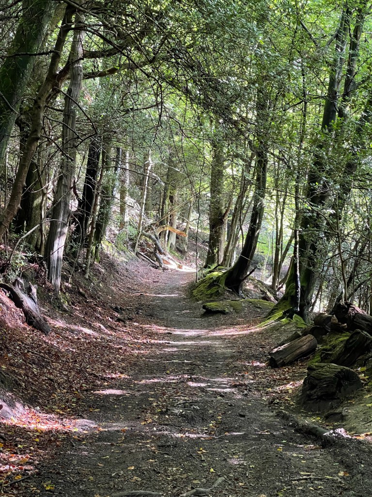
So off to Herefordshire with SPR today. Not quite sure what the route will be but happy to just follow today. A really slow journey and we stop off at a car park at the bottom of Credenhill. Andrew the other walker and myself walk up the hill as we’ve been instructed to do. Steve wants up to go up to be able to look out over the SAS Camp. We come back down sooner than he’d expected and looking at the map later we could have continued up to a hill fort. A quick trip in the car to the start of our walk proper.
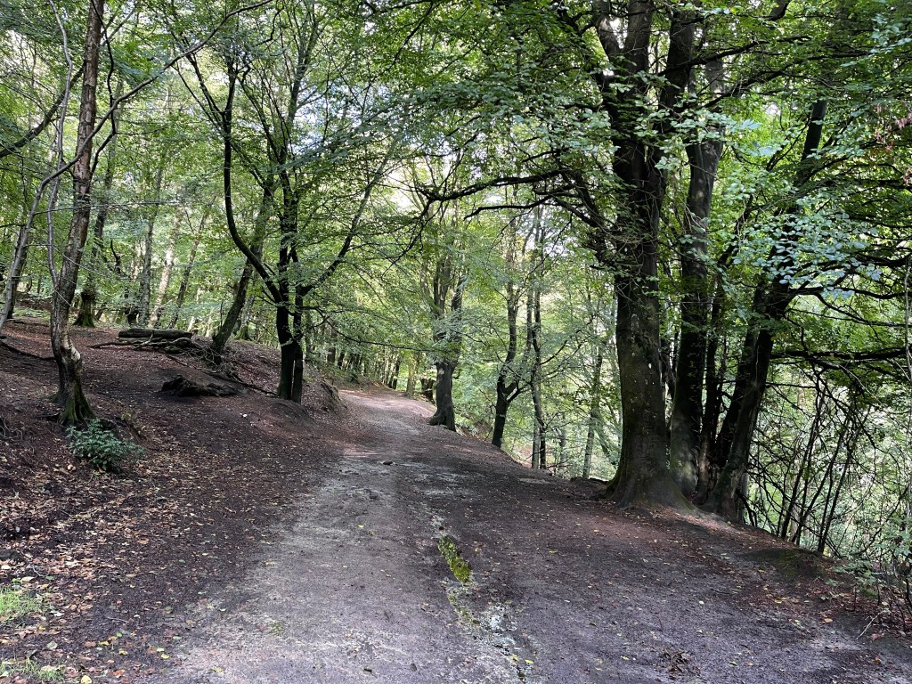
We are going to be walking along the Wye Valley Walk today, into Hereford.
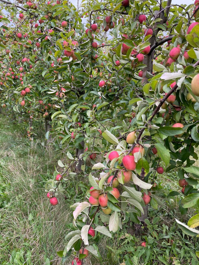
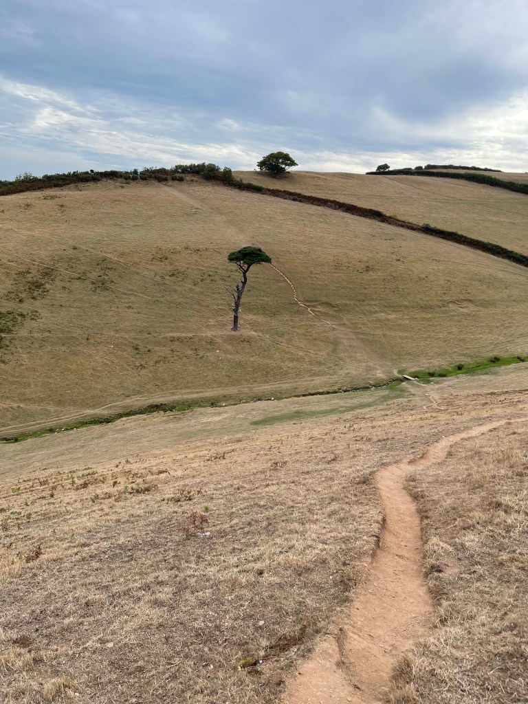
We are in the heart of an apple growing area and the first part of our walk goes alongside trees ladened with fruit. These apples are often converted to cider, I try one and it has a good taste – already feeling quite hungry as we left Millets at 8 am and we have set off on our walk at 12.15!! several different varieties of apples are growing as we proceed through the orchards.
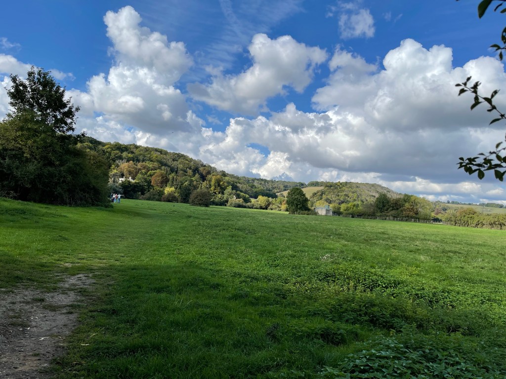
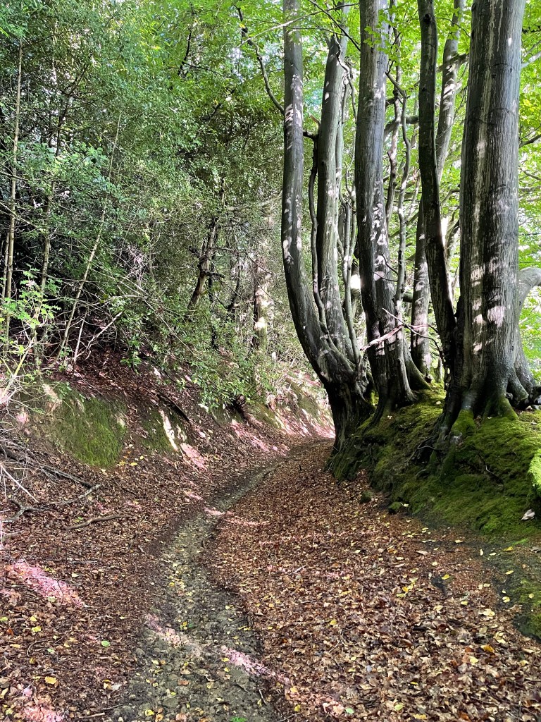
The farmers has sent us on a well labelled detour but we then get back on route. Some quite interesting properties around and I notice later on the map that we’re near the intersection of two Roman Roads and an old Roman town. Pleasant countryside but nothing dramatic . We cross some fields through herds of cows and Steve goes off to find a trig point.
We come to a very old orchard , not sure if these apples are ever actively picked but we do notice lots of mistletoe up in the trees . Reminds me of the apple trees in the school grounds which always had an abundance of this festive plant – I’m not sure I took sufficient commercial advantage of this resource!!
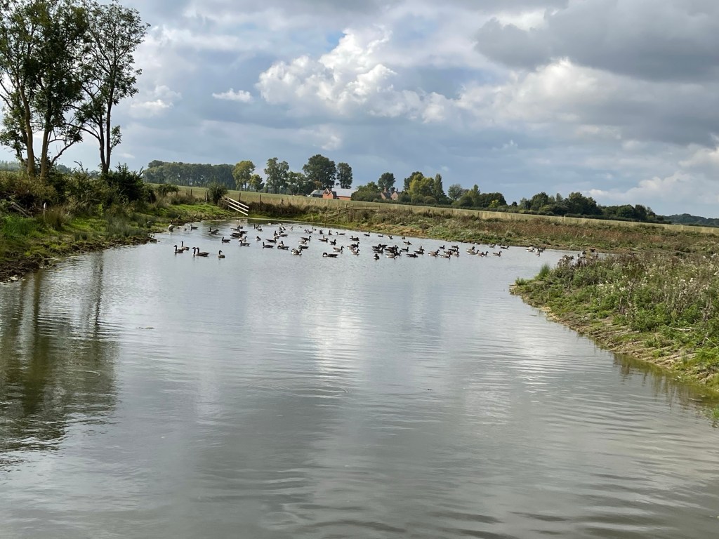
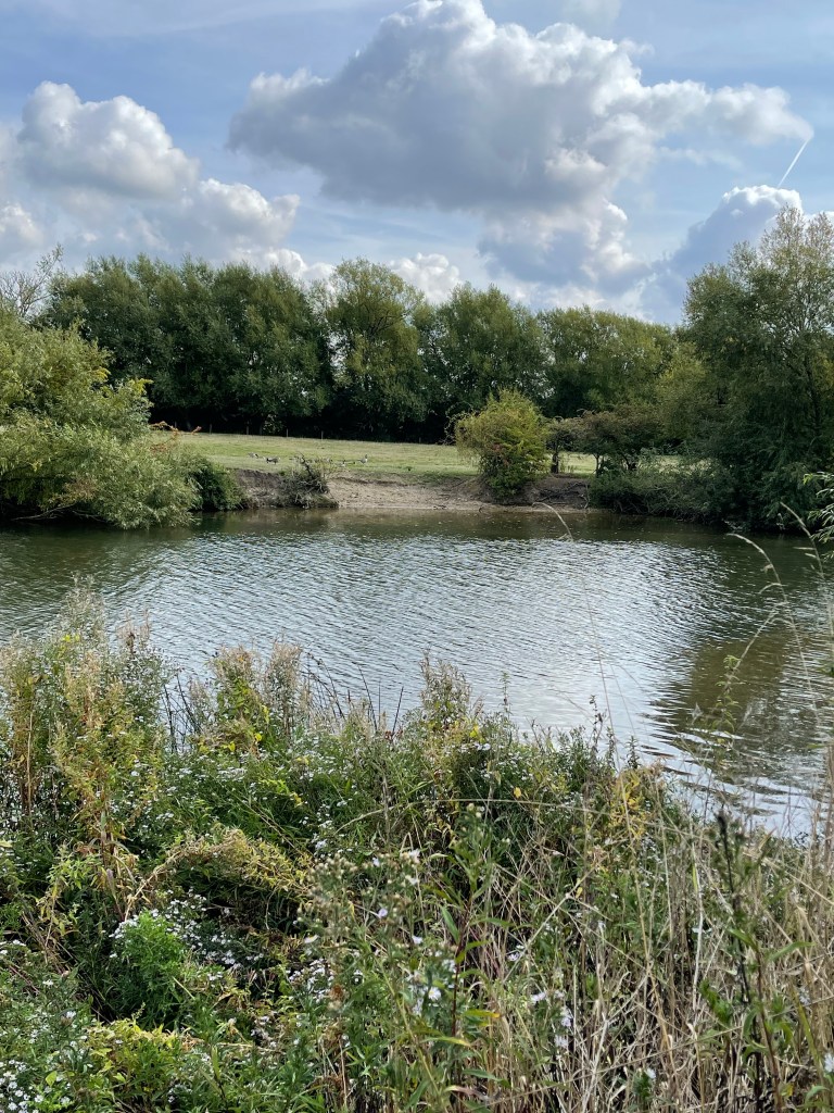
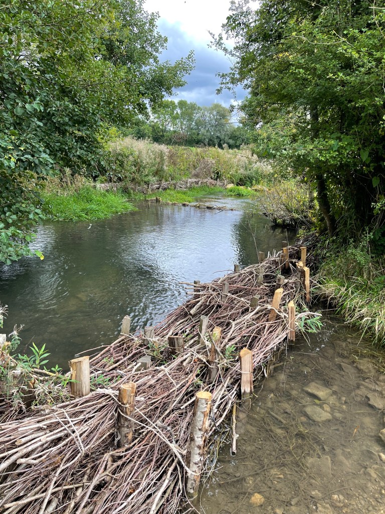
We do eventually get down to the river which is quite wide. In several places we notice stick debris up quite high in branches which are overhanging or next to the river. We weren’t sure what they were- seemed an odd place for nests – and then we found some ‘flood’ measures and realised that the height they were suggesting could possibly/ probably mean that this was placed there by fast flowing flood water. Some of these ‘nests’ were high up which is quite a frightening thought.
This was about 4/5 metres above the water.
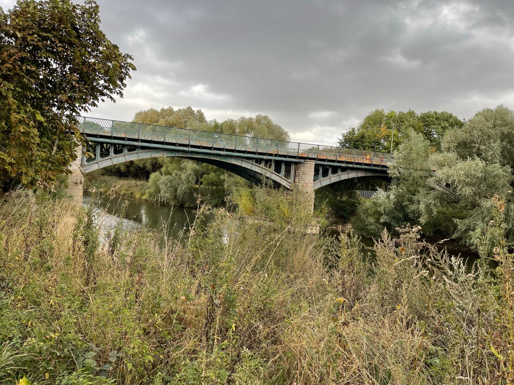
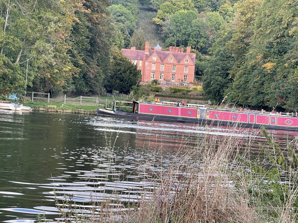
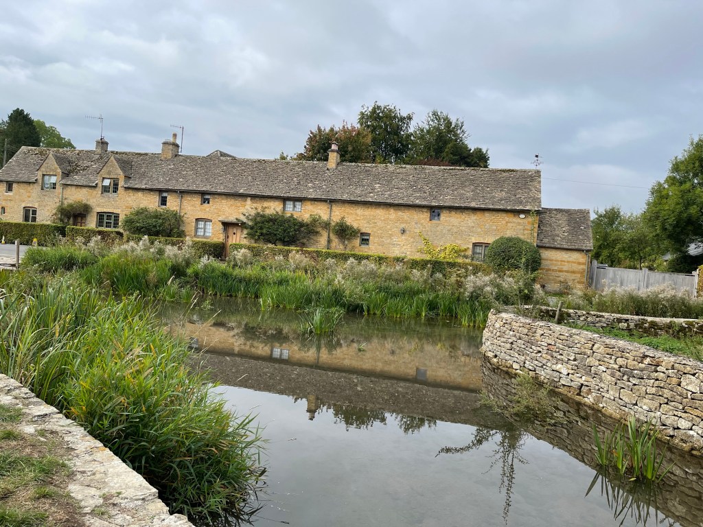
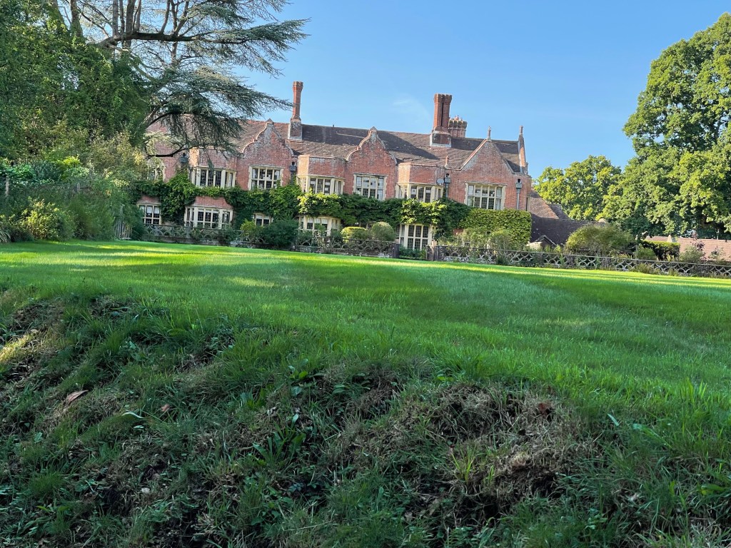
We spot one very big old house up on a hill and get the impression from the size and species of trees alongside the river that these have been planted as part of park land . Not long and we spot a large bridge over the river, this in fact where we are going to cross and we are nearly in Hereford.
Just before we cross we go past a sports field with primary school children playing Tag Rugby. I am able to explain the rules to the other two and we watch the absolute enthusiasm of the participants.
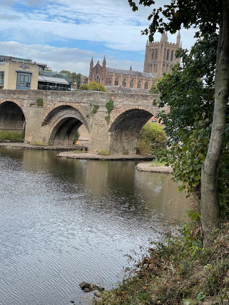
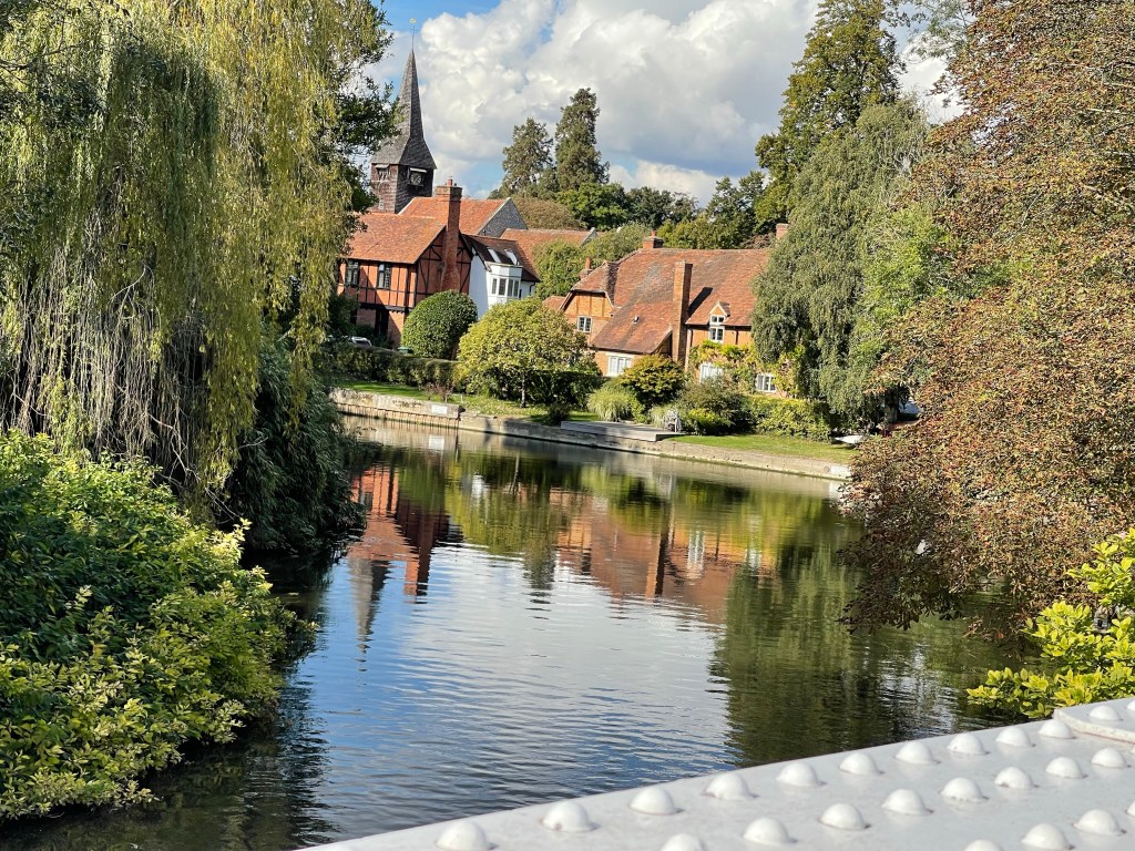
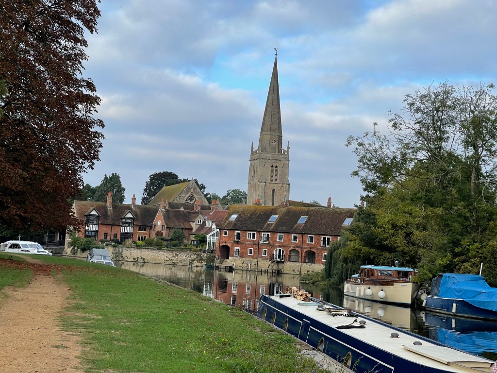
The old bridge into the city soon becomes apparent, we are going to climb up onto the road at this point and finish out walk at a car park where Jane is waiting. We’ve only been out walking for 3.25 hours and we’ve stopped for lunch!
We do turn to go back into the city to look for a map shop which it turned out was no longer there and we have a look around the cathedral which was quite magnificent. The coffee and walnut cake was good as well!
Good to go somewhere different but a whole day to walk 7 miles is not necessarily good use of time , luckily not quite such a long journey back but considerably more time travelling than walking.
So back to Didcot to park and on the train to Tilehurst. We’re starting a little later today as we can’t be picked up in Henley until after another party has finished. So the 09.35 train, which suits us all quite well!
Luckily the hill up from the station doesn’t seem as steep this morning as I thought it might and we soon come to the bridge and the narrow path beside the Thames which is squeezed in next to the land that embraces the railway line. A few more people out, especially families and as the train route bends away there becomes meadow/ parkland. The wide path next to the river as it approaches Caversham Bridge is even called the ‘Thames Side Promenade’.
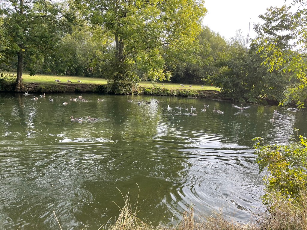
We are pleased to see a group of mature cygnets but with only one parent- not that Caversham is short of swans.
There is even an Ice Cream van and we jointly agree it’s not too early. My turn to purchase and we sit on a bench to eat our treat! Two rather different geese at this spot – a pair of Egyptian Geese.
It’s great to see so many people out enjoying the location and the sunshine, bikes are a bit hazardous , there seem to be quite a few. On the opposite side of the river is parkland with several families. This could be the grounds of a temple or similar. We also spot these geese, the white one is a mature gosling of the Greylag Geese.
At Reading bridge, a newish footbridge we discover there is a cycle event – explains a lot! We have housing on our right but some interesting islands and barge / cafes over the river – which we could reach if we had more time. Another lock – Caversham and soon after the boat yard which was referenced the day before. After a busy section the area to our right widens out again and becomes King’s Meadow with beautifully green grass and a recreational feel even though there is obviously a busy town on it’s other perimeter.
Just before the path turns to go through a wooded area there is rather a pleasant, if out of place splash of colour.
A strange bridge which goes up and over the Kennet and Avon Canal, further evidence of the vast network of water ways which once supported industrialisation and the transport of commodities. A section of rougher grassland and then back out to pleasant well kept meadow again. There are vast areas of water to our left , shielded by hedges but intermittently a gap allows a view of marinas or this vast expanse that was once gravel pits. On our right a Business Park so not as intense as the centre of Reading. The river really changes direction along this section as we begin to head north.
A small section to our left has several people in pairs looking carefully at the ground. These adults are being trained by BBONT to complete quadrant surveys. I think back to times I’ve done this with children, often with PE hoops, rather than them imagining a metre square!
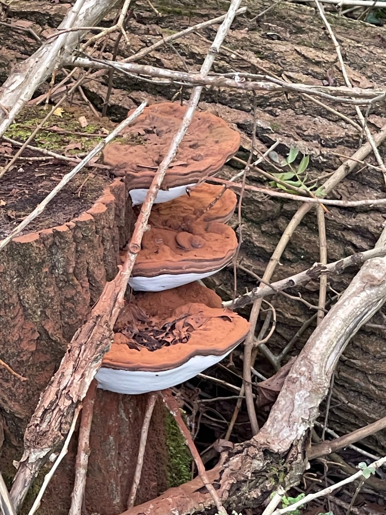
The path closes in again and we are bordering the grounds of Reading Blue Coat School. Obviously good growing ground for this bract fungus.
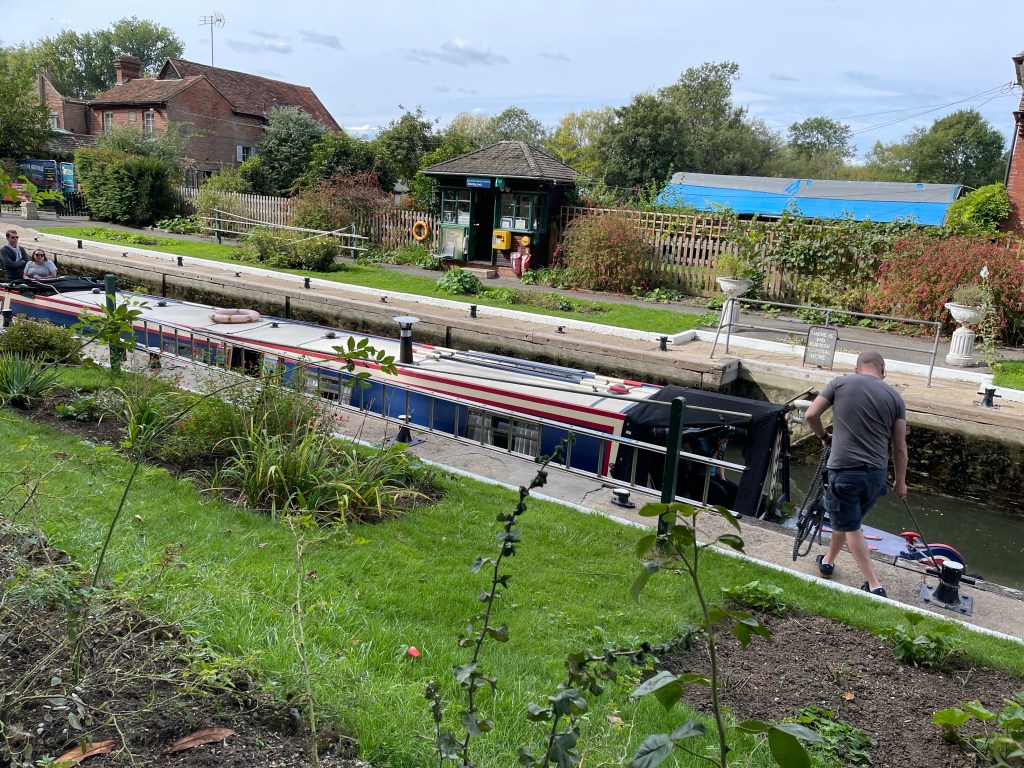
We reach Sonning Lock and decide it’s time for lunch- always good when there is some added entertainment !
Just around the corner on this very busy section of path and we can see Sonning Bridge. We are going to emerge here and cross as it’s time to be back on the north bank again and one of our last stretches in Oxfordshire.
Over the bank we can see a very busy pub/ hotel and there are lots of boats moored at this point. On our left is an area of once woodland, mostly felled but with just two or three very tall poplar trees remaining- a rather stark area. In contrast the bird song coming from a thick hedgerow a little further along is just amazing.
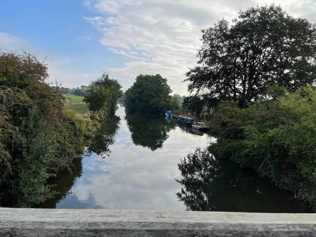
The river splits on several occasions in the next section and has several small wriggles. We come across someone next to their boat moored along this stretch and we have to ask about it. It’s an orange lifeboat like vessel. It turns out it’s from an oil rig and this design was one that was winched down – leaving one unfortunate person still on the rig! Apparently although comfortable for one to live in it was equipped to rescue 57 people. We had noticed several of these, or similar, along the river. Apparently the next design was released down a shoot where the g- force would have been quite horrific. Onward and we are just about to get to Shiplake School – a lonely paddle boarder on the river going up and down a particular stretch!
Just as we approach Shiplake lock we are directed away from the river. The path used to stay away from the river for quite a stretch but we quickly turn to our right, along the back of some houses and then across a meadow back to the river. We’ve passed under the branch line. Across the water is Wargrave with some impressive houses, my dad was born somewhere around here near Ruscombe or Twyford but certainly in that triangle of the three villages. Having continued round the loop of the river we are back under the railway and even I have to duck a bit ! But not before we are able to witness a bit of afternoon sailing.
Back up into the village and across the railway- this is the branch line to Henley – it even has a sign suggesting ‘Alight here for the Thames Path’ . Quite a long section through the village and it’s outskirts. I think I visited aunts here as a child? We eventually come back to the river and we can see sites of quarries on the other side where chalk has been dug out. We should be able to go on a wooden bridge out into the river but one end is closed due to damage/ age , so we have to take a detour round. Just before we hear music and then a rather interesting sight. It sounded like folk dancing and then we saw the band !
In aid of MacMillan Fund .
Pleased to be back by the river , we did step out onto the bridge but unfortunately it’s blocked half way. About twice as far round. We are running a little bit late, although we had said after 16.00 to meet. A bit like in Reading we are now in a popular area which you might again call a promenade. Some brightly painted barges with contemporary geometric designs and lots of people. We walk past the River and Rowing Museum and on towards the old bridge. Jane is waiting the other side of this but we have a little way to go yet. Almost out of context in this parkland like area I spot these fungi and up ahead a view of Henley.
We note that our next walk in October will start by crossing the bridge and then we meet our lift back to Didcot. Just under 16 miles today! So quite a solid four days.
Parked at Didcot Station today and we got a lift from SPR to Wallingford. Long stretch today as we were walking to Tilehurst, just outside Reading. Being picked up at 08.00 so Jane can get back to Millets for two sessions of children’s parties today.
Having been dropped off we worked our way back to the sign we’d seen the previous day and set off down a side road which goes past St Leonard’s Church.
The path then drops back down to the river and cuts through the bottom of several gardens . We soon come to a large boat house and it seems Saturday morning is rowing training . A good straight stretch out of Wallingford. Before we reach the boats a meadow with an abundance of little spiders webs , showing up because of the morning dew.
Our path continues next to the river and we are aware of Cholsey to our right and glimpses of new developments. Rather more peaceful on the far bank with a golf course! Under the railway line, this is the line for the stoping service which eventually goes up to London. Soon after our path takes us up to the road as we go around the vast estate of Moulsford Prep school – from the Ridgeway on the opposite bank you can see all the games pitches! We’re alongside the road for a while before going back down towards the ‘Beetle and Wedge’ Pub. More exclusive than local!
Back alongside the river and a pleasant enough stretch, we discuss some of the properties on the other side of the river and the fact that they are so close to the railway line, a bit of a pinch point along this stretch. As we approach Goring the path swings away to go behind the Swan pub and we pass Streatley Church. We’ve just been walking in Berkshire for a few kilometres. Up on to the road, over the river to Goring and we are back in Oxfordshire. One of my ways of remembering without looking at the map is by the primary schools- especially the ones we played football against!
A quick break at Goring, Richard suggests we stop at a rather good little cafe which has never been open when I’ve been here before and we are tempted with carrot cake to share between us as well as drinks. Then a slight detour to see George Michael’s house, Fiona was a fan and we are back on our way beside the river. We do manage to look over at the back of the house which has a great garden leading down to a small backwater. This section is starting to feel a little different.
Our path takes us up high above the river into some woods and this gives a completely different perspective. I’ve walked all of this section from Goring earlier in the summer. They like this wooded path more than I anticipated. Although we haven’t been close to the river we are now further away as we take a look across to Basildon Park and then cut round the side of Coombs Park. Discussion is now centred as to where George Clooney might live!
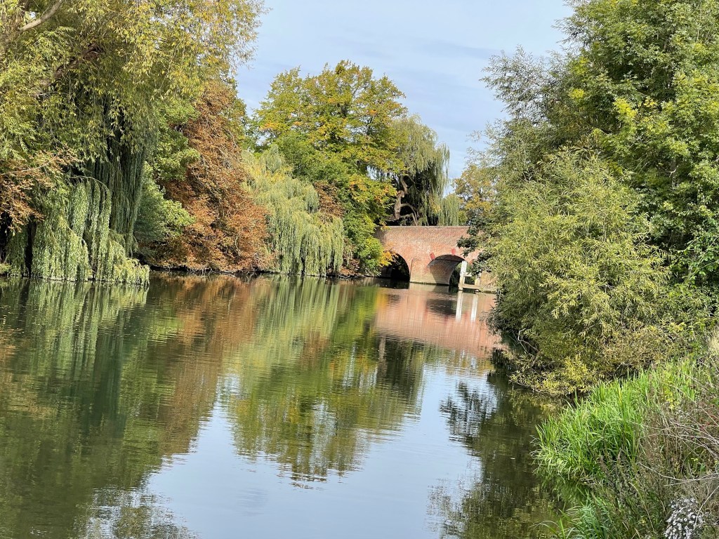
Our path comes out at the top of Whitchurch village and we walk through, just about to go straight over the bridge and I notice a marker sign on my right which looks as if it goes into the drive of a private house.we follow it and it bends round to the church and then further onto a track which affords us views over to the Toll Bridge.
As we enter Berkshire again, by passing over the bridge we are now in Pangbourne we are welcomed by a wonderful riverside meadow and quite a few people. We decide this will make a good lunch spot but not before we stopped on the bridge to look back at Whitchurch.
There river has a wide bend at this point and it is very rural and wooded on the far bank and meadowland on our side. Occasional glimpses of houses including Hardwick house.
As we continue round we can see Mapledurham Mill on the opposite bank but we are soon to leave the river. We have been so lucky with the weather, apart from first thing in the morning no fleece or top layer needed at all. Not a particularly good photo but I liked the light on the boat! we had also remarked how shallow the water was at the edge and starting to be more gravelly again.
We have a great interchange with a young women who is working hard to move a large stack out of the ground- her boat is tethered to it! This is the first of four and she is going to motor to Caversham boat Yard where her barge can be lifted out of the water by cranes and regular maintenance done to the underneath etc. she has apparently been in this spot for several years and her small solar panel has provided sufficient energy to charge her phone and laptop- so she can work from home!
At the lock, I see an ex parent and we have a chat, I’d already seen a previous head teacher colleague just before Goring!
The next section is a bit strange as the path turns abruptly away from the river and comes out in Purley, a suburb of Reading. We walk up through an estate and then head out at the end within a wooded area. I’m a little anxious to keep up our pace as we have to catch a train- we’ve missed the first possibility due to our earlier riverside conversation but I’m concerned not to miss the next.
The signage is not very clear and I take the option of a short path to the right which takes us up to the main road. Feel cross a couple of hundred metres later when our real path comes up to meet us- especially as I’d found it not that long ago!
The Thames Path goes down the side of an old pub and over a railway bridge but we have to ignore this and continue down the road to Tilehurst Station. Completely unmanned and the loos were shut! About a ten minute wait and we were off back to Didcot and our cars.
This was a long stretch today 27 kilometres – about 16.5 miles.
So back to Abingdon to start our day. We haven’t been able to have lifts to and from Millets Farm today as SPR are double booked. We are walking to Wallingford and I’m hoping my homework will work out! I certainly haven’t done this entire stretch in one go but have completed several sections.
Having parked at Rye Farm we crossed the first part of the bridge and went down the steps to meet the path which continues under the bridge and through the meadow which is opposite the ‘Old Gaol’ and the warehouses and Malthouse. Travelling the length of the river is making me consider it’s historic importance for the transportation of goods. A glance back at the bridge!
And a walk forward towards the church.
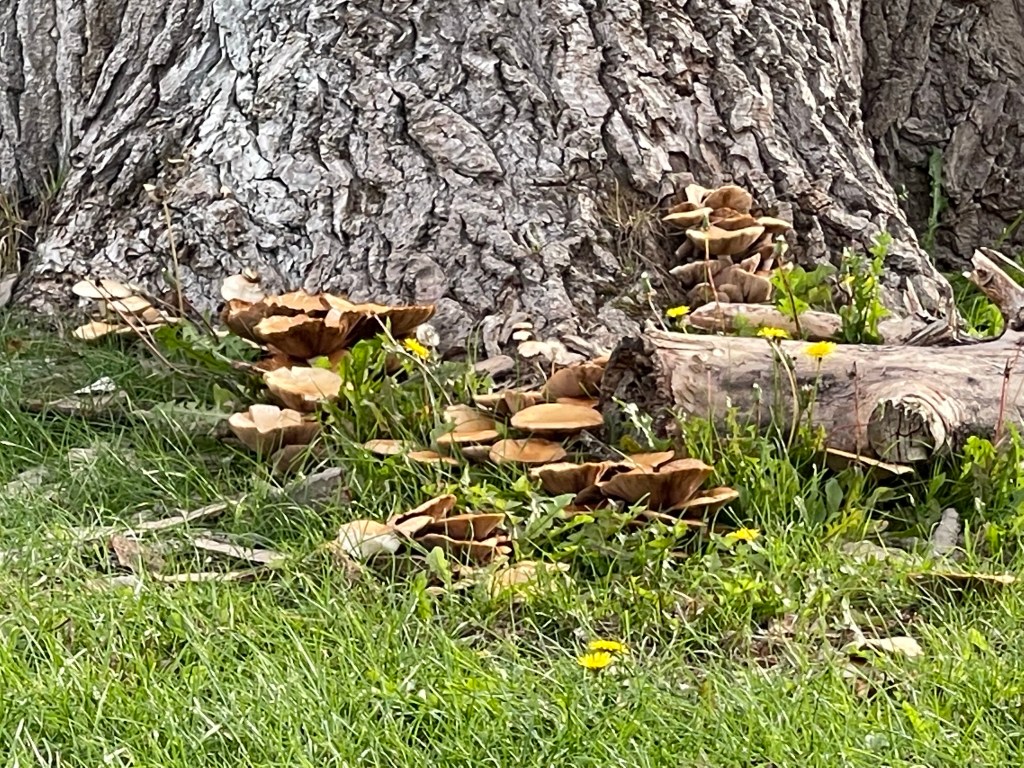
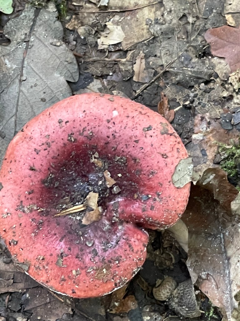
Always somebody busily attending to a boat along this stretch. It’s only about 8.30 so not much movement in the river yet. Three of us again today, Fiona, Richard and myself. Impressed by these fungi on the river bank .
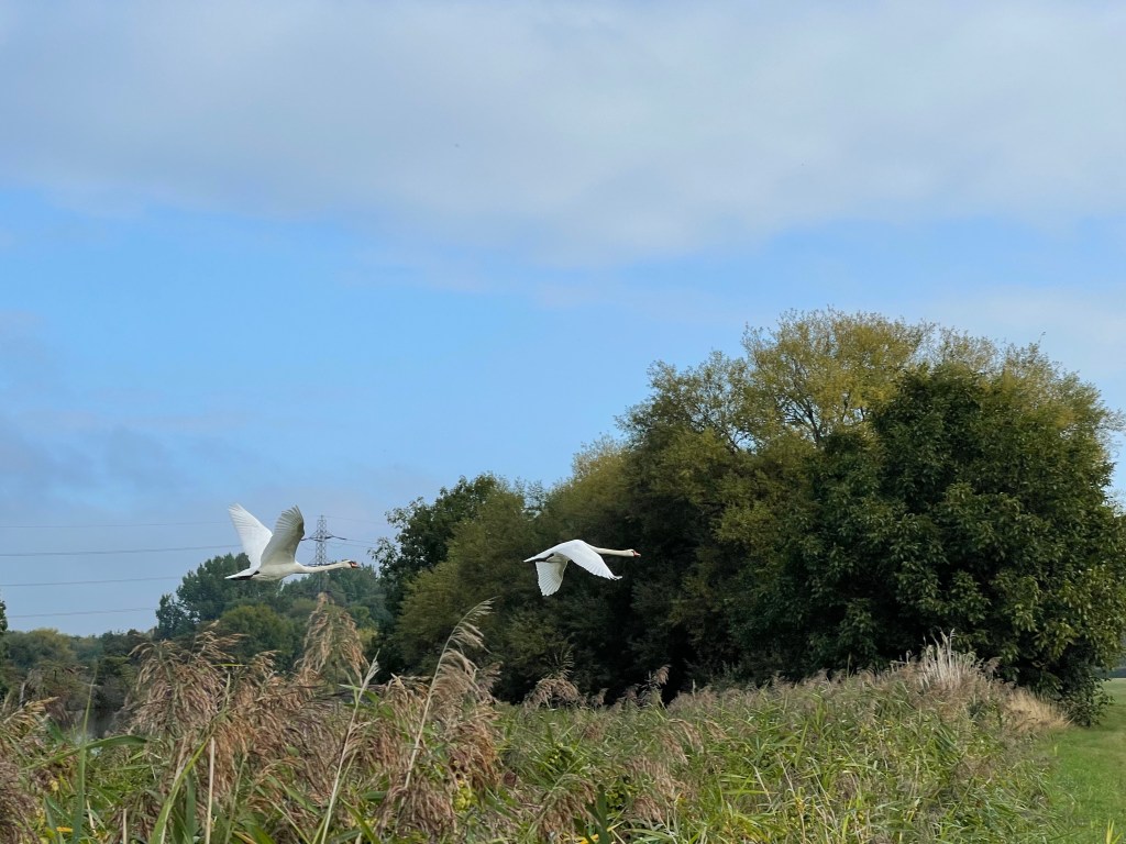
As the river bends around leaving Abingdon behind we are aware of a Marina and park on the other side but quite difficult to actually locate. Fiona is telling Richard about various local walks he could do. We spot our first swans of the day, looking very serene and then almost at the same time two fly over making a tremendous noise with both their wings and their calls.
We are approaching Culham Cut and the lock and there is a wooden bridge similar to those we’ve seen earlier in this journey. This path leads over to Sutton Courtenay and I have been over it with groups of children and when I lead a family walk from South Abingdon- and now I think back most probably with my guide unit when going on an evening hike! Urged by Fiona we climb on to it to look at the view!
Nothing particularly spectacular on the next section but we do go under the railway line just a bit down from the previous day and we can spot Appleford Church spire and the buildings associated with the large science research area at Culham. Further on we come to Clifton Lock which certainly has won the prize so far for the best cared for lock area- ‘prize’ dahlias and wonderful splashes of colour. Also an advert for ice creams but we jointly decided it is a bit early in the day!
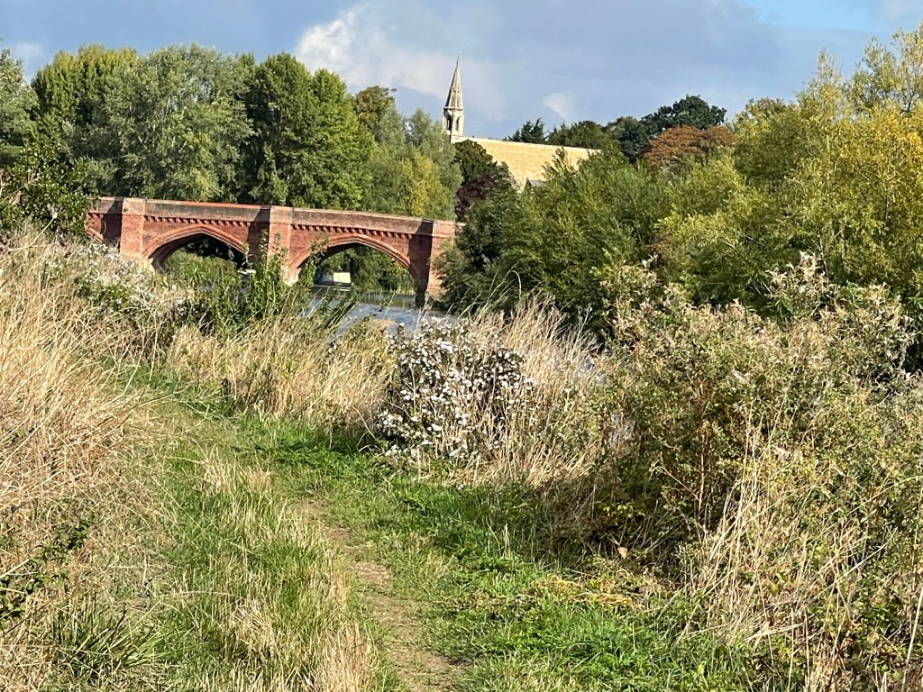
A little further round the corner and it’s possible to see the wonderful bridge at Clifton Hampden and the church spire which predominates – bit of a cheat really as it is up on a hill which makes it look more impressive. As we reach the road we have to walk across the bridge and our path continues on the other bank. No changing of counties today – firmly in Oxfordshire – all once Berkshire pre 1st April 1974.
We decided to stop shortly after crossing the bridge and have a snack break. Good choice of spot as I and then the others saw the long flight of a kingfisher go right across the river diagonally – very special. Just as we were about to leave we saw another interesting sight – wild water swimmers – with brightly coloured buoyancy aids – I’d only heard something on the radio about this idea , a few days previously. No wet suits – no desire to try this sport!
A bit further along we saw a dark coloured bird flying along the river – very like a cormorant but that didn’t seem right! We had spotted several herons and then one was walking on the path in front of us. We crept along so as not to disturb it and then it found a gap in the growth beside the river and took off in their slightly heavy looking initial flight- big birds.
Another huge loop round, it’s almost as if we are completing a circle with the bottom open, omega like. Somewhat disorientating, Wittenham clumps in our sights and then Dorchester Abbey. In consolation we have seen a Buzzard, Red Kite and a Kestrel during this section and there are some beautiful parts to the river, our lunch break view!
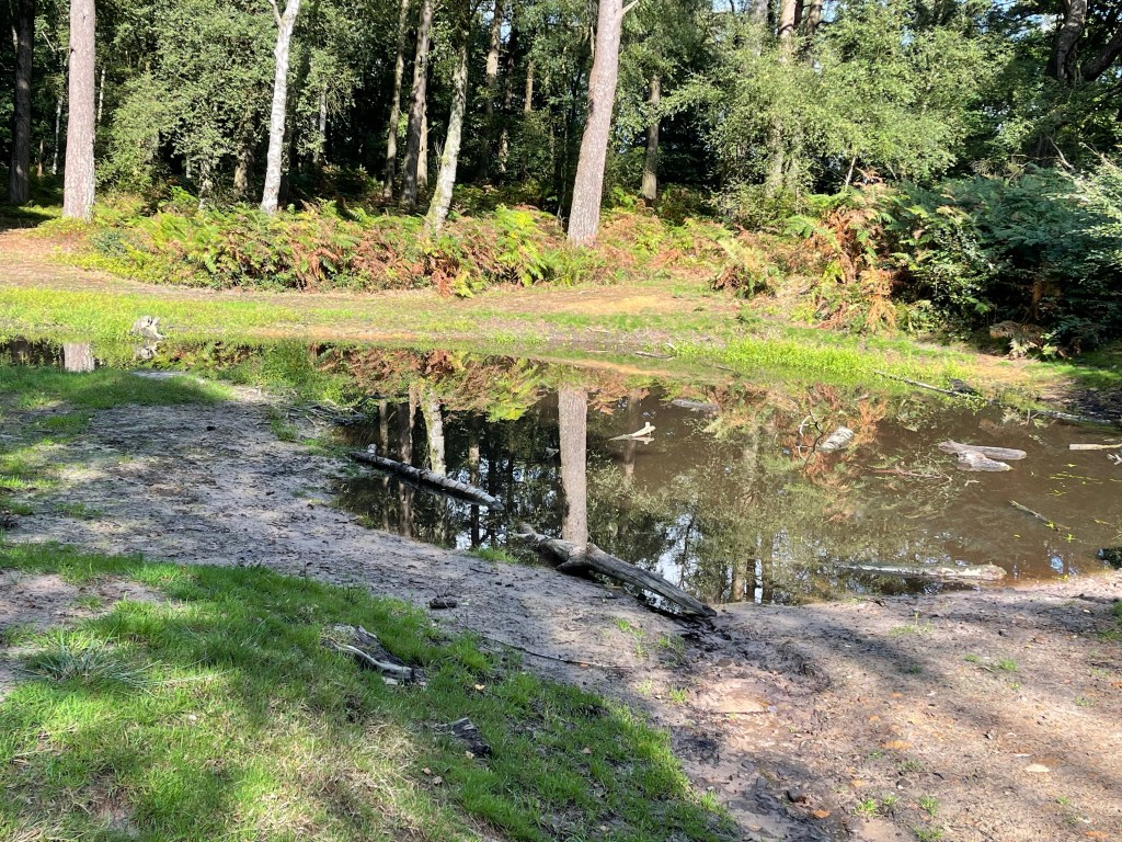
In the flood plain area of this huge circle the Earth Trust, based at Little Wittenham have dug some new ponds/ water ways to provide wet land areas and it was pleasing to see that one at least was already proving a welcome habitat.
Bit of a phone failure at this point, not sure what happened, trying to look up geese species and then nothing – oh well at least the path is well signposted and the bit by the river is obvious!!!
We eventual find our way round to Day’s Lock at Little Wittenham and cross over the weir. Just before that there are heavy machines moving steel girders apparently replacing a bridge – not aware there ever had been one !
We know that the next stage will involve us eventually going up on to the road. The ground to our left is very rough grass, but with occasional views over to Dorchester and on our right Wittenham Woods- good walks through there. So we are now out onto the busy road, luckily with a path on the far side. Not an easy one to cross, we are heading for Shillingford Bridge we turn back down a side road and into what looked like a once very important and rich part of this small village. Reference to wharf’s again and a track that led directly to the river. Quite concerning to see the flood markets on the wall, remarkably high. We are signed through a little passage way between the backs of houses before we cross the road leading to the bridge and are back beside the river.
The river is going ESE and then bends almost due south before bearing a little to the west. We have been remarkably lucky with the weather as it’s warm again – tee shirt weather after the initial early morning chill. We come to Benson Boatyard which also has holiday homes, lots of boats moored and a very good cafe. After some debate we decide it is more prudent to wait until Wallingford as there is only one bus per hour for our return to Abingdon.
We are aware of the Hydraulics institute on our left and the site of Wallingford Castle on our right as we complete this last section for the day. We emerge into the edge of the town and as we approach the square we spot the signpost which we will need the next day to set off on the next step of our journey.
First to check that the bus I’m hoping we can catch is a reality and pleased to see a timetable for the X33 and at the time I had expected. So next a tea and loo, take away so we could finish drinking it on the bus so that we could wend our way back to Abingdon. About 23 km today.
The second set of Thames Path walks – so this is the first day Oxford to Abingdon. Starting on the Botley Road and down into Osney Mead. Quite a special part of Oxford which once would have had warehouses and still has a boatyard. There’s a lock and large weir and also now a newly installed reverse Archimedes Screw . Having passed under the railway line there is a green area on our right which is cross crossed with well used paths.
We cross the Abingdon Road and the path is already busier with bicycles. Across the other side from us is Christchurch meadow and we then come up to the various college boat houses.
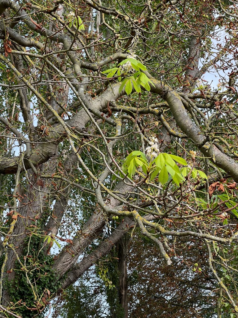
With the dry summer several plants have had rather disturbed life cycles. We’ve noticed most Horse Chestnut Trees are loosing their leaves but this one has flowers as if it was spring.
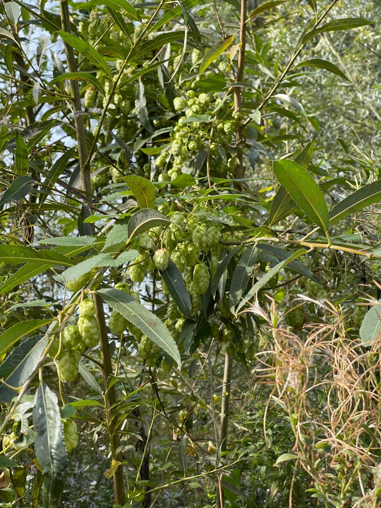
As noted the last time I walked most of this route, until the river passes under the ring road it seems remarkably rural. There are three of us today- Andrew, Richard and myself and they are both rather surprised at the tranquility. We have passed by Iffley Lock and one thing we are beginning to notice is the abundance of Michaelmas Daisies. We’ve also seen wild hops.
The river splits often at this point and as other water joins we watch some grey wagtails. Andrew also sees a Kingfisher. When we get to Sandford Lock we stop for a snack , sitting on one of the conveniently placed benches. Next quite a long stretch with not much happening. Very pleasant, the river is wide at this point.
The next point of significance is the boat house at Lower Radley, belonging to Abingdon School. Just leaving this area and I look up and over the river and gain a really good view of Nuneham Mansion – somehow I managed to miss it last time I walked this stretch. I explained to the other two that I had lived there for two years- what a great and unusual memory to have. Shortly after this is a rather splendid boathouse, I guess this might be connected. The house which I think still belongs to Oxford University, is now a retreat – Buddhist possibly.
Not too much happening on the next section apart from some reclaimed gravel pits and a couple of desirable houses! We pass under the railway bridge which serves the branch line from Didcot to Oxford – occasionally this stops at Appleford, Culham and mostly Radley. We’ve seen several trains and are aware of more as we stop for lunch, with our view over the river to the motor cross circuit at Culham. Alex has also run a very muddy cross country here with lots of ups and downs !
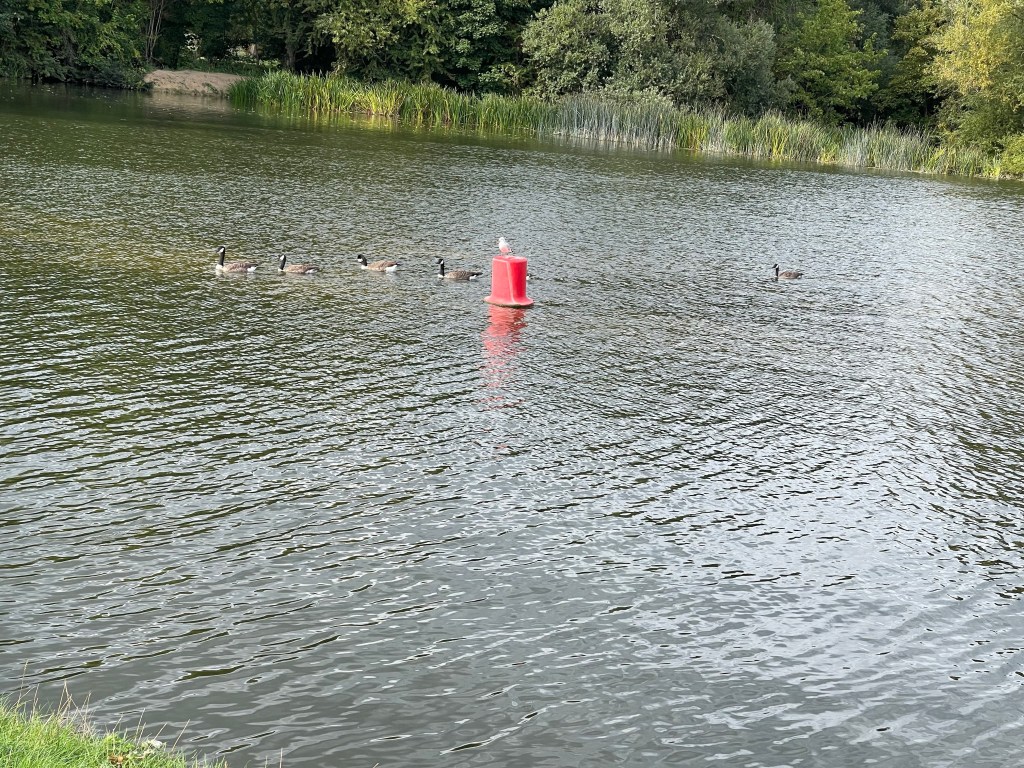
The river then wends it’s way to Abingdon, the path at some points moving away from the main bank and crossing side ditches. We come out by a nature reserve, a cycle track and the way across the weir, and to the lock. The river is very wide at this point and there are often canoeists and boats passing through the lock. Not today though! Just a few ducks and a seagull on a buoy!
We are soon walking along the meadow approaching the town and can see the dominant spire of St.Helen’s Church. Our on to the bridge and down towards Rye Farm Car Park. 19 km today, just to get us tuned up- we’ll be back tomorrow!
A slightly strange day for a walk today – the funeral of HRH Queen Elizabeth II. I’m leading today, a walk for SPR, starting in Bourton on Water. Four of us, Annie and her friend Jane plus Betty and myself. Steve has given me a route but with an alternative end section, my instincts are for the longer more interesting return.
From the car park by Birdland, somewhere I haven’t been for a long time, we set off, Annie having met us there. It’s just gone 09.00 but it is so quiet, very strange in such a touristy place. Along the Main Street and then off towards the church. A rather unique style!
We are following tracks and footpaths, designated as the ‘Monarch’s Way’ – I believe this refers to a direction of travel of Charles I but bit of an obscure route! We do however emerge into Lower Slaughter which is always wonderful and although there are few people walking around there are plenty of cars in at least one of the expensive hotels. No name for the delightful stream running through this village but tracing the route it seems to be a tributary to the River Diklar , which in turn runs into the Windrush. Always love this little bridge.
We decide to take a short detour round to the mill. One other person out with their dog!
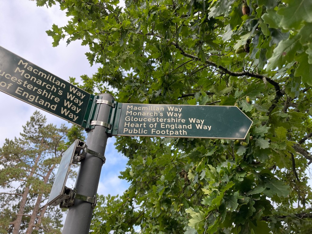
Retracing our steps we leave the village in the correct direction and come across this rather ridiculous sign post which sums up the plethora of named footpaths which seem to have been generated more recently. Why can’t a footpath just be a footpath? I guess if you give a route a name then you can generate a guide and information and anyone, whether they can read a map or not can possibly follow a trail. Probably a good thing but……
We are approaching somewhere called Hyde Mill and pass over this rather delightful little bridge on the way – the River Diklar. Some interesting use of willow to secure the near bank.
I recognise the Mill as somewhere I’ve been before when out on a walk with pupils from school. We used to stay mostly with Year 3 (7/8 yrs old) and further in the past Year 4 , at a Youth Hostel in Stow on the Wold. I’d already been reminded about such groups when we visited Lower Slaughter, where we’d sat to draw on more than one occasion and one time visited an art exhibition in the village hall. I clearly can’t escape my past!
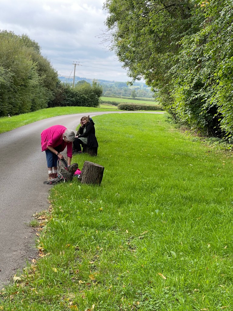
We all decide it’s time for a snack before we set off for our next village destination and manage to find four stumps along the driveway to sit on!
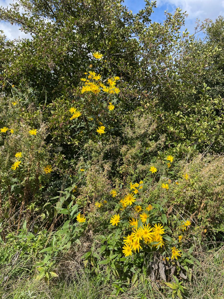
Across the busy road up to Stow on the Wold and we now head for Maugersbury – we are now on the MacMillan Way. These random sunflowers provided a bright spot in the field beside the road.
Slightly go wrong as the path should go off through some gates beside a house and conveniently no sign, so we back track down a road which says it’s closed but luckily not impassable. We find the other end of the blocked path and what should have been our way through!
So our path led us south out of the village. We had talked a bit about the Queen and the funeral and before we had started I had wondered if we should keep the 2 minutes silence. I hadn’t been checking my watch/ phone but just happened to glance down and it was exactly 12.00. I told the others this fact and although we continued walking we did observe that two minutes and it was quite a powerful experience to think that that was happening in so many other places.
Not long after we started to walk up hill, we’d already gone passed the abandoned railway line and all agreed that that would be a boring route!
It was quite a steep hill but it was the right choice! We did come down again into the very picturesque village of Icomb. There are so many rich villages in this Cotswolds area, originating from a once flourishing wool trade. We did spot a tree – below that I could confidently identify as a White-beam, having seen one on the first part of the Thames walk. These pears were quite impressive as well, we resisted the temptation!
We agreed it was time for lunch and there was a very convenient bench. A couple of other walkers came along, a little disappointed I think, they had possibly pre planned a stop. We had seen a few more walkers as the morning had passed and nearly all of them were men, unusually.
Very strange occurrence, it was now about 13.00 and my map app lost all maps and just went white- very strange. My very untechnical thought was that having finished watching the funeral there was an overload on the satellites. At least I had a paper map with me this time!
We now leave the village on the Diamond Way and head westward, crossing back over the road to Stow. This comes out at the edge of Wick Rissington, some where Annie and I have been before as our path back to Bourton on the Water now takes us on the Oxfordshire Way. We were obviously trying to score named paths today!!
There are some good sections of nature reserves with information boards. I am again impressed by this bank edging and recognise this river crossing from last December.
We head back into the town and it is now noticeably busier. We have had a good varied walk with good company and a range of conversations. 19.5 km, so about 12 miles.
Having got back to Millets Farm I was able to listen on the radio to do with commentary as the Queen’s coffin approached Windsor and was at home in time to watch that part of the day and of course could catch up with highlights later. Overall a good compromise for a sad day.
Still down in Surrey/ Sussex but also just venturing into East Hampshire today. One of the leaflets I picked up at the museum was ‘Rail to Ramble’, walks from Haslemere Railway Station. As I couldn’t leave my car at my accommodation on this last day of my stay I transferred to a car park near the station. Although combining the two walks was slightly more than I would normally consider doing before I drove home, one of them wasn’t quite long enough- and the weather was good!
I decided to make life a little difficult for myself as I chose to walk in the opposite direction to the instructions. My logic being to do with trains that it was better to have a definite train I could catch and walk back to the car rather than setting off and perhaps missing trains back!
Never been to Haslemere station before – of course the toilet was in the wrong platform so up and over the bridge, knowing I’d got 15 minutes to spare and then as I start my way back a train arrives 10 minutes early – as to confirm, yes it is my train and then we sit a while in the station! Arriving at Liss I miss the exit and initially struggle to get off the platform – this doesn’t bode well. I had driven across this level crossing many times in the past – set off and quickly started going down the wrong road!!! Noticed signs for Shipwright’s Way – wonder what the history of that is? Oak trees perhaps?
The first section of my walk is mostly along roads which is a little frustrating but some have a more scenic feel.
At last I verge away from the road and I’m back with old friends ‘The Serpent Trail’ and ‘The Sussex Border Path’. These do intermingle then separate and rejoin in quite confusing ways. At last the type of path I enjoy in this area!
Signs of autumn as I spot several rather red fungi – none in brilliant condition and also spot this wall along the border path – I wonder when that was built?
I ultimately come out in Rake where there is a pub I almost stayed at once and luckily there is a footpath for this section next to a quite busy main road. The map suggests I carry on along this road which now only has a verge, there appears to be an alternative to the one I have plotted and I go along the other two sides of a rectangle to get to the edge of Chapel Common.
There is some good light today and I’m enjoying being out although a reasonable amount of concentration has been needed to find paths in some places.
In most places the border path is quite wide but not just here and I almost have to do a double check to make sure I’m on the correct trail.
One great highlight in this section was a wonderful golden coloured, Slow worm which was curled across my path. As I approached it started to slither away and I was too slow to capture it with my phone – great to see though.
Having emerged from the common it’s time to cross the road again and although I’m following the SBP it is across a golf course! Some good advisory signs telling you which way balls might come from but however careful you are you do always feel suspicious of anyone who is vaguely facing your direction!
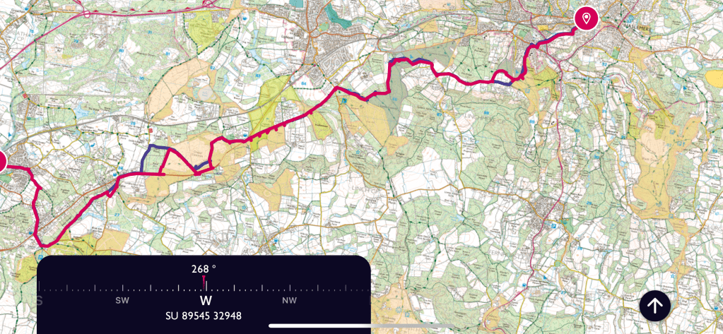
I make good progress across this section, it is mostly dry underfoot although there are a few muddy patches in shady areas – quite unusual this year. I soon get to the point where I could turn up to Liphook station. But that is not my aim. Because I am trying to follow a preset trail I have put that onto the map on my app. Not sure if this is then harder to follow, I’ve already made one deviation and my phone has told me I’m of course!!
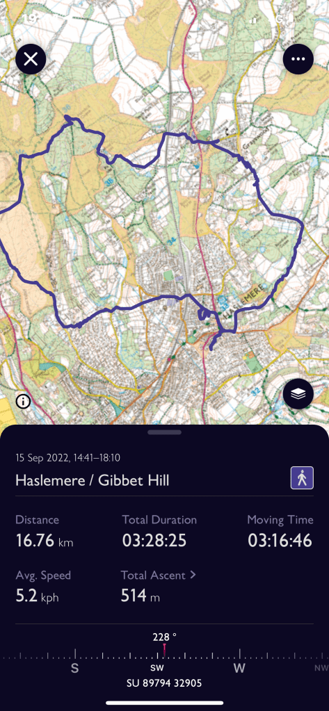
Where the trail is in red that is the plan plus my route – the blue shows where I deviated !!!!
I’m now on a short section which is just the ST, I have walked in this area before and there are a few sections that have some familiarity. I’m back into heathland and I keep hoping I’ll see a deer but alas only squirrels! Quite a lot of birdsong- and yet again I think that I should improve my knowledge.
I notice much to my horror that my battery is getting low and I’m very aware that I have at least another couple of hours walking to do. Every time I look at the map I try to remember which general direction I’m going in but this does vary between almost due north, east and everything in between! Sadly I decide I must stop taking photos. I realised that this has been quite a complex route in places and I have had to check my map a lot.
Apart from enjoying walking in this area as I always do, I did reflect on the need to either carry my charger or a paper map. Having done another slight deviation onto Marley Common I was feeling a little more secure knowing that if I got to Camelsdale I could get back to Haslemere! Phone still going but on red. A great path on the edge of the common.
I emerge onto one of the roads in Camelsdale, such a pity our school reunion was called off again this year as I was hoping to meet Jean again who lived in this village.It would be great to talk to her about some of my walks. Across the main road to Midhurst and beside the new housing estate which is even more extensive than last time I walked this way. Varied housing but rather intense. I’d forgotten that this path came out by a very large, grand looking house and that I had to turn left before going down the Longdene Road which reaches Wey Hill and the station.
The profile of this walk is quite interesting and it is one of the things I enjoy about the area. I feel quite pleased that I’ve managed three good walks during my visit. About 23 km today.
Slightly frustrating being in Surrey/ Sussex and not being able to set off for my walk until the afternoon as I needed to be at two important zoom meetings at 12 and 13.00. Still decided to visit Haslemere Museum in the morning. Arrived just after it had opened at 10 and had a good look round- most impressed and even picked up some useful walk leaflets!
A quick stop at a Bakers in West Street to buy a roll for lunch and then back up the steep hill to my accommodation. I’d looked at a possible route and picked up a leaflet which had the same start but a different way back, which I decided to more or less follow.
Zooms done I set off , later than I’d hoped at about 2.45. Down the High Street, that was okay and I found the narrow passage way which was the start of my path. Quite quickly I went wrong, a footpath sign mislead me, that and some workmen chatting on the path at the front of some houses where I discovered later was in fact the correct route. So having gone in a complete circle , found a locked gate to my path, doubled back completely, I was eventually on my way. Now half an hour behind schedule!
My path has now changed to a road and I’ve crossed the railway line and walked passed the church, good exploring a different part of the town. Eventually back onto a track – ‘The Greensand Way’. I spot my first potential obstacle but I’m pleased to see that the top of the trunk is quite well worn where many people have sat on it in order to swivel round to continue up the path!
My path cuts across the Polecat Valley and I decide to not go up to the Devil’s Punchbowl car park as the leaflet describes but cut off a corner. Almost as soon as I do this it seems rather familiar and I realise I’d been on this path last February with a two legged and a four legged friend! The sun was shining then as well. Confirmed my position when I came out on a clearing with a small bench where I had sat before.
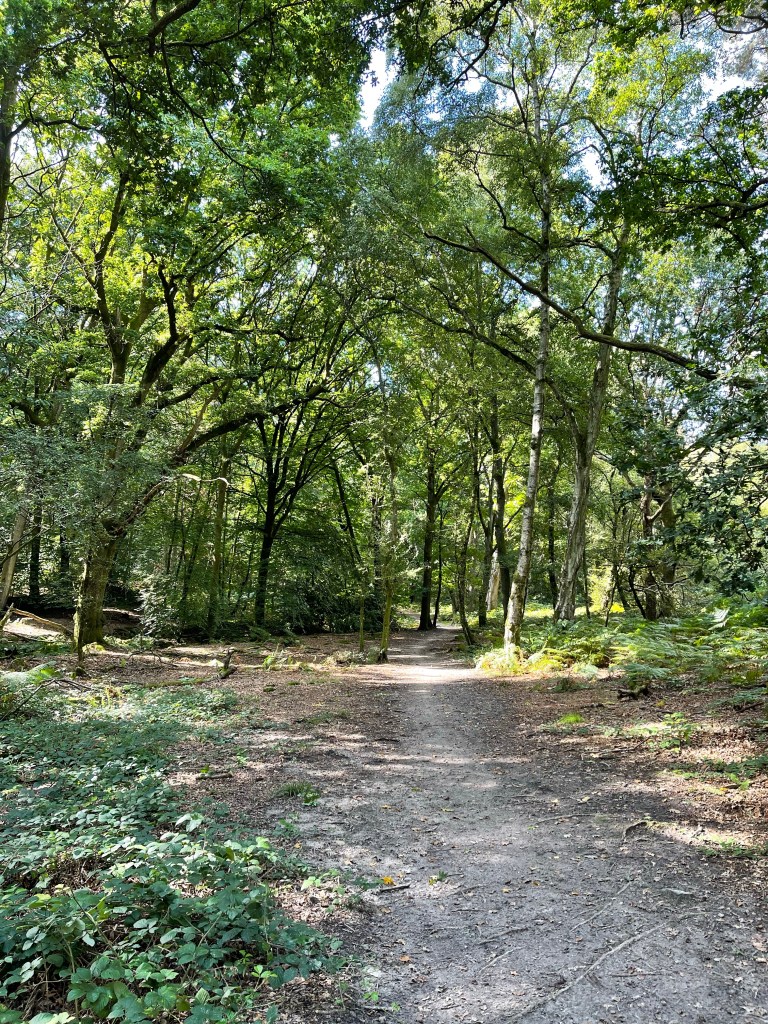
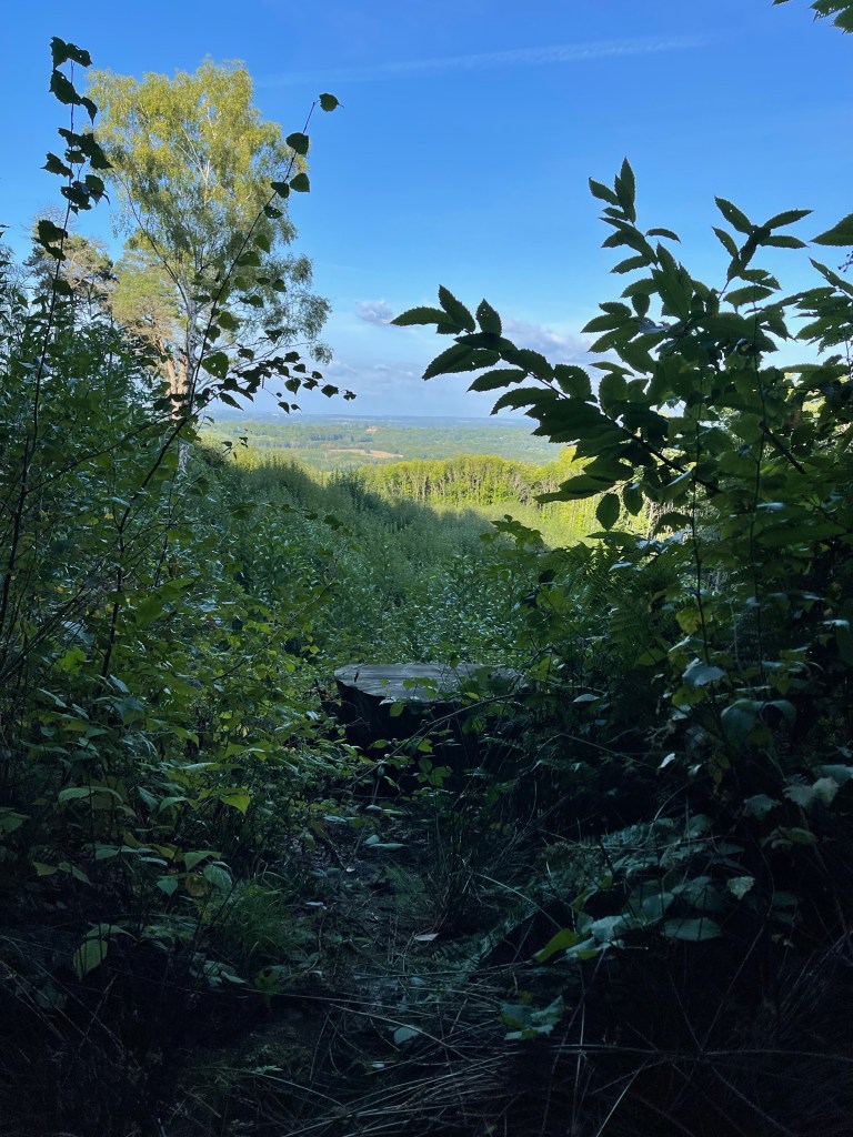
This time I was taking a complete right turn to continue along the GSW and up to Gibbet Hill. Good view across to London today although I didn’t linger for long. I knew I had to take a small path off the the right which would go down hill. I could only see a very small path so decided to engage a group of walkers in conversation in case they had local knowledge- I was heading for the ‘Temple of the Four Winds’. The weren’t sure but thought it was that way, so off I set, quickly going down hill.
I’m caught up by one of the walkers who chooses to share with me a fungus he has picked up and then decides it’s not a good enough specimen to keep. He then throws it away and his dog bounds off after it. He then comments that he’s been trying to get ‘Daniel’ interested in fungus. Cogs turning I realise that Daniel is not a human companion!
We get to an area called six ways and my instructions tell me to go straight across and uphill. Quite useful to have these as this stone plinth is not marked on the map. I am accompanied and there is a comment that if we are on the wrong path we could drop down to find the Temple Base. Luckily it soon appears and although he has suggested that our routes should soon split I declare that I’d planned to stop here for a break.
Kink in the path and then started to turn and really go down hill. Text message – my friend who I was meeting for a drink was going to be back in Haslemere at 5.30 – over an hour earlier than I had expected!! And I’m about as far away as I could be. I try to speed up but know I still have to be careful going down hill with tree roots etc. Going splat won’t make me any faster!
The track takes me down and down further, under the railway line and out into the village of Grayswood, which was always my intention. Obviously no time to circle round here so take the road downwards – well of course as always happens when you are in a hurry I took the wrong side of the fork to start with. I did hesitate for a moment to photograph this splendid Oak Tree on the village green. I was able to make quite quick time along Holdfast Lane and soon met the last section of footpath back into Haslemere that I had walked the previous day.
And back up to my accommodation. Very quick shower and walked into town for a drink. Had only kept my friend waiting an hour! Not sure I would like to do all my walks as quickly as I did that last section- averaged 5.2 kph and I ‘d had over 500 m of ascent so certainly speeded up on the last section! Still managed to do 10 miles / 16 k even though I set off so late.
Not having done any proper walks since Devon I was a little disappointed when I woke up on this Wednesday morning and it was so dismal. Down in Surrey/ Sussex again – this has become a favourite place to walk in the last year. Raining and poor visibility so I decided to stall and hope it would clear a bit which it did. Planning my route for the day I decided I didn’t want to drive and felt determined to walk from where I was staying in a different part of Haslemere.
My Airbnb was at the top of a very steep hill, one of those that you almost feel cautious walking down! I’d decided to stick to my side of town, include Blackdown – the highest point in Sussex and find a circular route of a decent length – this turned out to be about 15 miles.
So having come down the hill I was near the town hall, which splits the traffic and I started walking along Petworth Road. After a short distance a narrow path appeared on my right and this was the start – up hill of course. How could I expect anything different from this part of the world! The enclosed path ran between two high hedges with the ends of gardens on one side and a school on the other. Across a road and then down a steep hill, loosing all the height I’d just gained! More rural almost immediately though. Not long before I’m on a short section of the Sussex Border Path and a familiar feel of tunnelled walkways!
My path takes me southward, parallel to the road towards Midhurst that I have driven along many times and twists and turns a little around the edge of the hill. It feels so good to be back out amongst these wonderful trees and surroundings and not a spot of rain and walking in a tee shirt again!
My route turns to the east and I’m climbing a little but know I’ll probably have to descend again before I start to climb up Black Down. The light within the trees and on the water does have quite a restorative quality.
I do always wonder who has walked this way before and for what purpose? I have to cross Ferndean Lane and hesitate to eat something and then whilst checking the map as the ‘directly opposite’ path isn’t that obvious something fell out off a tree onto the top of my head – ouch, not sure what it was! The gradual climb up has started.
Some of these paths must have been created a long time ago and include walls as part of their structure.
Not long and the surroundings begin to change and I’m now in heathland and the pathways have become more sandy and the ferns are a vibrant green having responded to the heavy rain the previous week and heather is joining the equation of plants.
As I cut diagonally up the side of Blackdown I’m back on the Sussex Border Path which then turns into the Serpent Trail- anyway I’m on the path I hoped to follow!
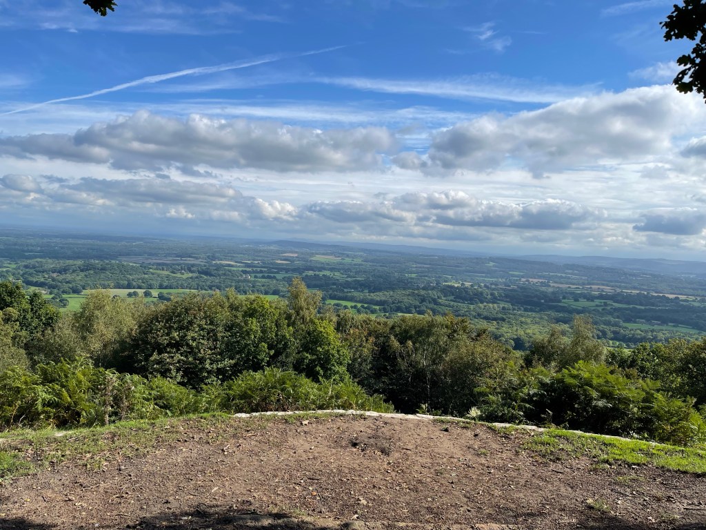
Quite surprised to see cattle- Belted Galloway again, I guess because they are so hardy on this type of land. The views out are great and I can scan the South Downs – hopefully will walk their length next year. Not long until I reach my first main goal.
I reach the Temple of the Winds and stop to look out again absorbing how little evidence of habitation there is, although there must be a little. I have been walking east south east and now I will go back up this massive, east north east, there are so many paths but I want to be quite exact on this occasion. Not sure if I start on the SBP or the ST !
My path takes me along the side of the hill , gradually sloping down but not dramatically. however there is quite a drop to the side! A bird of prey flies then perched at the top of a dead tree and then flies again. Not quite sure what it is?
I head down towards Roundhurst Common and then spend a short distance on a road. There are many times when I could take a quick route back to Haslemere but that isn’t my goal. On this side of the hill I begin to notice a new phenomenon. Many of the paths are covered with leaves- mostly from the previous year but along many there is a clear Chanel in the middle almost as if someone has cleared a path! I can only imagine that this is to do with the torrential rain that fell and that natural run offs were created.
I am beginning to turn northward but instead of continuing I go further east and then turn north again – having got out here no chance of turning back quickly. Following my own route so I can change it at will if I wished to! There are several Pond Bays marked on the map and along with the name ‘Furnace Place’ I conclude that this was another area used for iron smelting as with North Furnace near to Fernhurst. Unfortunately nothing left to see around here – or nothing obvious I should say! The house is quite impressive though!
A little further and the path makes a sharp turn back towards my destination. Ponds on both sides as I turn but nothing unusual spotted. A straight forward route with a stream meandering on my right. Through fields and crossing small streams. As I approached the town far more dog walkers. Just before the last stretch I came across an area where the National Trust had built a traditional wooden barn like building as a training centre. The last section was around the allotments and then down a lane, and only just as I arrived at the main road did you once again feel that you were in the town.
Just the last bit up the hill to my accommodation! A good walk though, much enjoyed.
So back on a bus! This time to Dartmouth, again somewhere I’d visited before, most frequently on damp non beach days! Visited last year when Franky had to rush off from our family holiday as her dad was seriously ill. That time we visited the castle and managed a short walk, number 24.5!
A bit different arriving on the bus and as it terminated I was thrust into a swell of people walking along the sea/ well estuary front. A rather overwhelming sense of busyness. My plan for the day was to walk back to Tor Cross where I had started yesterday. I was alone again as Alex had decided to go to the after wedding beach party. He was catching a bus to Salcombe and then running the route we had walked on Friday (Walk7/7a) and then on past Hope to Bantham – not my idea of fun!
Again the map first to help make more sense of the route, this was almost all new apart from some very short stretches completed last year so quite exciting. Added pressure of having to catch a bus at the end but hopeful that my timings would work out.
So first of all through the town feeling slightly incongruous with my walking boots and rucksack – not quite in visitor mode. The route mostly on road to begin with turns as it passes the hamlet / area called Warfleet with it’s small harbour and industrial looking buildings. The road then turns towards the castle where the official costal path runs through the church yard of St Petrox. Going through the courtyard where people gather to enter the castle and up steep steps to climb back up the hill as the coast is rounded. A sweep round the bottom of fields with steps down to some coves gives a different feel from yesterdays walk. This continues for a while and then a steep climb up before turning and continuing round the coast line. Good views out across Dartmouth Bay. Even as far round as Start Point and the lighthouse.
There are a few more people around on this section of coast and I realise there is a parking area not that far away. Before turning inland to that area, which is where the route takes me I decide I really must stop for refreshment. A bit of lucky timing as a couple started getting up from a bench just as I arrive and we swap places! There is obviously a regatta out in the bay. I often wonder how many near misses there are when sailing so close to each other!
The path cuts in land for about half a kilometre and then at the parking turns left onto a road. There is quite a section next along road and that bit further inland. The land is so undulating at this point, not rocky as in some of the outcrops yesterday but huge rounded fields which dip to steep valleys. The road takes quite a turn as it hits the head of one of these gorges then continues towards Stoke Fleming. This is a narrow village approach by a winding steep road with cars everywhere, this had been a challenge for the bus driver a few hours earlier! The route cut through the village luckily away from the chaos of the main road and then steeply down to meet the coast again just before Blackpool Sands.
On the map the path appeared to go along the busy main road but fortunately a path had been created just on the coast side of the road and protected by a hedge. As you approach this area it is easy to see the busyness and more commercial element of this beach with parking and cafes and fortuitously, toilets! Having used the only facilities I required I remembered why we didn’t ever come here but frequented beaches less easily reached, as seen yesterday! And also it’s small pebbles and not sand!!!
A tiny bit along the road before the path branches off across the road and into a field. Rather taken by this array of cottages!
The next section was a really steep climb up one of these large rounded hill sides. Good views though and one used in lots of commercial adverts for the area, always wondered where they had taken the view from and now I knew. Wonder if they planned it or needed to stop and breath and just turned round fortuitously as I did!
Bit of a navigational error in this field. Having been very glad to reach the top and pleased with the view I followed the path rather than looking more closely at the map! In the second field, it had levelled out I was met with a gate into the lane where I thought I wanted to be but it had an over generous amount of curled barbed wire along it’s top. No other apparent way out so I looked more closely and realised I had been led astray by a very well defined path, guess I wasn’t the first, back tracked and found a stile somewhat hidden in the hedge and nearer the top of the first field! Over and along a lane, turn right and just about opposite the offending gate my path led off across more fields!
Again I’m further away from the edge of the sea than I was yesterday and I have to once more dip down to the main road. Well the next section was interesting- I’d seen this distinct path from the road which went very steeply down and then immediately up the other side of a V and I did wonder. My thoughts confirmed as the finger post pointed the way. I met a family who had just reached the top by me and we exchanged a few views on the extremity of the path. And I set off, this photo doesn’t really show the steepness!
There were several paths cris crossing this area and people obviously coming up from days at a beach – I really wasn’t sure which one but….
The path continued round the top of a hill and then into a track coming to the edge of the village of Strete. I met the same family again and they acknowledged me, they had walked the flatter way by the edge of the main road. This time the path was along the road until at last it turned left towards the coast dropping down hill and through trees until it reached the top of the cliffs above the northern part of the long stretch of Slapton Sands. I had realised a little before that whilst I wouldn’t be in time to catch the penultimate bus of the day, I was in good time for the last bus- a relaxing thought!
The path emerged by the car park for Strete Gate and I was at last close to beach and sea. I was somewhat amused to see a notice requesting naturists should wear clothing when using the parking, toilets or other facilities. ‘There is space for everyone’ it continued. So apparently if I had turned left on the beach this is what I would have found. Rather reminded me of the time Alex and I went for a walk near Sandbanks, Swanage area and I ended up with a bit of explaining to do!!
I decided my best course of action at this point was an ice cream and a cup of tea. Luckily there was a bit of a wait for the drinks which gave me time to eat my treat for the day.
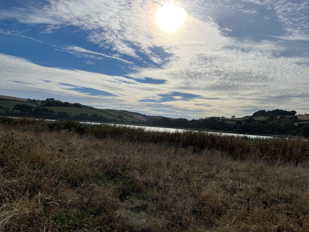
This is a strange area as there is a really long stretch of pebbly sand rising quite steeply up from the sea, then the road and the coastal path ran parallel to this but next to Slapton Leys, a large stretch of inland water and a nature reserve. Quite a good place to walk but quite Sandy. Good sky though.
Probably about 3.5 kilometres to go and my tea lasted some of the way. Towards the end , by a memorial tank, yes tank – reference to D-Day , the path crossed and it was possible to walk by the sea wall in Tor Cross – a narrow hamlet pressed against the sea, squashed in by the road. Several houses for sale which was a bit worrying and so to the bus stop with some time to spare. However when it was about 10 minutes late I was beginning to wonder if my power of being able to read timetables had failed me!!
Another good days walking, very different but definitely worth doing. Just under 23 km and an interestingly different profile from the day before !