A further 50! Walk 28- 29/10/2020

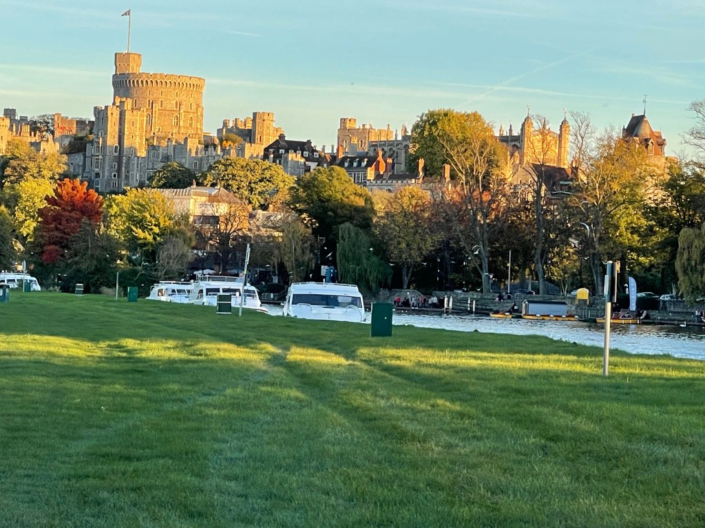
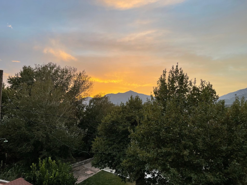
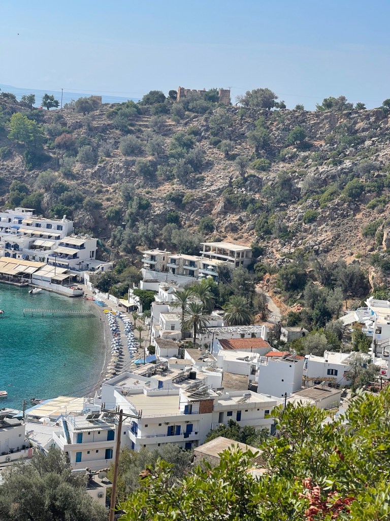
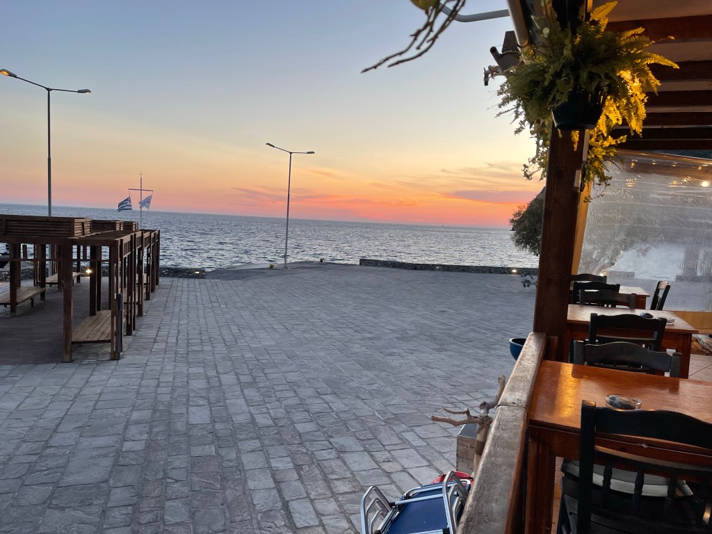
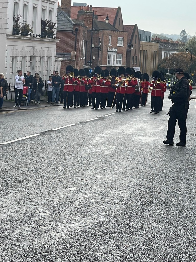
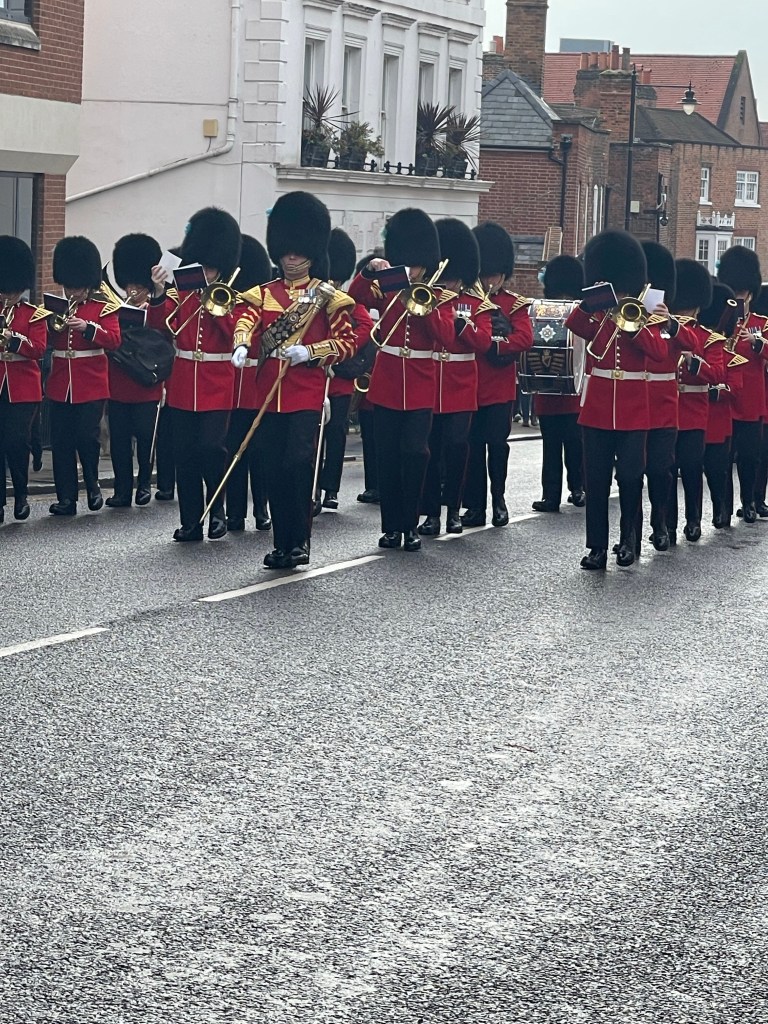
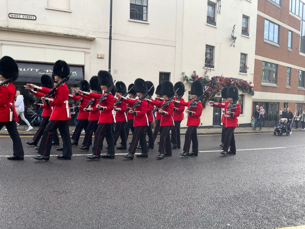
So back to Windsor to start the third day of this section of the Thames. Travelling by minibus today but starting quite late – we don’t leave Millets until 09.30. We get to Windsor and are on route to be dropped by the Castle and we meet a barrier across the road – changing of the guard! Change of plan – we jump out the van, turn into tourists for ten minutes or so and then find our way to the bridge. We are on the Windsor side of the river to start and in Berkshire and always good a convenient Conveniences before we reach the river!

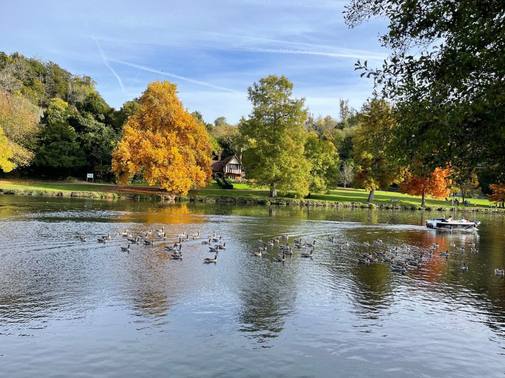
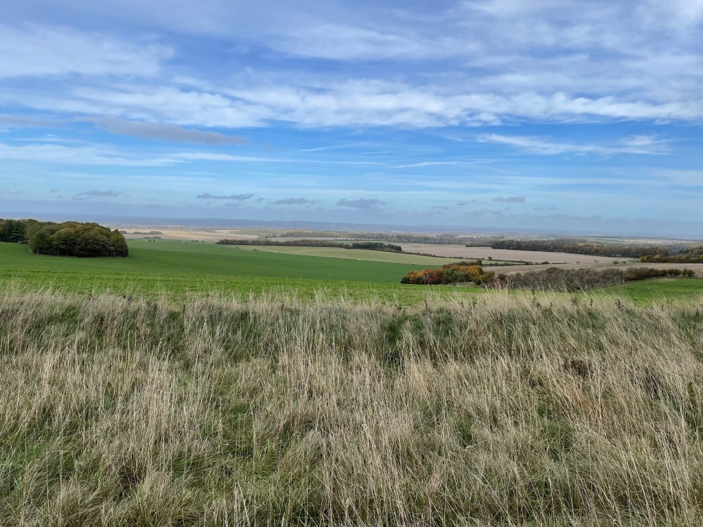
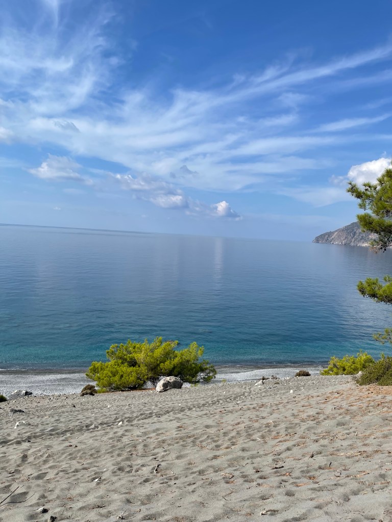
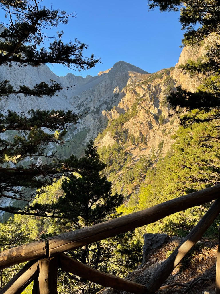
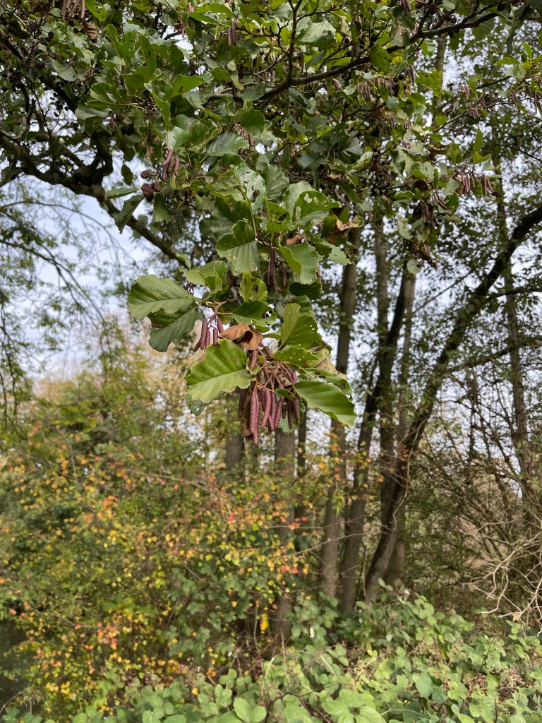
Our goal today is Shepperton -I’ve heard reference to the studios but not the place – up until now most of our destinations have a familiarity about them but not today. The path runs next to an open area which is the northern end of The Home Park , after a while we can look back to see Eton School and also back to the castle. There’s a tree next to the bank and we quickly identify it as an Alder – not very common. We can also see the branch line that runs from Windsor Riverside to Staines

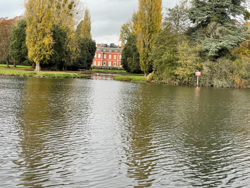
The path reaches a road and crosses over the river using the Victoria bridge and we are back on the far bank. There are plenty of signs about crown property and if you look at the map you can see familiar names such as Frogmore and Adelaide Cottage. It is obviously a rather beautiful park which also includes farmland and after curving right around the park we cross back over the river at the Albert Bridge and also spot a quite distinct gatehouse.

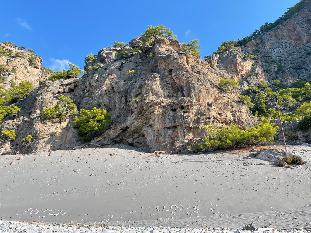
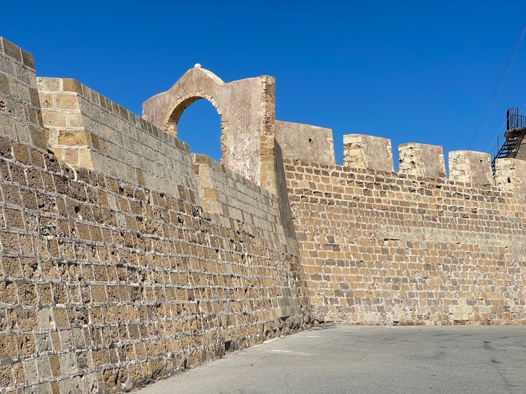
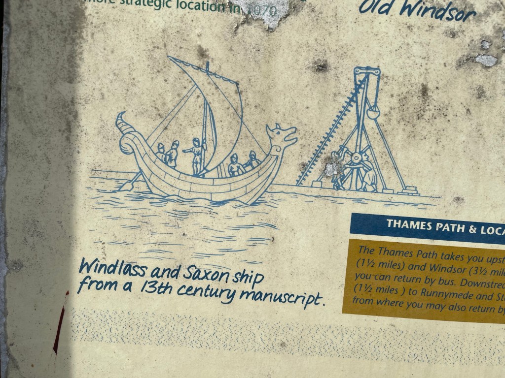
A very pleasant area which was quite important in the past- we are now next to Old Windsor – this was apparently the home of Kings before Windsor Castle took pride of place. By the lock this illustration helped to explain the way that boats were winched over weirs- created when waters were diverted to feed mills of various types. Locks are a reasonably new invention.

https://en.m.wikipedia.org/wiki/Locks_and_weirs_on_the_River_Thames

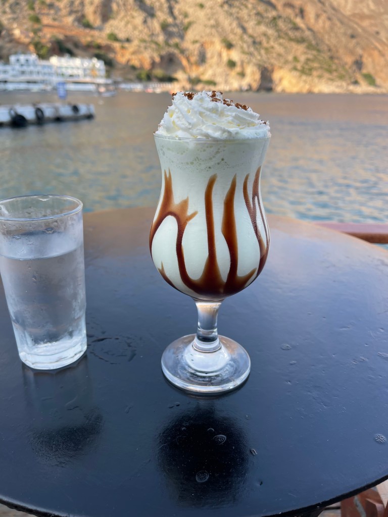
We are walking along the back of houses again and then for a while our path is next to the road as we approach Runnymede – we have decided that we will take a small detour here to make a visit to the site of the signing of the Magna Carta. A busy road and quite a lot of people around plus some useful picnic benches at the NT cafe. Having started walking quite late we decide it’s time for lunch before we make our quick sight seeing diversion !

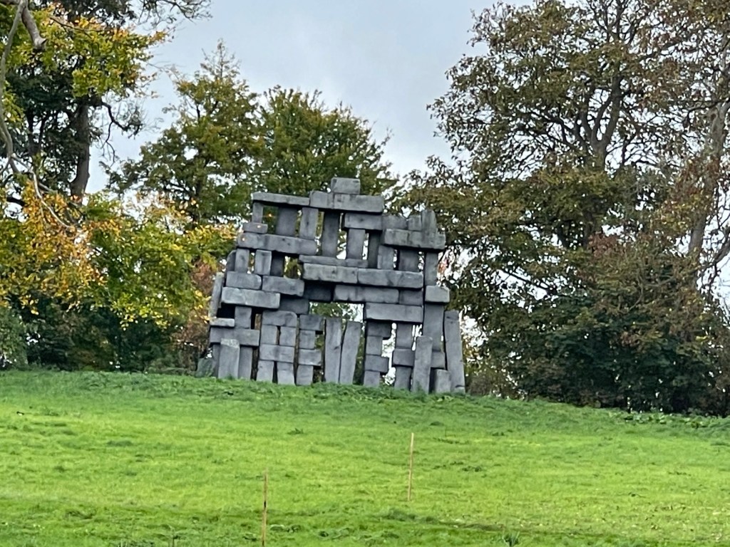
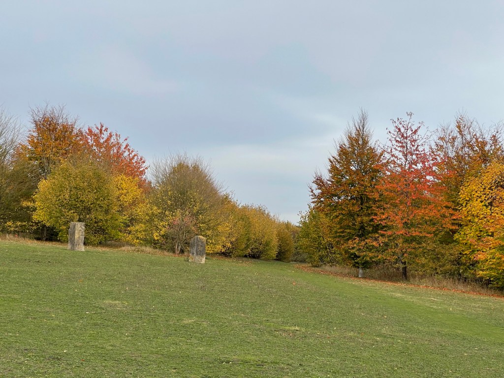
The education team have placed these sculptures to try to show that ancient civilisations lived in the area. Then in contrast a modern sculptural piece representing the law and justice with seats for twelve – in the middle of a field of course!

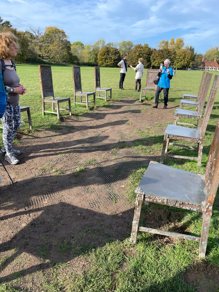
There is a John F Kennedy Memorial near the edge of the main field but we don’t really have time to explore. We go further along to the Magna Carta memorials.

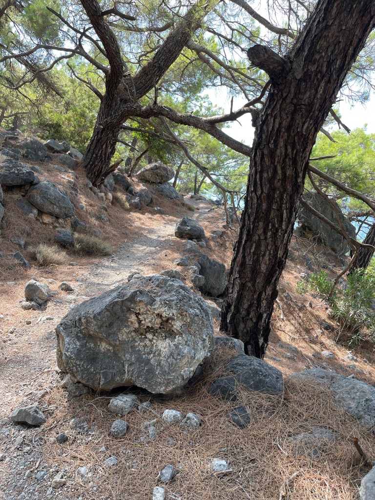
We cut back to the river and continue on our way – we haven’t really got far enough yet and there is quite a long way to go- finding the given distances are rather lean compared with the actuality. Perhaps current GPS is more accurate. 

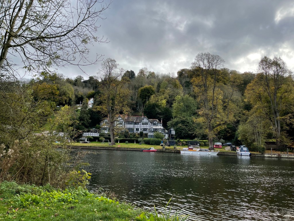
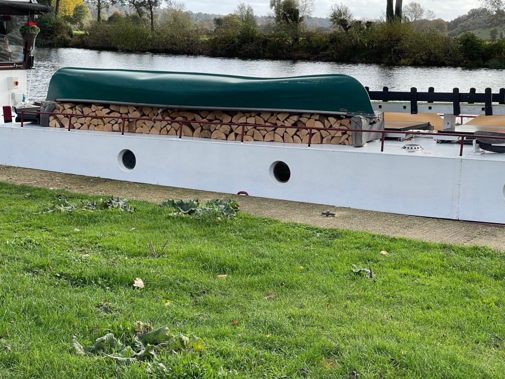
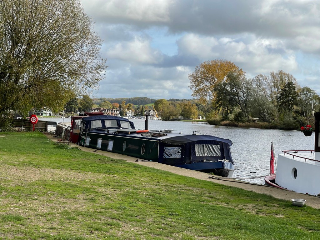
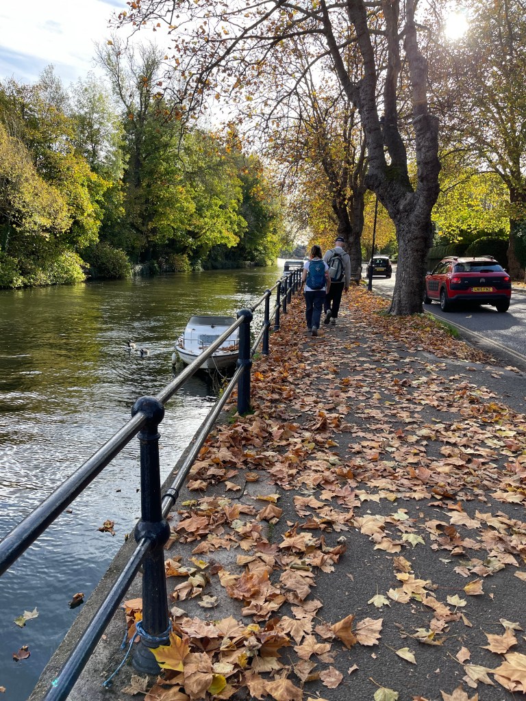
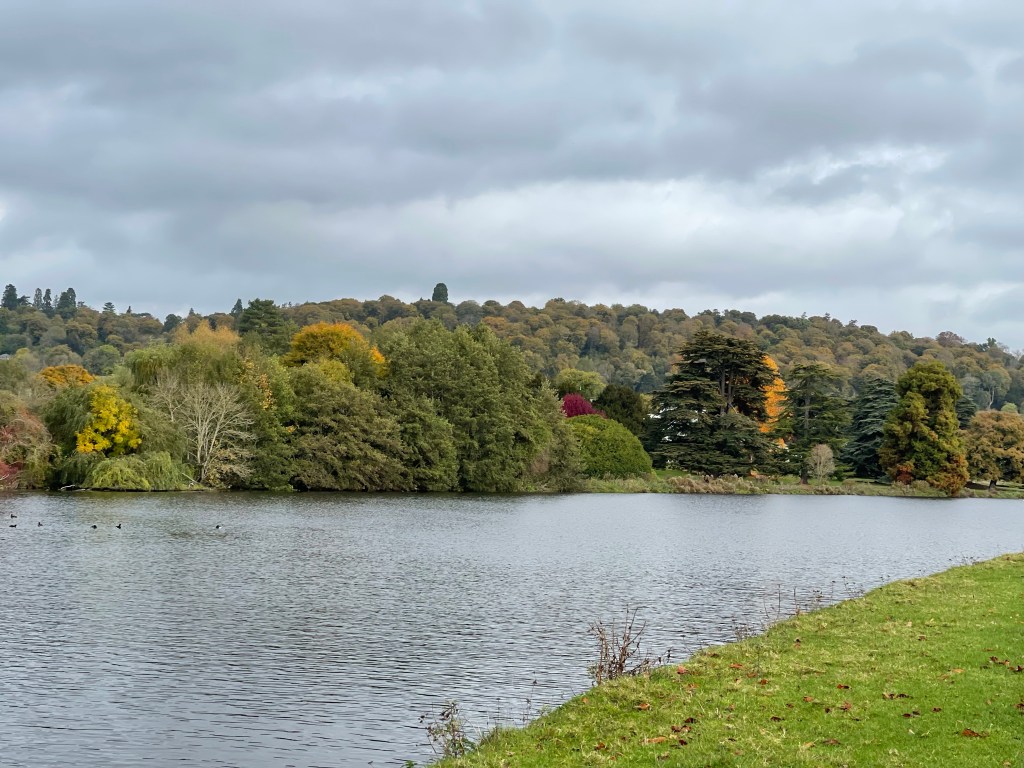
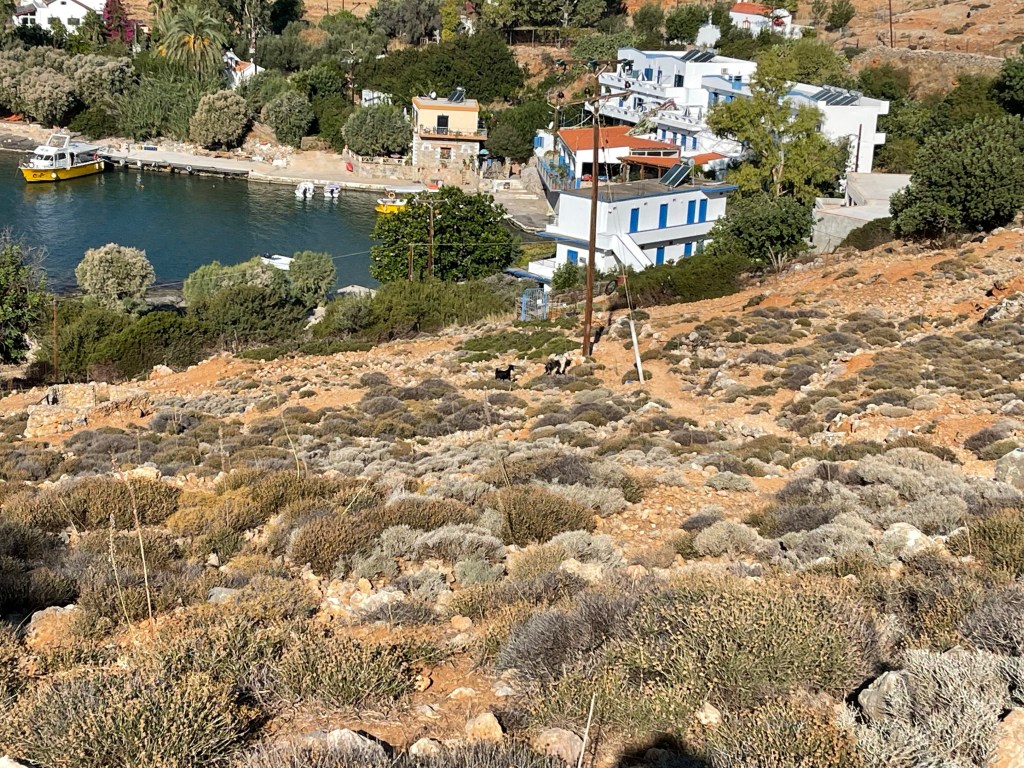
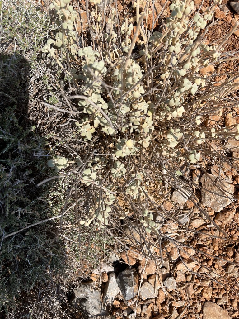
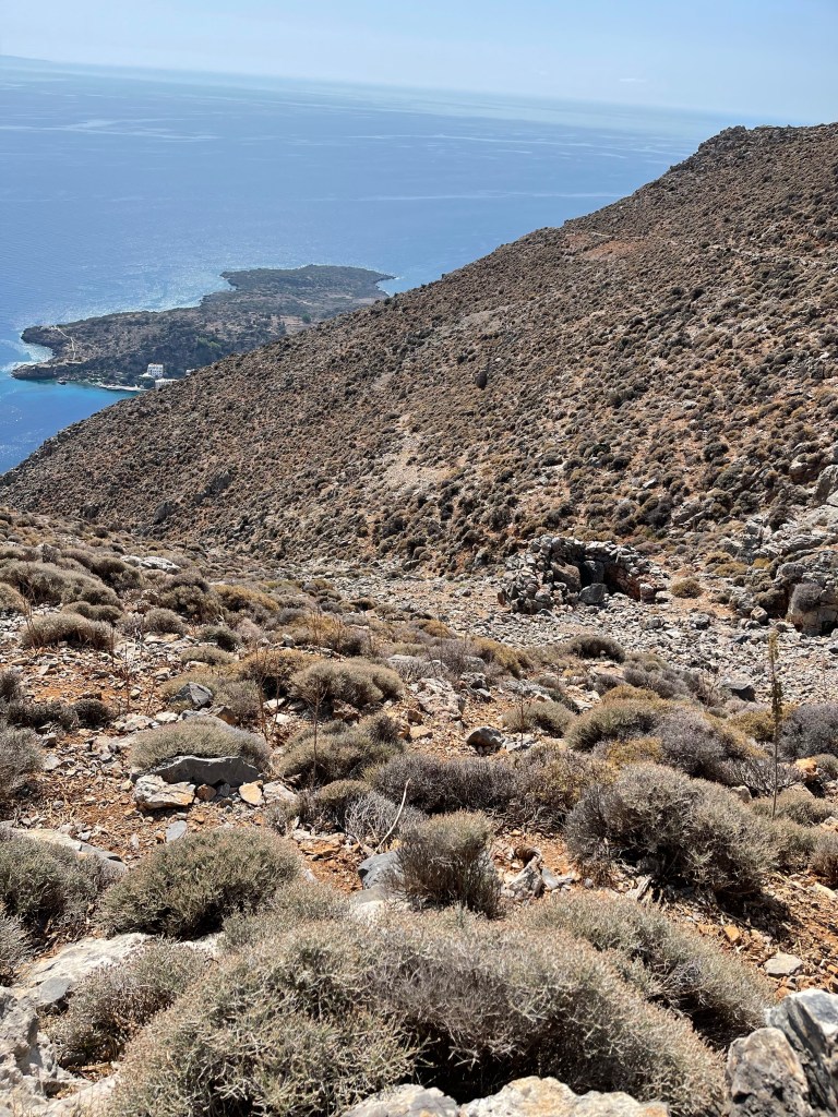
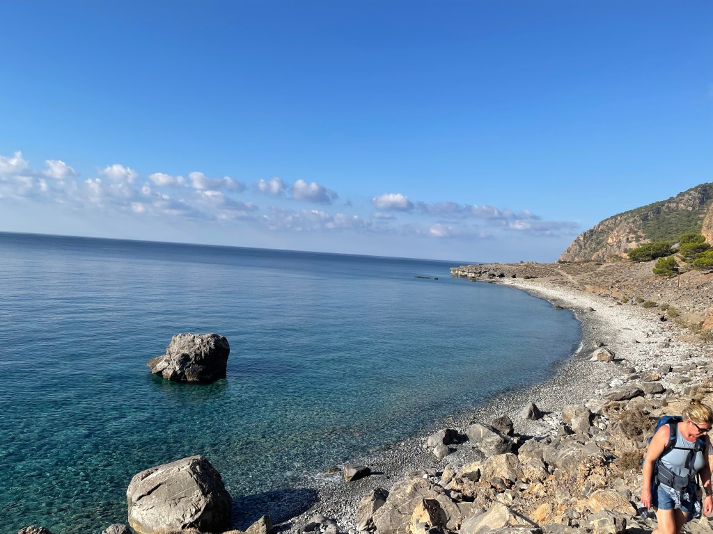
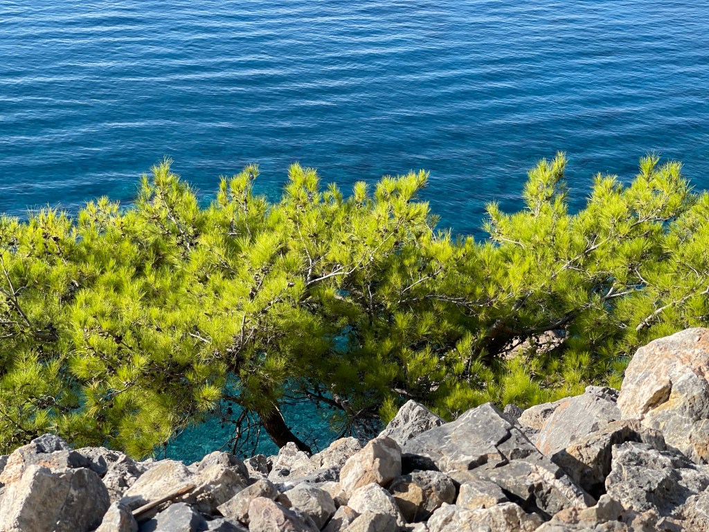
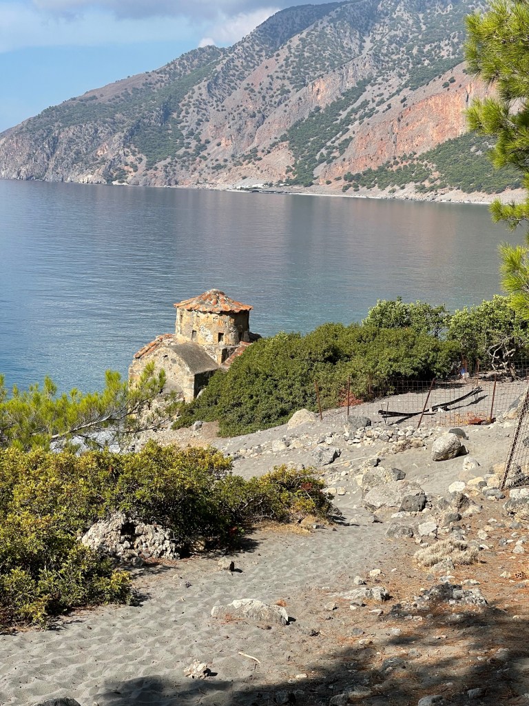
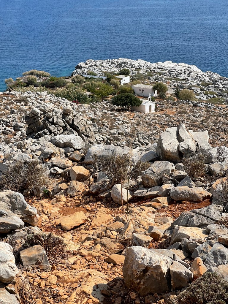
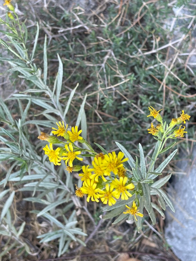
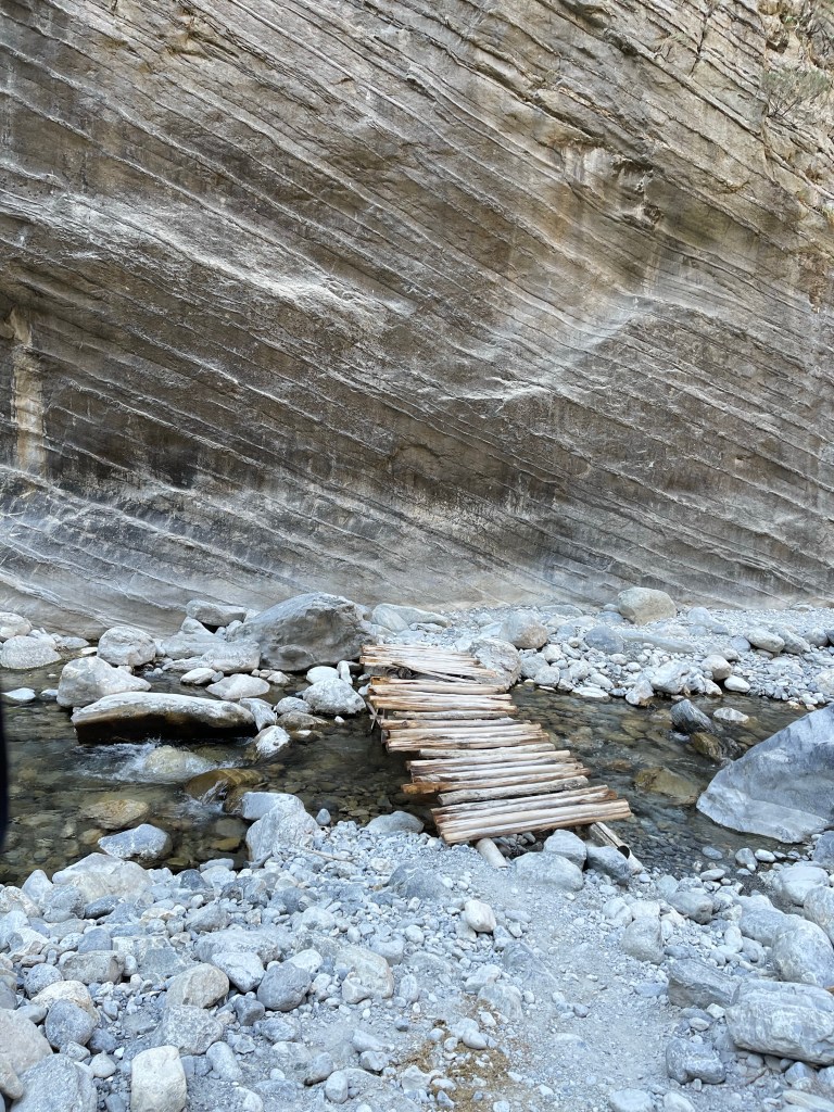
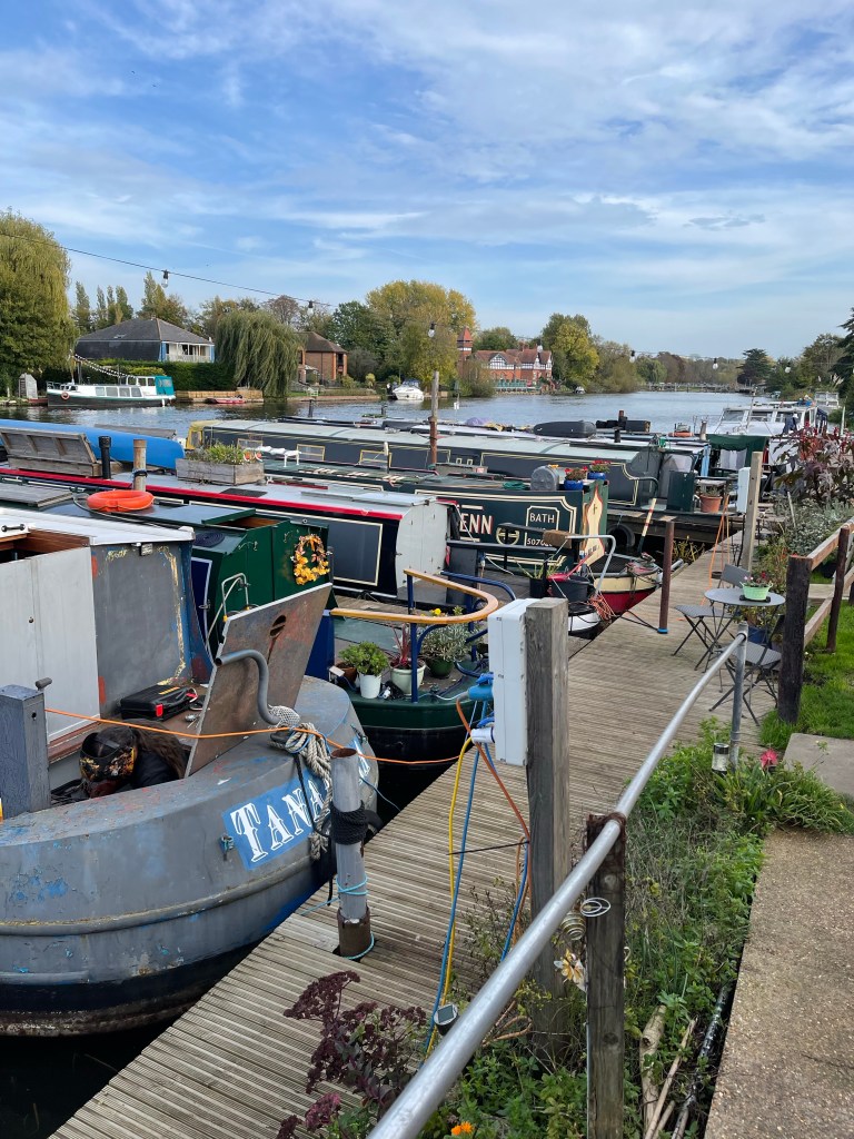
This area is clearly steeped in history and there is more to explore. We’re on to another lock and quite a built up area with Egham to our right and across the river Hythe End and to add to the complication we pass under the M25. As we continue along the river with its mix of rural and suburban there are always things to spot such as this tree covered in mistletoe and then an area where boats are moored next to each other and in abundance – some clearly still lived on, others being renovated- a colourful but peaceful busyness.

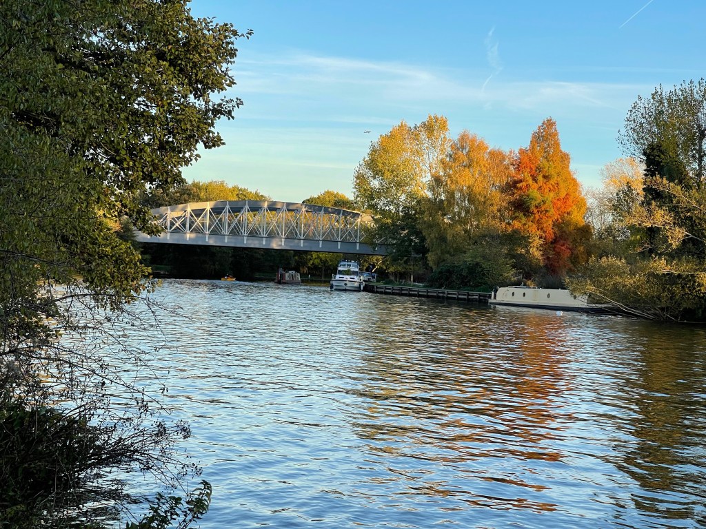
We are soon to cross the river again as we reach the bridge at Staines- don’t think I have ever been here. The part by the river looks quite reasonable but I suspect further into the town I might not be as impressed. An ancient market town which was populated by Romans and which gradually became more industrialised over time. Next to the river is the London Stone which marks the original boundaries of the City of London. There is also a possibility that this used to be the extent of the tidal Thames – now further down stream due to the addition of locks and weirs.

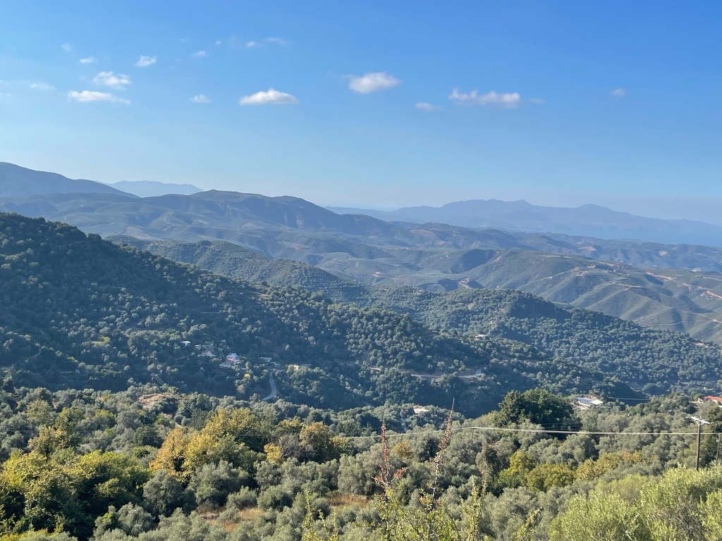
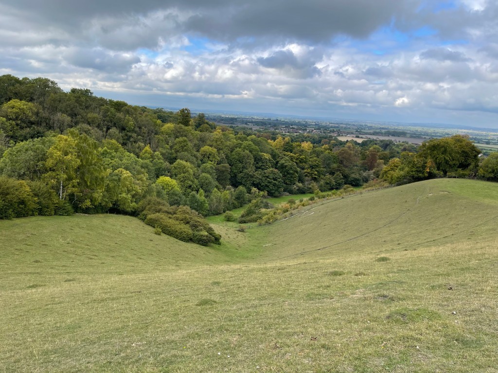
Still quite a long way to go and in sections of good paths we can increase our speed. The prevailing thought is that although more built up it is not unpleasant. The river twists and turns a lot here and it is a complex area of land and water, although that is nog entirely apparent to us. Reservoirs and gravel pits used as marinas. Penton Hook is the area of land on the opposite bank and we come to another lock – quite an early one. Fiona and I see a strange sight here – an open wide barge containing a JCB and a skip plus other tools etc , being pushed along and guided by a small truncated boat hull. Whilst captured in the lock we did ask the driver about the river vehicle and he explained he mended lock gates, bank edges etc and was sub contracted by the environment agency – another job opportunity we didn’t know existed.

Still quite a long way to go! I’ve been keeping my eye on the route and the time and we should be okay. Sometimes when you are expanding the map for detail it’s difficult to gage the distance. It actually works out that our route was about 16 miles so not surprising that we had that how much further feeling!

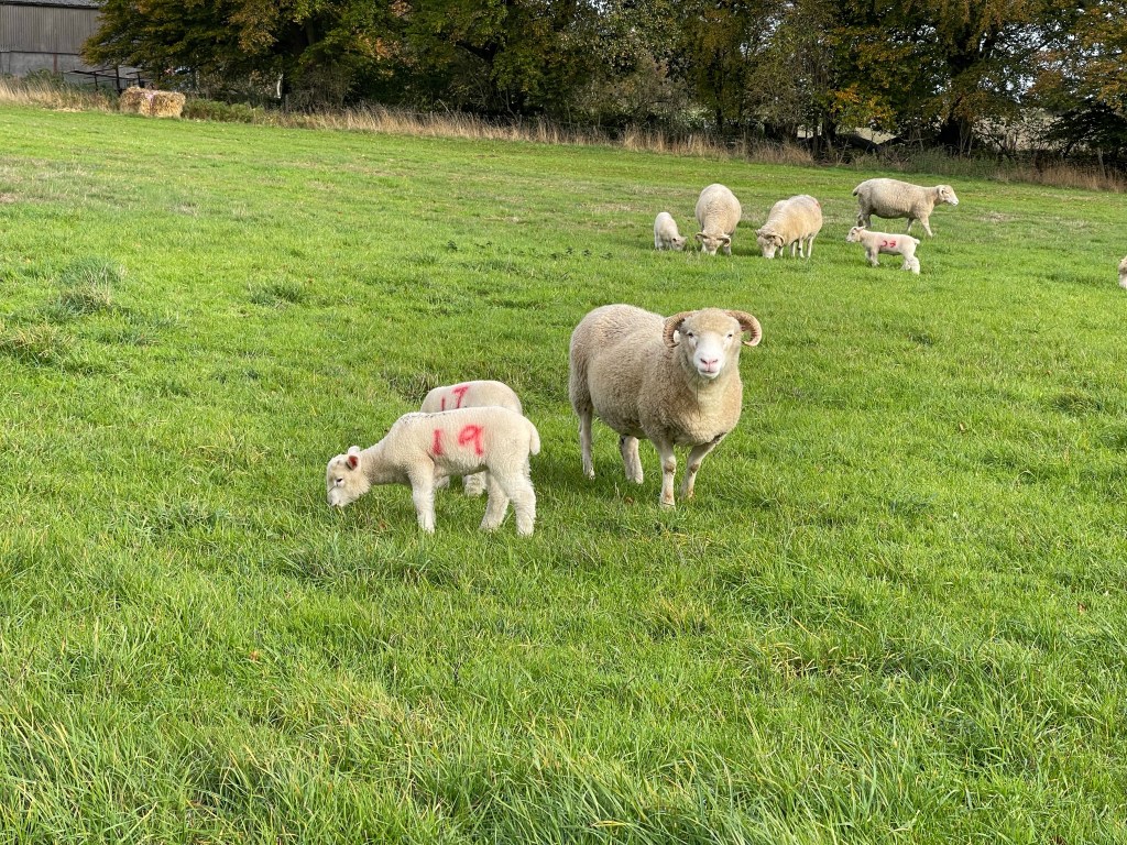
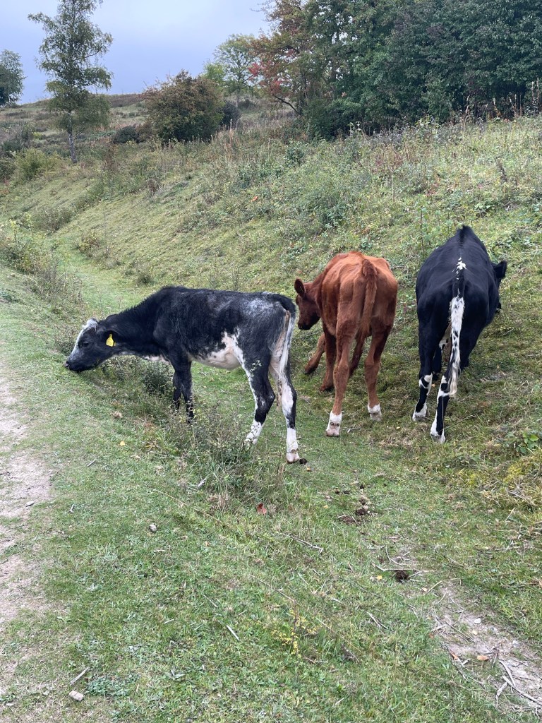
The landscape opens up and we see Chertsey Bridge – an old stone structure and we are next to meadow lands which apparently flood regularly but this increases the minerals in the soil and thus the vegetation and makes for excellent grazing ground. We see belted Galloway cattle again – they seem to be a reoccurring theme of my walks!

I’ve taken some good looks at the map which is lucky as my phone runs out at this point- really cross with myself that I haven’t got my battery pack or kept a closer eye on the status. Anna and I are at the front chatting away and realise we can’t see the others, so we stop to let them catch up around the latest bend. Still no sign and Anna’s phone rings , it’s Mirella- Jenny has been stung near her eye so they have stopped. I recommend cold water and they catch us up.

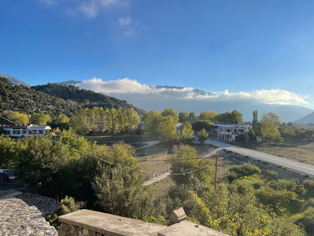
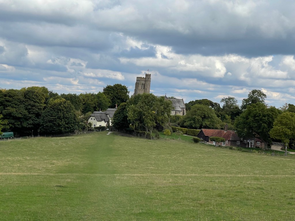
When they reach us there is already quite a lot of swelling and we put more cold water on and then my insect bite cream- this seems to slow the swelling at least. We continue and I know from a welcome sign that we are now in the Parish of Shepperton. Quite a few houseboats in this area and we continue along feeling slightly subdued.

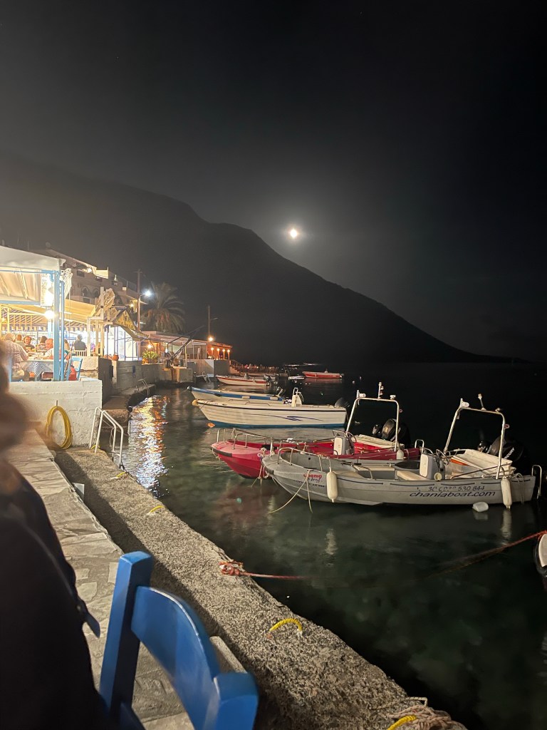
As we approach Shepperton Lock we spot a pub and Mirella dives in for ice. We are cheered by a family with fairy lights and pumpkins on top of their barge – enjoying a Halloween half term break. Not long and we reach Jane and the minibus.

The ice worked and helped and when we got back to Oxfordshire we called in at the Tescos Pharmacy for advice and anti histamine tablets. Unfortunately Jenny decided not to join us the next day but was feeling better – even if her face had reacted badly.

A good days walk again with a slightly unfortunate end.

A further 50! Walk 27-28/10/2022

Back to Marlow where we finished the previous afternoon- different transport today! Parking at Didcot we catch the train to Reading, change and then to Maidenhead- the branch line to Marlow has been replaced with a bus. We arrive at the back of the station and after a quick falter find the way back towards the town. We know we need to get back to the bridge and stay on the same side of the river but are a little perturbed to see a path closed sign. A helpful local points us in the direction of the churchyard right by the river. Having gone all round the church we come to a path that we should have followed from the Main Street, before we reached the bridge ! Oh well we are now on our way. We are heading for Windsor and this is quite a long stretch so we can’t afford too many errors. No Andrew today but we have got Anna who we have walked with before.

After a short while we are back next to the river and under a road, on the other side we already have evidence of quite an affluent area and we are also amused by the unusual log store!

We’ve been walking quite close to the branch line which wasn’t being used today. It looks as if trains should go from Maidenhead to Bourne End and then back out to Marlow. A large Bridge looms up as we are approaching an increasingly populated area. Populated by very pleasant houses fronting on to the river!

Luckily the railway bridge also has a foot bridge running parallel – sometimes how ever good the map is you are left guessing! We are walking now in Berkshire and can look across to the housing.we come across a group of young people with stoves out cooking their lunch. They have four paddle boards loosely secured together. We had noticed them moving down the river the previous day and had also met a mum/ leader with a very large camera awaiting them. A Gold D of E expedition, we were surprised to hear that wild camping was still banned, due to the pandemic! So they were staying overnight in sea scout huts. Their destination that night was Maidenhead. The smell of the food made us all feel hungry.

As we approached Cookham we found an area with several benches and agreed we should make this our lunch stop. Refreshed we cut away from the river and passed the church. We’d been through this village earlier on the rail replacement bus! However Mirella had helpfully seen a sign so that we knew that the church was 11 th century.

The difficulty with these slightly more populated areas of the Thames is that there are fewer wild wee spots! Luckily this village had a small car park and public conveniences- very well timed and we could all proceed on much more comfortably.

We are looking out for a lane on the left and this and subsequent footpaths cuts off a bend in the river and we miss a lock – I guess there are still some areas of land without owner permission. I’ve alerted everybody to the fact that Cliveden is up high on the opposite bank as soon as we rejoin the river. We’re all old enough to be aware of the Profumo affair – he’d probably just have to apologies now!

As we get to the river bank there are two mature but as Fiona told them, looking very glamorous , ladies in swim suits about to go wild water swimming- with their pink buoyancy aids but also with pearls and various other necklaces. We chatted for a while and then forgot to look up to spot Cliveden. We did catch a glimpse of the house later when we turned back and we were aware of people on the other bank in part of the parkland. On our side an avenue of trees.

Before long we reach houses again – some really extensive, some grand designs and some where they have extended their gardens onto the riverside path. We have a section along the road, with a good path but it does feel a little alien. Perhaps the strangest thing is Boulter Lock which is right next to the road. Quite a lot of splits in the Thames here, including one long loop which goes right away but bends round to rejoin much further along – called Jubilee River ! Maidenhead Bridge approaches, looking very fine in the sunlight.

I notice on the map that at Taplow there were Paper Mills which could be why the lock and the diversions were formed. A bit more of housing edging the path and then under this amazing railway bridge – somebody on the first side is set up with a tripod and was very earnestly eyeing up the arches with his camera. You know how you get the sense that engaging in conversation wouldn’t be very fruitful! Anyway on the other side was a large plaque explaining that this was designed by Brunel and was the longest and shallowest brick arch that was built to support a railway line.

Nothing too much happening on our side- back in Bucks again. On the other side is Bray and there is a discussion about restaurants but nobody can quite remember the name! Under the M4 next, then Dorney Reach on our left, I’m aware of the lakes where the Olympic rowers train – I recognise the name but draw a bit of a blank with the others when I mention it. I can see an embankment but no water – just have to believe they are there. Another busy area of the river with quite a few boats moored by the banks and yet another marina.

The river takes a sharp turn and we can see the large boathouse at the end of the lake. There is an area called Boveney Court and a small church in isolation – it looks rather deserted. On the other bank we can begin to see signs of the Windsor racecourse- we know we still have a way to go but hopefully we will beat the dark.

The area to our left is wide open common land in contrast to the far bank which is more wooded and organised. We are next to Eton Wick and we can just see the top of buildings that are probably part of Eton School. The river wriggles a lot at this point and an A road crosses this area supported on a series of bridges. We go under one and admire it’s decoration. As we come out from this we can see a railway bridge crossing the river- we are getting closer!

The path curves round across a green grassy field and we are able to see our end goal for today- Windsor Castle. The light is beginning to fade and it is beginning to feel like the 24 km we have completed.! We come into the town of Eton and some buy coffee before we cross the bridge into Windsor itself. Next quest find the railway station – first to Slough, then to Reading and lastly onwards to Didcot.

Great weather, good company and some fantastic views.

A further 50! Walk 26 – 27/10/2022

So back to the Thames Path, a further block of four days. Not a good nights sleep before this walk as I’d been double jabbed the day before and was some what paranoid about the way I’d feel in the morning! All good! Sadly SPR still haven’t got transport so it was suggested that we meet at Wallingford and catch the bus to Henley. We’d been alerted that the bus stop had temporarily moved but we planned to meet in good time. A bigger group for this section. Andrew joining for the day, Richard who had been part of the first group and Jenny and Mirella – all of whom I’d walked with before. Fiona plus her husband who had a rare day off had gone straight to Henley.

Well we got to the bus stop in very good time and waited and waited, checked with others that it was the correct place and waited and waited. Forty minutes after the bus was due we took the executive decision to get a taxi. Enough was enough.

We arrived at the bridge over the river in Henley and Fiona and Darren joined us- it seemed ages since we were at this point in September.

We crossed the bridge and we’re on the opposite bank to the previous section having left Oxfordshire and arrived in Berkshire. The river is straight and wide at this point making it a suitable site for the Henley Regatta. Before long we can see Fawley Court, now slightly concealed by trees and on a little further is Temple Island. Now used as the starting point for races, this building was built as a fishing lodge but also as a ‘folly’ to be seen from the large house.

The river makes a big curve round at this point. And we’re heading for Hambledon Lock where I’ve suggested we should have our first break seeing we all started our day quite early. This looks quite a good place to explore on another occasion and there are some interesting buildings, one of which is a mill – now restored and repurposed!

Although it is still a little overcast it is beginning to warm up and slightly more blue sky is appearing. We stay by the river for a while and then take a short lane into the hamlet of Aston before we come out by the river again just below Culham Court. Having trained at Culham College near Abingdon this obviously attracts my attention. A handsome house with some unusual sculpture in the grounds and then white deer in the park.

An interesting building up on the hill, called Culham House but following Fiona’s research that evening it transpires it is a quite newly built Catholic chapel – the owners of the estate are Swiss.

We have noticed several cormorants along this stretch of the river. I found it rather strange at first as usually I’ve spotted these at the seaside – later in our walk a notice board confirmed our identification. Some interesting farm buildings which are using the local materials of chalk and flint.

The river continued round and we went past Frogmill Spinney which was an extensive mobile home park- difficult to tell if these were residential or holiday homes – some looked very established – we discussed the fact that you are only suppose to be in them for a limited time. Onwards. We can see a very large white Hotel at the top of a hill on the opposite bank – the area is marked on the map as Danesfield and also has an old fort. The river is splitting into about four channels here and we go by the lock near to Hurley which is apparently equidistant from Oxford and London. Another site of a Benedictine Priory. We also noticed very full grown cygnets that still hadn’t quite changed from ugly ducklings! After the lock we cross the river, we are now in Buckinghamshire, our third county today and a feeling of greater affluence and busyness is apparent. A marina and many more boats moored.

As we begin to approach Marlow we can see Bisham Abbey on the opposite bank – this is a National sports centre where various teams and individuals train. We can just about see some playing fields but not much else. The area has obviously been repurposed and it’s good to see that the church is still part of the complex.

There are more people on the path as we get closer to the next town and our destination for the day. The chain bridge over the river at Marlow is soon apparent. We need to leave the river here and walk into the town to find the bus stop to go back to Henley and then a second bus back to Wallingford.

We note that there are some good looking shops in Marlow, a good place to visit again but content ourselves with tea and coffee on this occasion as we still have to find the bus stop!

Today’s walk was very enjoyable and quite short – warming us up for what was to come on the next days! About 15.5 km so about 10 miles.

A further 50! Walk 25 – 22/10/2022

Just over a week since my last proper walk and decided it was time to go from home and find a slightly different route.

Jack’s at home , meeting up with friends to discuss his wedding next year and also go for a walk. I decide to head straight up the hill, knowing they will follow me and hopefully they won’t catch me up too soon!

I make quite good time and make it up to the gallops below the Ridgeway.

At this point I can see them and wave before heading through the wood- they cut along a track and beat me as we all come out below the main Ridgeway Path. I equip Jack with a screen shot of the map to show where he intends coming off the Ridgeway and we part company.

I’m going to double back on myself in order to walk along the ridge a bit. I’m going to go past Latin Down Farm entrance and then double back behind their land on a path that I’d walked past many times but never taken. It was strange walking alongside the fence to woods that I had been in several times with groups of children- building g shelters, using mirrors to view the world as a mouse, an owl or a hawk. Looking to match plants with colour swatches and of course making toast over a camp fire!

None of that today as I continued along quite a narrow path, definitely there but not well used. I would eventually come out on the Wantage to Newbury ‘back’ road and go straight across. surprised to see these flowers out and then in contrast a carpet of fallen leaves.

The path opposite stretches out across an open field and several sheep turn to stare at me! I’m really surprised to see relatively young lambs and I wonder when they were born? Is this a new trend due to hot dry summers and lack of rain? The path emerges onto the road as I walk through Farnborough village and past the house with its haha and rather splendid red tree.

The map helps explain my slightly odd route. I walk through the village and then look for the track across the fields which is very clear At the junction I’m going to turn left back up towards the Ridgeway, I have turned right here before and gone down to West Isley. These really are old pathways although on this occasion I’m not using ‘Old Road’. The palette of the landscape is changing but there is still a good deal of green and some confusion as to the season! I’m always slightly in awe of the openness of this area.

As I get closer up to the ridgeway there is more estate management and signs to keep to the bridle way! One fright when a pheasant suddenly flies up less than a couple of metres in front of me, I really must try not to scream in such situations! The weather is clouding over a bit but no rain although that which has fallen has made for a few muddy patches along my way.

My path comes out onto the Ridgeway directly opposite to where I will descend- one of my reasons for wanting to walk a stretch earlier! This isn’t the most comfortable path to walk down, a winding steepish route with an uneven stony track which once past Ginge cottages comes out on to the road.

As I approach Lockinge Church I could have taken the easy way home but I was enjoying being out too much so an old familiar route through by the church, over to the back of Ardington and past the house. Pub not open when I got there and I wondered if the boys had been successful. Just couldn’t resist the climb up into the woods and through the Millenium stones. Not sure why the map tracker stopped before I got back home but I obviously did return!

24 kilometres today. I was welcomed at home by my son and one friend who had stayed the previous night. The other had departed back to Cheltenham but a different one had arrived. I do miss the buzz of a through flow of young people that used to happen so frequently. They found it hard to believe that I’d been walking all that time whilst they’d fitted in lunch at a pub and returning to the house!!

A good walk though and pleased to be back out into familiar territory – there’s always something new to see.

A further 50! Walk 24- 14/10/2022

Following on from our journeying the previous day we are now at Zaros which is in the heart of Crete in the Idi Mountains. We are already high up at the best hotel of the trip which also has a fish farm- trout a speciality. There are apparently many springs around here providing a source of bottled water.

As much as I like the sea I also appreciate the view of mountains from my window but no time to linger we are off in a bus to climb higher still.

It is sometimes difficult to see how the road can possibly wind up any higher into the mountains but we kept weaving our way up, s bend after s bend. Then we stop by a track it almost looks random. We are higher than some of the mountains but we know our route is down and that we will actually arrive back at the hotel on foot which seems rather unlikely considering the length and route of our journey!

We are about to explore the Rouvas Gorge, only a 540 metre descent today. The first section is actually down an okay track – luxury compared to previous days and although I’ve got my poles out ready they are not needed.

The first part of this walk is about 5km and is all on good ground. Unlike the other walks we all meet at the first stopping place which actually looks as if it might be used for BBQs and much to my annoyance as I had just found a convenient rock – there are some toilets as well as an open chapel and an information board.

The board explains that it is very much an ecosystem of importance- we had already commented about the trees which had rather unfamiliar shaped leaves but did have acorns – Kermes Oaks!

From here the track, much more of a path now, did start in a wooded area but of course quickly changed to rock. No guesses who was at the back – I had promised Steve I wouldn’t leave him behind – after the disastrous coastal walk and he reciprocated. This was the first time that everyone in the group was walking since the first day so the groupings were more varied.

Apparently the wooden fences edging many of the paths which had precipitous drops were not to be relied upon- always reassuring. Some bits were okay and then other sections had really awkward rocky steps.

There were parts where we were way above the river bed and then sections were we had to cross it and then it would drop away again. Most of the time the path was fairly clear and there were markers painted on the rocks. We had squeezes under overhanging rocks to contend with but nothing to horrific . About half way down this section we started to meet people walking up- I suppose that would be okay as long as you didn’t have to rush for a pick up. At least our way we were in control.

And some of us at least stopped for refreshment – if goes without saying that we didn’t see Roger at this point!

Our path dipped deep into the gorge before it started to track around the side of a mountain and left the potential river far below. Suddenly having opened out we could see Zaros in the distance and way below- a bit more to go yet, then!

The vegetation had varied as we had descended and in spring it would have been quite spectacular. The path continued down and around the side of hills gradually descending through areas of wild sage. Quite difficult to take as many photos as you’d like to in this situation .

As we approached a gate to mark the end of the National park Caterina was waiting and walked the last section down to the lake with the last few of us. Not just a lake but also a bar – perhaps our last chance at an outside drink in the sunshine. Pleased that a chair had been saved on the beer table as they thought I might prefer that to the coffee group !!! How did they guess!

A 3.5 hour walk today and again all the group were there for a drink. We did have a little way to go and we were going out to lunch at a very homemade restaurant – so not much time to waste before we were back to the hotel to turn around again and walk further down into the village. The actual gorge walk was about 11km but there was still more walking to do before the day was over.

Lunch was amazing, our host just kept bringing out more and more dishes – a divine moussaka, wonderful stuffed aubergine and much more plus of course a plentiful supply of luckily not very strong red wine! Some of the group learnt how to make cheese pies ! Before we went off to see some traditional weaving and do some last minute shopping.

In the village we found a good map which showed our route from the top and back down to the lake and village. A good last day with a great evening sky – little did we know!

The next morning the view from my window was not so good but there were only a few spots of rain when we set off for the airport.

As we approached there was a deluge and steep side roads turned into rivers, rained poured off the top of road bridges onto our coach and we were driving through lakes. At the airport we had to take off our shoes and socks and roll up our trousers just to get from the coach into the airport. No surprise that we didn’t travel that night and in fact ended up late in the evening back in Zaros.

Oh well bonus short walk back up to the lake for coffee the next morning with time to see the limes and pomegranates growing as well as the small chapel. On the way back to the airport again we learnt a lot from our taxi driver about the olive harvest and pressing – so there’s always a bonus!

A further 50! Walk 23 – 13/10/2022

We are not needing to meet for the boat until nearly 12 noon so last night some of us decided to do a short walk – Walk 1 from the book. We agreed to bring our stuff down to breakfast and go straight away. So this walk was only about 5km but the virtue and purpose of including it was that as four women we managed to stay together and chat as we went round!

The village of Loutro stretches round the bay and we go along to one end where we will later catch our boat and take a steep path up, having walked past a plant which has attracted hundreds of bees. It’s already quite warm and I’m pleased that there are no aches from my previous excursions. We can soon look back but also out across the Libyan Sea which lies between Crete and Africa. As I looked back over to the mountain behind Loutro it was strange to think I had been up and over that mountain the previous day and I almost felt I could see a trace of a path that should have led across and out of ‘Wood gorge’.

Sadly none of the immaculately kept chapels have been unlocked to see inside but their white paint does give them a very striking appearance. This isn’t a difficult path but still rocky and uneven.

As we have gone round the headland we can see over to Mataram Beach where some had gone the previous day and to the bay which seemed very popular with the Phoenix that I had found my way to a couple of days before. As we get nearer habitation and before we start to cross the plateau above Loutro there are several plants of interest and of course a cat!

We climb up from this bay taking a slightly different path from last time I was on this side of the hill and a different way that Jane had got to the top. We can look back and see the faint trace of a path around the coast that some of the group had taken and also the plateau on the cliff top that had been my easier route.

A short but enjoyable walk , a great way to start our day and we still got back with plenty of time for Carol to have a swim.

As we set off on the boat for Chora Sfakion and lunch it was good to look back and see the mountain I had ventured up and over the previous day. The col I had crossed can be spotted about a tenth in from the right and the village is still hidden!

A further 50! Walk 22 – 12/ 10/2022

On our tour schedule it suggested that this could be a day by the beach or a full or half day walk could be participated in! My preference as somebody who doesn’t swim well was for the walk , especially as the following day we were moving to another part of the island by boat and bus.

It became apparent during our evening meal that nothing formal was being arranged. A book was passed round but quite difficult to digest and decide when you are also trying to eat food whilst it’s hot. So good eating outside though!

A few people thought they might go for a walk whilst others decided it was definitely the beach. Awoke to find my phone hadn’t charged so needed to deal with that! I tried to rouse Caterina after breakfast but no lucky – I had thought I might be able to do a walk which would take me up to a village I’d seen the previous day and then down a gorge to the beach by the Taverna, join some of the others and come back by boat.

No joy at getting hold of the book- managed to buy my own copy and read my proposed route in more detail – perhaps not such a good idea by myself!

So decided to do a short route from the village knowing that several others had thought about the same walk. So with a half charged phone I set off to try and do Walk 2 which started at the back of the village zig zagging up the steep mountainside.

So armed with a guidebook and a rather poorer map than I’m used to I set off – no way of telling those on the beach that I wouldn’t see them later!

As I left the village I met about six of the group coming down having failed to find the crucial turning left off of the main track to complete walk 2. Undaunted I decided to give it a try and quickly started up the mountain side – it was 11.00 so I needed to get going. Having walked by myself a lot at home and for some of this trip I was to deterred about route finding! Oh for an ordnance survey map!

My path was apparently a 2000 year old mule track or kalderimi, I rather liked that idea and guessed that this would have been a way to the sea for the village that was way, way above me. Just as the day before I saw eagles or possibly vultures enjoying the thermals created as the air from the sea meets the mountains.. Upwards, I’m looking for a path that leaves a left handed hair pin bend and a smudged red sign saying FENIX – this is supposed to be an evening family walk!!!

I continued to zig zag and found one place that I thought might be correct but decided perhaps it wouldn’t be right, continued on a bit further, acknowledging that it would take me longer than the 20 minutes suggested by the two men that wrote the book.

Eventually found a chap coming down, an older German out for a stroll – he said I just needed to go a bit further and follow red signs- well I’d seen some of those already so I continued on.

Still couldn’t find what I thought was the right place, went back to take a look at my previous guess. Thought I was in luck as I saw a couple on the other side of the gorge, stood a while and watched unfortunately they decided to turn back and my ‘path’ was possibly only a goat track and did seem to go down too deeply into the gorge.

Feeling very frustrated, decided to try again going up , met somebody else coming down who said I just needed to keep going up. Only thing to do was enjoy the views.

Stopped by some rocks to try to photograph another lizard and make a phone call home. So what to do? I knew I could keep going up for the first half of Walk 6 to the village of Anopolis. Deep breath, yes I would carry on and more and more relentless uphill! Still a few zig zags and then after quite a lot longer I met Elaine coming down. She’d reached the village but did warn me that it was over the brow of the highest mountain I could see- oh well to continue.

Eventually I reach a track which quickly turns back on itself and after a short while the path leads off from this. In the distance I can see the tops of a couple of buildings and some masts which show signs of civilisation. Well if I thought the first section of my walk was a hard grind up then this was definitely harder, the path wound up and some of the steps were quite large. This was a much rocky section and I can see a Col near the top of this mountain and the path does go through. Before I got to this point I had looked back at the peninsula that stretches out from Loutro .

I was much relieved to get to the top, it had been tough. Luckily there were two couples in front of me , not close but they did come into view as the path twisted and turned.

Looking later at the book this section so far has been described as ‘ a steep, strenuous, but spectacular walk up the towering escarpment from Loutro to Anopolis..’ There is a small chapel but I resist the temptation to visit as I’m a little dismayed to see that the village is really quite a long way down in the next valley. Not much of a choice really as I was hungry and hadn’t brought a proper lunch and would obviously need to return. It had been a hot walk up as there was no shade at all.

The path had come out just above a road which finished at a dead end so no choice but to turn left and start walking down hill. After a while red arrows indicated I should drop down to the right through a gate and I followed the path between buildings and gardens down to the main square. Luckily here I found a taverna- had some delightful homemade lemonade and courgette balls and got a fresh supply of water plus ice cubes and of course used the facilities.

Whilst coming up the mountain I had wondered where the track / road went to and whilst I was waiting for my food I decided to check the book as I was now on a completely different walk. It suggested that I could have carried on along the track and come out and got to the village that way, instead of my scale a mountain route! So I decided that would be the way I would return- climbing back up to the col to go down the other side had little appeal!

Well slightly easier said than done, checked out at the Taverna and it was suggested just keep on until after the end of the village. Well it was an extremely long spread out straggly village. Checked again in a ‘honey’ shop and mix of poor English and lack of local knowledge proved no help. Next somebody mending their roof, again assured me to go on until after the last house. Well I thought I’d fond the last house twice and had to turn back, must have added on an extra mile at least. Lots of dog barking- Elaine had warned me about this. Eventually I found what had to be the correct road.

When I talked to Elaine that evening it turns out she only just got into this far end of the village as she’d followed the track up rather than my rock scrambling route. Having told her companion she’d only been gone a while she had turned back .

This track was long and rough and to my right I could see the mountain I’d scaled and the col. what I hoped to see know was a white water tank – which did eventually come into view. I knew then that the road would double back shortly and I would have to drop down off of it and find my descent.

I’d noted that the path led of by a goat pen which luckily I found quite easily. I knew I had a long way to go down but that I just had to pace myself and be careful as the later in the afternoon there might be less people around. Down and down and THEN I saw the illusive path that none of us could find. A red x on a rock but from above an arrow pointing off to the right which was not at all visible from the other direction. How annoying!

Just below this I met the German man again this time with his wife on an early evening stroll. I told him about my not finding the path and where I had been but that I had just spotted it. I explained that to me a redX would mean no path but obviously not in this case!

Felt a little uneasy that the sun was beginning to fade and I was still a long way up. Continued to be careful but steady and got back to my hotel at 6.30.

Almost immediately met one of the group who said they were meeting at 7 did I want to join them. Quick shower and change and managed 7.10 feeling very dizzy when I bent over to take off my boots. Not sure what that was!

A 16.5 km walk which seemed much longer! But a good restaurant view to finish the day! A beer seemed to cure the dizziness!

A further 50! Walk 21 – 11/10/2022

So after an evening by the sea it was time to pack bags and get them ready for another boat trip whilst we got ready to walk to our next destination.

We were one down today as Yani had apparently fallen over four times on yesterdays walk. I did point out that it hadn’t happened when she was walking with me!

My little toes were a bit sore and I could feel my thighs a little but some people were in a bad way! So we had discovered the alpha male of the group who was quite affable in the evenings but not good at walking in a group – he seemed to have misunderstood the brief and thought he was in a race. Well I had no plans to compete so …!

Some of us went to the supermarket – don’t think ASDA or similar and got some lunch – cheese pie – we’ll I was in Greece. I’d already bought some apricots the night before. ( Some/ one of us would at the end of the day complain that he hadn’t eaten since breakfast!! )

Just a short stretch along the front of this small village and we start on our coastal path, initially through a goat pen!

We started off chatting but as the path narrowed a bit I could see how it was going and became resigned to the fact that I would be at/ near the back. Again it was quite rocky in places but an actual path – I chose not to use my poles – which I managed to keep to all day. The path went round the first headland and across a beach area – actually sand which I have found is quite rare, the cliffs are sandstone . We then rose up a little and the contrast of the trees and the sea was quite glorious- I certainly wasn’t going to sacrifice photos for walking quickly .

We continued on and before long Steve who was suffering from the day before and myself were definite back markers. After a bit more glorious scenery the path divided and I was aware that we should be reaching a Taverna before long- we’d been walking for nearly an hour and a half and it was already quite warm. Luckily as we were trying to decide which path we needed Caterina appeared in the distance waving to us and we dropped down to the beach .Quite a sandy path at this point.

A good opportunity to buy a drink and use the loo, I never did get to look in the chapel because by the time I was ready the front group had already set off up a steep sand dune and were away, so at the back again! The views really were magnificent and I’m not sure what the hurry was, perhaps because I’ve often walked for 6 of 7 hours I’m not worried by that so don’t feel a need to get it over quickly. So after a steep climb up we were on a path which skirted round and Steve and I were discussing the light and the reflections. I took some photos and he was about to. I suggested I’d just walk on a bit knowing he should catch me up!! Little did I know!

The path continued to be quite sandy but then turned sharply to the left and became quite rocky but was clearly still circumnavigating the coast. I looked back several times and couldn’t see Steve but didn’t worry too much as he dropped back the day before on several occasions and had been fine. After a while I met Caterina who was waiting to tell us to go on the right fork of the path and I explained I was a bit concerned that I had’t seen Steve for a while so she traced back to look for him. After a while she returned and said she hadn’t found him but she was sure he’d take the right path and that she had to rush to catch up with the others . I didn’t feel very happy about this but it wasn’t really my responsibility. I just hoped he’d found the rocky path as it left the sand as although it was marked wasn’t blatantly obvious. Still good views!

The path continued now across a more open stretch of land and I did intermittently stop and turn to look back but no sight. I did feel concerned but at this point I was also completely by myself, a few people coming the other way but still having to concentrate due to the rocky path and it was quite hot . A few interesting rock formations and quite a long way to go.

Still feeling a bit guilty that I hadn’t gone back the next stretch was much more exposed and sandy rocks. Fewer features so just a matter of keep going . I did make myself stop and have a drink and some apricots – oh and a slow worm slithered across my path and at one point I had a lizard as a colourful companion.

It was at some point along this stretch that I met Caterina coming the other way – strange. She’d had a phone call from Explore to say that Steve had hurt his ankle and was waiting in the little church by the first Taverna- this seemed a little strange and I wondered how he’d got down the steep sand dune and of course felt even more guilty- I wonder what she was thinking?

She said the others would be at the next taverna and to wait there and if she hadn’t come back in a couple of hours to go on ! So I continued and it probably took almost another hour before I got down to the Taverna , with the path down being one of the most difficult sections. I was a little forewarned when I met four quite young adults who suggested it would take me 20 minutes to get down. Eventually I did- it had taken over three hours to do this section from the last Taverna, mostly by myself!

This apparently was the spot where St Paul came to Crete but I couldn’t get in the chapel. As I reached the Taverna I was scanning for the group but couldn’t see anybody – did feel a bit miffed but eat my cheese pie, had some water and used the loo. I messaged Caterina to say I’d carry on to our final destination and dropped down to the beach , just to have a look. There I spotted three of the group who’d had enough and were enjoying the beach and waiting for a boat for the last bit of the journey. The’d assumed I was with the ‘injured’ Steve. I guess I would have got there sooner if I had been a little less hesitant and expecting him to catch up.

I decided after chatting for a while that I’d carry on, quickly taking the path up and around another headland. I’d come across goats most of the way, well often heard them and sometimes seen! These were a little more adventurous! Little did I know what this was signalling for me. The path started going round the cliff edge , above the sea and didn’t look very wide. A bit of a guardian Angel moment as an older German couple came along , just as I’d started and said hello. They asked if I was going to Loutro , which I confirmed. They enquired if I really liked rock climbing because they could take me a safer way which was a little longer but in their eyes was preferable. I didn’t take much persuasion.

So I retraced the few steps I’d made and started following them uphill steeply, at last we reached a plateau at the top of the cliff. I crossed this with them and we then came to a small road which wound around the next valley. They then left me to go down to a small coastal village where they were staying. They pointed out where I should aim towards – a white building above the next bay – I was told my destination was the other side of a hilly spur behind the building.

I realised I didn’t take any photos in this section. I eventually headed towards the building but lost courage of conviction at the end as the path seemed to go through somebodies garden! I had just passed a man and small child feeding a chicken – I turned round and managed to catch up with him – possibly Dutch – he explained that I was going the right way. Try again.

At last I found the path up and over the spur which I had been able to see from a distance. Enquired of another couple – 0.7 k up and over or 1.7 k to go round. Decided on the former. As I was looking around a lone female walker caught me up and engaged in conversation. I stoped to take a photo of the Venetian Castle at the top of the hill. At this point she realised she couldn’t find her camera and went back to look. Over the top and before descending met an older English couple who had just climbed up from Loutro to get some late afternoon sunshine in the bay I had just left. Quite difficult steps down and my recent German companion caught me up , having found her camera in her rucksack. I began to see the village below – my destination- at last!

I came out half way round the bay and of course turned to the wrong side to find my room. Eventually found the right place and caught up with the three who had used the boat. Of course my room was up three flights of stairs. Still no news about Steve. Messaged Christina to say I had arrived and got a message back to say all well – he’d got lost at the very place where I wondered and had gone on to the beach and then got lost- he of course hadn’t put C’s number into his phone so had had to contact Explore who had exaggerated the problem.

Decided to get some refreshment and enjoyed a pistachio milkshake and enjoyed the view!

So of 16 plus leader, 1 didn’t go at all, 1 got lost and eventually turned up on a boat with the guide, having come from the second Taverna. 3 finished by boat. I trod a lone path, R had trodden a lone path at the front and the other 9 had managed the lower path but hated it and felt quite scared in places.

Talking later to Caterina she had told Explore that she would only take the alternative of the top path as she felt the lower one wasn’t safe. Bit of a mess but all ended well – I apologised to Roger who took full responsibility for his own stupidity – the problem arose because he’d stopped to put some gel on his Achilles. Today was 20 km – what would tomorrow hold!

A further 50! Walk 20 – 10/10/2022

A quick nip over to Crete for a bit of walking!! Great to be in sunshine and this trip has started in Chania. On the 9th we explore this Venetian town which has a busy harbour with a lighthouse on it’s wall and of course the obligatory waterfront cafes with their tempting and delicious Greek Salad – that is as long as you like tomatoes!!

We then venture up away from the town and into the White Mountains. We are heading for the Omalos Plateau which is at 1082 m. This plateau is in the middle of the massive of mountains and gives us a gateway towards tomorrows challenge of the Samaria Gorge. This area became a refuge for Cretan revolutionaries against the Turks. Like many places in this part of the world there have often been times of turbulence and influence.

So we arise for a 7.00 breakfast and our bags are left in our hotel lobby to be transported by boat to our next destination. The pressure is on to complete today’s challenge of walking the Samaria Gorge – we know it will take 7/8 hours so no illusions about its difficulty. Our transport takes us upwards further climbing at least another 200 m until we reach the drop off point for entry into the Gorge. We are lucky as this was closed at the end of the previous week due to rain and we are coming towards the end of the season for completing this walk. Slightly chilly but very quickly it warms up. Almost like steps to begin with and soon realise that poles really are going to help.

We are a large group 16 plus the guide- it very quickly becomes apparent that I will be near the back! Probably the oldest member of the group and I like taking photos. My knowledge of group walking gives me some concern as to the leadership- no chatting about what we’ve done before, any potential problems – just off. I suppose new hips make me a little cautious but I know I have good stamina and can tackle most things. Two or three of us jostle for last place! One a self professed couch potato, one with a bit of an Achilles problem and myself. Subconsciously I sort of assume a back marker situation. Really hard to have to keep looking at the ground as it’s a bit tricky and try to absorb the splendour of the surroundings.

In places there are boulders and then sections with looser smaller rocks, a bit of a respite through a more wooded section – but plenty to trip over! At the top of the gorge you have to buy a ticket , partly so they can check everyone is out at the end of the day. There are also loos and water taps on route. At the first of these I catch up with another couple of members of the group but by the time I’ve used the facilities they’ve moved on!

As you get older it is a bit disconcerting as 20/30 somethings almost run down past you. Did I ever do that? A group of loud American youngish people going on about how annoying Apple Watches were when they spoke to you and being dictated to by rings – I resisted the temptation to tell them they could put them on silent and secretly hoped mine didn’t speak whilst they were in earshot.

For a while the three of us at the back manage to walk together and then as we approach the next designated ‘rest’ spot we realise we have lost Steve who had been just behind us. Feeling slightly guilty we wait rather anxiously to make sure he comes in sight. Some of the group have clearly already gone on and I am left feeling a little that the group dynamics of this walk do lack some strategy. I’m not sure see you at the bottom and Everyman for himself is quite the right mode!

There are quite a few remains of the now uninhabited village of Samaria and we have been walking about three hours, which is about the expected time. We are not now dropping quite as steeply having already descended about 760 m. I rush my stop in an attempt to walk with the group in front of me but as soon as I stop to take a photo I’ve lost them again. Basically I come to terms with the fact it’s just me and the rocks!!! The sides of the gorge are beginning to close in a little, not at their narrowest yet. Some of the strata of the rocks is fascinating, I could spend a great deal more time just absorbing and looking but the general urge from all that pass is just to get through the gorge.

Beginning to see a few flowers as the vegetation varies slightly more lower down. Having done a couple of stepping stone crossings these are now changing to wooden bridges- some with slats missing, quite bouncy and some arched up in the middle.

As the rock cliffs narrow you begin to wonder what you will see next – what’s round the corner, through the gap. How much will it drop away and how high does the water go when it fills the gorge as it must do at times. I come to another resting area and refill my water bottle. Seeing the horse may seem strange, the park rangers use them and they have left their own evidence on the ground. Thought it was not quite right for Cretan Ibex( Kri Kri) droppings! Still haven’t spotted one of those.

Fast approaching the narrowest point of the gorge, the sidheroportes- ‘iron gates’ are only 4 metres apart but over 350 m high- not made of iron at all !!! The path is next to the waterbed in places now and for a short busy section there is a wooden walk way presumably to aid transit when there is some water in the river.

Almost at the section when it is beginning to flatten out a little and the end is in sight. There were a few sections when it felt that I must be the last person walking down the gorge but now it’s busy with people going up as well. Some stop at what for them is the first resting spot. A wide range of nationalities and ages on this walk – the one great advantage is that they path in 95% of places is easy to spot -just a few occasions in big boulders when it’s not so clear. A couple of times I’ve seen Catarina our guide along this route, when she has waited to check we are okay but as soon as she’s caught sight of all of us she’s back towards the front again. After almost 6 hours we are nearing the end and will soon come to the edge of the National Park. Having handed in our ticket we are through the gate and the last stretch is along a track which becomes a road – 2 km. At the first cafe our guide is waiting plus Yani who I’ve walked part of the way with, and we set off together to reach Agia Roumeli, which is by the sea and our stopping place for the night. On this stretch we do spot some goats , high up on the rocks but they are only goats! As we almost reach our destination I look back and see an Ottoman Castle on the hill – It is 14.48 and I really do wonder what the hurry was?

By the time we reach the village we’ve covered about 19.5 km – some of the others have already had drinks and ice cream. We take our turn and before long Paul appears, he’d already stopped at the cafe for one beer and then Steve and Catrina. A sorting out of our rooms and then a relax before fish which has been freshly caught and grilled !

So glad to have completed this particular walk at last!

A further 50! Walk 19 – 29/09/2022

A little closer to home today but still with a bit of travelling, not a good start as local traffic was really bad so we all arrived at Millets late! Once away from Abingdon and Clifton Hampden the journey to Wendover was a little better. Parked at the station and we set off walking at 10.45 ish.

Our start was the reverse of the penultimate day of the Ridgeway completed last January. Quite good as on that occasion we were picked up in the dark as the track came out on the road into Wendover. Then the following day we started in the town, so it was good to do the missing section!

The path climbs straight up on to Bacombe Hill and some friendly cattle. Only three of us again today, Steve the leader, Richard and myself. Richard an ex farm manager doesn’t think much of these cattle! There’s quite a good view though.

Our path continues up on to Coombe Hill with it’s rather magnificent Boar War Monument, last time I was here the sun was setting !

The path turns south along the hill spur and then into woodland . I’m hoping to see some fungus as the environment should be right. A good path in a mini hollow way and just one lot of fungi.

We rather abruptly take a turn away from the Ridgeway path that we have been following and drop down hill, coming out onto the road. The purpose is to get close to ‘Chequers’, we are now at the side entrance – I can’t see a great deal! We now have to walk along the road and eventually get to where the Ridgeway path comes out. At this point we cross the road and in to the estate. We now have a small fence and it suggests that there is high security. Quite a good view of the house!

The path runs around the edge of the estate and it is great to see that unlike my last visit it is not muddy! Great view across to the memorial, I can remember when I was doing the route the other way and we spotted this with both hope but slight dispair as to how far we had to go!

Our path now takes us around a steep valley and up onto Beacon Hill. There are an abundance of box trees in this area which must have been planted at some point. We are afforded magnificent views for what is eventually our lunch stop – worth the wait and feeling rather hungry!

After lunch we set off down the hill and head for the village of Ellesborough, and beside the church. We go towards the Aylesbury Ring path but actually go wrong and overshoot. A bit of back tracking and then we are on route.

We cross some fields and a familiar feature is again quite close to us. Our track is across fields and we are in horse owning country again!

Towards the end of our walk Steve ignores the path and starts crossing some horse fields, as we’ve got near a stable he’s so far ahead Richard and I don’t know where he is and the owner is not pleased with us- bit embarrassing, especially as I knew we shouldn’t be there. Steve reappeared and apologised, in the end she let us out and on to the road. So we ended up retracing some of the start of our walk.

There was an area next to the railway line which was being developed- we assumed it was a housing estate and then we saw a sign which we felt shocked by – this turmoil of soil and devastation was due to HS2. How can so much countryside be destroyed just to get more quickly between two cities- surely there are better things for a National money to be spent on!

Just over 9 miles today and some very pleasant parts to this walk but a few changes I’d make if I took the opportunity to lead it myself.