Wanting the challenge of a long distance path but not really wanting to pay for my baggage transportation and the extra single tariff that goes with such tours, I decided to try my own version.
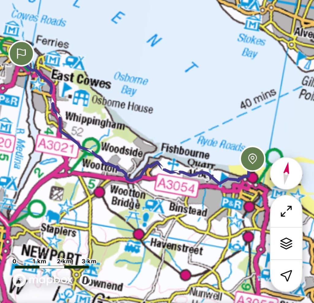
I’ve chosen the Isle of Wight as there is a good transportation system, and is therefore less remote, than my ideal challenge of the South Downs Way. My hesitation is due to walking with all my belongings. Luckily I have a well fitting 40 litre rucksack, so that is my companion for the next few days.
A couple of minutes walk to the bus, then the train to Portsmouth Harbour a swift crossing to Ryde and ready for the first leg.
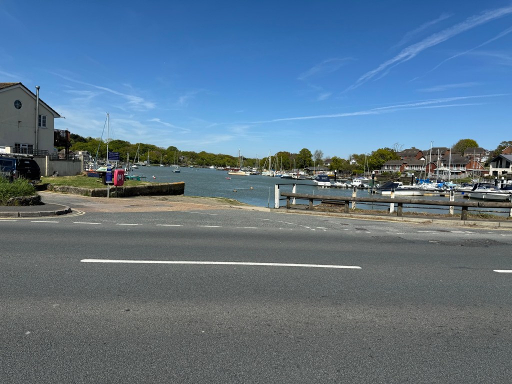
Only 8 miles today, 14 kilometres, as the route plan didn’t account for the very long pier at Ryde. Much of this section is not that close to the sea but much of it was very pleasant. Found an old Cistercian monastery at Quarr and then a modern Benedictine Monastery.
A busy road with a good pavement ultimately lead down into East Cowes and the floating chain bridge over to Cowes and my first night’s stay.
Good to have got the feel of the rucksack and got started. The longest day tomorrow and staying in a holiday home for the night so some careful food planning needed.
Learnt that it is more important to stop and sit for a while with a much heavier sack.
So started with very warm sunshine but also a great sea breeze.
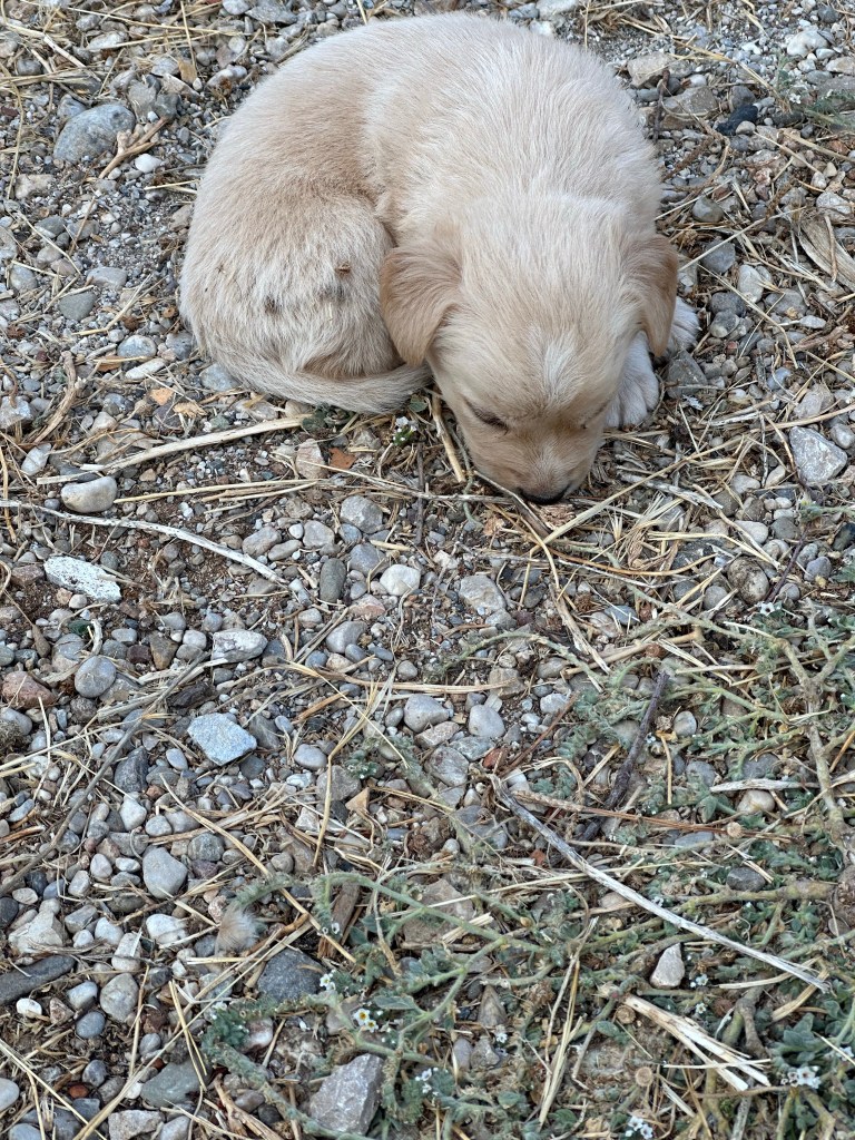
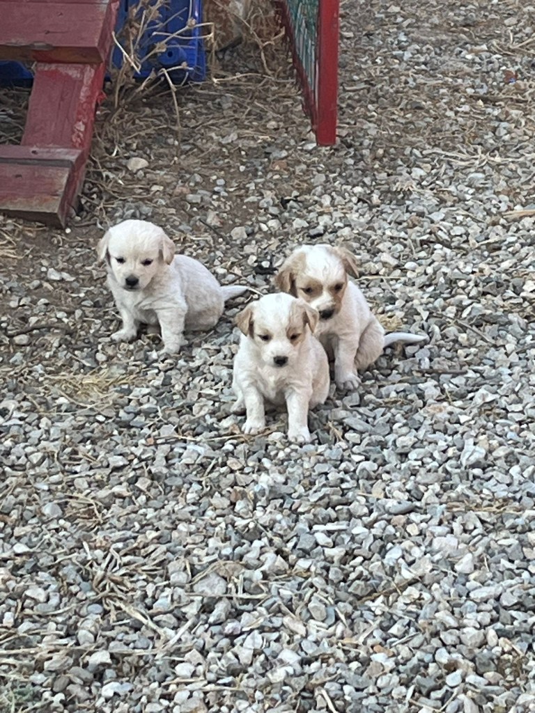
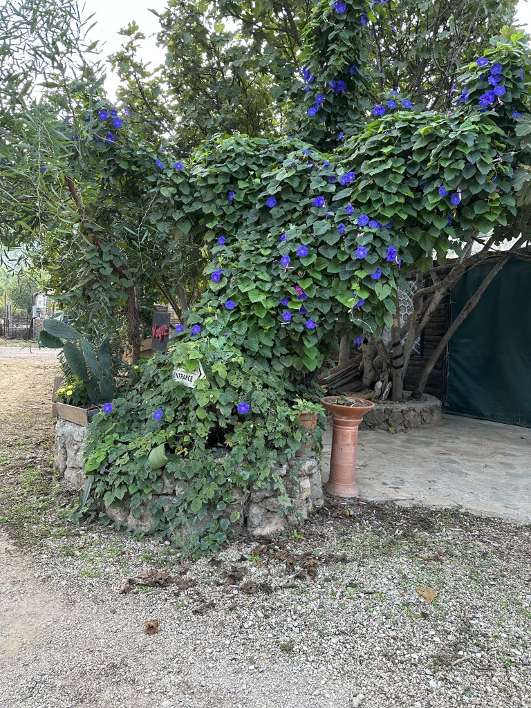
We awake quite early in our shared accommodation, a mix of cows, cockerels and calls to pray don’t necessarily aid sleep! A good breakfast, cooked by our host and some Turkish pasty like provisions for lunch. A last look at our accommodation and of course the puppies before we set off back through the village. Almost over shooting our first turn to the left, there is a discrete hand made ladder stile over a brick wall. We allow a local to go through. The lady has so much grace climbing up and over, even though she is carrying a bundle of wood and has far less substantial shoes than us! We are soon in an arable area crossing fields. Very dry and it is hard to see what could grow in this situation.
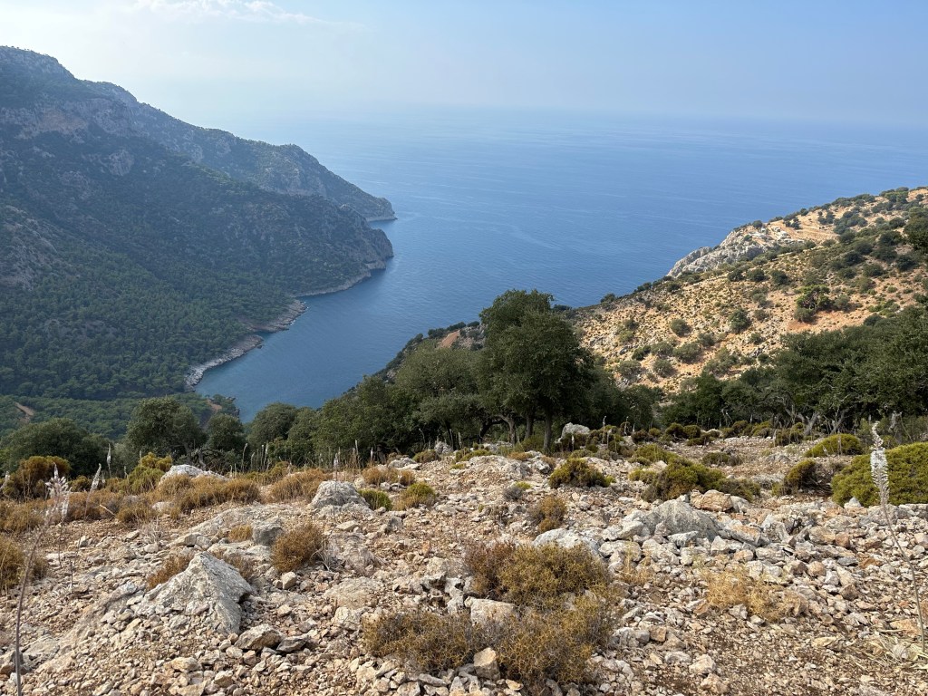
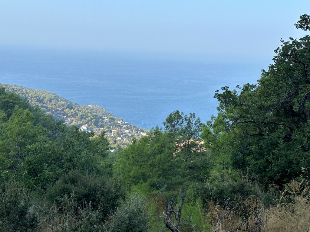
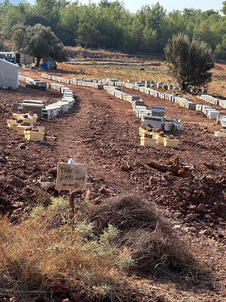
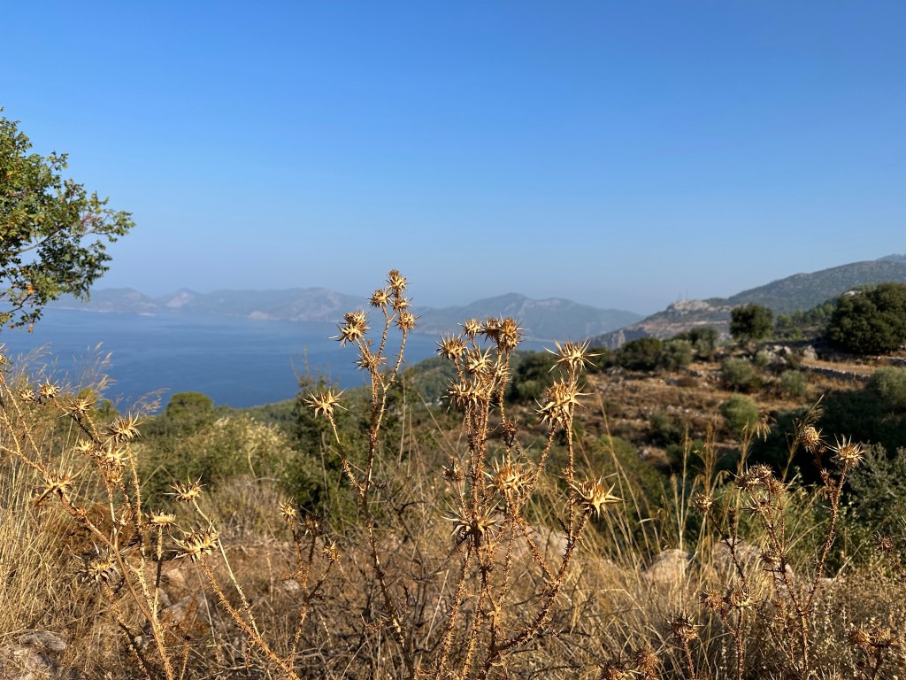
We are crossing a plain which has many man made terraces, although it is quite difficult to discern their purpose. We are still high up and our path keeps reasonably level with some bits of ascent and descent as it winds its way around the mountain. We can glimpse the sea below. One of the most significant aspects are the numerous bee hives and today we also see beekeepers setting out to harvest the honey. Thank you to Paul for his photo montage. We even got to taste some as we went passed somebody operating a makeshift extracted, outside his house.
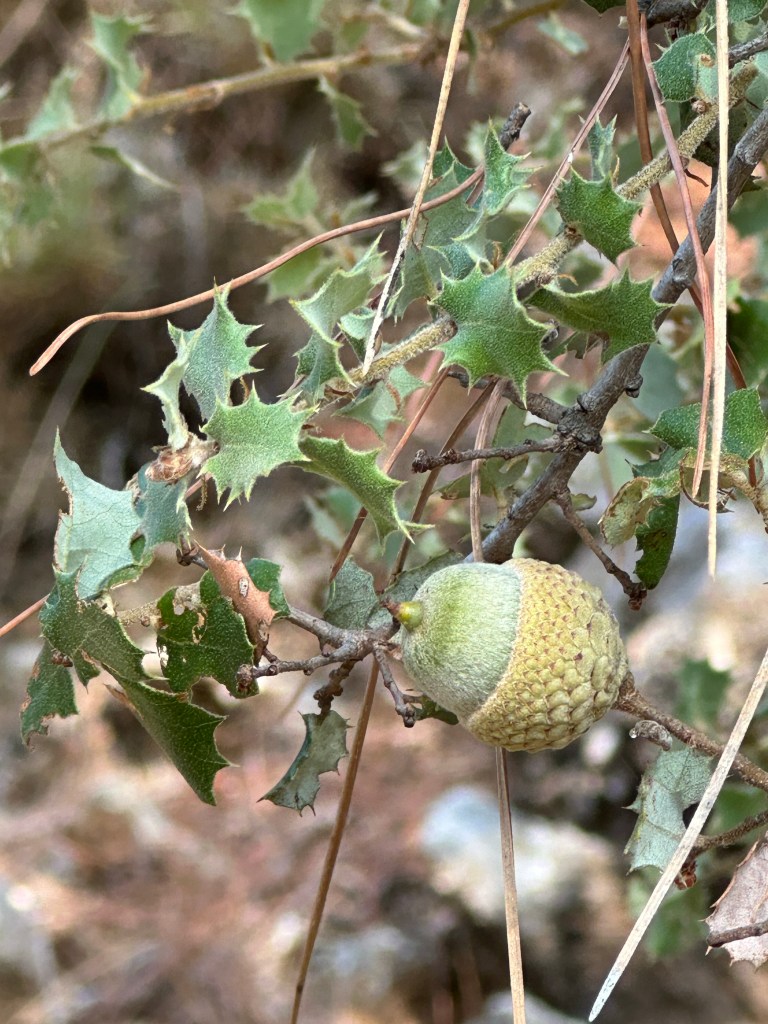
Our walk is varied by the type of rocky dry track and occasional pine forest , not the most exciting bit we make steady progress and there are some interesting plants to observe. We have noticed a low shrub with leaves very much like holly but then a taller version and it has an acorn so clearly a type of oak. It is in fact Kermes Oak , Quercus coccifera – which is part of the Ilex genus – hence the holly connection. A great example of a xerophytic adaption to the climate.
We stop at a road side house with a courtyard where we can eat our lunch and our guide transforms again into a waiter and orders our drinks from the ‘supermarket’ at the side of the house- the tiniest of corner shops. However the cold drink is great.
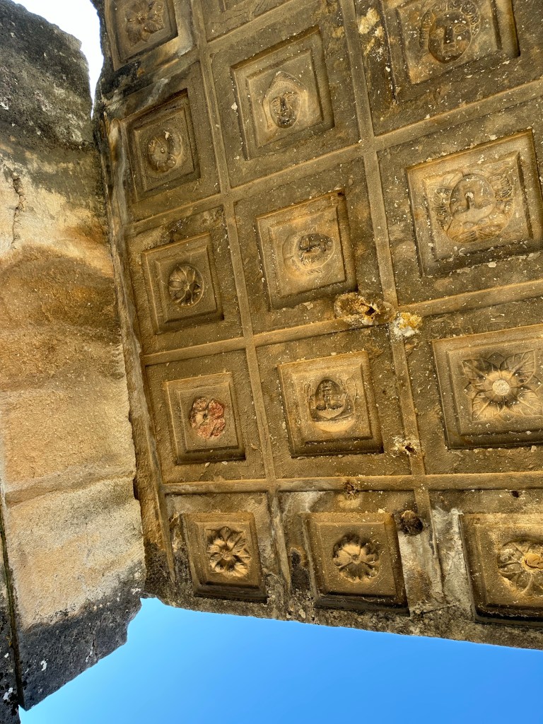
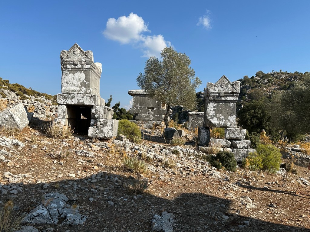
After this stop we are dropping down to Sidyma Ancient City. Once inhabited by Lycians it also has Roman and Byzantine remains.
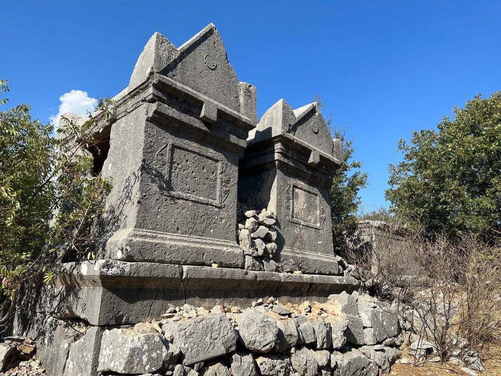
The current village is set in it’s midst and we walk by houses to fields with significant ruins, mostly tombs which have very particular shaped roofs. These small tombs would be for one person but after ten years somebody else could have the space. I’m not sure we ever quite found out what happened to the remains of the original occupation. Some more elaborate tombs were for family groups- they are really large but apparently important people had much larger final dwelling places.
As we entered the village we could see a really deep well which still had a bucket attached and also observed a style of grain grinding mechanism significantly different than we might expect.
The gateway to the city was significantly small which reflects it’s comparative importance. One very interested local inhabitant did come to greet us with a plate of grapes she had just picked. We eat quite a lot but Nebil did feed the rest to a cow tethered in the vicinity !
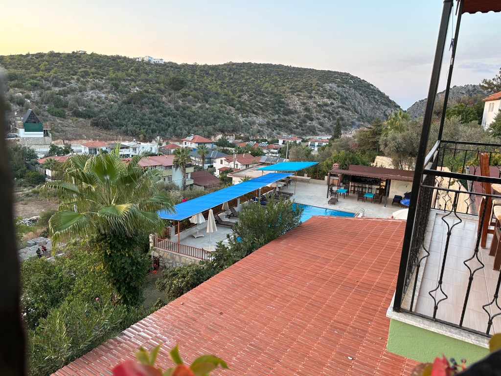
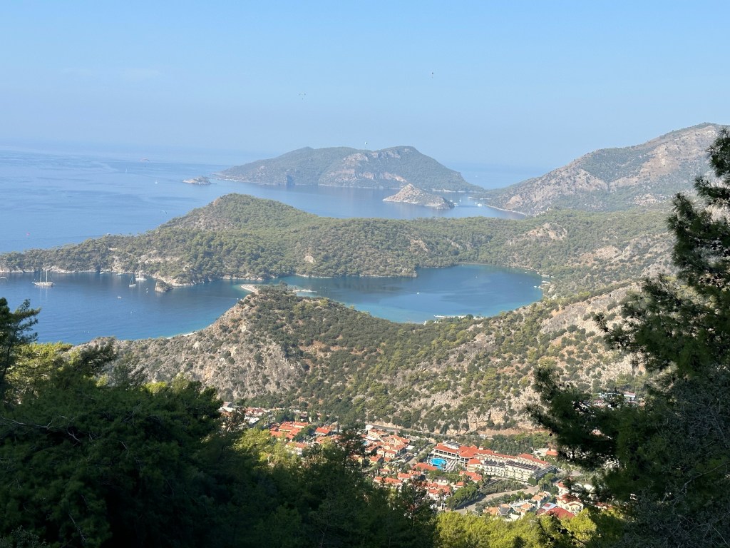
After a very pleasing stroll around several fields we found our way back to the entrance of the modern village and met up with our luggage and a bus before going to the slightly more modern setting of our hotel- as the view from my balcony portrays.
One more thing of note this apparently is where the original St Nicholas was born. The restaurant on the street below our hotel strongly reinforced this theory. As well of course providing excellent food -Calamari and then shrimp stew – excellent!
The cat had been shut in which it didn’t appreciate and spent most of the evening trying to escape from closed windows. Roughly 12 km today, a bit more relaxed now we had done the “long” walk.
We set off at quite a brisk pace and can still see the Mediterranean far below us. It’s quite a wide track to begin with with a downward slope well it warms us up a bit. We come across a strange building which has a ‘museum” window which has links to climbing and Elvis and more. The language of this sign is also interesting.
We come across a very hopeful stall, selling honey and offering juice. Lots of seeds/ grain drying in the sun and an unusual “lounge” area. Too early for a stop for us and there are goats to negotiate.
Today’s walk has a lot of ascent, over 900 metres. We are in a mix of pine forests and more open areas. The ground is remarkably dry and as the temperature is about 27degrees it isn’t going to change.
We see the first of the many beehives we will come across and our footpath has been directed a little away from them. Still some great views as we continue to climb up. Many plants that are well adapted to their environment or have been dried by the heat plus a lot of small wild cyclamen.
Still going upwards but good views out at points. This is good walking but as of yet not too many main features. By my reckoning we are making quite good time and then a bit of a hiccup. Nebil stops us and tells us to cover up as much as possible – sleeves, hoods – he has just come across a couple – she has been stung badly and their rucksacks are covered in hornets , just off the path. They possibly disturbed a nest off the route. We walked hastily passed , feeling bad that there was nothing we could do to help.
Our route took us near remote villages until we came to one where we stopped for our lunch break. We had a packed lunch from the hotel so it was just a matter of buying drinks. This looked as if it was a mini resort although a long way above the sea. Around the next corner we spotted another resort with “African type round hut ‘ accommodation, very strange.
Our path skirts around mountains until we can look back and see our lunch spot perched at the top of the hill some distance away. There really are bee hives everywhere. Some parts are really arid but then we come across an ancient water cistern built possibly by the Ottomans – a rather complex history in this area.
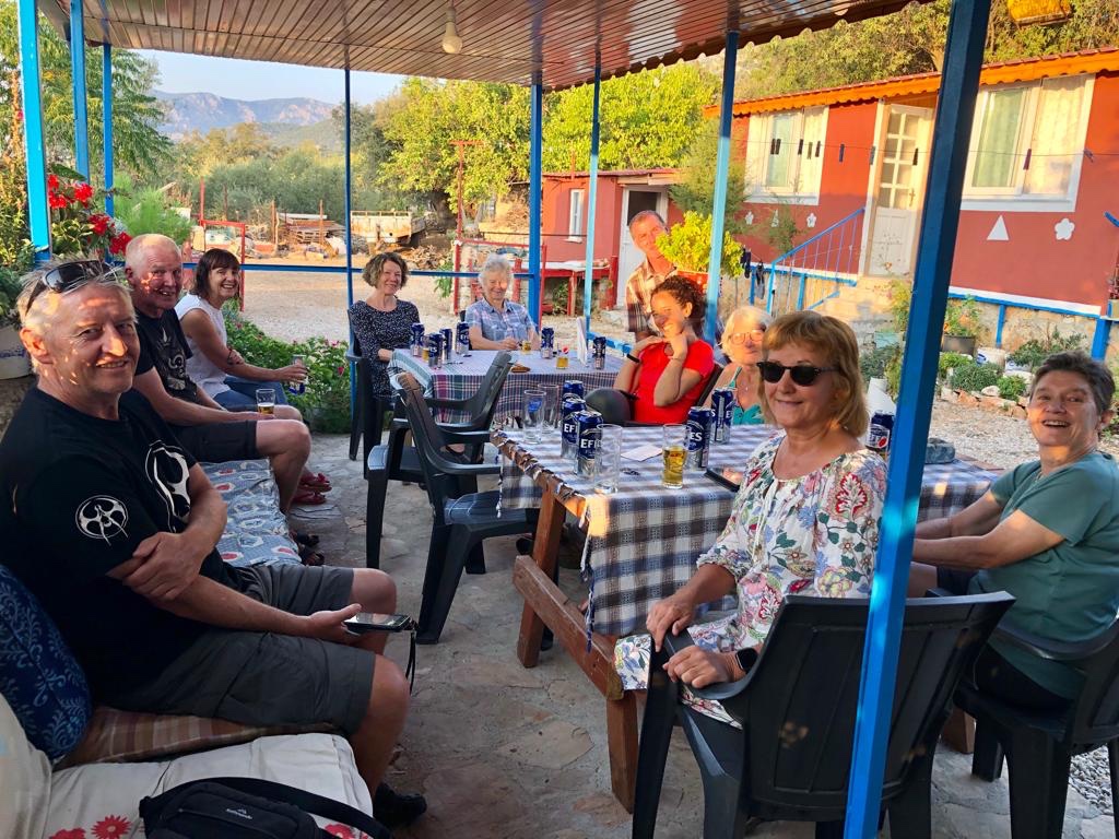
Nebil was concerned we might run out of daylight but we arrived at our village destination earlier than expected and surpassed his expectations. We were staying in a village ‘guest house’ – some cabins for twos and then a four and a three up a steep staircase for seven of the women.
As we were in a small village there was of course the call to prayer but this was also a small farm, with the added attraction of puppies! Showers ended up being very staggered due to two power cuts and rather a lot of beer was drunk before a wonderful homemade meal.
So in the end it was about 19.5 kilometres / quite a challenging day but rewarding.
So today was the first day of the Lycian Way in southern Turkey.
Having been delayed at Gatwick and not arriving at our destination until past 10 pm it was very difficult to have any concept of our location. The day started with a walk around the ‘Ghost city’ at Kayakov – deserted by the Greeks after a treaty in 1923. Our tour started at 07.00 – well I managed to catch them up at 7.05! Quick hours walk and then breakfast. The buildings looked quite desolate, aided by some Earth tremors and desertion.
Noticeable were the chimneys in the corner of many houses and the water cisterns.
After breakfast and meeting up with the rest of the group – there were 16 of us with our one very young guide Nebil, we set of in a bus to a nearby town to exchange money and buy snacks before we were transported to the start of the Lycian Way. Much dispute as to how to pronounce this – any reader can put on their own interpretation.
Our hike starts from Ovacik village and is marked by a large sign. Several people are gathered near this spot, some I guess taking shorter walks than ourselves. Below we are aware of a beach area and the town of Olyndiz and can even hear loud music which is rather at odds with our locality. We head south and are going up onto the foothills of Baba Dagi (1989m), a large massif.
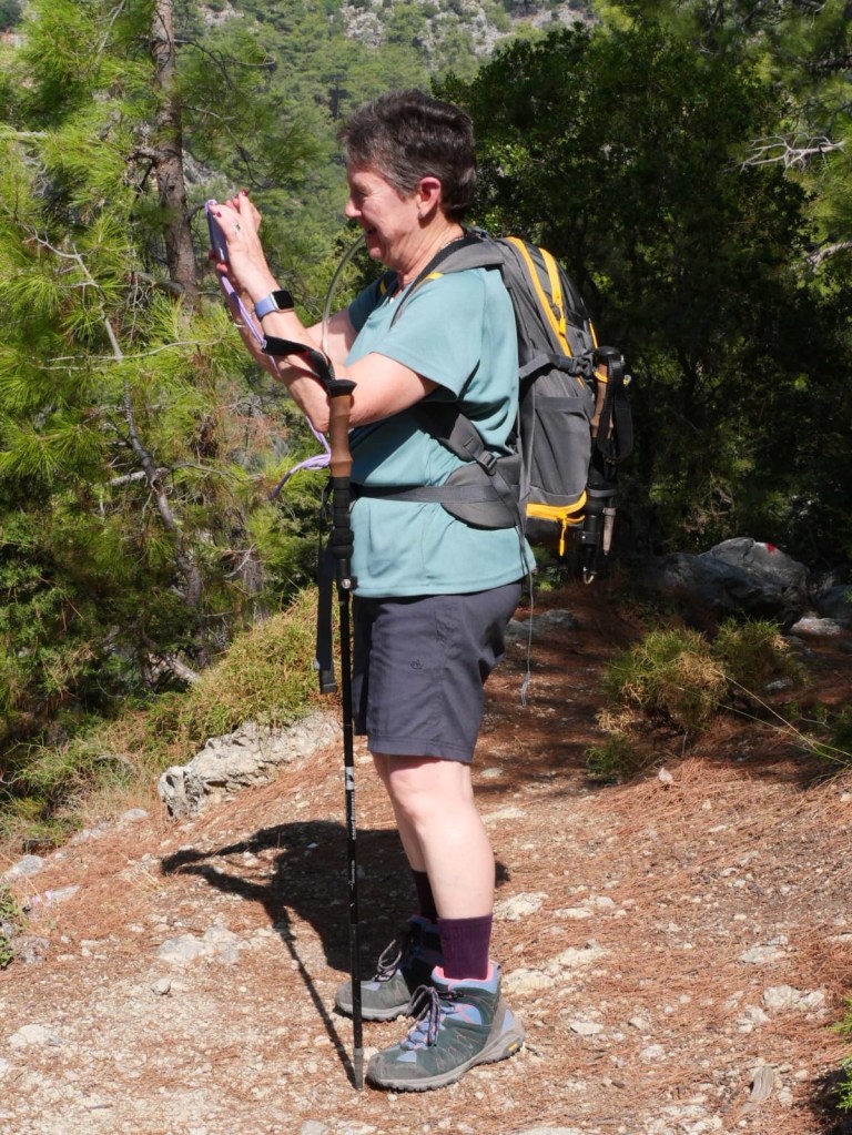
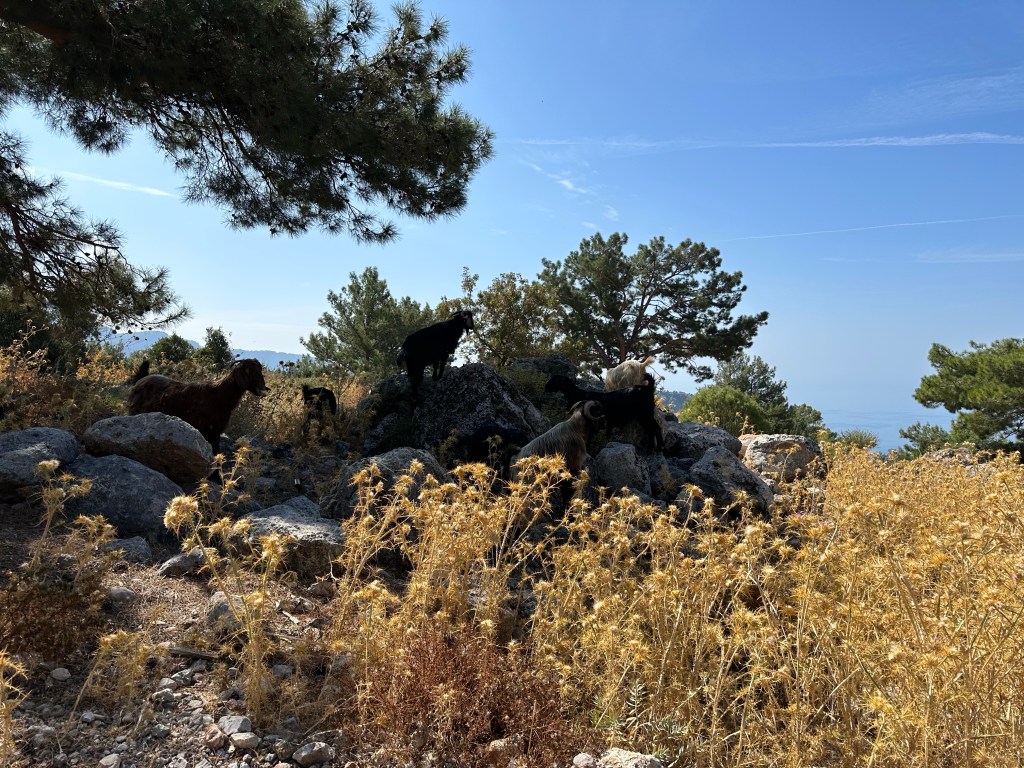
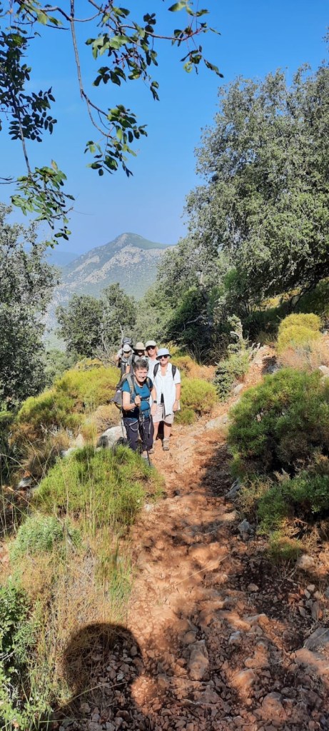
Our tracks vary between stony and pine forest and is mostly up hill for the first part of this walk. Looking around I can see that I’m probably the shortest and oldest and whilst stamina is useful it doesn’t always compensate for speed up hill. Luckily our guide designated a back marker, so I know I’ll never be left behind! The views are very good and taking photos does give breathing space !
There’s always goats! Even well camouflaged ones!
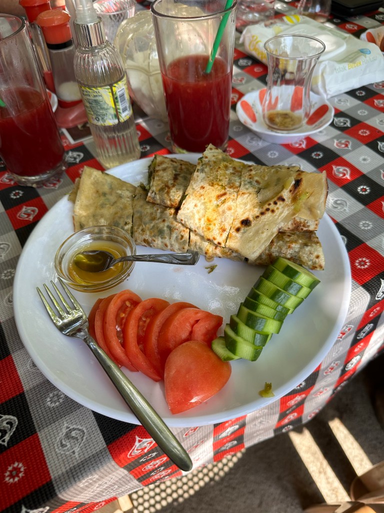
Before too long it was time to stop for lunch- we had been told that it would be Turkish Pancake. We walked into a veranda area off the road which was a cafe/ restaurant as part of a farm. My first experience of fresh orange and pomegranate juice – very good. I did avoid the yoghurt drink ! We also had tea, brewed in large urns with a tap for tea and one for hot water. This was the method everywhere we went .
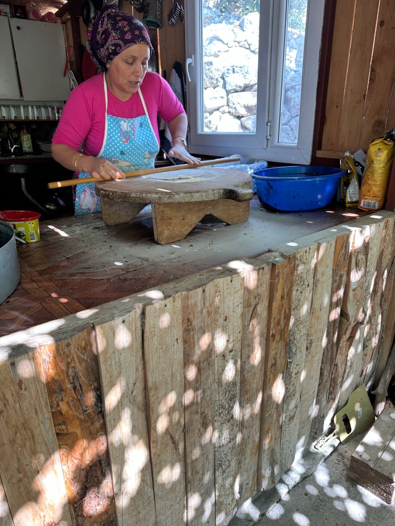
The method of making the ‘pancake ‘ was great to watch. A ball of dough that got bigger and bigger, sprinkled with vegetables and cheese. Then folded before being flash fried and served with wonderful tomatoes and honey. A combination that really worked.
After seeing a box of chicks and calves and being very full we set off along a road, having paid about four ponds each for lunch!
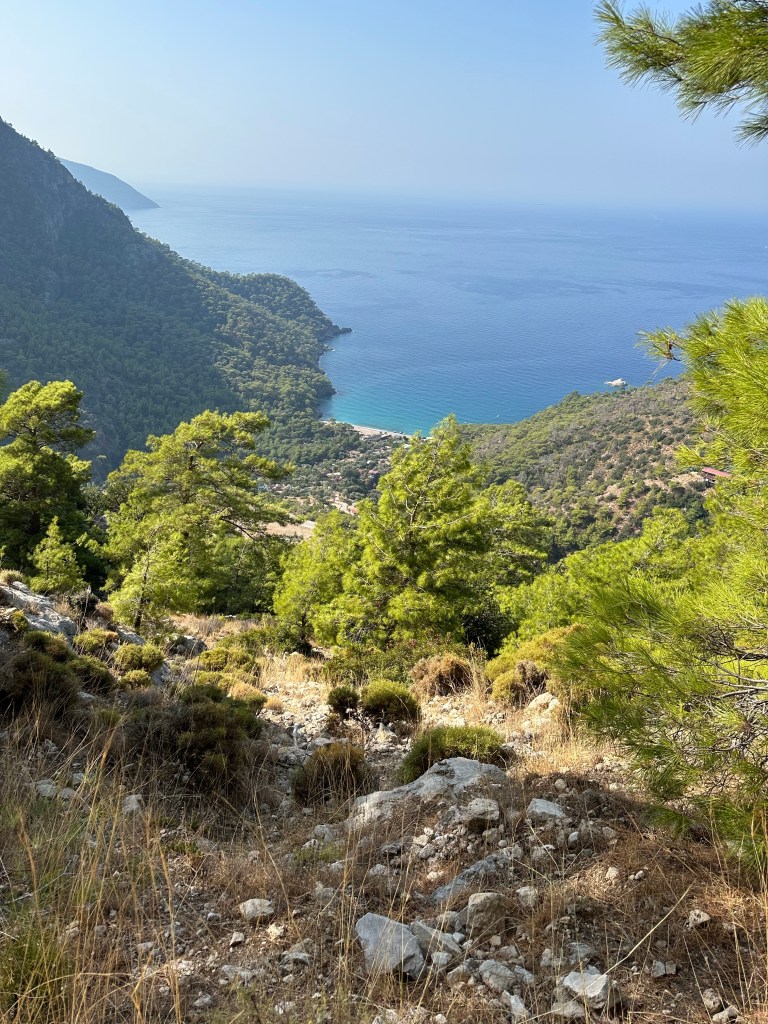
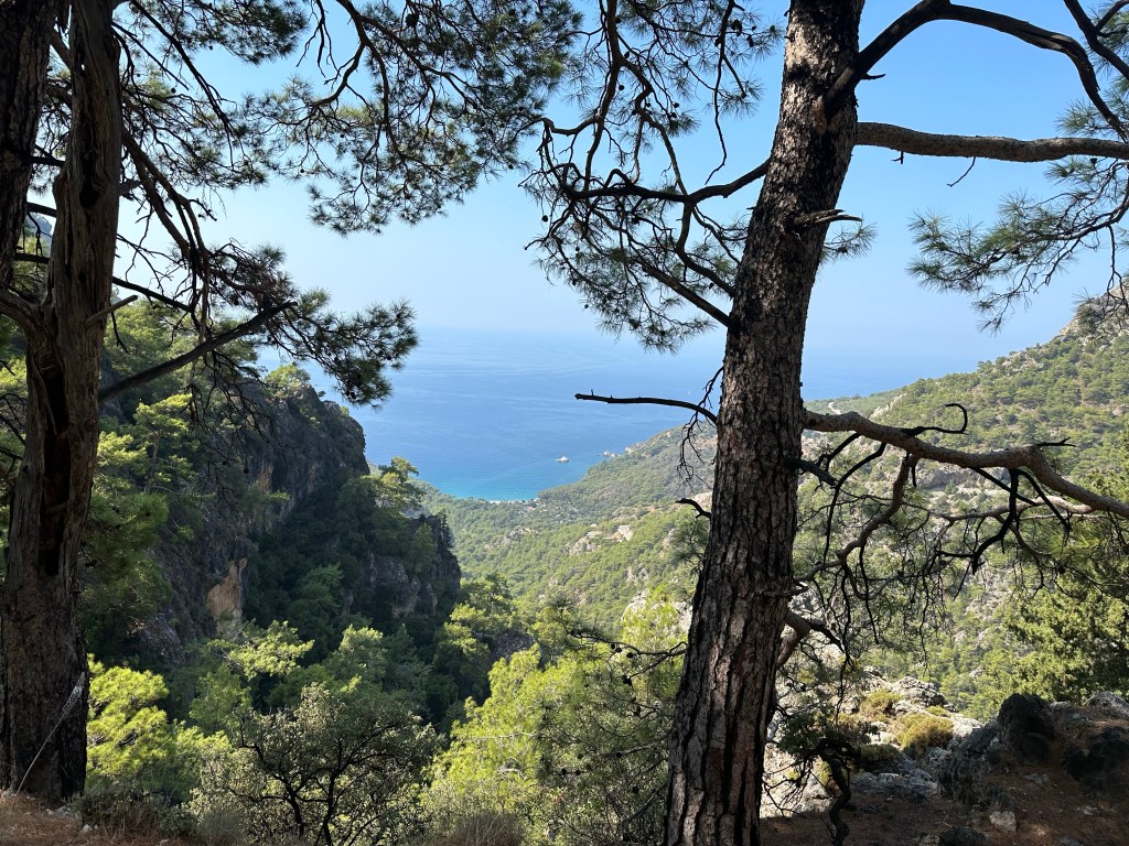
A few more pine forests this afternoon and still some good views before we eventually come down through the village of Faralya to a plateau above ‘Butterfly- valley’ where there is a steep sides inlet from the sea.
Poles were very helpful on much of this walk as the rock was quite loose in places. Our resting spot for the night was the Montenegro Motel – accessible by road. Individual chalets with enormous beds! And a swimming pool.
An excellent meal of fresh whole sea bass which was proceeded by various mezze which nearly all put on the edge of our plate thinking something else was coming and then realised we had to eat before the fish! All good as was the beer and the local wine.
Only down side was Nebil’s talk about the fact that it was further and harder tomorrow and that we needed to walk a little faster. Not a possibility!
About 14.8 kilometres today – doesn’t seem far but combined with the height gain of about 600m and the terrain it was a good stretch!
So more local this time and out for a walk with two of my walking companions. Quite a bond as Anna, Mirella and I did complete the Ridgeway together.
We start in Wantage and our first destination is the edge of East Challow, behind what was once the Goodlake Arms and up passed the primary school and heading towards Childrey. Why is this path always windy?
I negotiate a stop in the village shop in Childrey, good coffee. I usually arrive when it’s shut! We walk passed the village pond- very iconic and head towards Sparsholt. The church is a significant size for a small village – more sheep/ wool wealth, I wonder? A little community building that has the distinct look of a school – big clue round the corner – old school house!
As we head towards Westcot the Ridgeway comes into view. Our next target.
We cross the road and follow a track that takes us up, not too steeply until we reach familiar territory – the Ridgeway.
Really pleased that I chose to go on further before heading up the hill, much better route than if we had just taken the road up from Sparsholt.
We all really enjoy the Ridgeway and the weather is ideal, bit cloudy, bit bright, not too warm not to cold and most importantly no rain.
Having walked passed Crowhole Bottom we decide to find a grassy spot to sit for our lunch. We can all cope without proper seats but it does take longer to get up and down than it used too! It’s strange how some sections seem to take longer to walk. Eventually the stile for our path down comes into view. Last time I was in this field there were cowslips.
Anna has remembered that there might be horses in the next field -luckily these always seem good humoured and on the far side, munching away. After much down and then up we are back on the flat and heading towards Letcombe Bassett.
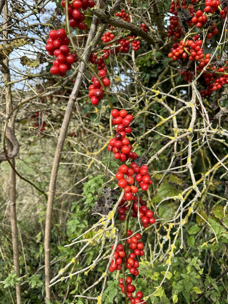
We have all noticed the abundance of rose hips this year but in fact everything seems to be flourishing.
Through the village and a familiar path back to Wantage. Today we walked 19.55 km – almost exactly 12 miles. Good company, good weather and a good route and both the other two managed to quickly catch their buses home.
Well! Anybody who has followed me in the past will know that I haven’t written in a while and there are quite a few missing walks. I have got so far behind it keeps putting me off, I’ve done lots of walking – short local trips and lots worthy of being included in the blog. So the plan is to write the latest walks- especially as I’m about to walk some where more exotic and also fill in with the missing walks. So here goes!!
Found myself down in Sussex for a school reunion weekend. Strange concept in itself when you consider we all left the sixth form 53 years ago! How did that happen?
A mix of getting some outfits ready for a son’s wedding and the very sad illness and subsequent death of my father in law, I hadn’t completed any significant walks for half of August or the whole of September.
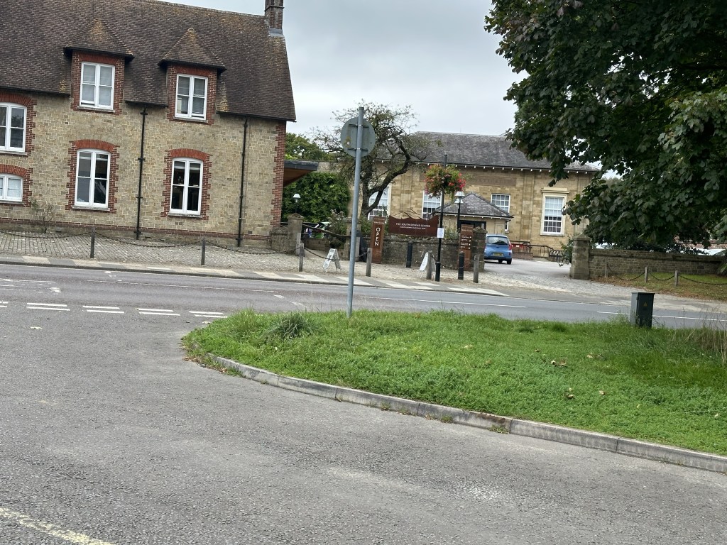
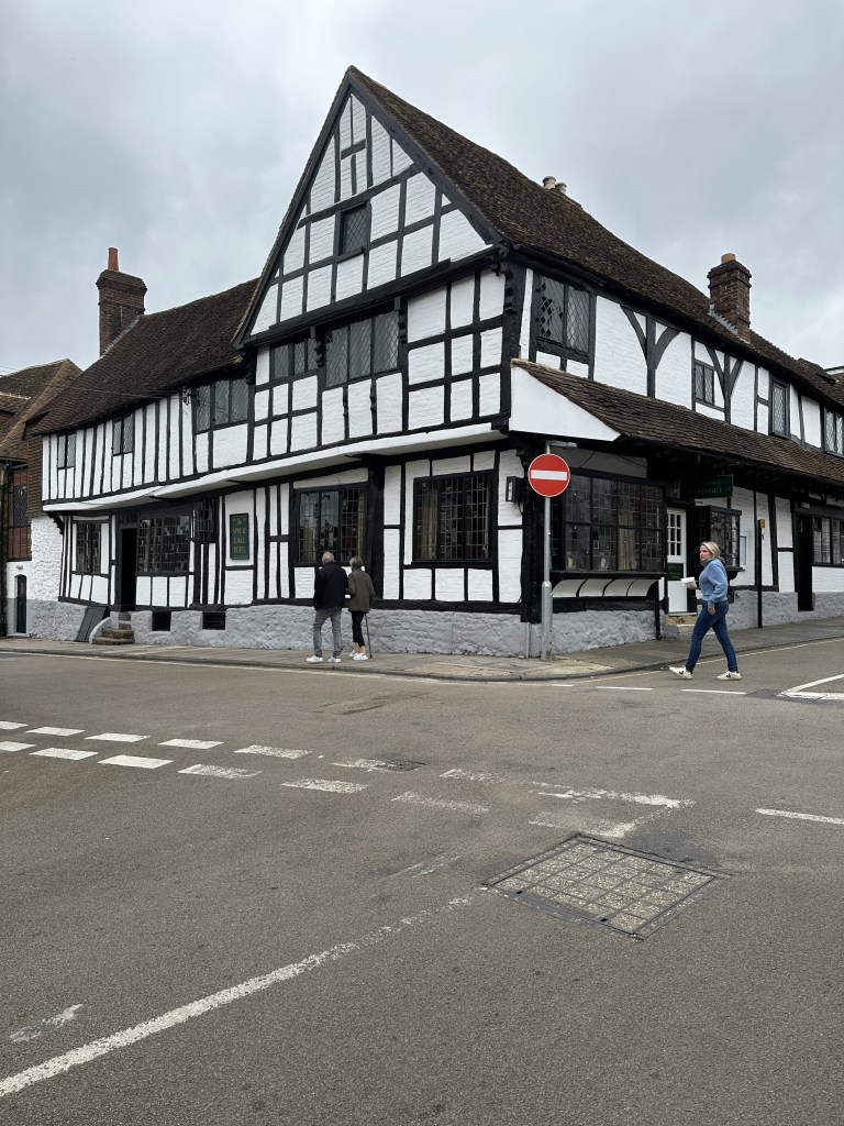
So rather enjoying walking in this part of the country I decided to complete a walk before setting off home. As I was staying in Midhurst, setting off from there made more sense. The River Rotherhithe is a significant feature of this area so I parked in the main North Street Car Park crossed the road by the now South Downs Centre. This was the sight of my school all those years ago. Still a Grammar School when I started, with the unusual addition of a boarding house. The school was founded in 16 something. Going comprehensive in 1965/66 and opening a Girl’s boarding house, it was a small, progressive thinking school with a strong social awareness philosophy.
I cross the entrance to the now Rother College entrance, which once led to the Secondary Modern School. The path diverts away from the road and edges towards the river. A few weirs and complications at this point. Some times close to the river and at other times a little further away, the path followed the undulating curves and edges towards Woolbeeding. The house and gardens come in to view, visited just as I started my walking journey.
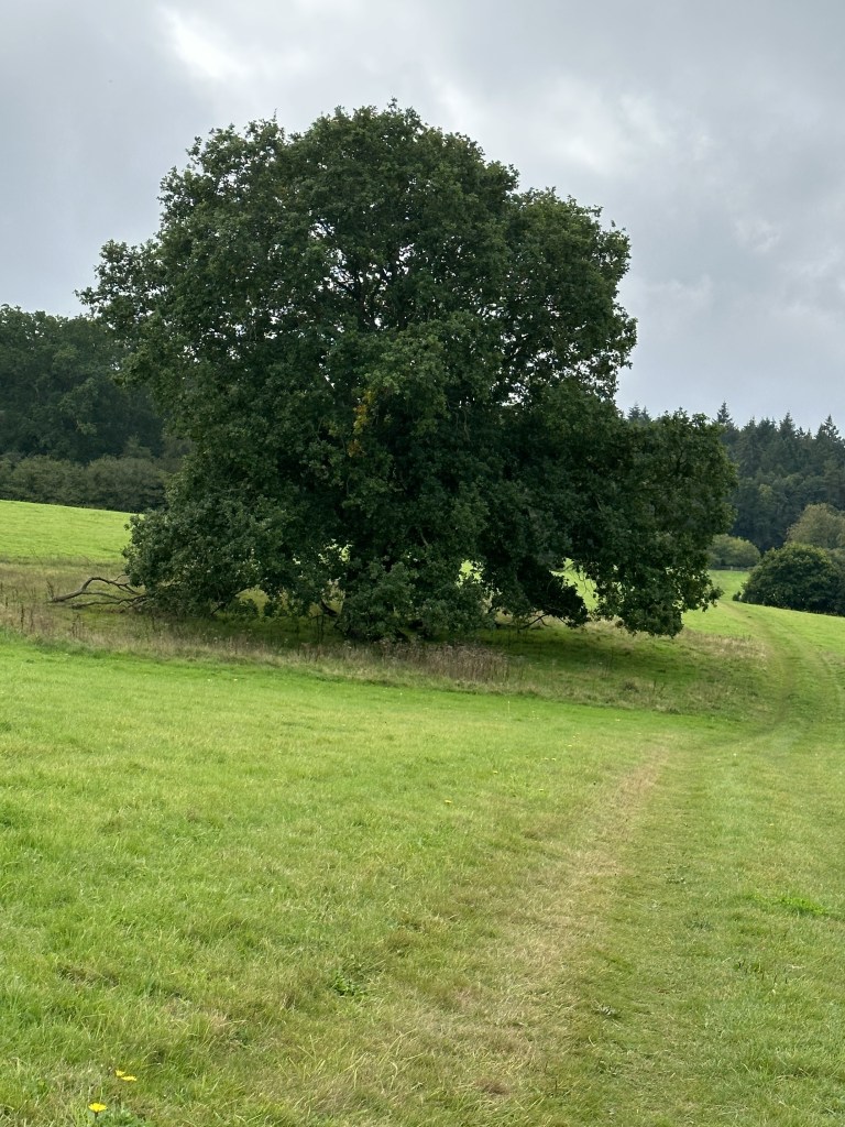
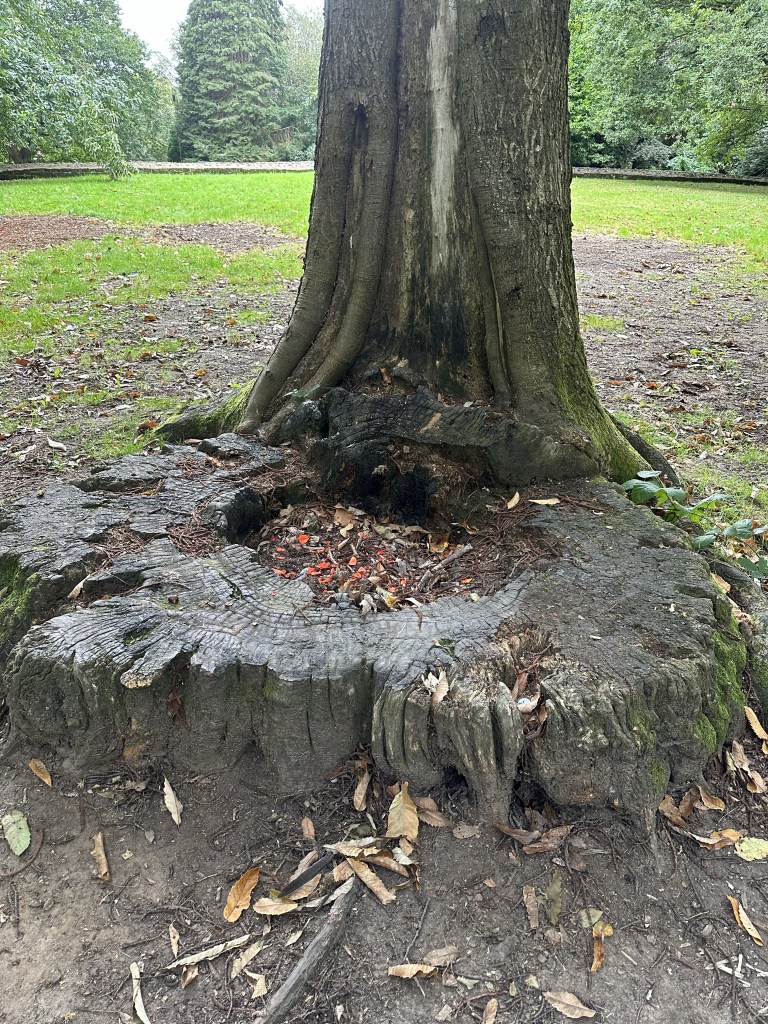
The tranquility of this walk and the bird song is just what I needed after a hectic few days. This wonderful tree was marked as ‘Oaks’ on the map!
Eventually met some other people out walking on this fine morning and then forgot to check the map. Quick bit of doubling back as I didn’t want to walk along the road and continued on the ‘New Liphcis Way’ – had I been on this before or the ‘Sussex Diamond Way’ – this plethora of named paths can be very confusing.
Across a field a I see some ‘Belted Galloway’ cattle at the far edge – slight air of caution having already crossed a field which warned of a bull! They seem a breed ver much in favour, perhaps they are the National Trust go to cattle.
I’ve walked this section of river once before, as beautiful as ever. Stop to watch some kind of brown wagtail playing by the water’s edge. Then on to Stedham Mill and through the village beyond.
When I was a guide with 1st Petworth, I did my last camp as a Patrol Leader before becoming a young leader, somewhere near Stedham. One of the most significant events was a massive storm – I can remember trying to make sure everyone kept away from the poles incase they got struck by lightning. We got up early and climbed up a hill to see the flashes still in the valley. No storms today! Through the village and across some fields to the main road.
Quite a contrast on this side, the soil and vegetation are much more similar to Blackdown. Briefly I’m on the Serpent Trail, I do want to do this section but not today- I’m heading for Midhurst Common. Paths that are on the map and some that aren’t. I will admit to not going exactly where I had planned but did weave my way across this section to come out on Carron Lane. Strangely familiar as I had just stayed in this area for two nights on a small estate across from the park and cemetery.
As I emerged onto the Petersfield Road I turned towards town and then through by the Spread Eagle Hotel – I have stayed once – I must have been rich that year!!
I’m heading for the path to St. Anne’s Hill. This is the site of castle ruins but more importantly I was looking for a significant tree. Due to other commitments I had missed the visit to this area with my school group. At each reunion the gathered group lay stones, shells etc and we collectively remember fellow pupils or significant staff who are no longer with us. I went to reflect about my botany teacher that made a profound difference to my learning and on going interest in plants.
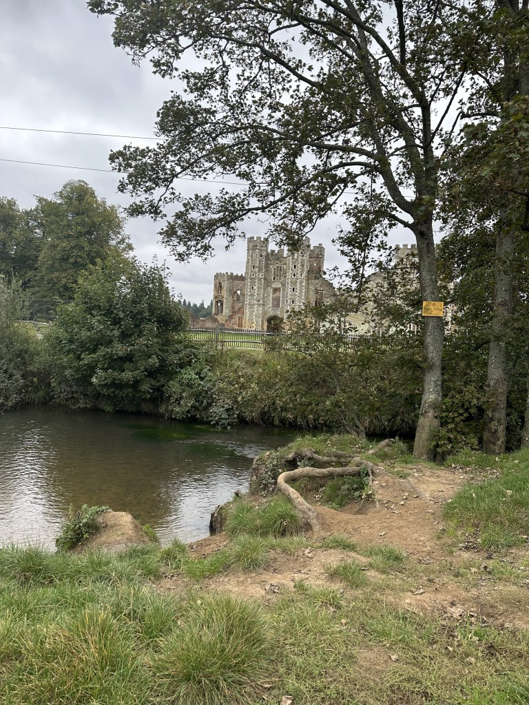
From here it was a steep down hill to Cowdray Ruins – another significant venue. Our games fields were behind the ruins so there were several cold treks to and from Hockey and some more hospitable journeys for athletics. Probably worth the walk to avoid Netball which I found too frustrating. At least with hockey you could run and didn’t have to keep stopping at lines!
The causeway led back to the edge of my car park. Not a hugely long walk, only 11.5 km but much enjoyed and needed.
So a local walk today by myself, some of which was familiar territory but with a couple of new twists. The ground is surprisingly dry for February with actual cracks which is very worrying for this time of year.
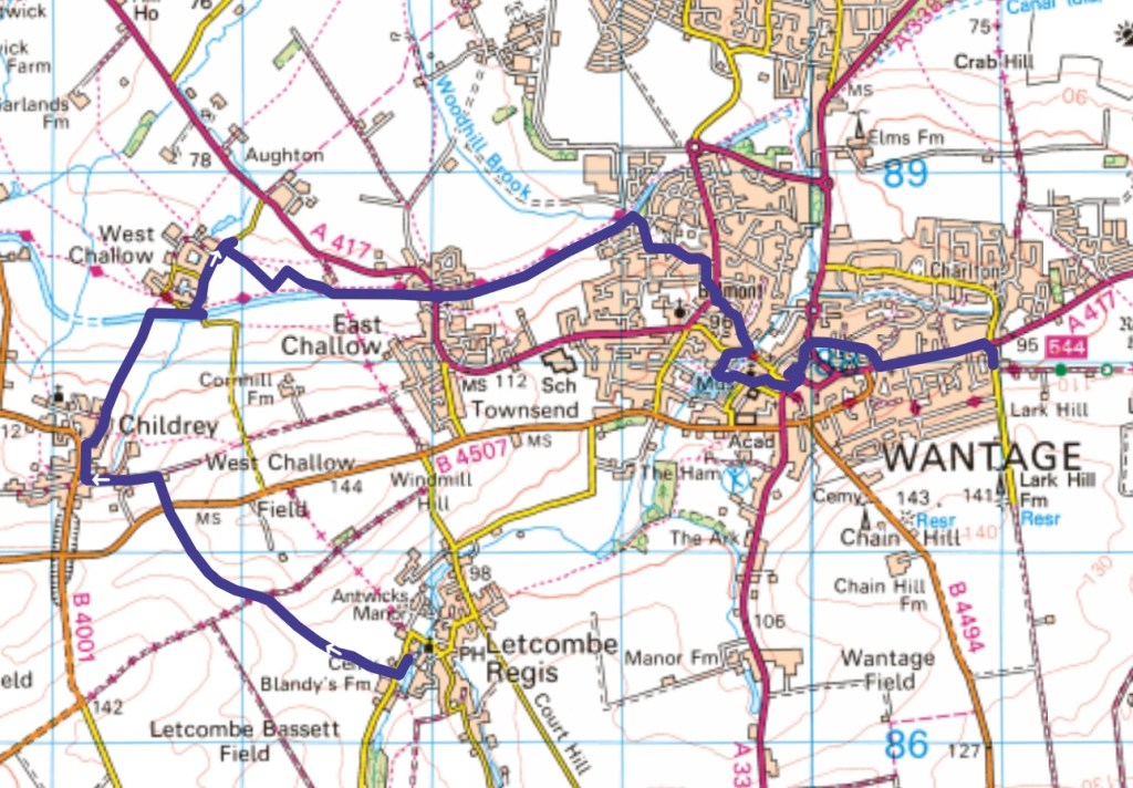
A slightly incomplete map of my route as I failed to record the first 4.09 km – probably because I knew the route!
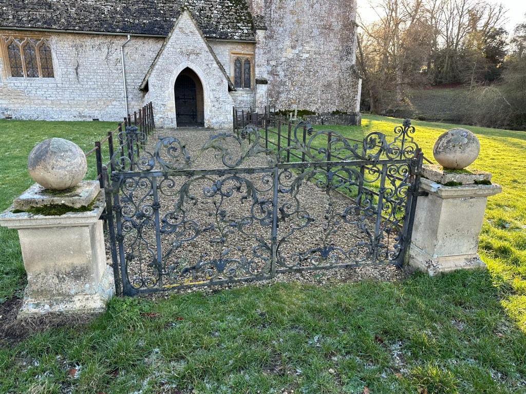
Having taken the familiar route across to Letcombe Regis I then went passed the church, a lot of care has been taken to always ensure that there are wild flowers growing in the churchyard.
Next out onto the road to Letcombe Bassett and a small path up to my right , by the cemetery. This was new to me and I was rather surprised to find I was walking next to a Deer Farm, with venison for sale. Not sure how I had not realised this was here.
Having passed the farm and crossed the Green Road track, the path, still one I hadn’t been on before , curved round the bottom of a distinct small hill. This then came to the road from Wantage towards the White Horse. Crossing this and passing between hedges I soon came to the familiar path from East Challow.
I always seem to time it wrong to get a cup of tea from the village shop in Childrey – one day! Now a familiar bit of route over to West Challow.
So trying to find a different route I started walking through the village to find the footpath that went across a large field and should have taken me to the old Berks and Wilts Canal. Well having walked up and down a stretch of road a few times and no sign of an actual path I decided that as I could pinpoint where it should leave the road I would go into the field anyway. Slightly rough ground and very uninspiring. Luckily I did find my way across to the exit onto the canal path, so that I could continue towards East Challow.
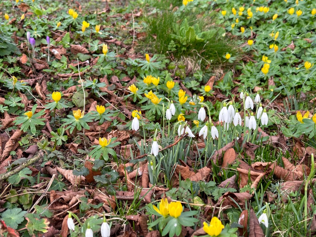
A patch of snow drops was a consolation before I crossed the main road and continued next to the canal and back up into Wantage and home.
About 14.5 km today and although not a very extraordinary walk, good to have found a different local route.
Today there were four of us walking, Betty, Anna, Mirella and myself. I even got picked up from home and we then met the other two in the Waitrose Car Park- courtesy of their toilet facilities! Then up to the NT car Park at White Horse Hill. We walked first toward Wayland’s Smithy, reminiscing about our trip the previous January, in the opposite direction. I never tire of visiting this mystical place.
Having had a quick wonder we’re off again; for a short while we followed the Ridgeway, very soon there is a major junction and we turn off to the left, passed Odstone Barn. As we turn again I look back into the trees which bound this point , an impressive copse that is used for forest school type activities.
We walk on and cross and our path is almost through an avenue of trees, boundaries to our left indicate that we are approaching a significant estate. We turn again keeping woods on our left and pass Alfred’s Castle – a hill fort. We explore a little and I am able to pint out Ashdown House to the others. A doll’s house like building designed at the time of the plague for an aristocrat and his friends and as a base for hunting. https://www.nationaltrust.org.uk/visit/oxfordshire-buckinghamshire-berkshire/ashdown/the-winter-queen-and-the-history-of-ashdown-house
Our path turns near the end of the estate gardens and then heads off for Upper Lambourn. This is a hidden village not really seen from the road to Lambourn. Very quaint and horsey! This sign rather backs up this comment.
At this point we take a steep turn to the left and climb up what seems like a never ending hill. Our track takes us around the edge of gallops, this is a very serious affair in this part of the downs and is the locality for some serious horse trainers.Whilst there are well defined paths some new structures such as warming up circles seem to divert our direction. Back on track, just the wrong side of one gallop! We head along a straight path and pass several small tumuli up towards White Horse Hill. We cross the Ridgeway and then we climb onto the Hill Fort and over to the chalk horse. From here. It is a route across fields back to the car Park.
So I am really very far behind with writing my blogs- consequences of walking everyday, working hard on a European Art based project and probably a bit of time wasting on my behalf- is retirement suppose to feel this pressured?!
Also I seemed to have taken far less photos in the last few months not sure why. My plan is to try to quickly write up this back log to get on to some more exciting stuff- we’ll that’s the plan.
So walk 40 was quite an interesting route, three of us again but starting this time in Abingdon – Anna, Betty and myself. Neither of the other two drive so to be fair we started this walk from Betty’s house.
A bit of nostalgia for me as this was close to my first teaching job and the roads where many of the children lived and where I first taught cycling proficiency. I suppose after 45 years in the profession lots of places or events will remind me of something.
Firstly through the Dunmore Estate and then along a section of the ring road before heading over fields to cross the A34. A lot of new building happening in and around this area. We were now heading for Sunningwell across some fields – quite a long stretched out village with some pretty houses. We cross a small Brook before passing through a narrow passage to meet the Main Street. Down another path and past the school. Yet another place from my past – as a Deputy Head teacher but new to Year 2 , I landed myself the task of ensuring that these assessments were being carried out appropriately in lots of the local, mostly small schools! I always enjoyed visiting other schools, at home and abroad.
From here the path cuts through farmland and down a significant driveway to cross a not too busy road and head towards old Wotton Village. That is in contrast to the now main part of the village which has a large pub and shops. After passing the tiny but old church it was time for more fields, this time with horses – I realised I’d walked this section before! A different track at a T junction and we are on the ‘Oxford Greenbelt Way’ – not for long as we branched off across more fields and up an incline to a wood. Lunch was calling and someone had placed some convenient logs just where we needed them!
We were now in Youlbury Wood and walking on a path that passes the International Scout Camp site and then a Carmelite Priory. We decide to come off of the road and walk through an Oxford Preservation Society area before climbing up to Jarn Mound – built as a viewing point for Oxford but with nobody accounting for the fact that trees grow.! Some of the housing on Boars Hill is ridiculously large and expensive! Across the top of the field with wonderful views across to Oxford and it’s spires and to the main road . We walk down this a short way and divert down to Foxcombe Hill.
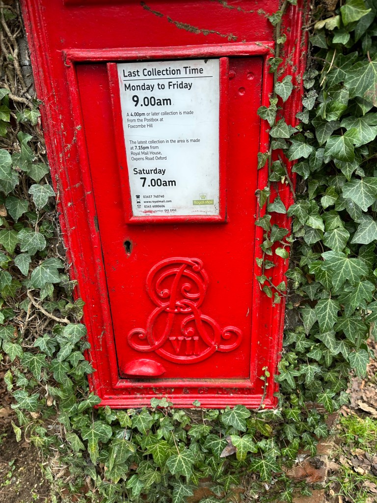
At last I take some photos – a gate – bizarrely I have somehow followed the ‘Gate appreciation’ group on Facebook – but I didn’t post this! The second a postbox – not many George VII around – strange how he had a fancy cypher but George VI was very plain.
I’m really pleased when we have two options and the other two choose to take a steep narrow path downhill between two hedges. Our bonus as we approach Sunningwell was an unexpected Deer farm , advertising venison!
From the village we take a track as we head back to crossing the A34 – better option than the soggy field on the outward journey. instead of returning the way we had come we divert away toward Lodge Hill and Radley park – again evidence of more potential building – such a pity as the shrubby land which will be used must house a multitude of wildlife species. Bit of a silly extra but we were all enjoying being out and about. As we headed down Northcourt Road Anna decided it made sense to catch the bus there and Betty and I cut through South Avenue and past the back of Dunmore School and a side entrance , not sure if this used to exist and back to the house and my car.
So only three of us today but with doing so much walking by myself it’s great to have company. Gives even familiar routes a different dimension.
Writing up this route, it’s not exactly new but I do try to put together different combinations and the other aspect of not writing up every walk is that you do forget where you have been when you are out each day!
To start the day Betty and Anna caught buses to Wantage and I had the easier task of just walking into town. We were starting with a path I’d often used before and one that Anna had been on when I’d led a previous walk.
We set off for Letcombe Regis and managed not to fall in the slightly swollen pond area where the Brook overspills – probably more hazardous at night!
Having emerged into the village we continued round passed the Greyhound Pub – which I recommended – like to put in useful snippets of information if I lead a walk! We pass the church on our right, taking a left turn up the raised path , looking towards the downs. Always a little nervous on this section with groups of pupils, one of those internal risk assessments- quite a drop, over a metre in places.
The road bends round and then round again, heading for Segsbury Camp, an Iron Age Hill Fort but we turn right along a track – quite muddy but the day is warming up quickly. A change of top layer is needed before heading up towards the Ridgeway which is our next goal.
The track heads straight up alongside a hedge and we are able to pick our way reasonably well, this is a different way than the one I had led last time, although the two routes would converge. The last time I had been in this section a week or so before I had been travelling in the opposite direction in steady rain – so anything was better today!
Quite straight forward alongside the field and then to a stile with three steps on the far side as the ground drops away! The sun often shines in this field – not too bad today. So down and up and across to a small copse. There always seems to be an abundance of wild clematis – ‘old man’s beard’. We emerge on to a field which goes down steeply and then immediately back up.
There are a couple of horses sharing this space but they are calm and content. Anna shoots up the hill, not so much showing her hill climbing prowess but horse avoidance! Another smaller field, still on an upward incline and then the safety of a flatter field with distant sheep. Across this and we meet the Ridgeway. Time for a snack stop!
A very chalky section of this ancient long distance path and now the third time Anna and I have walked this stretch together. Not expecting the next incident though!
Just walking along chatting, noticed that a bit of hedge trimming had happened and then felt a sharp prick on the bottom of my foot. Thought perhaps I trodden on a sharp stone and tried to scuff it off- no luck so had to ask the others to stop. I became aware there was something attached to the bottom of my boot.
Betty held on to me whilst Anna tugged the stick away from my boot, with some effort. A blackthorn thorn had vertically spiked my boot, through the sole and just through to my foot. Well, that was a new and not too pleasant an experience. Made me rather wary of sticks and debris on the ground, for the rest of the day.
Not much to say about the next stretch, having crossed the main road to Hungerford. Just passed the farm buildings the house that we have seen over the past year in various stages of development, appears to be finished! Good views!
Onwards past the entrance to Latin Down and then to cross the road to Newbury- the monument which we have viewed from afar is now within our sites. Our agreed lunch spot.
Grateful for my sit mat on the cold concrete seat round the base of this memorial to Lord Wantage. The Ridgeway path beyond looks splendid in the sunshine and tempts us. Amazing how quickly you cool down this time of year when you stop, so it’s good to get going again.
We have alternatives but the way I advise we go down today will takes us to Betterton and much of the track down is solid if not rather stony. My favourite route a little further along would have been rather muddy.
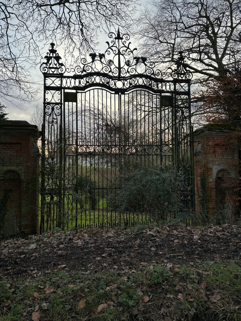
Good in a way to stride out and not to worry about mud. Our track takes us past a row of cottages which along with a farm and a large house is Betterton! There are glimpses into the house and a now unused gateway – photo taken about 9 days late on another walk.
This road takes us to the gates of Lockinge Church, a quick discussion as to whether we want the short or longer way back to Wantage! The longer won so we are on one of my very familiar routes around the back of the church. I do stop on this occasion to photograph the back gates.
I obviously looked at a ‘Gate appreciation’ post on Facebook and possibly liked something as it now pops up regularly. Perhaps I’ll post one day!
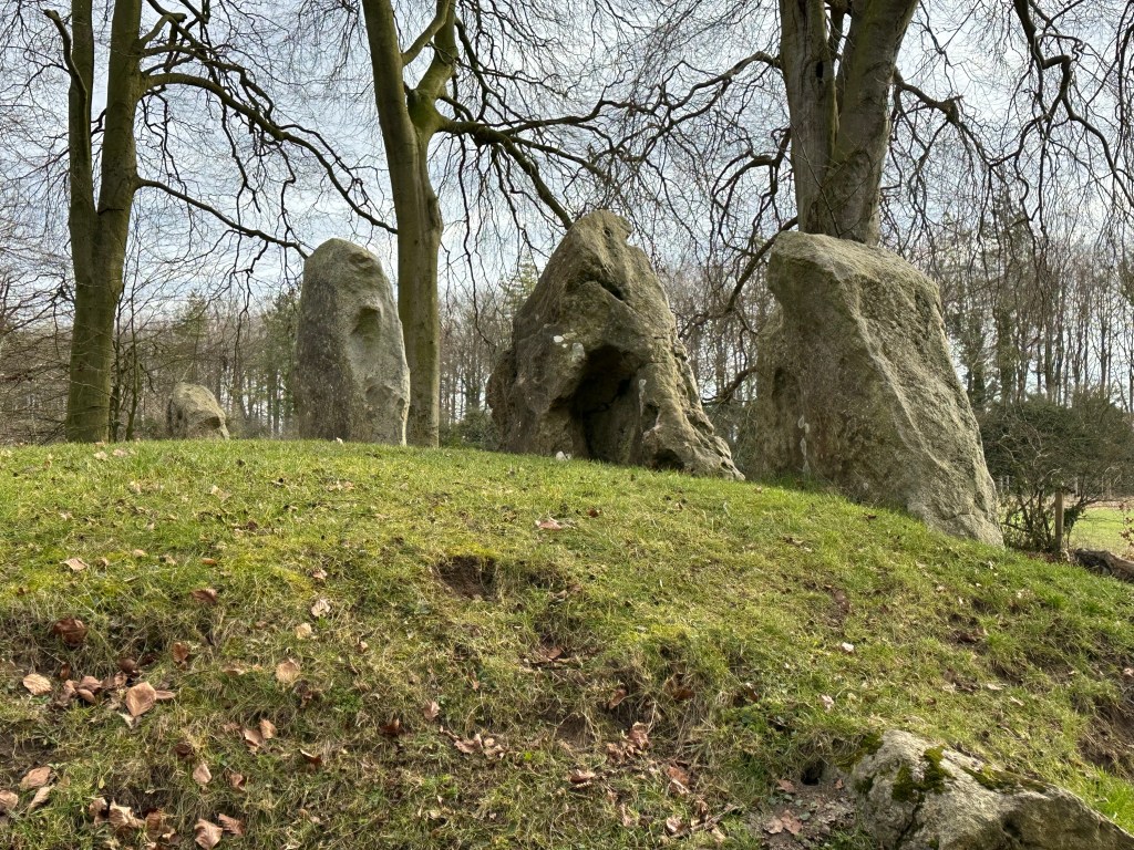
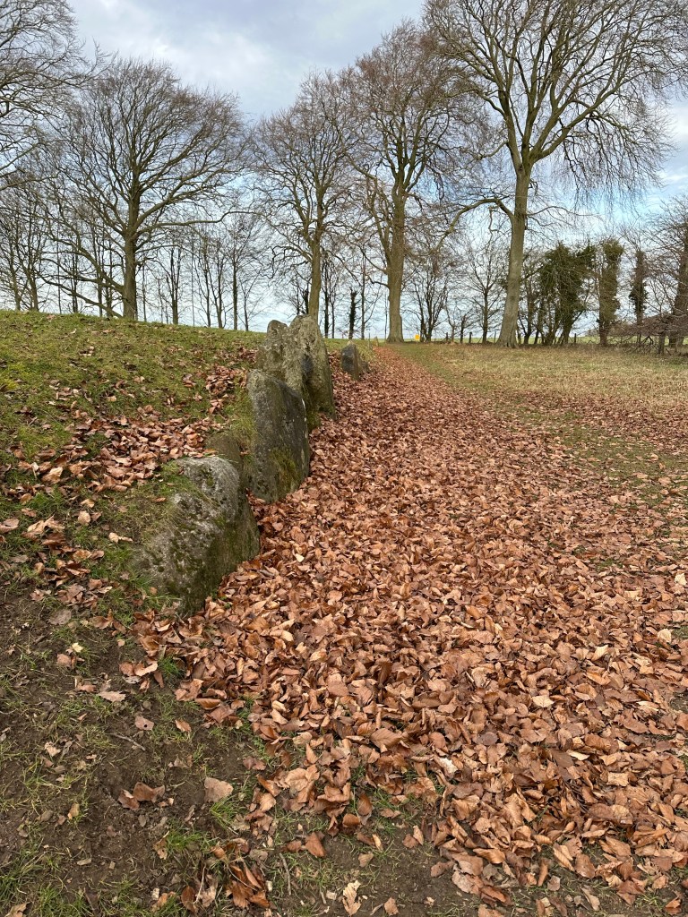
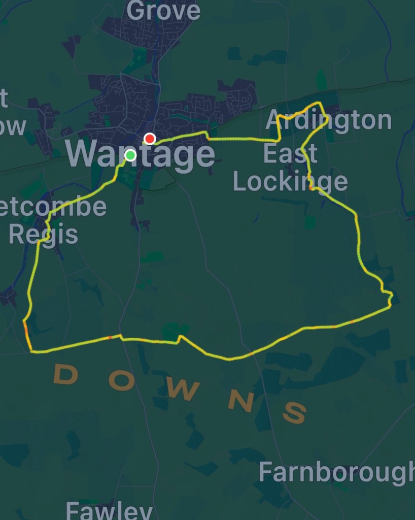
So through to Ardington and then up to the stones, our boots had been a little cleaner – but not now! Good to see as always. And then back down and heading back to Wantage. A quick stop at my house to change shoes and collect a parcel that needed posting before walking with the other two back into town so that they could catch their buses home.
Our route was 21.5 kilometres/ nearly 13.5 miles – great to be out in sunshine.