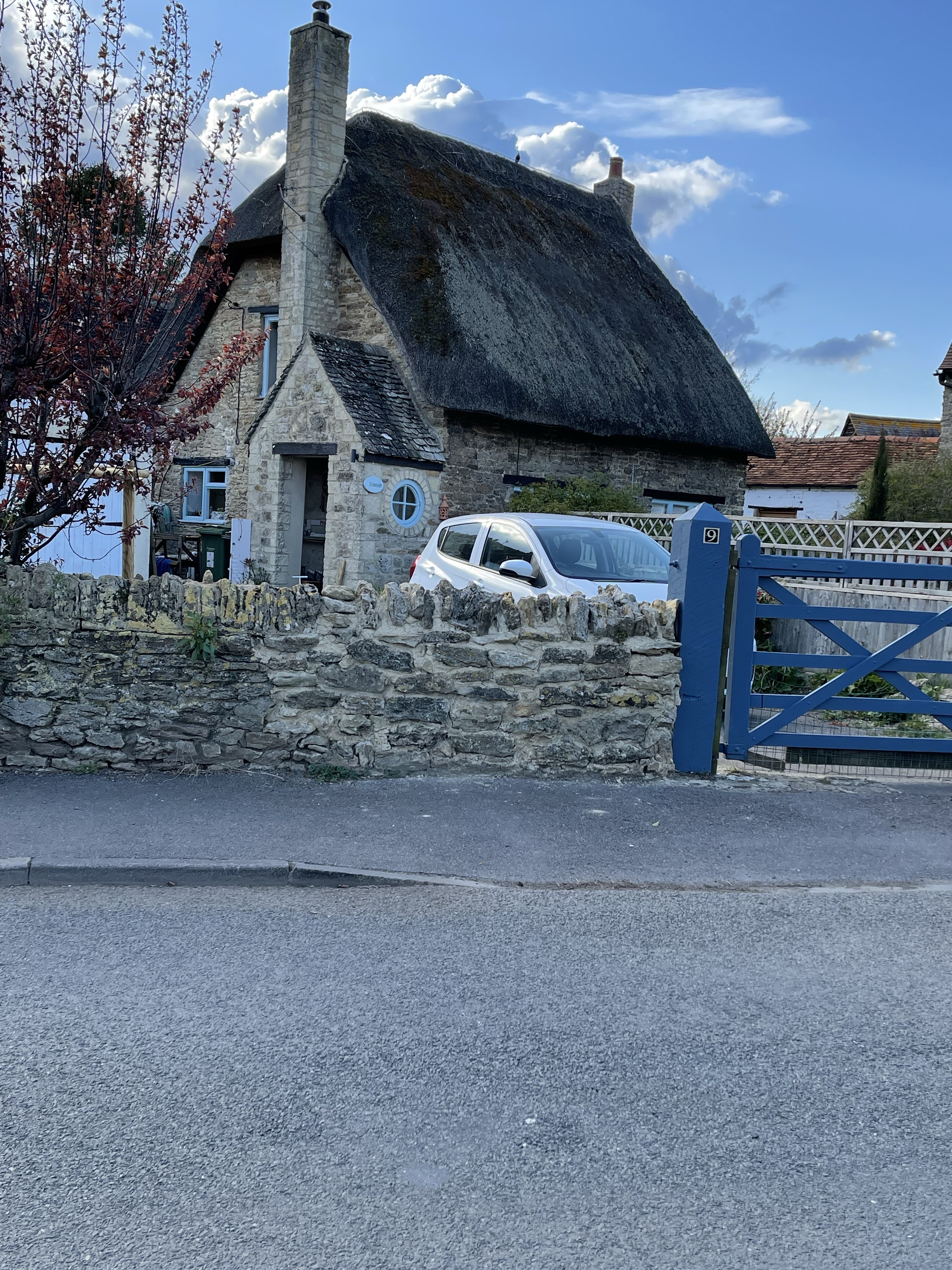
Slightly different walk, on theses two days. The same walk, local to home, done twice but for a double purpose.
First reason was that my boots purchased last August, which had served me well on my long distance paths and throughout the winter had developed a problem with some of the stitching. It had actually broken and consequently they were not as waterproof as they should be and the problem would have become worse. Luckily Mountain Warehouse were happy to exchange, even though I had to wait five or six days for delivery. My next dilemma then was could I wear them to do a mountain walk on the Friday of this particular week. My solution was to do a walk from the house and see how they felt, I decided I needed to do it at least twice, which I successfully did.
A quick 5..59 km which measured 5.65 the second time! My second challenge was to try and walk at a faster speed. In June I have a major walking challenge and so I’m trying to improve my capability to walk a bit faster not only on the flat but also up hill. I tried to spot some interesting things on this quick walk but didn’t want to hesitate too much for photos – but there is always something new or different to observe.
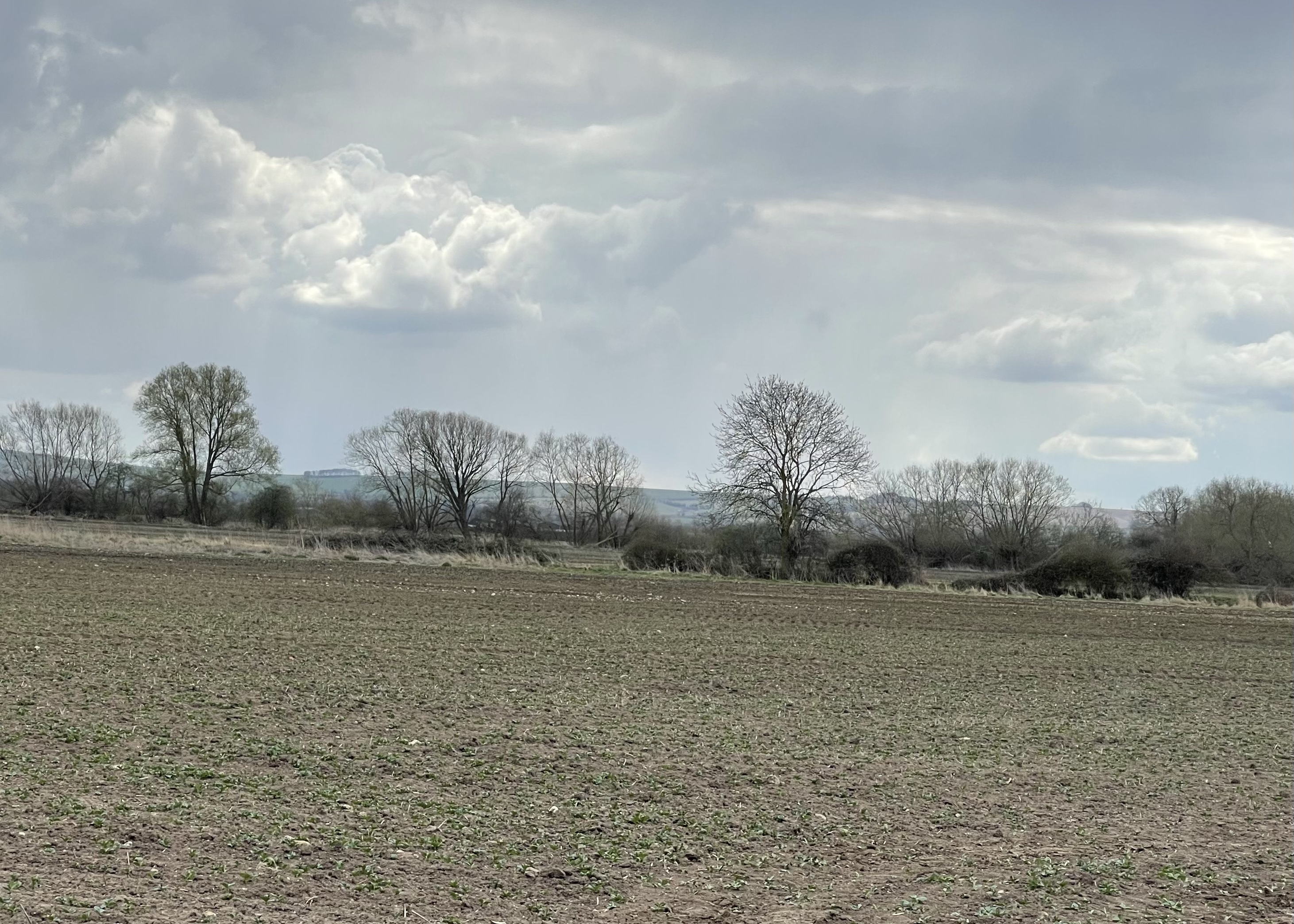
On the Monday an abundance of buttercups caught my eye. And the sky!
Both were early evening walks, fitted in around intense furniture moving and carpet and laminate being laid! 
I was pleased that I managed to get quicker on the second walk. So walk 1 took 1 hour and 49 seconds and walk 2, took – 58 minutes and 46 seconds. So average time taken per kilometre was 10 min 52 sec – improving to 10 min 24 sec.
Further more the boots were comfortable and I was able to use them on Walk number 121!
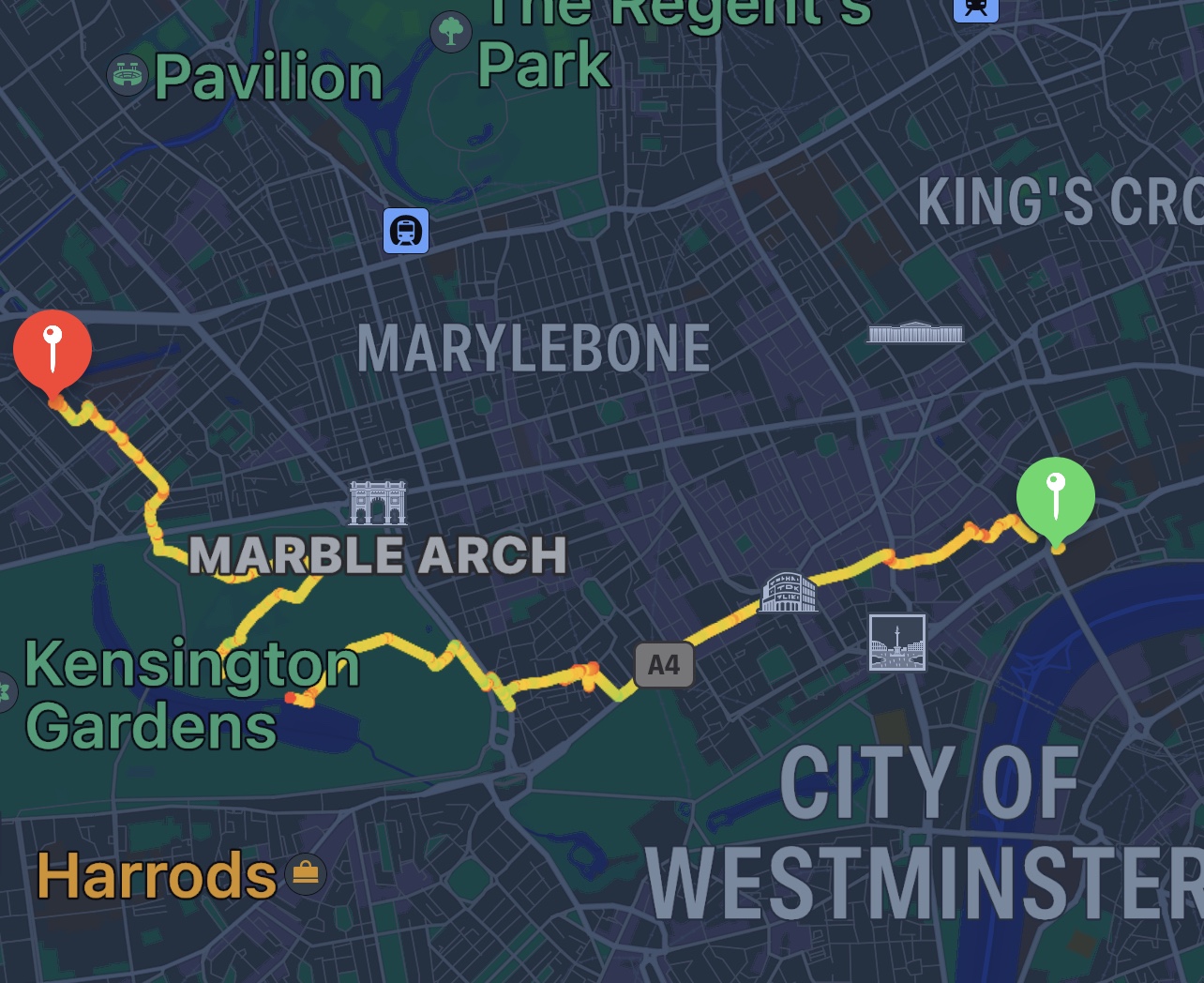
A completely different walk today – up in London for a meeting which was held in an apartment in County Hall. Very strange coming out and having such a good view of the back of eye. Rather an unusual gathering next to the apartment block.
Having left the meeting we walked to the Strand where we were having lunch at the India Club. We crossed the Thames by the Charing Cross bridge and then turned right into the Victoria Embankment gardens which I’d never been in before.
After lunch a quick walk to Covent Garden and of course the Apple store , can’t resist. I then decided that I wanted to go to Shepherds store which sells book making materials and papers. So through Leicester Square and along Piccadilly, before turning up Half Moon Street.
It was when I came out in Curzon Street I realised that I had managed to get myself to Shepherds Market and not where I had intended to go. Now too late for a shop visit I continued my walk heading for Paddington Station. I continued down Curzon Street until I came out on Park Lane – not really a possible place to cross where my route was suggesting, so a bit of back tracking. Once across my next aim was to find a way into Hyde Park.
I decided to take a slightly roundabout route down to the serpentine. Beautiful trees and roller skating lessons!
Decided to find a kiosk for a cup of tea and admired the view of the swans and turned to find I had a view of Spider-Man, in duplicate!
Next to a small island I spotted a heron- no it wasn’t plastic – it did move and a gull.
I loved the vibrancy of all the different things happening and had a bit of a wander rather than just taking the quickest route out. A police vehicle stopped by a group of young people playing football next to a small tent, and got out to talk to them – hopefully just to remind them they couldn’t stay overnight!
Before making my way towards Victoria Gate and crossing the Bayswater Road, I spot two more features of interest. A magnificent chestnut tree in full bloom, the shape reminds me of a child’s drawing and this rather unusual bench, celebrating the creativity that can extend/ repurpose the life of an object.
Along various side streets before coming to Sussex Place, I quite like visiting there. And then back to Paddington. On several occasions I have been met at the station by my son and we have walked through the park before setting off to our final destination- I think he just likes to keep my step count up. I did spot this wonderful little mews on the way.
Not sure of my complete distance today as I forgot to record the first section and then had a couple of gaps! At least 10 km in total.
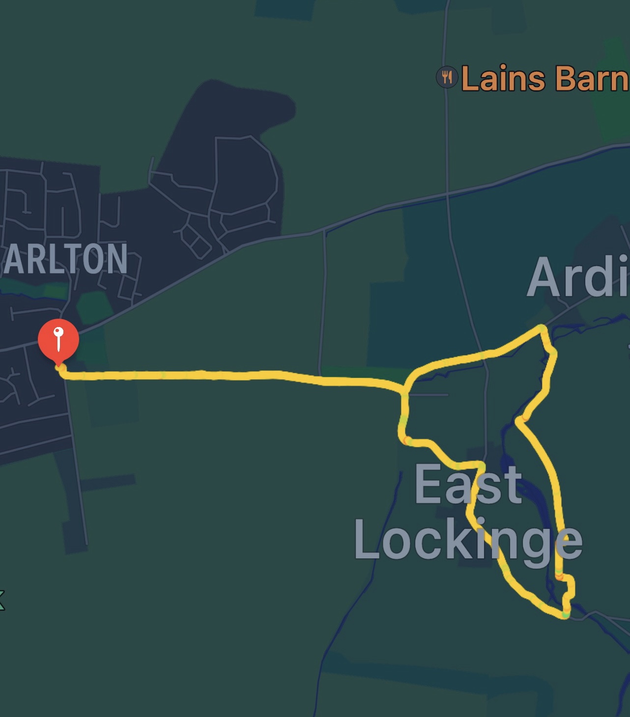
Walking from home today and ensuring that I take some different paths. My last two walks have given me some ideas for some paths to explore. So as often is the case I start down the track, along the lane and round by the stable. As I get to East Lockinge I double back and turn off the road to head through the new orchard area towards Ardington.
I take the path passed the back of Ardington House and as I get the end of this track I turn right up the hill. This path will come out where we met the other two walkers the previous day. I’ve walked down this path but never up.
As I meet the path from yesterday I this time cross straight across. The path leads down to the road to Ginge; in the distance I can see the chalky track which will lead up to the Ridgeway.
Having reached the road I turn left and walk passed the few houses and stables in this hamlet. A T junction is reached, the road turns to the left and the track I will take turns to the right. There is shortly a turn to the left which is the Sustrans track towards the Harwell Site. Looking back I can see the line of trees that marks that track . Looking up I’m able to watch a kite circling above my track that curves its way up onto the ridge.
The path emerges and I walk a short way along the Ridgeway. To my right is the wooded area surrounding Scutchamer’s Knob, I choose to walk through the wood parallel to the main track and come out by the car park where I had parked last Saturday with Alex and Pete. My plan is to walk down the path that we were originally going to use to get back up to the car. It is quite a chalky but not particularly significant track and descends quite quickly down to the road where I turn right and follow for a short distance. This side of the Ridgeway is much more sparsely populated.
There is a track off the road which curves round and is initially the same route as taken less than a week before. However my choice was to take the track to the left, along ‘Old Street’. This turns out to be a really pleasant route back up towards the Ridgeway and I’m really pleased with my choice. The track is not in a hollow but there is a very definite route way.
Then a real treat, suddenly movement in the field to my left and two hares are moving as a third joins them they start to race and I manage to get a short video. They disappear over the horizon of the field and I have to move on. I can’t quite let myself just walk off and I’m pleased that my patience has been rewarded as they are back nearer my end of the field.
There are several areas of woodland which looks very much like estate planting and there are signs about private land and keeping to the footpaths. The fresh, clean green of the new leaves on trees is always a wonder to observe at this time of year.
The path discretely joins the Ridgeway, not like a major junction but a side path sliding in to merge. Just a short way along the Ridgeway but before the Monument the path splits and I take the much less common route down to the right. I decide to stop here for a rather late lunch. I’m also waiting for a phone call to discuss some rather tricky issues around a European project I’m involved in supporting.
The skies are often interesting along this ridge, trees not quite fully in leaf. A section through a wood and then down to the gallops. A stretch back towards Lockinge and then a turn left which takes me to the road junction and the very top of Larkhill and the way home.
I was a little tight on time today and my phone call was quite long. I had purposely tried to keep up a quick pace and managed even on the uphill stretches. Average speed of 5.1 k p h and 289m of ascent. It was a good walk, bit of a work out and stress relief, plus being 16.74 km in distance. Nearly 10.5 miles.
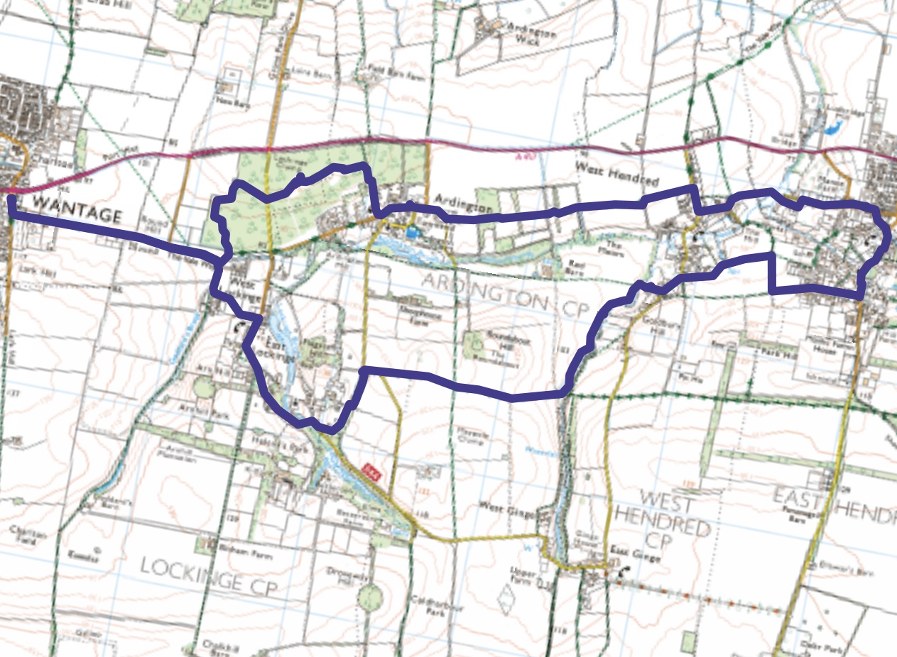
Leading a walk for SPR today that in my diary I called ‘Short Wantage’ but advertised as a walk to visit surrounding villages. Meeting at 08.15 but luckily about 100 metres from my house! Supposed to be leading three people but only two have turned up.
So we set off down the lane – my familiar route and along the road newly planted with Lime trees for the Queen’s Platinum Jubilee- no more conkers! Apparently, whilst talking to a wood turner, horse chestnut is a very soft wood and not particularly good for turning which is probably why all the trunks were chipped.
As we go passed the stables I can explain about racing success stories and the design and structure of the ‘social’ villages of Lockinge and Ardington. Fliss and Mirella are my companions today and we are also able to discuss other route ideas. Nearly opposite the church these plants caught our eye. Possibly young Acer seedlings but whatever they are they add a great vibrancy to the area.
We loop passed the gates and church yard and head up a private road / footpath which has a wood running alongside. Whilst taking a ‘natural’ break I notice a path and we decide to continue along this as it will come to where we wished to go. Wonder why I haven’t used this before? We rejoin the road and turn to the right before setting off on the high path which leads across to Ginge Brook.
Half way along we meet another couple of walkers at a cross roads, I made a mental note of this route! As we come over the rise in the hill we can see back over to Ardington – our last village on this route.
Next down to the brook and we start to walk alongside it, having scoped it out I was sure of how far we could go before it became a scramble challenge. Worth a look at the wonderful fast flowing meanders.
We come out by the church and then turned left, taking an interesting path away from the road which lead behind several houses and let us into some of the secrets of life in the village. In order to make the most of our visit to East Hendred we completed a third side to a rectangle so that we could walk next to some exciting new barn builds and down a road with much older houses. There was a general appreciation of the architecture and an agreement that there was something satisfying about mixing crossing fields, going through woods and passing through villages.
We decided to stop outside the shop for a drink and snack. Then refreshed we walked through the village, spotting an alternative use for a bus stop!
Now passed the recreation grounds where voices could be heard- it was still the Easter holidays. The path, one I have used before cuts from this no through road which once led down to a mill. From the path the mill, once owned by a potter looks as if it is being renovated. We go over East Hendred Brook and cross fields to a farm at the edge of West Hendred. As we emerge into the village I’m able to point out the apple picking ladders on the side of the barn. This area was once key for Apple and cherry growing due to the underlying soil and also because it is in a dew dip.
A contrast now as we walk across a series of fields towards Ardington. At least two have broad beans growing in them. This is not a market garden area so I can only assume this is for animal feed.
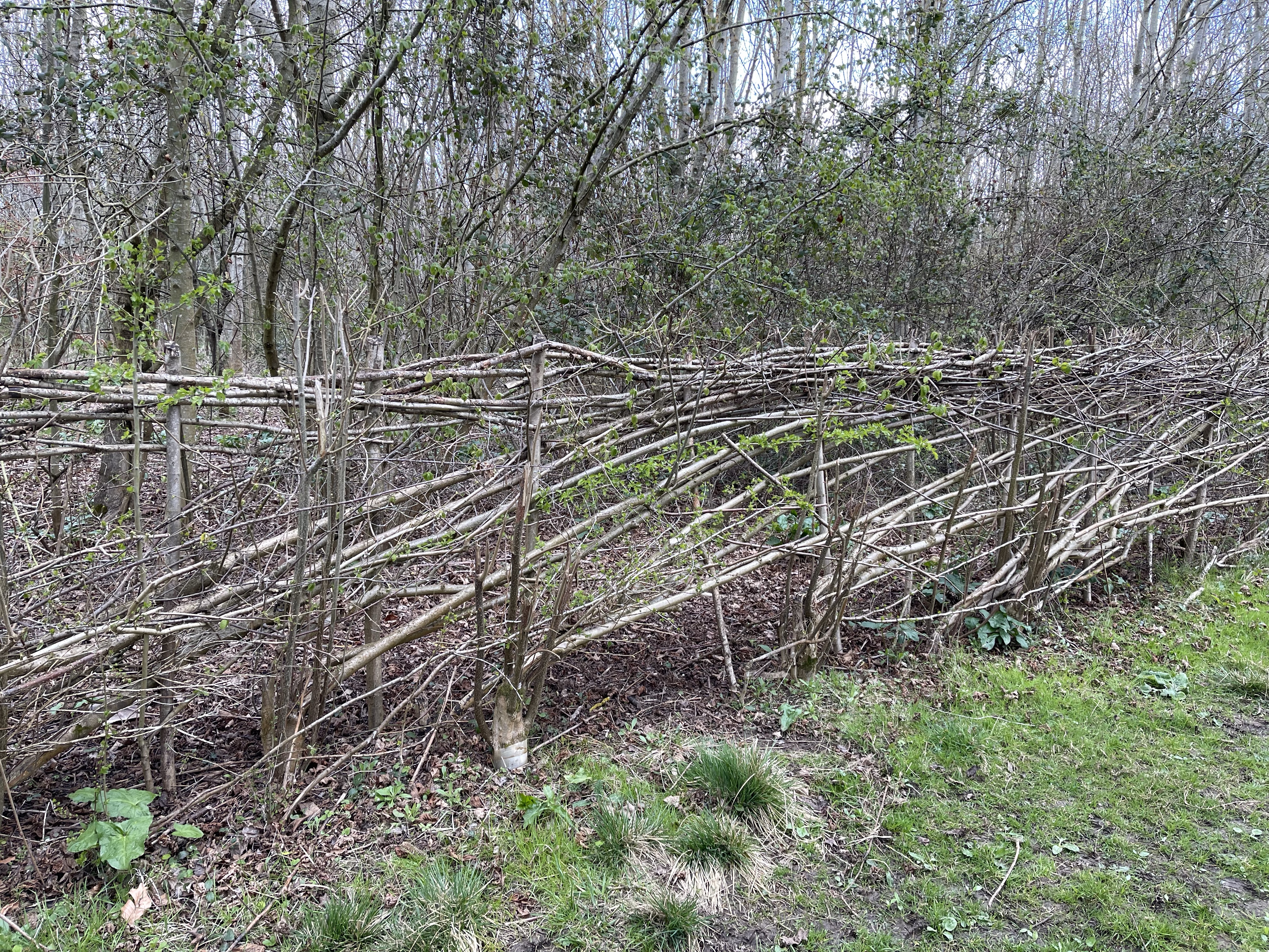
We come down into the village and walk to the ‘ Ardington Stores’ – unfortunately closed for refurbishment so no drinks and no loo! We did see a rather unusual hedge though!
The group agree to walk up to the wooded area – ‘Christopher’s Wood’, planted in 1993. We walk across to the stones, always special. A wonderful patch of cowslips as well. We decide not to go straight down the hill for the last stretch and take a path that leads into the wood. Just a bit of a wriggle and then after a look in the Parkinson.me garden we walked the last stretch and it was time to go home.
Just short of 9 miles today/ 14.39 km. A route that was enjoyed by all.
Local today but with a short drives and accompanied by Alex and his partner Pete. The starting point was the parking on the Ridgeway at the end of the long road up from East Hendred, I had parked there once before but this walk was going to incorporate the southern downs below the Ridgeway.
The weather was quite reasonable as we set off and Pete made the choice that we would go along the Ridgeway first- a stretch of about 4 kilometres. There are two paths off down to West Isley and we took the second one which is quite close to the A34 junction. Quite a pleasant track gradually dropping down towards the village. It splits and we take the right hand fork next to a wooded area.
The plan is to walk through the village to the pub and see if we can get some lunch- unfortunately they offer a rather short window of opportunity and we are later than we had intended! Good job we put some snacks in the bag – a drink and crisps had to suffice for the moment ! The village pond looked good though!
We had to backtrack almost the length of the village to find our path which headed almost due south. The start of this was the same as the path I’d taken last time. Just after the large stables there is a set of paths more or less in a rectangle – luckily the boys chose the other two sides than my previous route! AND we did see a hare in the field. There is such an abundance of dandelions in the field next to the path as well as the amazing blossom.
I share the map again and Pete and I agree we will go the longer route at this point, going south westerly along ‘Dark Lane’ and then ‘Red Lane’ before reaching the bottom of a triangle and going north west along ‘Old Road’. These names are fascinating and I really must try to find out more about their origin. Much of the path is either through woodland or alongside trees with the occasional avenue.
This is a long sweeping path which links back up to the road between Farnborough and West Isley. The land is very undulating in this area – rolling hills! The sheep reminded me of an illustration in a children’s picture book.
Then on the other side of the path there were bluebells, these are always so joyous to see. The wood anemones are particularly beautiful this year.
As we reach the path there are route decisions to make again. Alex is already complaining that it’s further than he thought – and isn’t interested in looking at the map! We can see the path in front and to our right which will bring us straight back to the car. However there are two more routes going up towards the ridge and Pete and I decide on the middle one, it’s still not too late and a very pleasant late afternoon!
It proved to be a great route which ultimately led up to the Ridgeway where we could turn right before reaching the car.
19.76 km in the end, just a bit more than the 15/16 I suggested at the start!
A different location today, with a starting point at the southern end of the Malvern Hills. The path started by going straight uphill through a wood and edging around the peak of the hill, Chase End Hill. It is quickly evident that this is an area with many wild flowers and it’s tempting to keep stopping and photographing them.
From the side of the hill we can see the next section of hills and this will be the pattern of the day. I haven’t ever seen as many wood anemones as these spread widely amongst the remains of last years ferns.
We meet a B road which we followed for a short while and we were ready to start the next section. Again round the side of the hill – this time ‘Ragged Stone Hill’. I would have quite liked to have gone to the tops! Bluebells in this section and this part of the hills comes down to a more main road but before we do I spot small yellow flowers that I hadn’t noticed before this year – Potentilla aurea- Golden Cinquefoil.
we leave behind the lower less popular stretch and approach the first of three more significant and popular sections, again cut top and bottom by roads which have obviously been built to intersect the countryside in the dips between this hilly ridge. We pause for coffee at the edge of a car park and then set off up hill. Across the fields to the right is a large castle/house and we are on the edge of an estate. Having climbed Midsummer Hill we reach some extensive Earth works and the site of a fort.
We are taking a less conventional route off the top of this section and are heading for a path down a hidden valley. Firstly we had to go though a section with a large number of fallen trees- climbing over and under. Towards the end of the section I spot a notice about Ash Die back and realise that I should have noticed the black buds rather than assume it was storm damage. The clambering was worth it to walk down the valley.
After a short section along a B road we walked through a parking spot and started uphill again. After a short climb we turn north and are travelling parallel to the top of the hill- I do begin to wonder if we are going to go to the crest of any of these mounds! We continue around the bottom of the crest Swinyard Hill and in the next dip join and follow the Three Choirs Way. This area has many more walkers and intersections of paths. One prominent feature is a cave- not sure whether it’s natural or manmade?
I’m a little disappointed that yet again we go around the next peak which is called Herefordshire Beacon. This is an elongated ridge with spurs stretching south and north east, much of which is covered with earth works . Shire Ditch which runs north to south and a hill fort called British Camp amalgamate at this point. The land falls away on our right hand side and we can see a reservoir. Steve from SPR suggests that we sit on a well placed bench for lunch and then decides he doesn’t want to eat his sandwich as we’ve still got lots of up to do! After our food stop it is a short way to the end of this section- a car park, pub and snack shack. Unusually Steve hasn’t brought his flask of tea so we stop for a ‘pre planned’ tea and then he also orders a toasted tea cake which takes for ever. I feel a bit concerned as we haven’t even started the last two sections yet which have the biggest hills!
As we start climbing up the next section I’m offered the choice of track or almost a road. No real choice! I’m also offered over the tops or round- again no real choice – so we start along the track to the first of three peaks in this next section. we can look back and more or less see where we started.
After the start of the first peak Steve decided to follow a path which went round the side but told me to just carry on which I did. I certainly wasn’t going to go round another hill! I continued and reached the top and went on and reached the second peak. I turned round expecting to see Steve coming up to meet me – instead there isn’t a proper path and he is climbing up the side of the hill, he then turns back because he assumed I wouldn’t have got that far!!I had to wave and attract his attention before he turned and followed the correct way! Third peak to go and then the ridge dips quite steeply down to a road again. I did explain that walking along a ridge like that I was in my happy place.
Just the last ridge to go – Worcestershire Beacon – quite a steep climb up but very rewarding and then a path which edges round the size of the hill before dropping down in wonderful zig zags back down to the edge of the town. A good view back to see where we’ve been.
A good days walking, I would have preferred more peaks but perhaps that’s greedy! 16km so just over 10 miles.
Decided to go from home again today and that I’d start by walking up the hill towards the Ridgeway- not been that way for a while. I planned to get over to above Letcombe and come down towards it from the top- not a direction I usually take.
One of the first things that struck me was how dry it was on the ground even though it had been a wet start to the day. The chalky track up Larkhill is ever changing and it didn’t let me down – one of the best aspects is the skylarks singing.
About two thirds of the way up I can look across to we’re my route will take me near Furzwick Farm – they seem to have a deep chalk pit which is very visible and a track that I followed to come out by Courthill Yourh Hostel. The hostel’s trees are clear from this view point as well – I can’t remember seeing this so clearly before- perhaps more walking has just given me a greater perception of my surroundings or perhaps it’s just that you can’t miss the white scar!
The view back down the. Hill is more familiar!
When J reach the B4494 to Newbury I cross it and head almost due West, the path joins the Newbury Road to the one to Hungerford. A pleasant route but nothing spectacular. Past the farm and the chalk quarrying is even more evident. My path cuts upwards across this field going south to join the Ridgeway.
I’m pleased that more walking seems to have improved my fitness level and I can keep going up hill for much longer without stopping. There are various routes up on to the Ridgeway but all are about 5 km and take about an hour.
At the edge of the first field going up I meet a couple and a dog and stop for a chat, I’m really hungry but need to get further up the hill before I tackle my sandwich. Not long to wait and I manage to sit with my back to a bank which gives a little protection from the breeze. Half way through and the dog and owners come up the hill- he makes a straight line to me – I think he can smell my lamb sandwich – it wasn’t for sharing!
A familiar section as I cross one more field to reach the ancient path and turn right- a familiar stretch but so often walked in the other direction. In the fields before Segsbury Camp I’m really pleased to see a plethora of cowslips – not that common any more.
Not long before I reach my favourite stile and I’m heading back down Smith’s Hill. I’m going to go down the very steep hill – there is a bit of up after the dip and then divert across towards Letcombe Basset – possibly walked this bit before but not for very many years. No white cat in the trees today! I’m happy in horse fields when they behave like this!
The path joins the road into the village and I continue down until I can see the church – take a photo and realise I’ve missed my next path so back up hill! This track takes me behind some houses and then to the original path above the brook, before they developed and regenerated this area. A good opportunity to see how other people have added to and landscaped their properties!
I decide to stay on this top path and turn right at the end towards the end of Letcombe Regis that used to host ‘The Sparrow’ pub. Again so as not to repeat my tracks I took the path into Anvil Close – assume a blacksmith once lived here. After the houses the path was narrow between a wall and hedge – glad it wasn’t dark! I had wondered whether to detour to Challow but decided as rain seemed imminent I would go back along the obvious path into Wantage.
One of those – ‘Shall I put my raincoat on?, moments. I did in the end probably a bit late! From the path back I could look over and see the familiar shape of the trees at Court Hill and noticed the ever changing colour spectrum. And a chance of a close up of a cowslip.
Again for some variety I continued on the path around the back of the leisure centre and out opposite the park. From here I took advantage of Waitrose before heading home.
Another good walk of just over 16km so a good 10 miles.
A whole week since I went for a real walk as not counting a tour around Oxford viewing possible art outlets. Also rather distracted by curtain and cushion making! I didn’t set off until late due to family visitors so decided I needed to go from home.
I decided to walk the usual route to West Lockinge and then go up to the Ridgeway via the long straight route passed Bitham Farm. I haven’t ever walked up this way and it was a steady climb. Trees still stark against the blue sky. And then realised there was an owl on the fence. Managed to get close enough to photograph before it flew away. Upwards to the monument, a point of interest for many visitors.
I set off along the Ridgeway, a wonderfully warm late afternoon and great to be up here with fantastic views and a noticeable change in pallet as the oil seed rape begins to dominate.
There are several choices of ways to leave the Ridgeway, I’ve decided not to go down via Betterton and keep my options open a little longer. The next exit is one I haven’t ever walked before, as I approach I have in my mind that if it is dirt or tarmac I will continue on but I’m pleased to see it is grassy – never noticed this before. As I set of downward I can see what remains of Didcot Power Station, once the proud owner of three large cooling towers – no more!
This really is a pleasant route, some wooded areas and some deep clefts in the ground. This path comes right down to the road to East Ginge. A turn to the left and then right down a farm track which then leads to the top end of Ginge Brook.
The path is high above the brook and then the way marked path drops down and crosses a small stone bridge before coming out near the new bridge which helps facilitate the cycle route to the Harwell site. Not really a path on the Wantage side of the next section of the brook but plenty of tracks. I want to investigate how far I can safely good – I will lead a group along here very soon and I need to find a safe route.
After a while the banks become very steep and they would be wonderful to scramble on if I was with an able bodied companion but I decide that whilst I wanted a future group to see the brook I also needed to keep them safe, so determined my exit point where I continued along a well trodden path round the edge of the field. At last a chance to go back into the wooded area just before the track to the church.
Coming out on to the road I decide to turn left and then quickly right. This track leads across to East Hendred, parallel to one I’ve used before. My path runs alongside the school field and I remember not only a snowy football match but also the now retired head teacher who was a colleague for several years when I taught in Wantage. My path loops back towards West Hendred and across the fields to Ardington. The light is beginning to change a little and I also notice a proliferation of cabbages growing in the fields I’m crossing.
I decide not to take the track up to the stones but continue through the village of Ardington. After I’d walked passed all the houses and get to the grassy area in front of the woods on the side of the hill I have the thought that maybe I could take my group up this way to see the stones. I had been in this area once on a sculpture trail- an amazing event organised by a sculpture artist that tragically died too young. Foolishly as it is now nearing sunset time I decide to take a track up towards the stones. All going well and then I found myself fast approaching the ground- a small root had caused me to trip and it is a strange feeling when you accept you are not going to regain your balance and you are going to go splat on the ground!! As my left hand hits the ground my watch starts doing an emergency SOS bleep. Feeling a little shocked but no real pain I click the no attention needed message and get up to brush myself off. I continue to the top of the hill and to find the stones, wondering at my foolishness! The sky is beginning to look really interesting and I hope there may be some good views at the top.
Back down again and the sky looks impressive but still enough light to see my way back along this very familiar route.
Nearly 12 miles today- really pleased I set off out – very impressed with the SOS Feature on my watch- feeling a little sore and cross with myself. Discovered I must have crashed onto my rib cage when I got into bed! Ouch!
A local but different starting point today. Having visited a friend in Charney Bassett I decided to take advantage of my locality and create a route from that village- a bit of a village hop with fields in between!
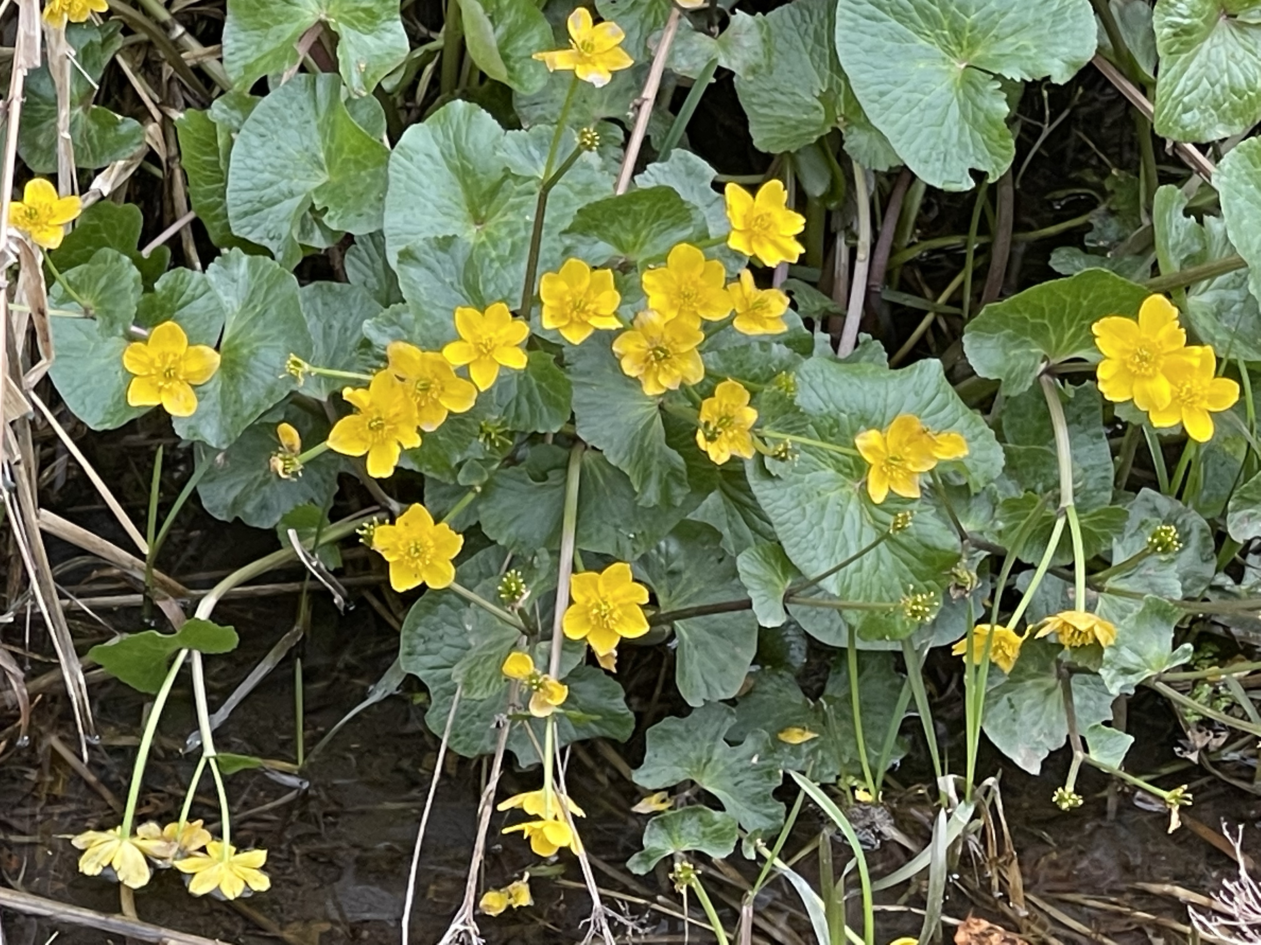
I started by setting off towards Stanford in the Vale – on the map this looked like a bit of a boring trudge through fields but actually was much more pleasant than anticipated. Quite a flat area with the Ridgeway in the distance. Immediately I left the main road through the village and was walking next to a ditch I saw some King Cups – my guess was confirmed by the facility on my phone to identify flowers and plants.
Once out of the village the path eclipses the edge of a wood where they have been preserving the art of hedge laying. Then to one side the Ridgeway and on the other the seasonal yellowness of oil seed rape.
Stanford in the Vale is a large village which has several older areas as well as new developments both well within the nucleus of the village and increasingly surrounding it – greatly increasing it’s footprint. It is a very tightly shaped village and immediately you enter there is an awareness of a change in architecture, Cotswold stone becoming more prevelant
The church and school are very much in the middle. Towards the end of the route through the village there is a green but on closer to scrutiny of the map this area in the northeast corner is actually Bow with it’s own Manor House and Farm.
From here it is a short section across to the small village of Hatford. I go passed the church but this isn’t the same one as the impressive chapel/ church that I saw last time I was here and neither is it marked on the map.
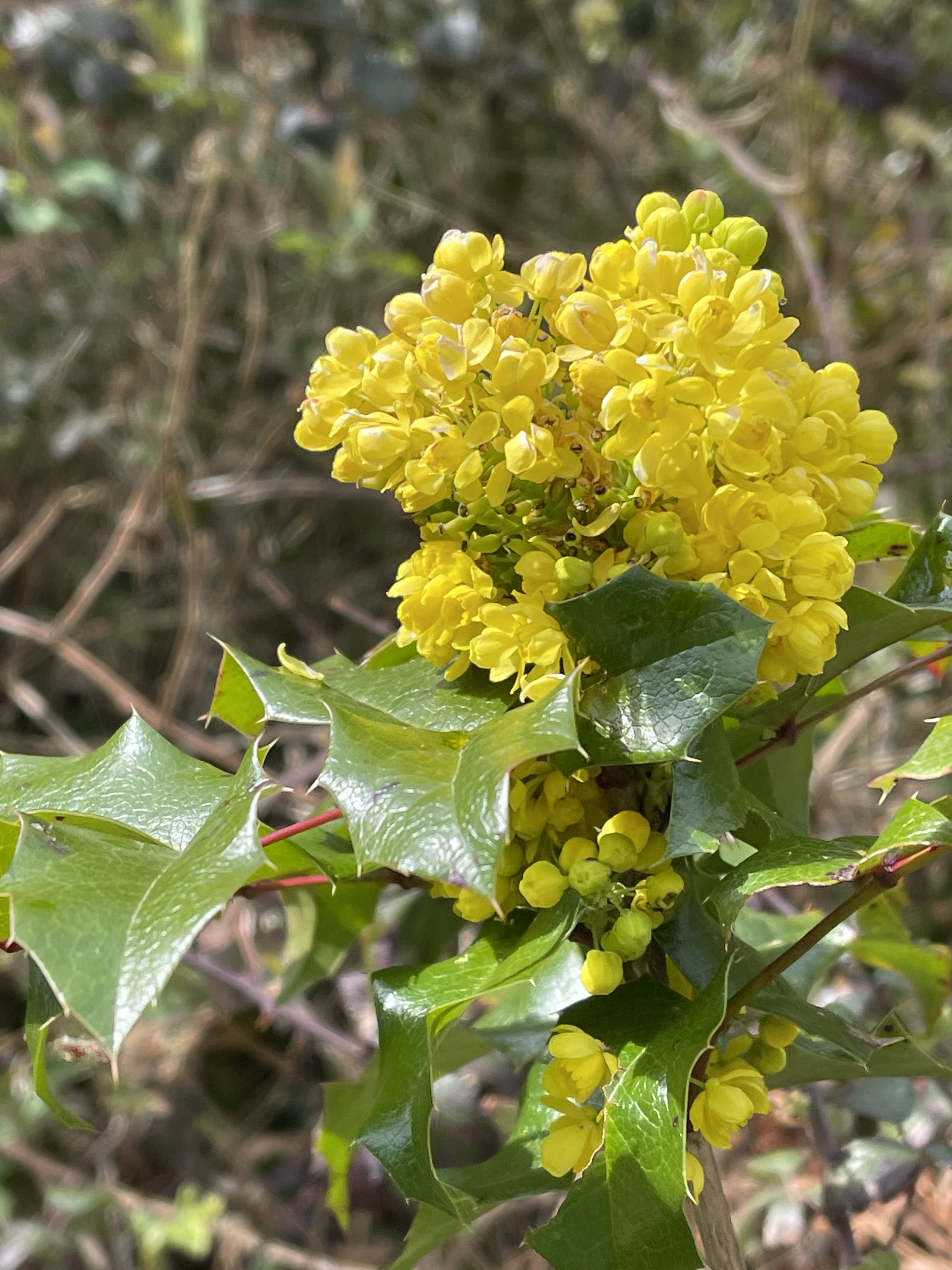
Passed where I parked last time with Alex J and along the road a bit before crossing fields to a wooded area. Definitely time for a comfort break – this has been the first opportunity and a chance to eat a sandwich, a rather late lunch but I did have cake with my coffee earlier! The most striking part of this walk through the wood is the abundance of a particular yellow flowering plant, as well as some gorse. It looks similar to something I have in the garden but I thought that was cultivated? Again the rather useful feature allows me to name it as Berberis aquifolium – Oregon grape. I really don’t think I ha be seen it wild before.
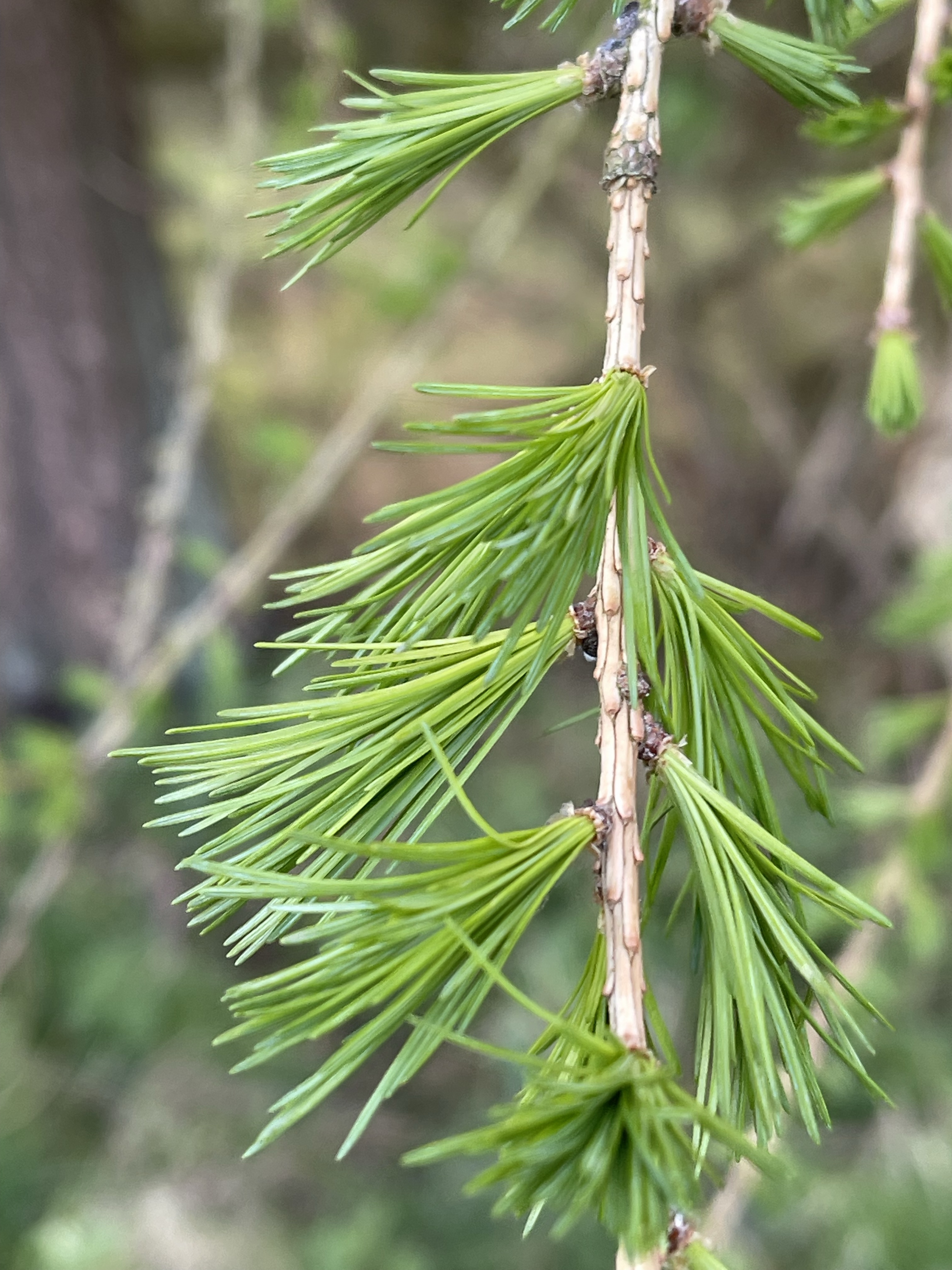
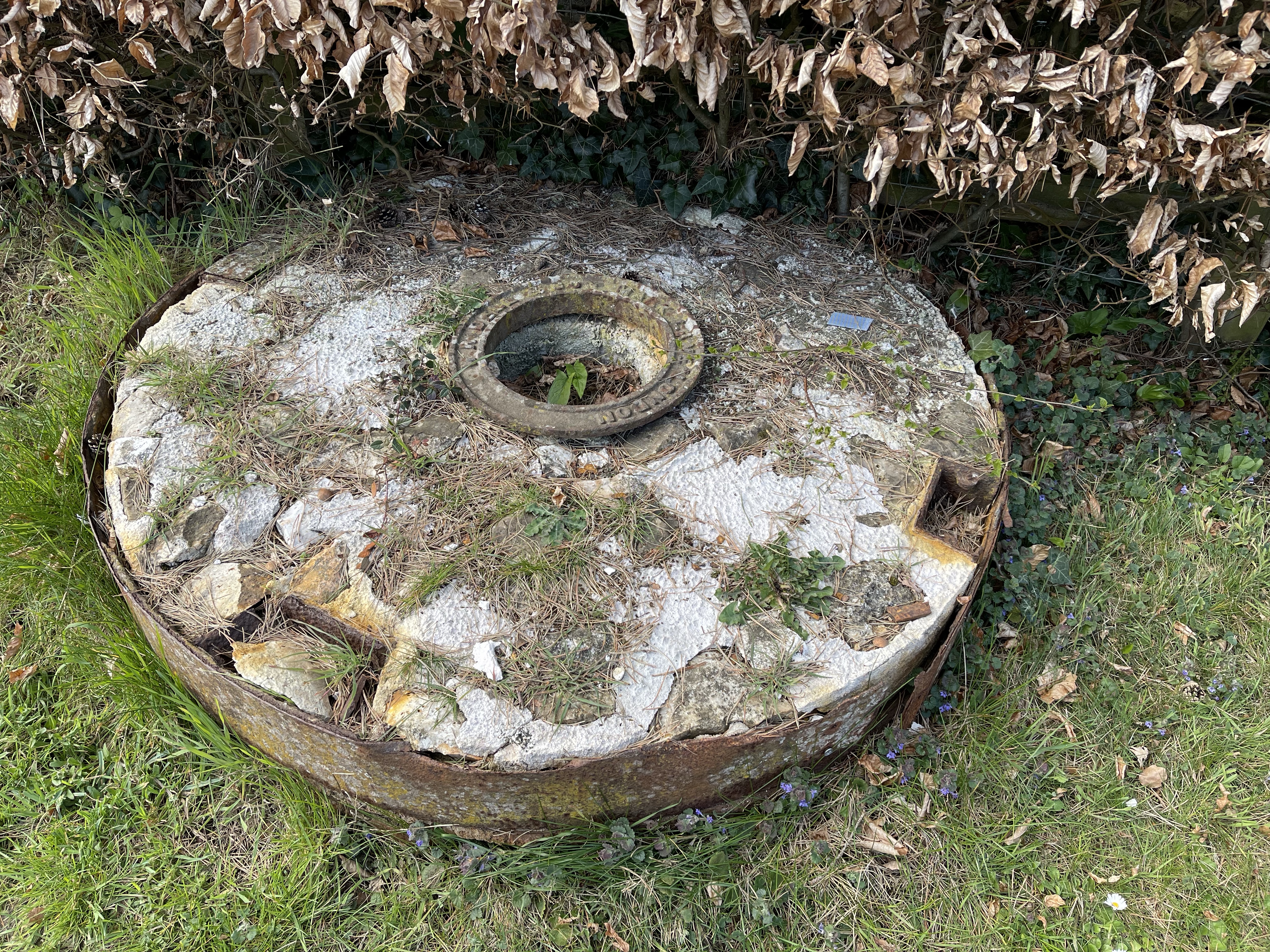
A bit further through the larch is beginning to show it’s new growth – a wonderful bright but gentle green. This path comes out by yet another Home Farm and this rather splendid hexagonal building – too grand to be a dovecote? And then by the side of the track this stone – not quite a mill stone but could be- a mystery to be solved.
I’m about to cross the busy A420 to visit Buckland. Luckily there is a bit of a gap in the traffic and my new path is straight across. From my path I can see an avenue leading down to Buckland House and then eventually it comes into view, hidden at first and then a better angle. I believe much of the village is or was owned by St. John’s College in Oxford. Again a compact village but it does have a school and strangely again two churches.
Having had an enjoyable walk around this village , the sun was out and by now reasonably warm, it was time to go back over the main road and head for the very small village of Pusey. The path meets the road opposite the main gates to Pusey House and as I go round the corner I’m aware of the house and lake with a haha like boundary. I’m now heading back to Charney but looking out I’m afforded magnificent views of the Ridgeway again. Somebody has parked to take photos and on chatting it appeared that she felt compelled to do this even though she lived close by.
And so back into Charney Bassett another splendid village with it’s own Manor House, now a retreat for Quaker’s and also a mill that is opened at Heritage times. To finish a photo of Alex’s cottage and the church.
This was a good stretch out for a Saturday pm, being out for four hours in what turned into a splendid sunny start to April. Just over 10 miles / 16.46 kilometres.
Somewhere different again today and what turned out to be a very long day and quite a short walk! Beside water again but this time the sea.
An early start at Millets – 07.00 but then the van wouldn’t start – 3 of us walking today plus Steve. The alternative vehicle – the jeep which we could all fit in was in Wallingford. We eventually set off from there nearer 8 am and reached our parking spot to the east of Weymouth at about 10.45. We parked at the top of the hill above Ringstead Bay – a very sharp wind greeted us and I put on a snood/ hat/ head band which Alex had kindly bought me at Christmas. I hate wearing hats when walking but this round my head was very useful. From our starting point we could see over the sea to Portland Bill.
We set off walking away from Weymouth and turned south in order to join the coastal path, after just a short distance we cut down a small path through a dune like area on a small steep path to reach the beach and we continued on our route until at the end of this accessible beach we climbed up to meet the coast path again.
A few slurries of sleety snow during the next section so head band still on! Then as hedges increased a little more shelter and protection from the wind. There are several springs in the hills to our right/ above us and the resulting streams need to be crossed. At a footbridge we see not only a way marker which indicates the coastal footpath but also a grid reference – something I had not seen before, we went on to notice these on several posts throughout the rest of our walk. We are now approaching the Sandy stretch before Osmington Mill – stopping for coffee at the pub has been suggested!
After a short interlude and some sunshine we set off along a road through the village before we turned left back onto a more typical coastal path. After about half a kilometre we walked alongside one of the perimeter fences of Osmington PGL site and we could spot the typical structures of problem solving activities and high wire including a Jacob’s ladder- something I never mastered. We continue along this grassy stretch, with some blue sky and some heat from the sun.
Nearing 13.30 I put in a bid for lunch, please! Our view point was good and the sun very warming as we sat on a gentle slope above the path looking out to sea. Portland Bill was getting closer so, so was Weymouth! Along another stretch and we were able to see a distinct ledge that protruded from the water. Rediffe point sticks out into the sea beyond this stretch.
We soon come to Bowleaze Bay, the holiday park, the smell of fast food and suddenly many more people. We have met other walkers on our way but nothing like this. We are walking across a beach again and then after a while we come up onto the path beside the sea. We have some respite before we reach the town as we walk next to the Nature Reserve. On the edge of the town beach huts are being painted all in the same blue, the ornate lamp posts also look fresh with the same colour. A real effort is being made to give a good impression as the footpath beside the road turns into much more of a promenade. The large sweeping bay of Weymouth is now next to us.
The advertised plan was to get some refreshment at a pub on the far side of the bay but an issue with parking meant we met our transport before we had time to walk around the bay.
This had been a very pleasant walk and the sun did shine and on several occasions was quite warm but it did seem rather short at about 7 miles. I had thought we were going from Durdle Door or Lulworth.
A rather torturous journey home, being stuck due to a nasty lorry accident and needing to pick up Maddie’s car from Wallingford, meant that it was well over four hours later that we arrived back at Millets!