On our tour schedule it suggested that this could be a day by the beach or a full or half day walk could be participated in! My preference as somebody who doesn’t swim well was for the walk , especially as the following day we were moving to another part of the island by boat and bus.
It became apparent during our evening meal that nothing formal was being arranged. A book was passed round but quite difficult to digest and decide when you are also trying to eat food whilst it’s hot. So good eating outside though!
A few people thought they might go for a walk whilst others decided it was definitely the beach. Awoke to find my phone hadn’t charged so needed to deal with that! I tried to rouse Caterina after breakfast but no lucky – I had thought I might be able to do a walk which would take me up to a village I’d seen the previous day and then down a gorge to the beach by the Taverna, join some of the others and come back by boat.
No joy at getting hold of the book- managed to buy my own copy and read my proposed route in more detail – perhaps not such a good idea by myself!
So decided to do a short route from the village knowing that several others had thought about the same walk. So with a half charged phone I set off to try and do Walk 2 which started at the back of the village zig zagging up the steep mountainside.

So armed with a guidebook and a rather poorer map than I’m used to I set off – no way of telling those on the beach that I wouldn’t see them later!

As I left the village I met about six of the group coming down having failed to find the crucial turning left off of the main track to complete walk 2. Undaunted I decided to give it a try and quickly started up the mountain side – it was 11.00 so I needed to get going. Having walked by myself a lot at home and for some of this trip I was to deterred about route finding! Oh for an ordnance survey map!
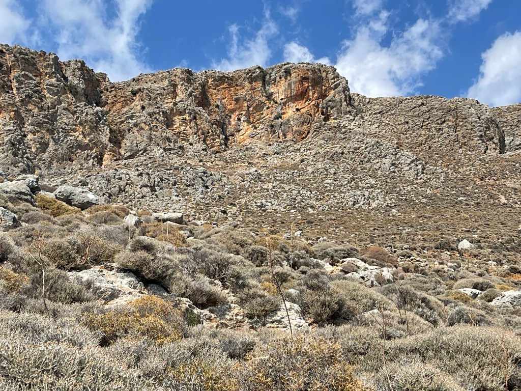
My path was apparently a 2000 year old mule track or kalderimi, I rather liked that idea and guessed that this would have been a way to the sea for the village that was way, way above me. Just as the day before I saw eagles or possibly vultures enjoying the thermals created as the air from the sea meets the mountains.. Upwards, I’m looking for a path that leaves a left handed hair pin bend and a smudged red sign saying FENIX – this is supposed to be an evening family walk!!!
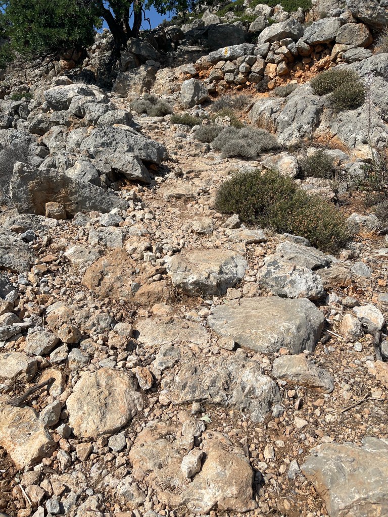
I continued to zig zag and found one place that I thought might be correct but decided perhaps it wouldn’t be right, continued on a bit further, acknowledging that it would take me longer than the 20 minutes suggested by the two men that wrote the book.
Eventually found a chap coming down, an older German out for a stroll – he said I just needed to go a bit further and follow red signs- well I’d seen some of those already so I continued on.
Still couldn’t find what I thought was the right place, went back to take a look at my previous guess. Thought I was in luck as I saw a couple on the other side of the gorge, stood a while and watched unfortunately they decided to turn back and my ‘path’ was possibly only a goat track and did seem to go down too deeply into the gorge.
Feeling very frustrated, decided to try again going up , met somebody else coming down who said I just needed to keep going up. Only thing to do was enjoy the views.


Stopped by some rocks to try to photograph another lizard and make a phone call home. So what to do? I knew I could keep going up for the first half of Walk 6 to the village of Anopolis. Deep breath, yes I would carry on and more and more relentless uphill! Still a few zig zags and then after quite a lot longer I met Elaine coming down. She’d reached the village but did warn me that it was over the brow of the highest mountain I could see- oh well to continue.

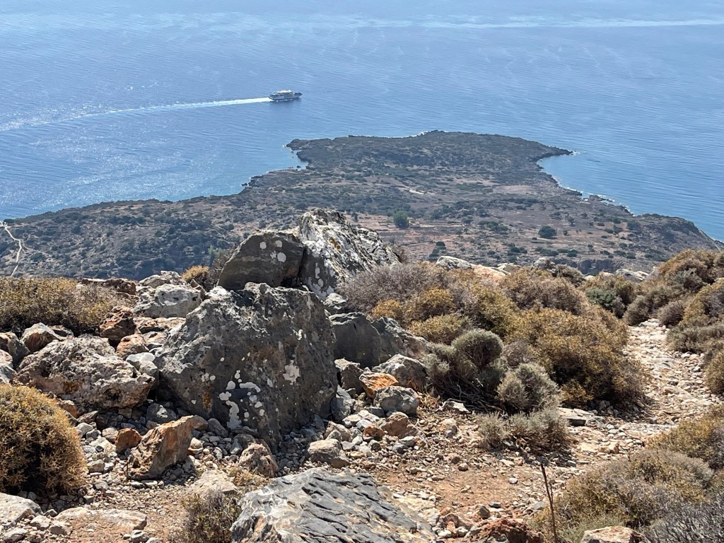
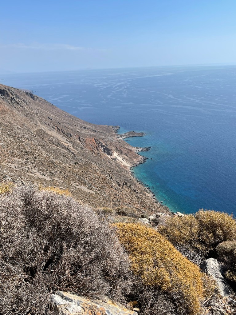
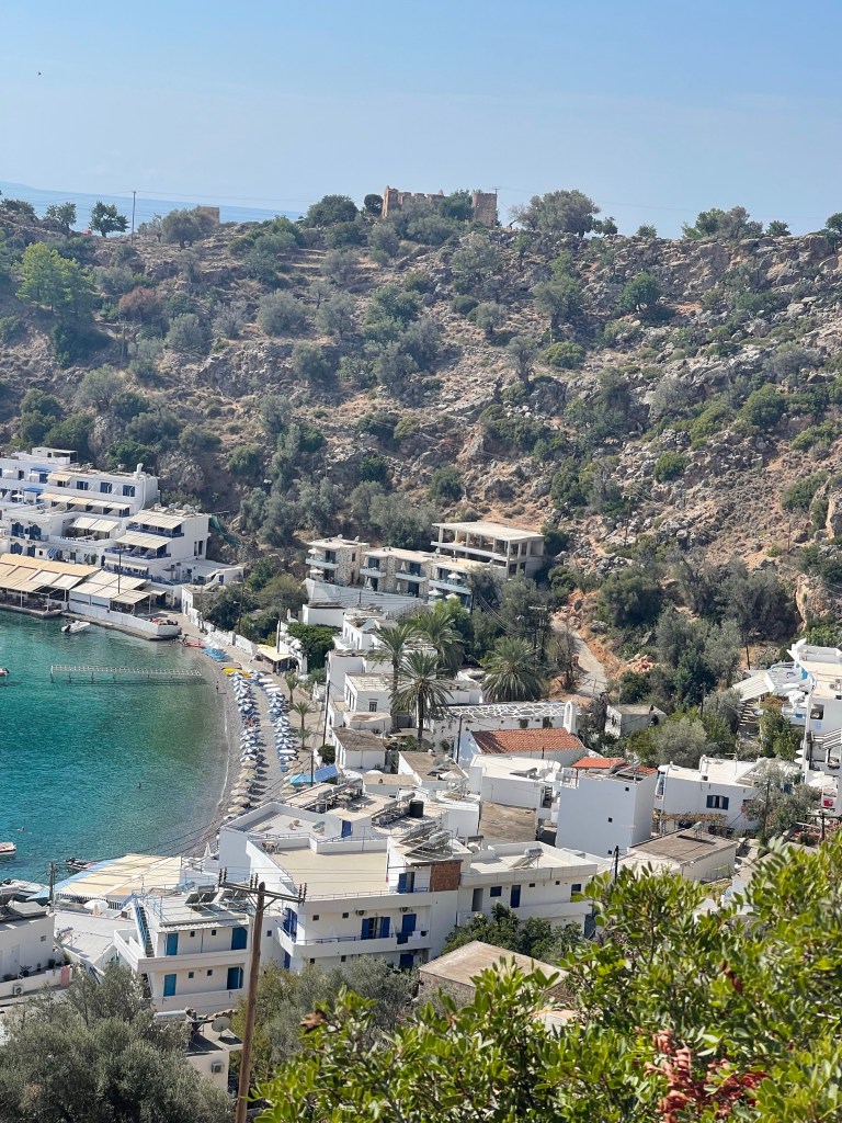
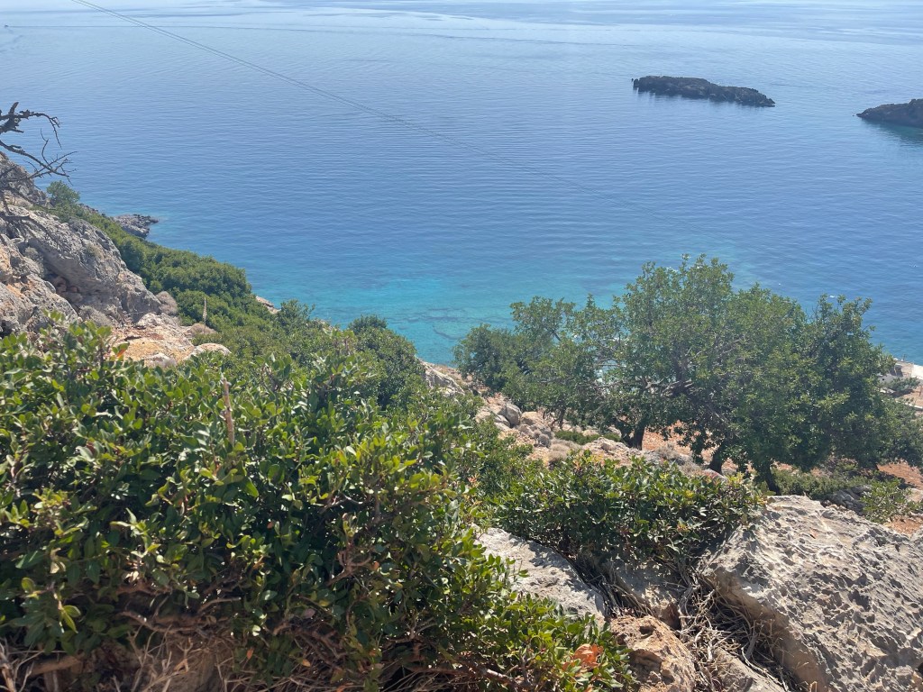
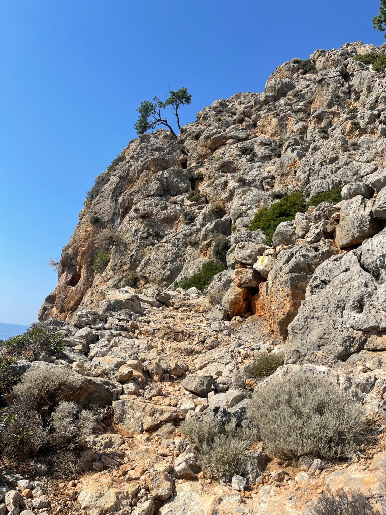
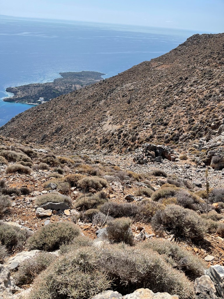
Eventually I reach a track which quickly turns back on itself and after a short while the path leads off from this. In the distance I can see the tops of a couple of buildings and some masts which show signs of civilisation. Well if I thought the first section of my walk was a hard grind up then this was definitely harder, the path wound up and some of the steps were quite large. This was a much rocky section and I can see a Col near the top of this mountain and the path does go through. Before I got to this point I had looked back at the peninsula that stretches out from Loutro .
I was much relieved to get to the top, it had been tough. Luckily there were two couples in front of me , not close but they did come into view as the path twisted and turned.
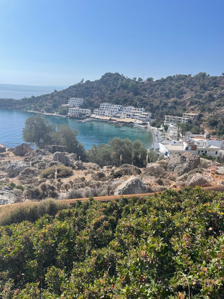
Looking later at the book this section so far has been described as ‘ a steep, strenuous, but spectacular walk up the towering escarpment from Loutro to Anopolis..’ There is a small chapel but I resist the temptation to visit as I’m a little dismayed to see that the village is really quite a long way down in the next valley. Not much of a choice really as I was hungry and hadn’t brought a proper lunch and would obviously need to return. It had been a hot walk up as there was no shade at all.
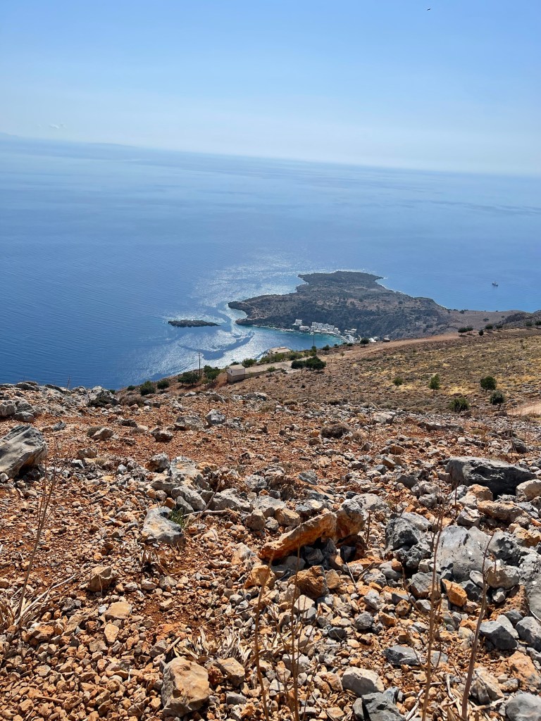
The path had come out just above a road which finished at a dead end so no choice but to turn left and start walking down hill. After a while red arrows indicated I should drop down to the right through a gate and I followed the path between buildings and gardens down to the main square. Luckily here I found a taverna- had some delightful homemade lemonade and courgette balls and got a fresh supply of water plus ice cubes and of course used the facilities.

Whilst coming up the mountain I had wondered where the track / road went to and whilst I was waiting for my food I decided to check the book as I was now on a completely different walk. It suggested that I could have carried on along the track and come out and got to the village that way, instead of my scale a mountain route! So I decided that would be the way I would return- climbing back up to the col to go down the other side had little appeal!
Well slightly easier said than done, checked out at the Taverna and it was suggested just keep on until after the end of the village. Well it was an extremely long spread out straggly village. Checked again in a ‘honey’ shop and mix of poor English and lack of local knowledge proved no help. Next somebody mending their roof, again assured me to go on until after the last house. Well I thought I’d fond the last house twice and had to turn back, must have added on an extra mile at least. Lots of dog barking- Elaine had warned me about this. Eventually I found what had to be the correct road.
When I talked to Elaine that evening it turns out she only just got into this far end of the village as she’d followed the track up rather than my rock scrambling route. Having told her companion she’d only been gone a while she had turned back .
This track was long and rough and to my right I could see the mountain I’d scaled and the col. what I hoped to see know was a white water tank – which did eventually come into view. I knew then that the road would double back shortly and I would have to drop down off of it and find my descent.

I’d noted that the path led of by a goat pen which luckily I found quite easily. I knew I had a long way to go down but that I just had to pace myself and be careful as the later in the afternoon there might be less people around. Down and down and THEN I saw the illusive path that none of us could find. A red x on a rock but from above an arrow pointing off to the right which was not at all visible from the other direction. How annoying!
Just below this I met the German man again this time with his wife on an early evening stroll. I told him about my not finding the path and where I had been but that I had just spotted it. I explained that to me a redX would mean no path but obviously not in this case!
Felt a little uneasy that the sun was beginning to fade and I was still a long way up. Continued to be careful but steady and got back to my hotel at 6.30.

Almost immediately met one of the group who said they were meeting at 7 did I want to join them. Quick shower and change and managed 7.10 feeling very dizzy when I bent over to take off my boots. Not sure what that was!
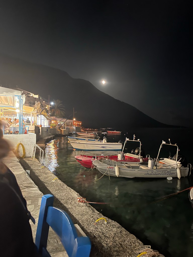
A 16.5 km walk which seemed much longer! But a good restaurant view to finish the day! A beer seemed to cure the dizziness!