Not having done any proper walks since Devon I was a little disappointed when I woke up on this Wednesday morning and it was so dismal. Down in Surrey/ Sussex again – this has become a favourite place to walk in the last year. Raining and poor visibility so I decided to stall and hope it would clear a bit which it did. Planning my route for the day I decided I didn’t want to drive and felt determined to walk from where I was staying in a different part of Haslemere.
My Airbnb was at the top of a very steep hill, one of those that you almost feel cautious walking down! I’d decided to stick to my side of town, include Blackdown – the highest point in Sussex and find a circular route of a decent length – this turned out to be about 15 miles.

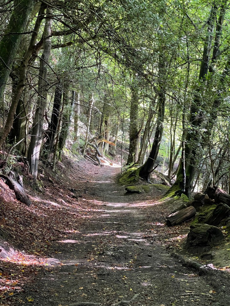
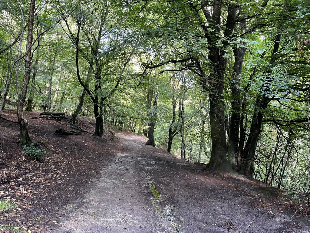
So having come down the hill I was near the town hall, which splits the traffic and I started walking along Petworth Road. After a short distance a narrow path appeared on my right and this was the start – up hill of course. How could I expect anything different from this part of the world! The enclosed path ran between two high hedges with the ends of gardens on one side and a school on the other. Across a road and then down a steep hill, loosing all the height I’d just gained! More rural almost immediately though. Not long before I’m on a short section of the Sussex Border Path and a familiar feel of tunnelled walkways!


My path takes me southward, parallel to the road towards Midhurst that I have driven along many times and twists and turns a little around the edge of the hill. It feels so good to be back out amongst these wonderful trees and surroundings and not a spot of rain and walking in a tee shirt again!
My route turns to the east and I’m climbing a little but know I’ll probably have to descend again before I start to climb up Black Down. The light within the trees and on the water does have quite a restorative quality.

I do always wonder who has walked this way before and for what purpose? I have to cross Ferndean Lane and hesitate to eat something and then whilst checking the map as the ‘directly opposite’ path isn’t that obvious something fell out off a tree onto the top of my head – ouch, not sure what it was! The gradual climb up has started.
Some of these paths must have been created a long time ago and include walls as part of their structure.

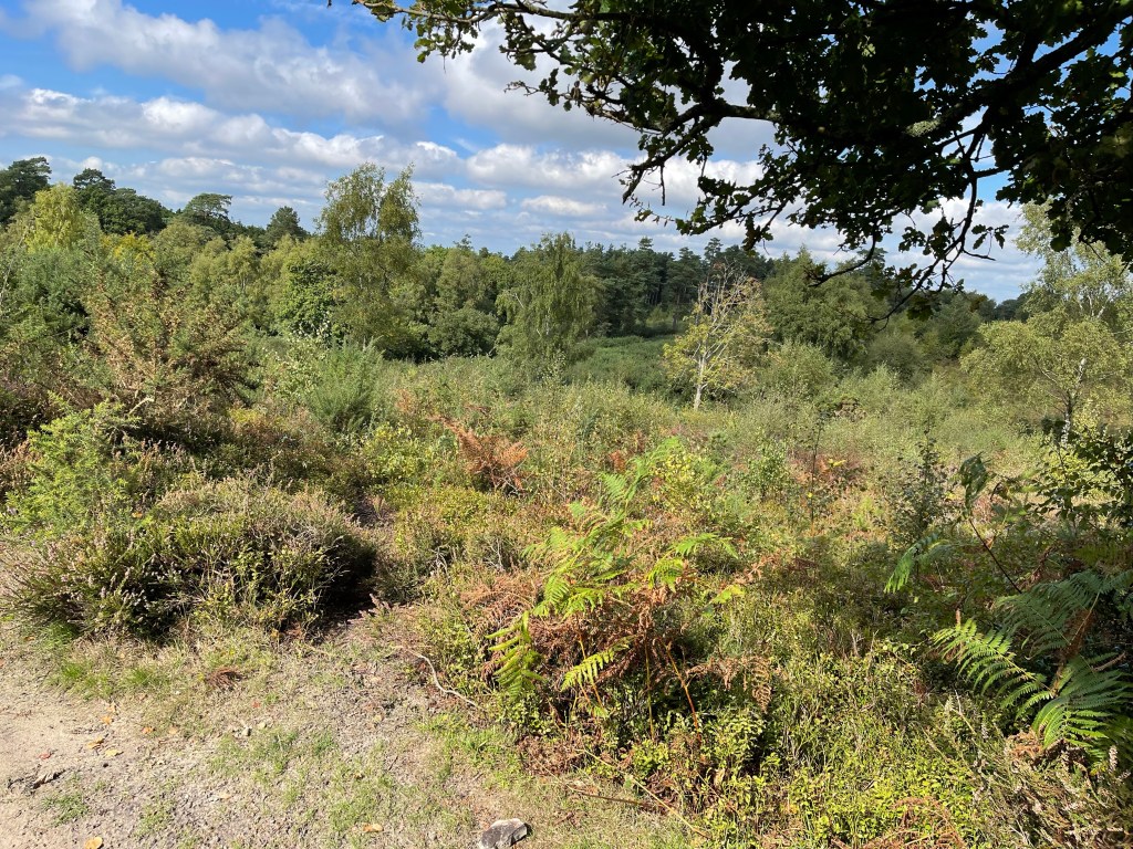
Not long and the surroundings begin to change and I’m now in heathland and the pathways have become more sandy and the ferns are a vibrant green having responded to the heavy rain the previous week and heather is joining the equation of plants.

As I cut diagonally up the side of Blackdown I’m back on the Sussex Border Path which then turns into the Serpent Trail- anyway I’m on the path I hoped to follow!
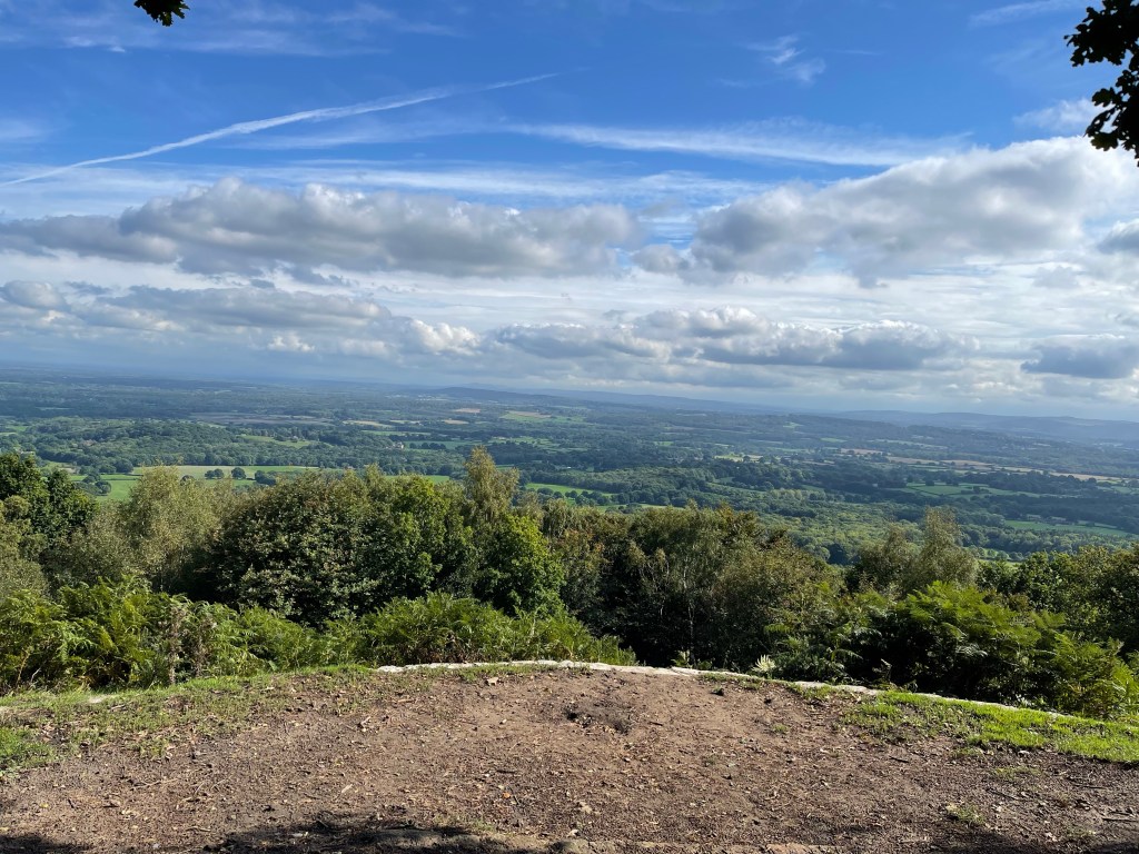
Quite surprised to see cattle- Belted Galloway again, I guess because they are so hardy on this type of land. The views out are great and I can scan the South Downs – hopefully will walk their length next year. Not long until I reach my first main goal.


I reach the Temple of the Winds and stop to look out again absorbing how little evidence of habitation there is, although there must be a little. I have been walking east south east and now I will go back up this massive, east north east, there are so many paths but I want to be quite exact on this occasion. Not sure if I start on the SBP or the ST !
My path takes me along the side of the hill , gradually sloping down but not dramatically. however there is quite a drop to the side! A bird of prey flies then perched at the top of a dead tree and then flies again. Not quite sure what it is?

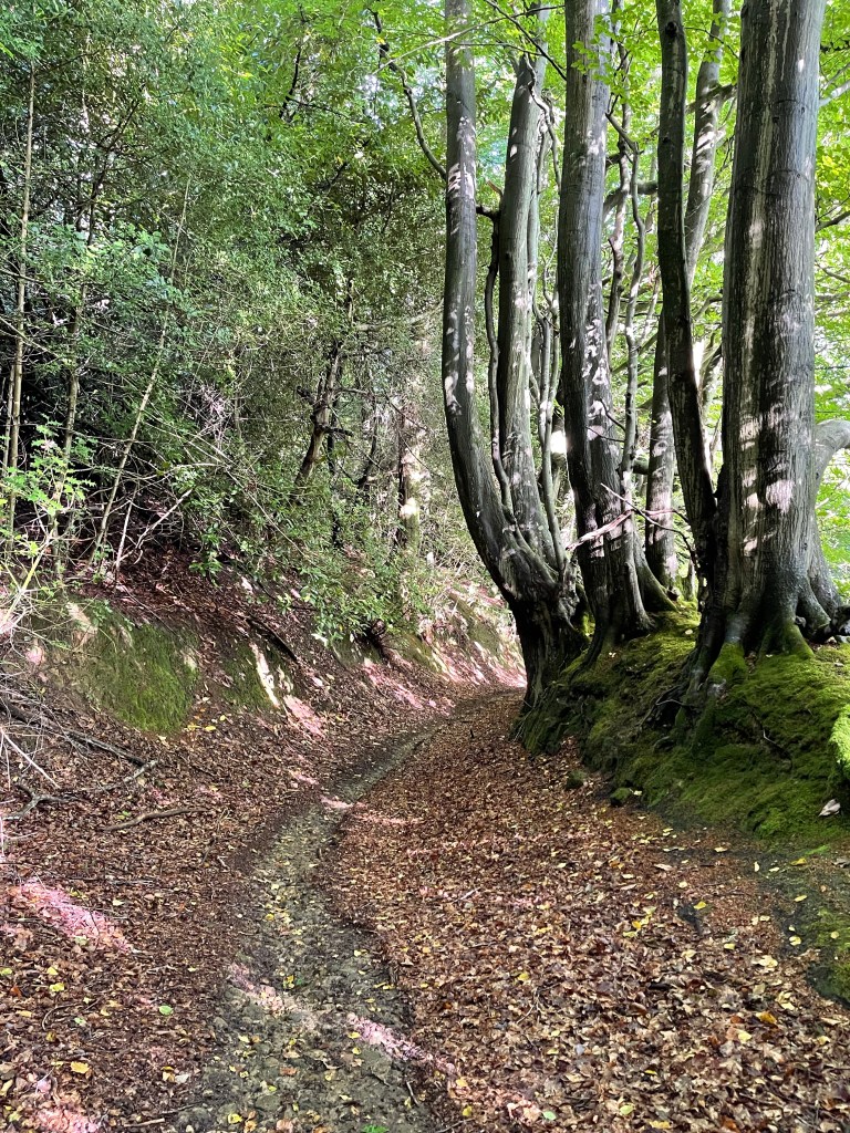
I head down towards Roundhurst Common and then spend a short distance on a road. There are many times when I could take a quick route back to Haslemere but that isn’t my goal. On this side of the hill I begin to notice a new phenomenon. Many of the paths are covered with leaves- mostly from the previous year but along many there is a clear Chanel in the middle almost as if someone has cleared a path! I can only imagine that this is to do with the torrential rain that fell and that natural run offs were created.

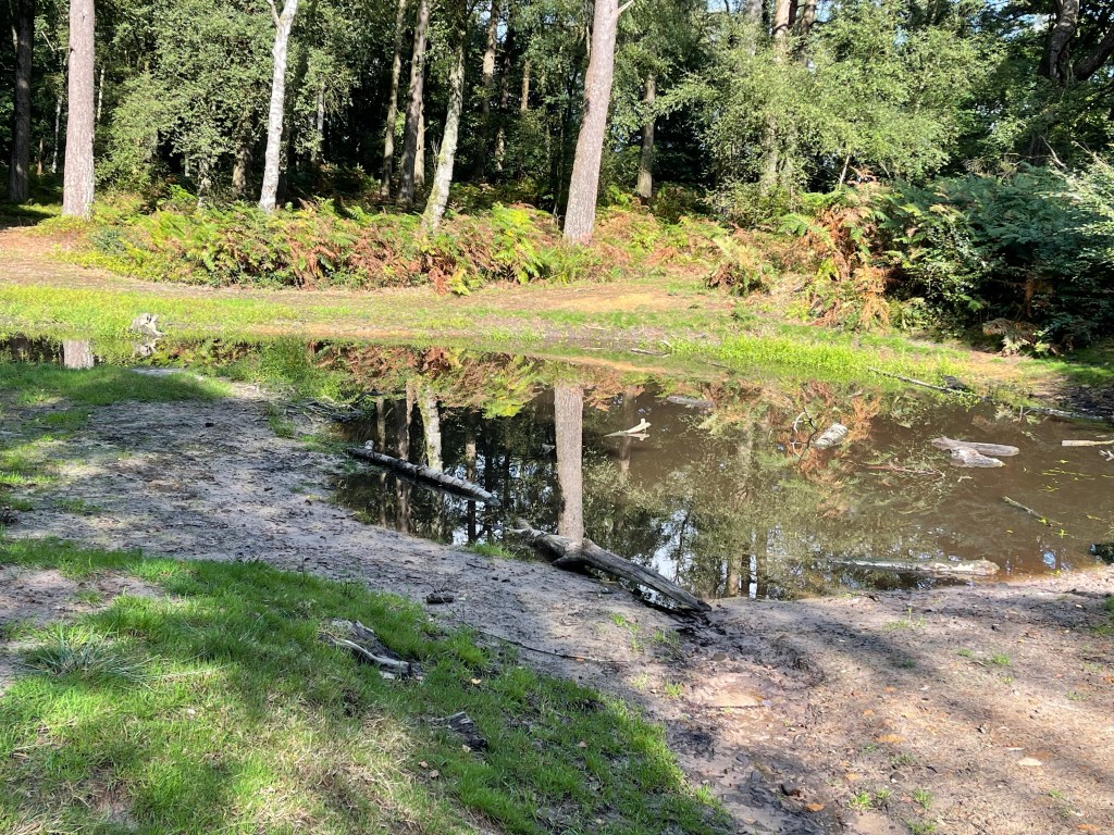
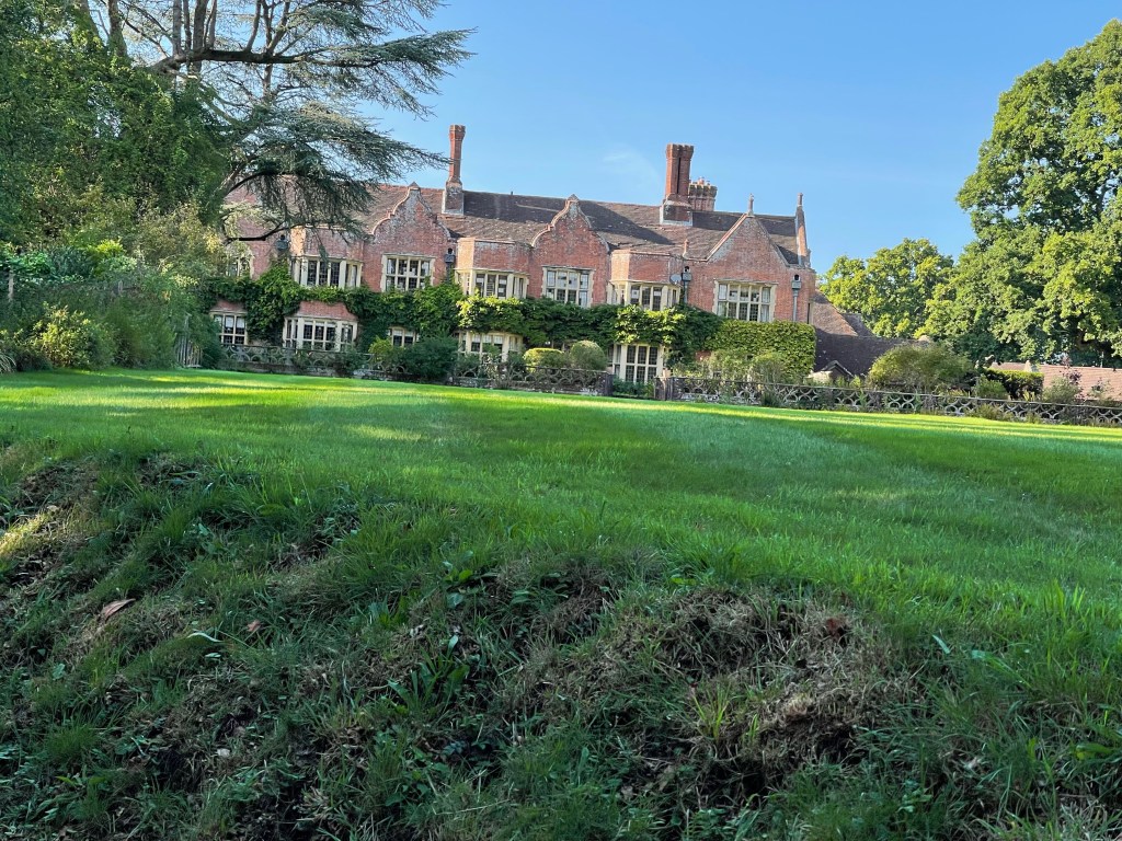
I am beginning to turn northward but instead of continuing I go further east and then turn north again – having got out here no chance of turning back quickly. Following my own route so I can change it at will if I wished to! There are several Pond Bays marked on the map and along with the name ‘Furnace Place’ I conclude that this was another area used for iron smelting as with North Furnace near to Fernhurst. Unfortunately nothing left to see around here – or nothing obvious I should say! The house is quite impressive though!
A little further and the path makes a sharp turn back towards my destination. Ponds on both sides as I turn but nothing unusual spotted. A straight forward route with a stream meandering on my right. Through fields and crossing small streams. As I approached the town far more dog walkers. Just before the last stretch I came across an area where the National Trust had built a traditional wooden barn like building as a training centre. The last section was around the allotments and then down a lane, and only just as I arrived at the main road did you once again feel that you were in the town.
Just the last bit up the hill to my accommodation! A good walk though, much enjoyed.
