So back on a bus! This time to Dartmouth, again somewhere I’d visited before, most frequently on damp non beach days! Visited last year when Franky had to rush off from our family holiday as her dad was seriously ill. That time we visited the castle and managed a short walk, number 24.5!
A bit different arriving on the bus and as it terminated I was thrust into a swell of people walking along the sea/ well estuary front. A rather overwhelming sense of busyness. My plan for the day was to walk back to Tor Cross where I had started yesterday. I was alone again as Alex had decided to go to the after wedding beach party. He was catching a bus to Salcombe and then running the route we had walked on Friday (Walk7/7a) and then on past Hope to Bantham – not my idea of fun!

Again the map first to help make more sense of the route, this was almost all new apart from some very short stretches completed last year so quite exciting. Added pressure of having to catch a bus at the end but hopeful that my timings would work out.

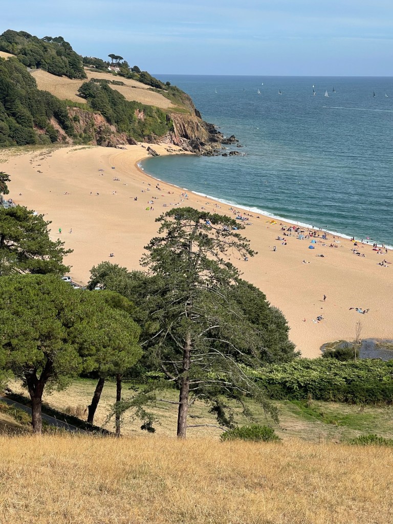
So first of all through the town feeling slightly incongruous with my walking boots and rucksack – not quite in visitor mode. The route mostly on road to begin with turns as it passes the hamlet / area called Warfleet with it’s small harbour and industrial looking buildings. The road then turns towards the castle where the official costal path runs through the church yard of St Petrox. Going through the courtyard where people gather to enter the castle and up steep steps to climb back up the hill as the coast is rounded. A sweep round the bottom of fields with steps down to some coves gives a different feel from yesterdays walk. This continues for a while and then a steep climb up before turning and continuing round the coast line. Good views out across Dartmouth Bay. Even as far round as Start Point and the lighthouse.


There are a few more people around on this section of coast and I realise there is a parking area not that far away. Before turning inland to that area, which is where the route takes me I decide I really must stop for refreshment. A bit of lucky timing as a couple started getting up from a bench just as I arrive and we swap places! There is obviously a regatta out in the bay. I often wonder how many near misses there are when sailing so close to each other!

The path cuts in land for about half a kilometre and then at the parking turns left onto a road. There is quite a section next along road and that bit further inland. The land is so undulating at this point, not rocky as in some of the outcrops yesterday but huge rounded fields which dip to steep valleys. The road takes quite a turn as it hits the head of one of these gorges then continues towards Stoke Fleming. This is a narrow village approach by a winding steep road with cars everywhere, this had been a challenge for the bus driver a few hours earlier! The route cut through the village luckily away from the chaos of the main road and then steeply down to meet the coast again just before Blackpool Sands.
On the map the path appeared to go along the busy main road but fortunately a path had been created just on the coast side of the road and protected by a hedge. As you approach this area it is easy to see the busyness and more commercial element of this beach with parking and cafes and fortuitously, toilets! Having used the only facilities I required I remembered why we didn’t ever come here but frequented beaches less easily reached, as seen yesterday! And also it’s small pebbles and not sand!!!
A tiny bit along the road before the path branches off across the road and into a field. Rather taken by this array of cottages!

The next section was a really steep climb up one of these large rounded hill sides. Good views though and one used in lots of commercial adverts for the area, always wondered where they had taken the view from and now I knew. Wonder if they planned it or needed to stop and breath and just turned round fortuitously as I did!

Bit of a navigational error in this field. Having been very glad to reach the top and pleased with the view I followed the path rather than looking more closely at the map! In the second field, it had levelled out I was met with a gate into the lane where I thought I wanted to be but it had an over generous amount of curled barbed wire along it’s top. No other apparent way out so I looked more closely and realised I had been led astray by a very well defined path, guess I wasn’t the first, back tracked and found a stile somewhat hidden in the hedge and nearer the top of the first field! Over and along a lane, turn right and just about opposite the offending gate my path led off across more fields!
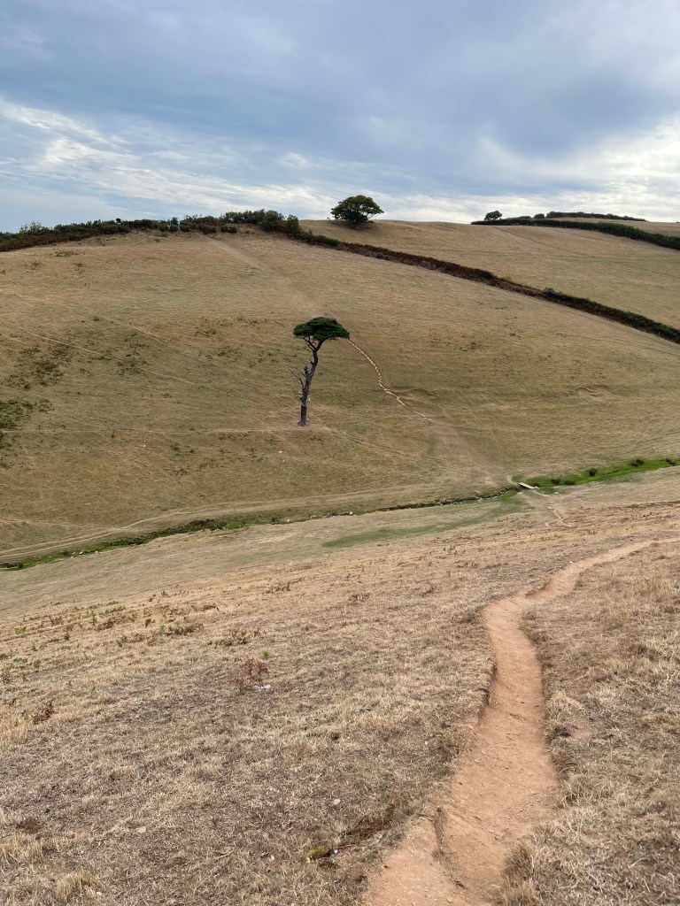
Again I’m further away from the edge of the sea than I was yesterday and I have to once more dip down to the main road. Well the next section was interesting- I’d seen this distinct path from the road which went very steeply down and then immediately up the other side of a V and I did wonder. My thoughts confirmed as the finger post pointed the way. I met a family who had just reached the top by me and we exchanged a few views on the extremity of the path. And I set off, this photo doesn’t really show the steepness!
There were several paths cris crossing this area and people obviously coming up from days at a beach – I really wasn’t sure which one but….
The path continued round the top of a hill and then into a track coming to the edge of the village of Strete. I met the same family again and they acknowledged me, they had walked the flatter way by the edge of the main road. This time the path was along the road until at last it turned left towards the coast dropping down hill and through trees until it reached the top of the cliffs above the northern part of the long stretch of Slapton Sands. I had realised a little before that whilst I wouldn’t be in time to catch the penultimate bus of the day, I was in good time for the last bus- a relaxing thought!
The path emerged by the car park for Strete Gate and I was at last close to beach and sea. I was somewhat amused to see a notice requesting naturists should wear clothing when using the parking, toilets or other facilities. ‘There is space for everyone’ it continued. So apparently if I had turned left on the beach this is what I would have found. Rather reminded me of the time Alex and I went for a walk near Sandbanks, Swanage area and I ended up with a bit of explaining to do!!
I decided my best course of action at this point was an ice cream and a cup of tea. Luckily there was a bit of a wait for the drinks which gave me time to eat my treat for the day.
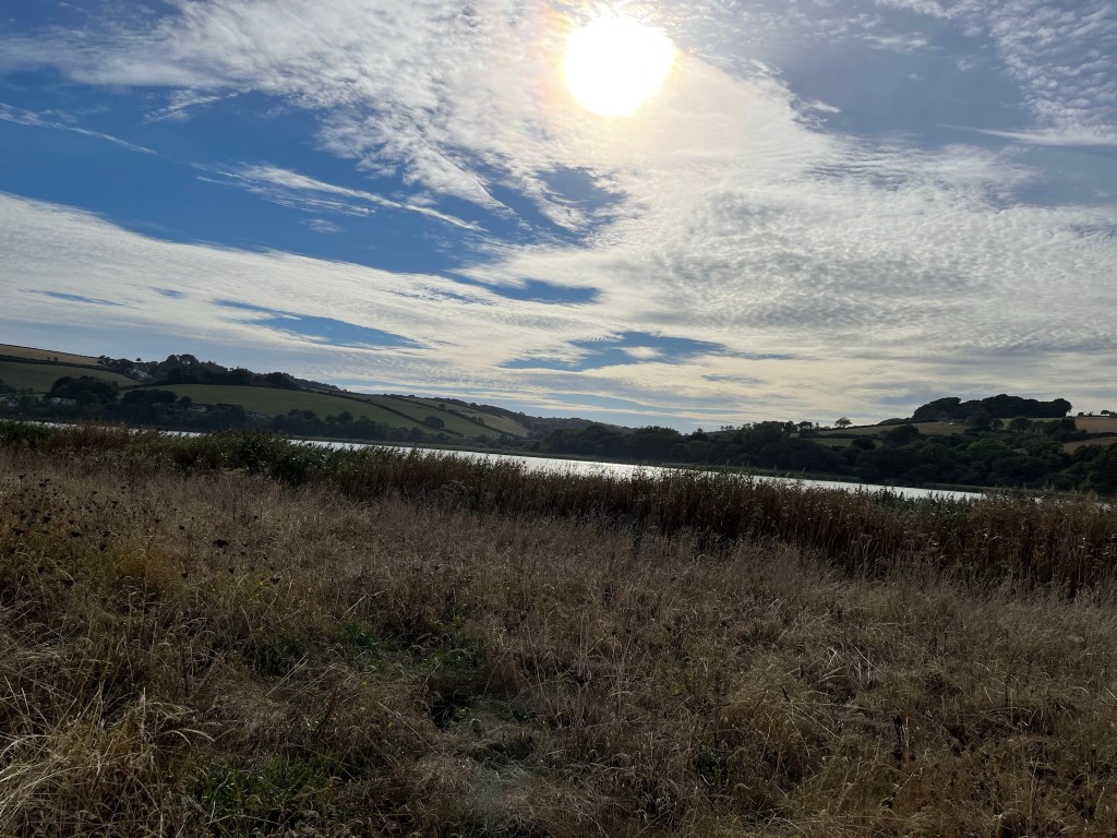
This is a strange area as there is a really long stretch of pebbly sand rising quite steeply up from the sea, then the road and the coastal path ran parallel to this but next to Slapton Leys, a large stretch of inland water and a nature reserve. Quite a good place to walk but quite Sandy. Good sky though.
Probably about 3.5 kilometres to go and my tea lasted some of the way. Towards the end , by a memorial tank, yes tank – reference to D-Day , the path crossed and it was possible to walk by the sea wall in Tor Cross – a narrow hamlet pressed against the sea, squashed in by the road. Several houses for sale which was a bit worrying and so to the bus stop with some time to spare. However when it was about 10 minutes late I was beginning to wonder if my power of being able to read timetables had failed me!!
Another good days walking, very different but definitely worth doing. Just under 23 km and an interestingly different profile from the day before !

