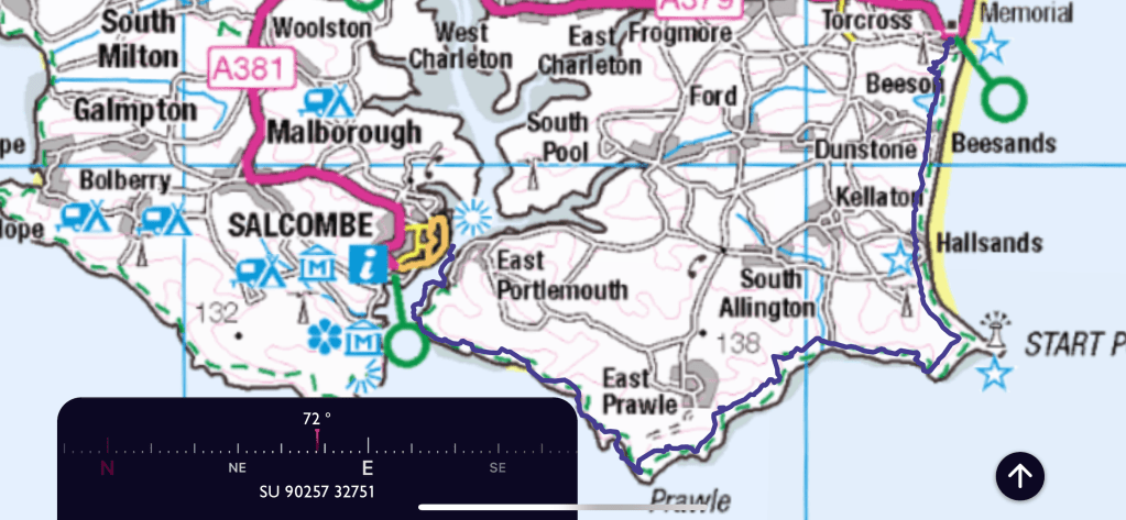
A day on my own today and planning to do quite an epic walk. Much looking at bus timetables to help work out the direction of travel and timings of the last ferry as well. It will be a coastal walk again and although I have done a few stretches along this part of the south west coast path, I have never contemplated this whole stretch before. Again the map at the beginning to see the route .
So having got off the bus at Tor Cross there is a steep climb up to start my walk. Steps and then a steep path, quickly there is a view over Tor Bay
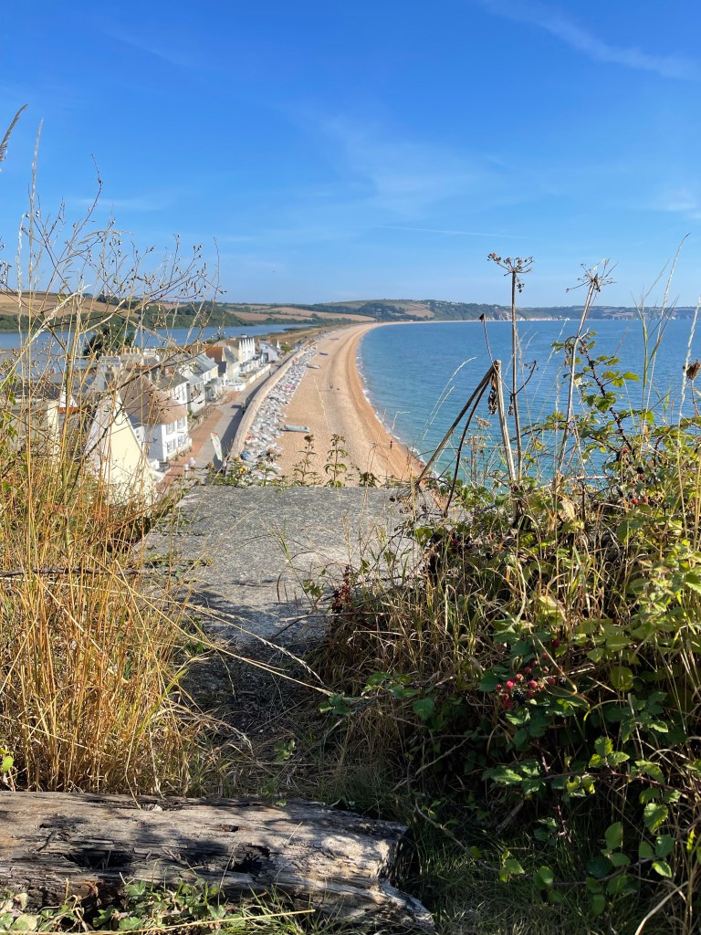
Not a stretch of beach I have ever felt very comfortable about- it is where they practised the D-Day landings and not all those taking part survived the experience. The path moves away from the cliff edge and goes inland around a quarry area but it is then possible to look ahead and see the start of Beesands and an inland water area called Widdicombe Ley. Again not a beach area I have ever used, but I am pleased to find public toilets – well timed, when I do get down to the beach.

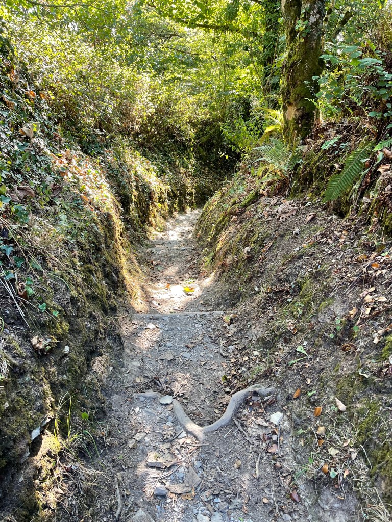
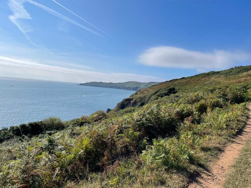
Before I drop down to the beach I can just see the lighthouse at Start Point which is the peninsula in the distance as the coast curves round. The way down to Beesands is along a wonderful holloway and I contemplate how many have passed this way before. Fisherman perhaps taking catches to Tor Cross – I wonder?
The sight of Start Point feels good as it is my first pointer of progress along this quite long route – still a way off but with the familiar air of somewhere visited before.
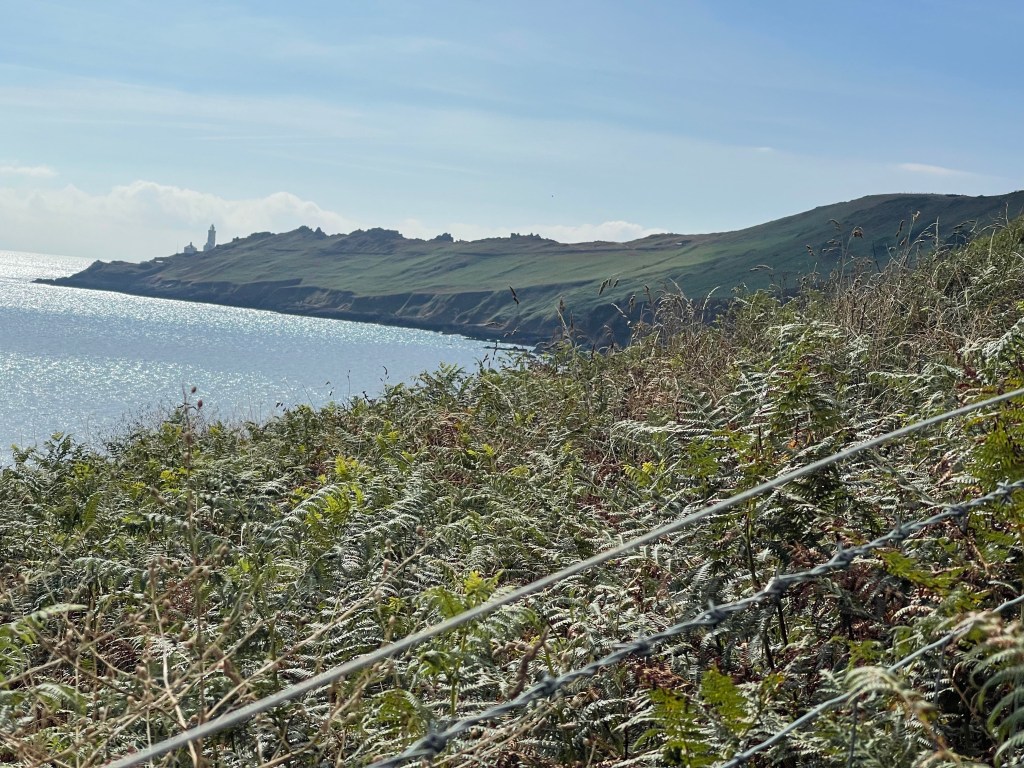
The path has stayed close to the edge as it goes towards Hall sands as I climb up some steps I’m met by a group of young people coming down who are obviously doing a D of E expedition. Three boys and one girl, she enquires if she can ask me some questions- they have to interview four / five people during their trip , I oblige, I continue, beginning to move upwards through the vegetation and knowing that it must reach the car park before the lighthouse. Really strange to approach somewhere on foot that I’ve been to many times by car!

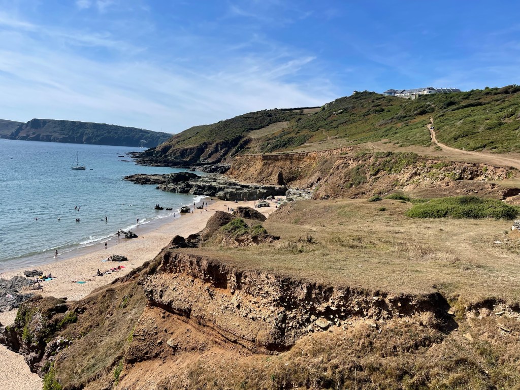
This car park serves two major purposes – for those wishing to see the lighthouse and for those wanting to follow the path down to great Mattiscombe Sands which is perhaps just over a kilometre away. This is familiar territory and that’s a great feeling. We often used to walk down to the beach on one of our holiday days and if I got my way, which didn’t always happen we would walk back along the cliff path, which is the way I’m now about to go. I did persuade my children and their partners to go this way to the beach last year! The path sets off from the car park down the road to the lighthouse and is lined with a substantial wall on the sea side, probably useful as there is an extensive drop! A good place to look back and see how far I’d come and check on whether my pace was appropriate.

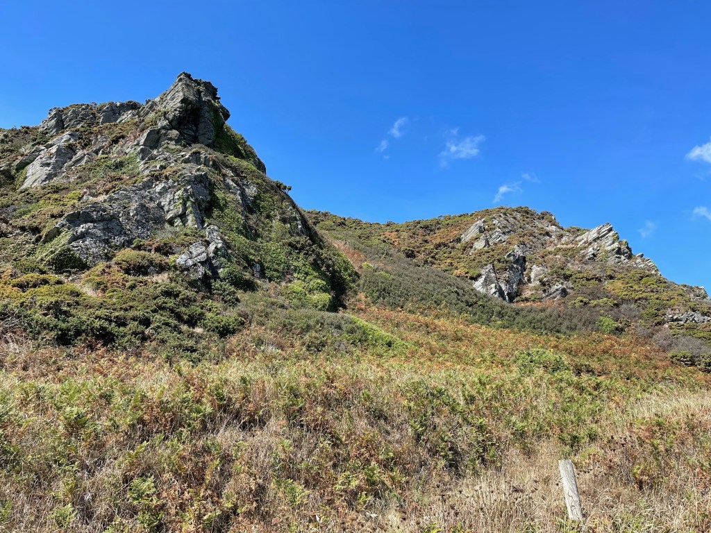
Quite quickly the path cuts diagonally away from the road and then goes steeply downward- a little unnerving as not much grip and a large expanse of nothingness in front of you – quite quickly it turns a little to the right and feels much more comfortable! This path, narrow in places and teetering along the land edge has wonderful views of rocky outcrops. I stop to photograph one of these and remember Jack clambering across to explore and also watching seals. I think I can see one out on the rocks but is this wishful thinking?

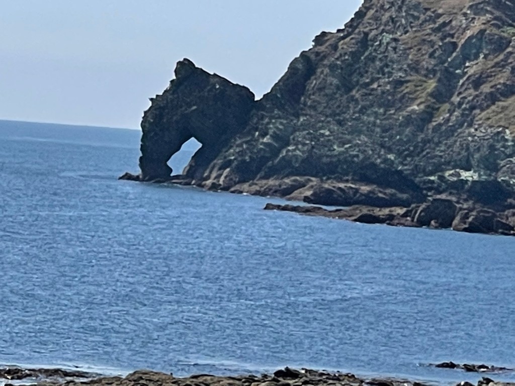
When the tide is right out there are sandy stretches between the rocks and deep rock pools to explore. I continue on round and one of my favourite beaches comes into view. I always enjoyed coming here when the children were younger, no distractions of ice creams or commercialism just sea, sand and a few rocks to explore. Many happy hours. I have decided that this will be my first stopping place for a snack and as the path bends round and splits in two I inadvertently take the upper path and have to double back to reach the wooden seat overlooking the beach. People already enjoying it and others about to start the steep climb down from the car park path.

I’ve walked bits of the next section before but only usually in short stretches. The path keeps close to the edge but is often quite shrubby and then around the edge of fields. It crosses little streams which are much drier than normal. And the next significant point is Lannacombe Beach, another delightful spot but with narrow roads leading down and minimal car parking only a good choice if you could set off early and the tides were in your favour!
From Lannacombe the path winds slightly up hill around the side of one hill before dipping into a small valley and then contouring round a much rockier outcrop- Woodcombe point. Here the path turns almost to a scramble in places and rather than the even tracks found for the last stretch this is somewhere where more concentration is needed.
Just before I started clambering I had met a family that obviously weren’t quite sure where they were but I was able to help and they decided it was probably time to turn back!
The scenery along this stretch is varied and again becomes reasonable walking. There are quite a few people out and about and it is one of those walks where you leapfrog certain people as you stop at different times. There is an older man , French I think from his accent, who I have seen a couple of times. The next significant point will be Prawle Point as it is there that I change direction.
This part of the path has a few more people, there is some parking to the south of East Prawle village. This is a village that is always busy with a pub which overflows with people who often spill onto the village green. The Pig’s Nose can be recommended.
As I get closer to the point and the coastguard cottages I am enjoying the play of colours and shapes contrasting the rocks and the cropped fields. People going down to a beach – not really sure there was one down here! Thought once it would be good to stay in the coastguard cottages but it never happened. There is a look out post on Prawle Point – had hoped there might be a loo amongst the few scattered buildings but, no!


Having rounded the corner I spotted something unusual, a very big yacht moored off of Elender Cove. As I stopped to look a runner came by and also commented, we were both surprised. He told me he was running in honour of his friend who used to organise a marathon walk from Tor Cross to Bantham, a bit further still than the previous day’s walk plus today. Unfortunately his friend had ended his life a fortnight before, jumping off of a cliff. I wished him luck.
A bit further on and with the yacht plus water shoot in fuller view and I met a lone solo female walker coming towards me. We stopped and chatted and discussed our routes – we both felt the large decadent vessel was incongruent with the surroundings. She advices me that there were some trick bits round the corner and we both went on our way. She had detoured down into Elender Cove and had had a quick swim but although very beautiful was restricted by the number of boats that had dropped anchor to take advantage of this wonderful little beach.
I met another couple above this beach area as we looked out at the yacht again. It was also towing platforms to lay on or dive off of. They clearly disapproved!!
As well as going over rocks the path contours round the edge of some steep ground- an exciting bit of coastline. The next place of familiarity will be Gara Rock beach – again a favourite. Approaching from this direction it is easy to see the track up to the hotel and car park – always a bit of a struggle at the end of the day. It used to be a really old fashioned hotel where some summers they sold ice creams, but then abandoned and now completely refurbished.
The headland from yesterday’s walk can now be seen very clearly and luckily my path up from the cliff above the beach cuts across the hill lower down. This is a section I love and have walked several times. It turns and cuts round Portlemouth Down and towards the estuary. A few rocky outcrops on this section but nothing too serious, I decide to take the coast path although there is one parallel and higher up along the edge of the downs- perhaps next time. So, past the beach far below with the sandbank at very low tide and Sunny Cove from the day before. Through woods – quite dark in there , had to remove my shades so as not to trip over any roots etc. Mill Bay car park and more importantly toilets are in sight, quite a relief. Coastal paths aren’t very good for having a ‘wild wee’! So to finish down the road to the ferry – not too long a queue and once over through Salcombe for the bus – via a ginger ice cream – well it would be wrong not to!
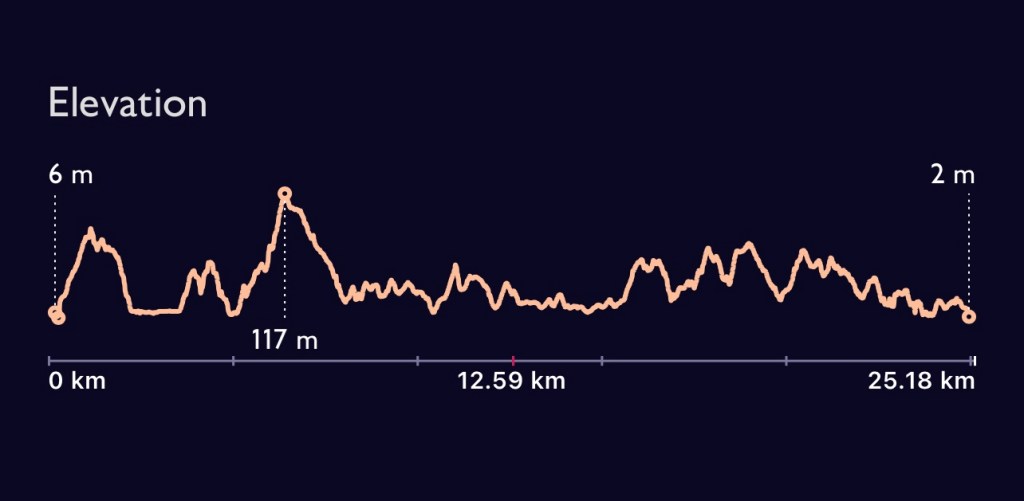
Having been worried about timings and making sure I had plenty of time before the last ferry I had plenty of time to spare and further indulged myself with a local lager at a new tap house in Kingsbridge just a couple of minutes from where I was staying and booked a table for my evening meal. A very satisfying day. I was out for 7.5 hrs walking and covered 27.53 kilometres. Perhaps the ascent / descent profile of the walk is the most revealing illustration of the terrain!