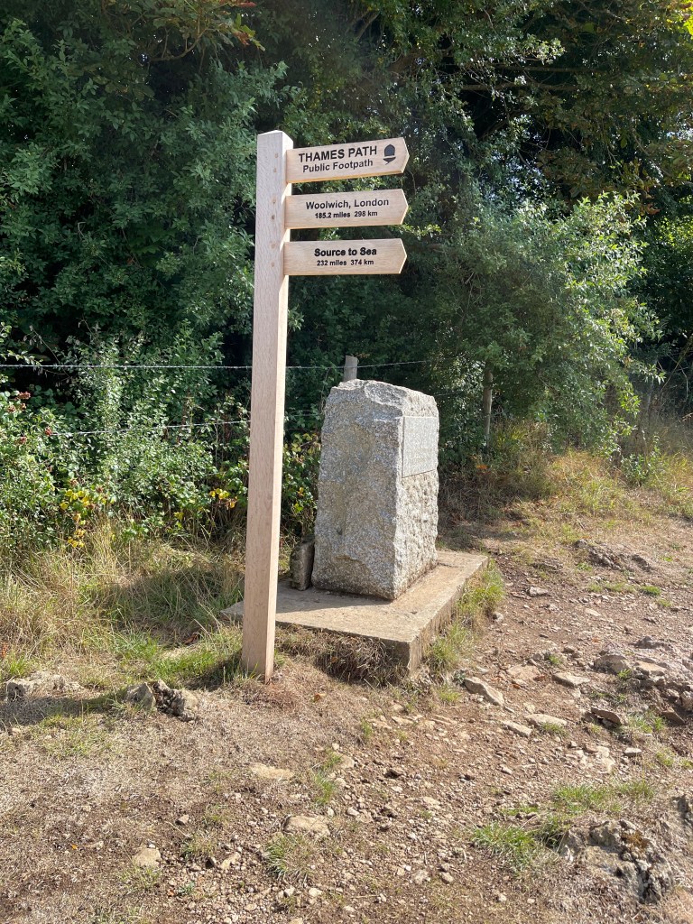
The start of a long distance path today . My proposal for the Thames Path was accepted by SPR and the plan is to complete the whole length before the end of the year. I’ve divided it up into four blocks – so this is the first day of the first block and we are setting off to find the source or the designated spot. There are only three of us as Betty our fourth person has unfortunately got Covid.
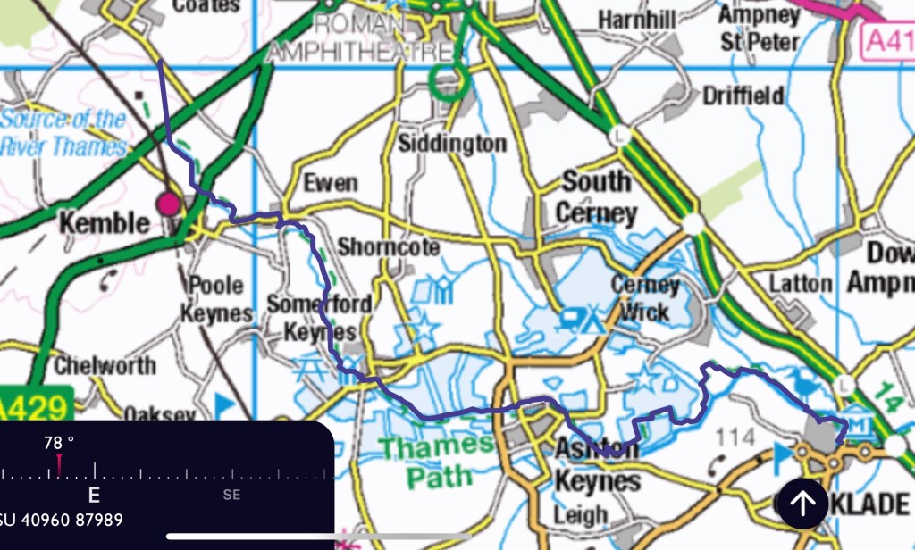
In order to approach the source without having to double back I decided to approach it from a side road off of the A433 which is actually a Roman Road out of Cirencester (Fosse Way) . To begin with we set off along the Monarch’s Way, the area of Trewsbury House is marked with two forts – intriguing. we walk alongside it and soon get to a cross roads where we turn onto the Wysis Way. Unfortunately my route didn’t record this first bit properly. Interestingly as we approach the source we are also near the route of the now disused Thames and Severn Canal, in fact during the day we will sometimes be on the Thames and Severn Way as well the Thames Path.
Great seed heads just before the source.

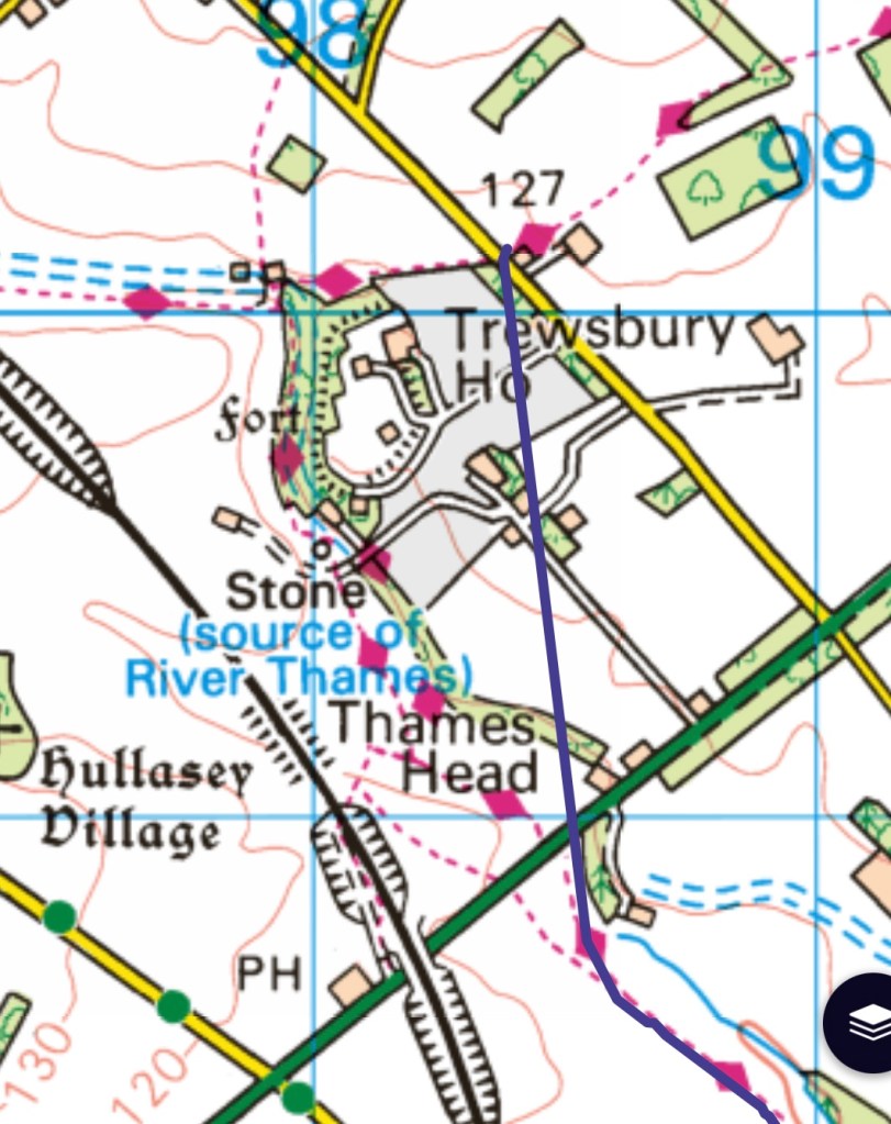
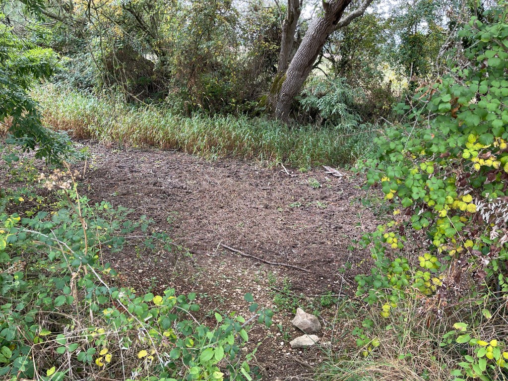
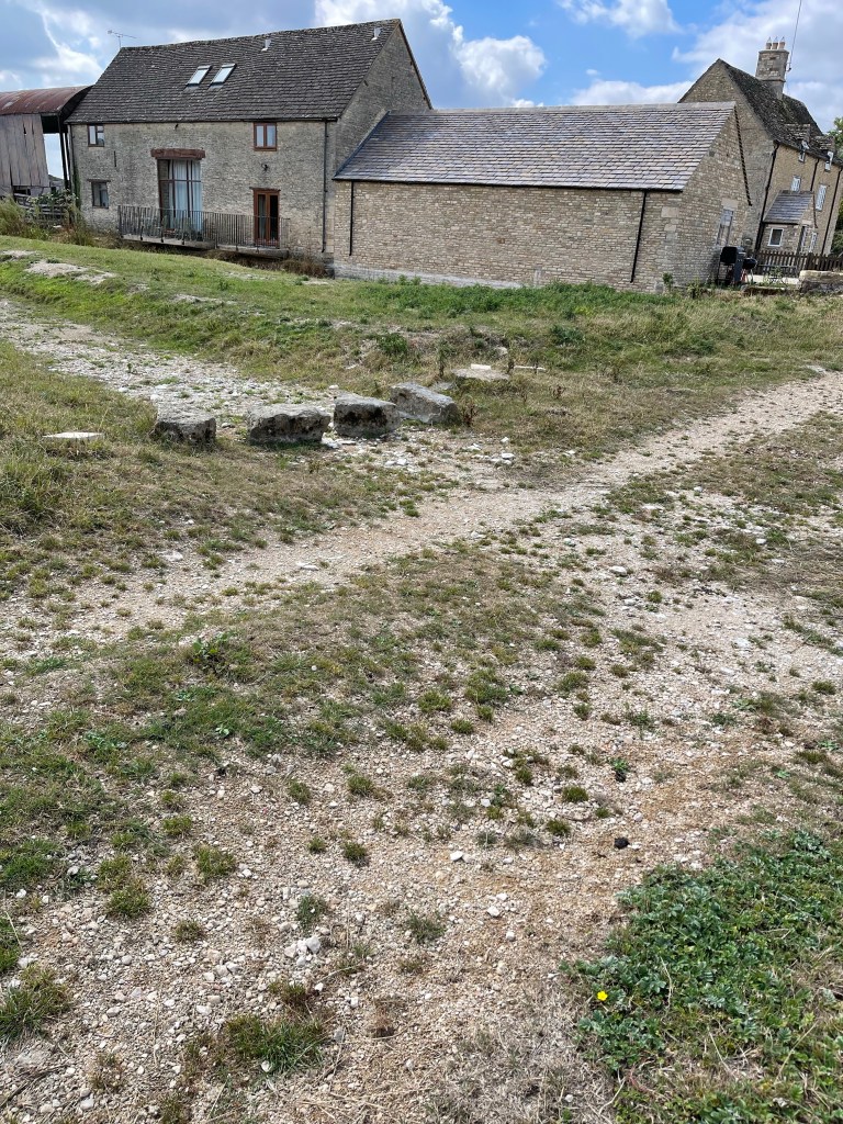
And now the source by alas no water – this was anticipated and well reported. We guessed that at some point there might have been a stream along this ditch area marked with longer grass.


We are now back to the A433 and we go across by a bridge with no water under it and then next to a stream bed which at some point must have had water.
The path really does wriggle around a fair bit and although quite well signposted a careful eye has to be kept out for the route. I also feel as leader I should be informing my companions of what to expect next or what to look out for. We haven’t exactly got a river to follow!!
A complex area with some evidence of the old canal, an existing railway line, an abandoned branch line between Cirencester and Kemble as well as the ‘pretend Thames or Isis’. Why two names? It’s ancient name was The Tamesis. Some literature suggests it can be called by either name until it is joined by the river Thame when the Isis name is dropped. Other commentaries suggest that it is the Thames to the north and south of Oxford but the Isis flows through the city!
The path runs through the village of Ewen and then changes direction completely heading towards Somerford Keynes on the edge of the Cotswold Water Park – derived mostly from filled in gravel pits. Before we reach these vast areas of water we pass Upper Mill Farm and we can see evidence of a ford and stepping stones – just one element missing! After two hours we see a puddle – very exciting- we think it’s the Thames- could be another stream but we’re hopeful.
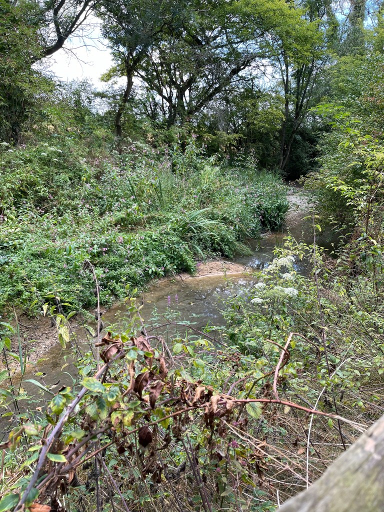
We are now in the water park although hedges screen us mostly from the lakes and there is little access. We’ve been looking for a lunch spot for a while and at Freeth’s Wood we spot a footpath crossing ours and we are hopeful for a way to sit next to a lake. No luck but we find a grassy patch for lunch and when we are nearly finished a family come along and decided to pick blackberries around us- we obviously had our invisibility cloaks on! There are some straight stretches with the bed showing clearly – very unsilted.

We spotted a few interesting trees in this area, one of which was a Whitebeam and the other with small cone like catkins -an Elm.

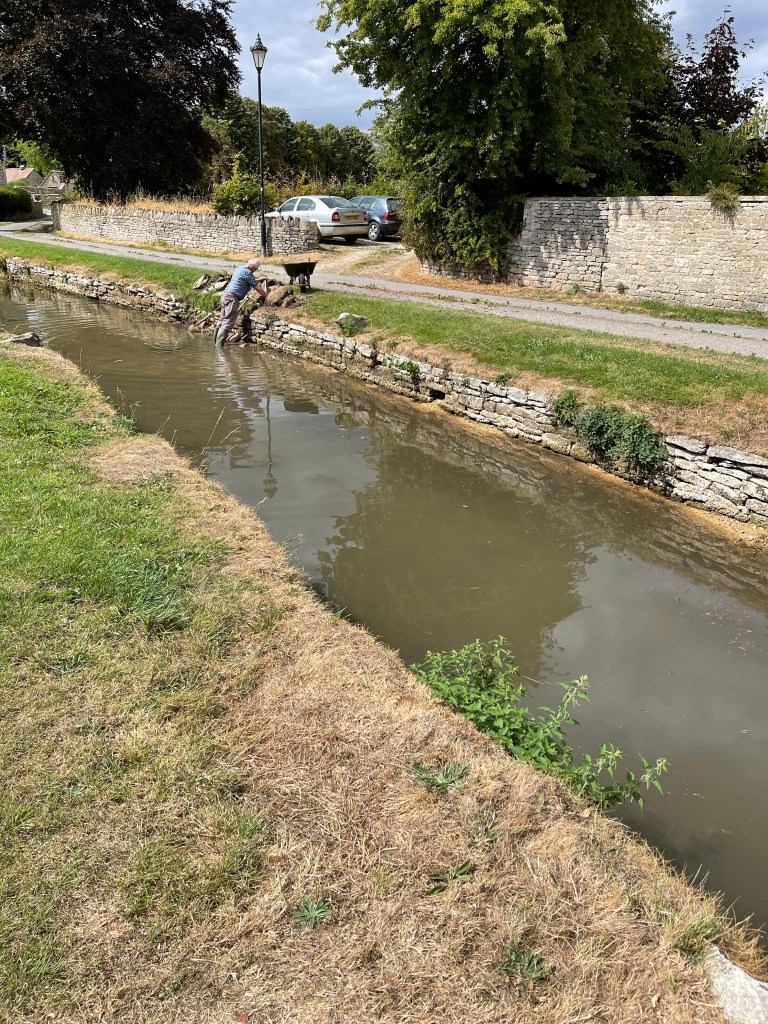
We carried on for a while longer seeing disappointingly little of the lakes until we got to Ashton Keynes , a very old and pretty village. Firstly passed an old Manor House and then on to the main village where there was water and it had been restrained between two walls as it flowed through the village. An elderly gentleman was repairing one of these walks. He indicated that there would have been a mill at the start of this area.
There were a lot of blackberries and sloes growing in the hedgerows and also just this one plant of Guilder Rose- I helped make jam from these berries during a bushcraft session at Hill End.

Having passed through the village we are back at another set of lakes, these are a bit more open and we can spot some water skying and here the chatter and laughter of children enjoying an activity. Our path takes us across some fields and away from the ‘river’, although it is possible to envisage it’s route due to the type of vegetation. We have noticed that it looks slightly more green in this area than at home.
As we get closer to Cricklade we are close again and the plant life certainly indicates the presence of water – even if it isn’t freely flowing. We also walk alongside North Meadow which is a National Nature Reserve – it is apparently the home to rate Fritillaries – that would be a splendid sight.


We approach the old town along the route of the old town walls and come in at the top of the Main Street looking out for Jane and our lift home.
Just over 22 km today but we managed to keep up a pace of 4 km per hour. Back home to return in the morning.
