This walk took place during one of the hottest parts of the summer. The plan was for a three day expedition with day 1 and 2 being separated by a wild camp on north Dartmoor, followed by a night on a campsite before walking across the southern moor.
This would have been my first time backpacking for over 40 years so in preparation I bought a lightweight one man tent, a smaller sleep mat, a small 2/3 season down sleeping bag – the one I usually use was in use, all that time ago – and it’s still good! I even bought a tiny stove and having held out against bladder water systems, I bought a 2.5 version. And of course a new 40 litre ladies fit rucksack.
So having equipped myself all that was left was to make sure I could carry this load. Having filled up the water I did an 8 kilometre circuit from home. Managed to walk quite quickly – 5 k an hour and really surprised myself. Having got a message that I need to carry at least 3.5 litres of water, I added the extra load. Packed my spare clothes, food and toothbrush! Round the circuit again and pleased that I still could keep up my pace- bit of a cheat as the second run was late afternoon and of course it was flat!
So having practised on Monday and Wednesday I planned an easy day for Thursday, knowing we were meeting up at 6 am. At about 7 pm I received a call to say that Stuart wasn’t feeling well and he was worried by the weather. Yes, I was still happy to go. At 9 pm another call, the other walker Phil had dropped out because he was worried by the weather. Needless to say I went to bed a little deflated that night. This was something I had really had to steal myself to do and now it wasn’t happening- quite a defeating feeling.
I wake the next morning feeling disheartened but not yet prepared to give up! Steve the leader had been cross about the waste of the campsite fees and I had noticed a walk planned on lDartmoor for later in the year. So decided there was no harm in sending a message suggesting a stay in the campsite on the Saturday as planned and a walk on the Sunday.
After a while got a reply suggesting a walk on Saturday and then again on Sunday. Leave at 7 am so Dartmoor was on again! Not with the full back packing kit but still plenty of water.
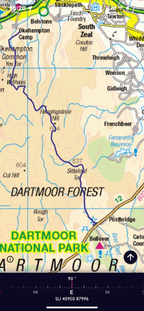
A drive to Okehampton which took longer than expected and then a turning onto the moor towards the army camp, feeling grateful that the track was going up hill. We started our walk at 11.45 setting off across a grassy track but soon joined a stony path. This is an area used for army training and as an artillery range, luckily not today. As soon as we start walking, although warm, there is a noticeable breeze so in fact very pleasant.
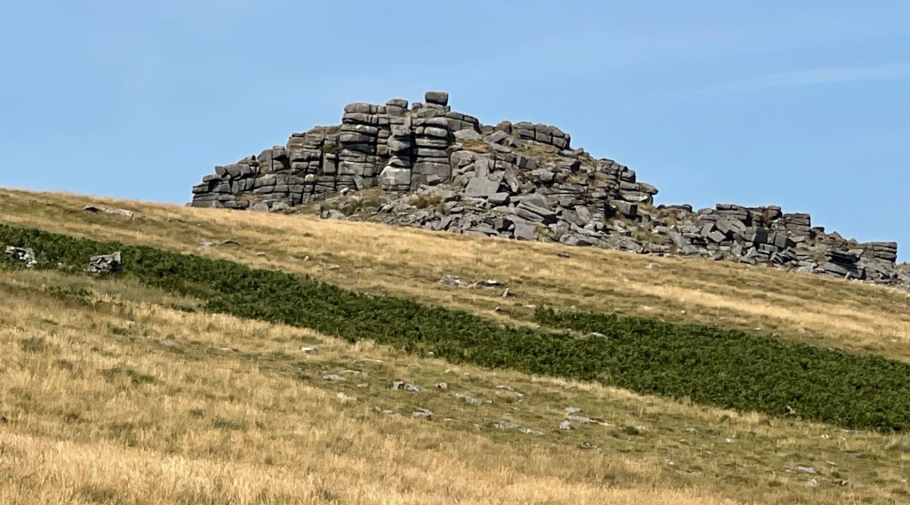
The track is going south east and then south and cuts round the side of a hill. The area is covered with rough grass and although obviously much drier than usual is not quite as dry looking as Oxfordshire. soon on our right Yes Tor strikes an interesting sculpture against the skyline.

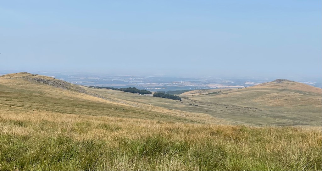
It’s great to be out and walking especially as it nearly didn’t happen but the landscape could not be described as exciting. Somewhat desolate, remote and a wide landscape. Possible to look back at Okehampton and it makes you realise that we are at quite a high elevation.
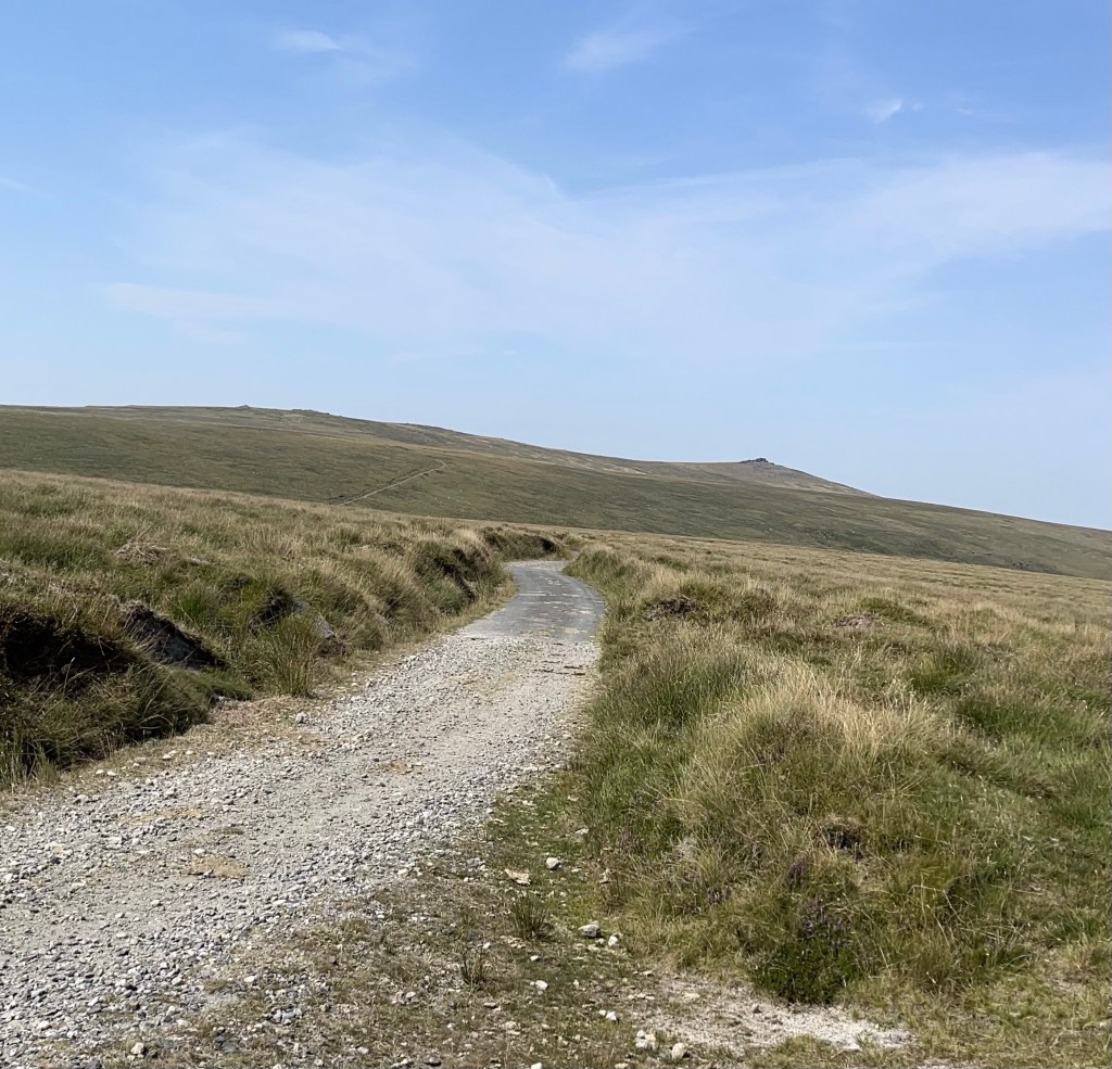

We seem to be on tracks for quite a long time, apparently I’ve been spared some of the off track navigation that I might have been treated to if this section had taken two days. At the bottom of Okement Hill I feel excited that I might have found an old structure, on further investigation I’m disappointed to find it has a horrible metal front and is some sort of army look out post!!

As we turn and go up towards Hangingstone Hill we see a van parked – strange – and it is a South West Water Van which seems very strange positioning. There’s an observation post at the top and we decided to take a break to eat. To this point we haven’t seen anybody else, then in the distance and coming towards us a group of five – we are looking out over an area called Cranmer Pool – often very wet apparently. They have been measuring the water content of the Peat and had also done that the day before elsewhere. I guess if that gets too low it has an effect on all the streams that run off from the moor – well it explained the van!
This is roughly the area where we would have camped, not quite as tufted as in some parts. We are nearly at the edge of the artillery range and this border is marked with posts. We have a wood to the east and we are navigating SSE, crossing through a ‘Peat Pass’ and down towards Little Varracombe. A bit of pacing needed. I have walls marked on my 1:25,000 map which Steve doesn’t have on his 1:50,000 – this causes some discussion. I feel we should aim for a wall junction under Sittaford Tor and after a bit of stream crossing – yes there is some water we reach the goal.
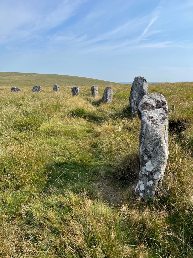
Between ourselves and the wood is a path which heads due south for several kilometres. No point in going backwards to find the start of this path – if it in fact exists! Hoping a bearing East should take us to our path , marked as a bridleway. A great surprise ‘The Grey Wethers Stone Circles’, restored but still exciting to see.

There’s a well defined path leading through the middle of the circles and this stays quite obvious for just over a kilometre, there’s a bit of a divide and we go left but then it’s decided that that’s not correct. We are going into a bit of a valley and I feel we should be on the left hand side of the valley but we are on the right. Steve decides he has found a path and I’m out voted – quite a lot of gorse creeping into the equation now! Very noticeable as the path gets narrower – I’m still not convinced but there are other people walking towards us on the same path. We cross a small stream and we are now on the side of a hill with the route of the East Dart River below us. Interestingly having tracked the route but not looked at the OS app whilst out – mostly because the sun was too bright – it shows we should have been higher up and on the other side- pleased with myself that I haven’t completely lost my ability to read the map and the landscape!

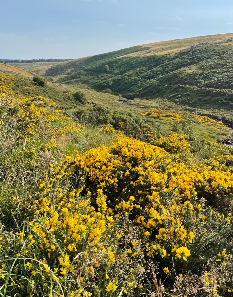
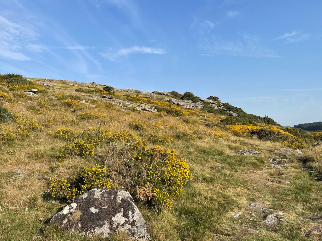
The plants are changing and we now have Heather as well as the vibrant gorse. The purple and yellow as complimentary colour look both overly vibrant but also comfortable together.

The path passes Hartland Tor before it opens out into a conventional looking field as we come down to Postbridge. This has been a great days walking and never too hot – the other two missed out! Finishing at 18.20, so out for six and a half hours – not bad seeing we had driven down as well.


We covered 22.84 km and managed to walk at 3.5 km ph – not particularly fast but when we weren’t on the tracks some of the walking was through very rough terrain.

