The forecast for today – day 4 suggests it will clear later! Not hard rain but persistent mizzle. There are more of us today, Phil, the vicar and geography teacher is leading today and we also have Theresa and Helen. Our path couldn’t be more easily defined from our starting point, a clear grassy sweep away from the car park which continues in a straight forward way until we reach a tunnel under the A34.
Having looked at the map I know it will be a little complicated once we get on to the top an undulating area much used by farms but more particularly for racehorse training. Many well defined paths cross cross including riding routes as well as the Berkshire Circular Route. Phil has suggested that I am his back up navigator and as we get to our first major path junction he refers to me and we agree the change in direction about to come up and then luckily are backed up by good signage! This has really improved in the last few years.
Horses are seen on the gallops on the horizon but sadly there route doesn’t swing our way. We soon cross over the old railway line which once went from Didcot to Compton, Newbury and Southampton. There was even a stop at Upton – how convenient that would be. I’m reminded that very nearly 40 years ago when I back packed some of the ridgeway that we went down the bank and camped one night above Blewbury. It didn’t look very appealing in the damp today.

The path splits again and we arc in a south westerly direction, not long ago in one of my walks I had taken the other part of the fork. We are about to come to an even greater cross cross of paths and a little wooded area. Not much shelter but time for a coffee stop. Phil shares round some of a large bar of chocolate, I’ve been sharing biscuits from Madeira towards the end of each day I’ve been leading and I’ve still got some for later today. Just something to spur us on the last leg.
From here it should be straightforward down into Streatley which is another 7 kilometres. Still a bit damp and it is difficult to tell whether this is low cloud or just rain. I think it is moving with us as the time it is suppose to stop keeps extending! Quite quick along this track and not too muddy – just a bit boring after a while. The advantage of dropping down into civilisation is that there are pubs and Mirella is very keen.
We agree coffee and a loo stop at the Bull in Streatley is suitable as it is on route- good job we didn’t choose the well positioned cafe further along as it was closed! After refreshing ourselves and pulling ourselves away from a very good log fire we set off across the Thames. Streatley is in Berkshire but Goring on the other side is back in Oxfirdshire. Our path this morning has straddled and cross crossed this county boundary. The church of Streatley is close to the river and rather detached from the rest of the village. More houses are beginning to use flint as a building material in this area. The. River is wide and complicated at this point with several weirs and a lock as well as riverside pubs.


We turn down a side street parallel with the river but above it. No hope of a riverside bench for lunch at the moment. The path becomes squeezed between the river and the railway but always elevated above it. There are moorings below and areas which are almost ‘allotments’ for boat owners with summerhouses, sheds and plants! Several trains go past and the situation seems incongruous with the price of the houses and the view of the river. Still no lunch and then we spot some steps on the bank above our path and some leading down to possibly a boating club- this will do and we can see the river!

Onward and our next port of call will be South Stoke an attractive village with some very large houses and a mix of smaller dwellings – one of those villages that gives you a good community feel. It has been there since the Domesday Book given out as a manor by William the Conquerer. The Perch and Pike pub looks as if could be very inviting. I really like the patterns sometimes used in the construction of old houses- was this done by a master builder or the apprentice trying out designs?


As we come out of the village we turn to meet the river and walk along it’s banks. On the opposite bank is Moulsford and the ‘Beetle and Wedge’ pub/ hotel. Helen suddenly realised she stayed there many years ago and I reflected on the fact that we met there for several School partnership days several years ago – a good lunch I seem to remember.
What we have got with the river is mud and our walking becomes much trickier. Still a long way to go but this is slowing us down. I can hear a very faint sound of children outdoors. – possibly on a playing field and I’m aware of the private school on the opposite side from us. A bit of a rival in the past, most village primary schools can’t compete with numerous sport’s pitches!
The mud continues and an impressive bridge, actually marked as a viaduct on the map, looms up. Built to accommodate the railway built by Isambard Kingdom Brunel, between Bristol and London. There are several arches and it is a double bridge linked in between. The engineering of the bricks in the design used is something I’ve not seen before.


A lot of noise alerts us to a great number of geese on the river – really a great number! Further on a couple of swans, not in a very obliging position but a compulsory photo!


A bit further on when we are almost opposite Cholsey with Helen and Theresa chatting in the lead they take a wrong turn towards Littlestoke Manor. They are retrieved and we continue to North Stoke. It seems much further when walking in mud between the two villages than when you drive! We go through the village.
Again another memory , I’ve been here with children making clay tiles of houses and drawing. We did once see Michael Caine who has lived here. He is downsizing at the moment – we did look out but didn’t notice him. We walked through the church yard – the sundial on the side of the tower wasn’t much use today!

A wide track out from the village with a rather exclusive golf course on our right belonging to a hotel and wedding venue. Not as muddy as the river but some careful negotiating still needed. Still marked as Mongewell Study Centre on our right but now possibly a nursery was a building I once used for the former purpose. My first residential with 8 year olds and we were using tents- not as terrible as you might imagine. They actually slept quite well. This was my second school and at my first only Year 6 went away. This started me on my quest to provide opportunities for Year 3 upwards – something I successfully achieved.
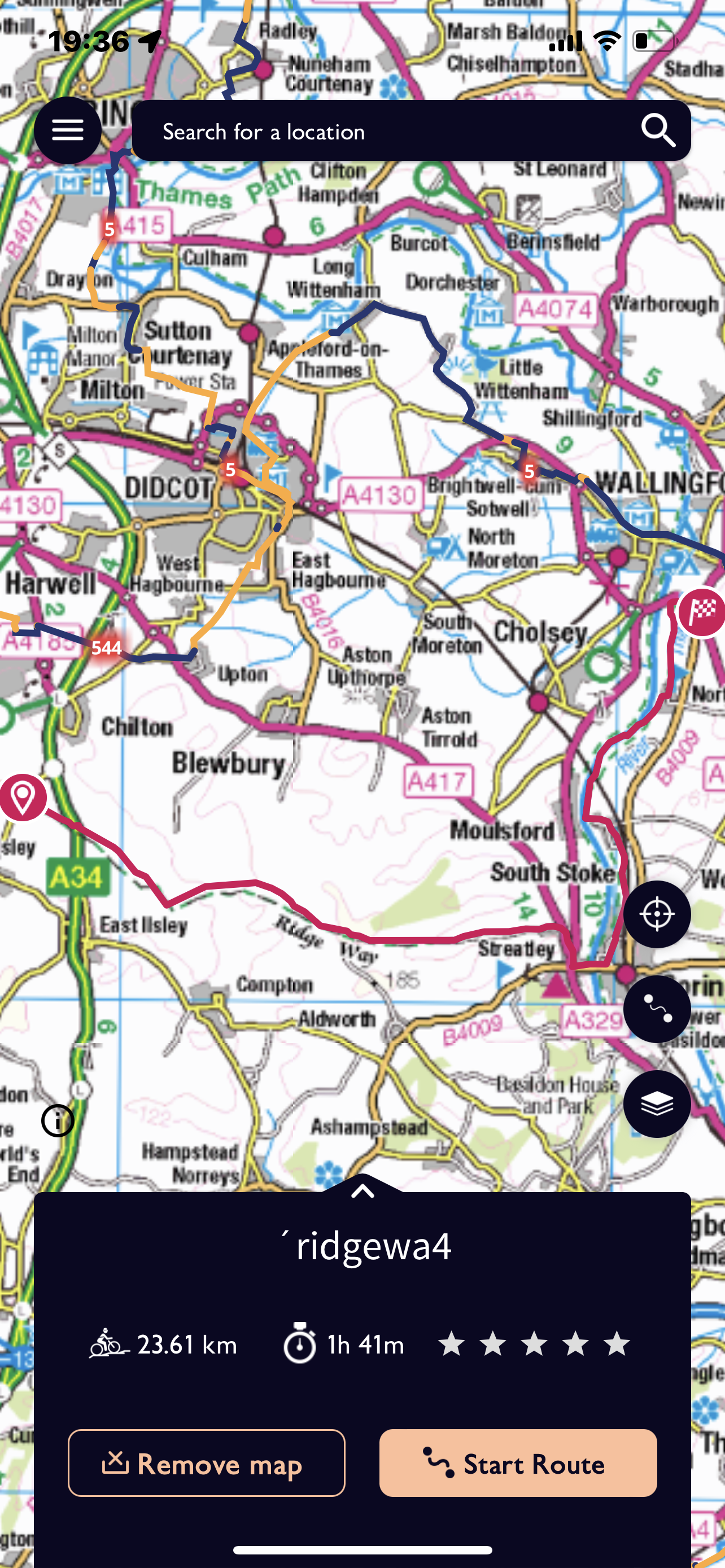
Not far to go now and we come to Mongewell Park and Carmell College – not sure if this is still used but it was a Jewish residential school. There is a tunnel under the A4130 and some deliberation where we are being met. We ring Jane and she confirms not there! Another kilometre to go through a wood parallel to the main road before we pop out onto another road and opposite our start for tomorrow. Biscuit time to keep us going the last stretch. Quite a long walk today, it did more or less stop raining eventually but definitely damp! Nearly 15 miles/ 23.61 kilometres.