A walk today by myself and closer to home. I parked in the village hall car park at Letcombe Regis but I was aiming for the neighbouring village of Letcombe Bassett. Both Norman names.
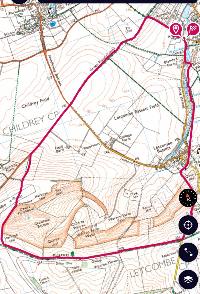
After a short distance in the village the path turns sharply left and up some steps. This area has been revitalised and there are new information boards. The path runs parallel to the road and Letcombe Brook can be seen below.


This area of the brook has many springs originating from the chalk and once was an area renowned for growing watercress. There is still some colour on the trees but many leaves are now on the ground. The path emerges in the village of Letcombe Bassett and my route goes towards the church.


Ledecumbe”, comes from the “lede in the combe” or “the brook in the valley”, referring to the Letcombe Brook, whose source is in Letcombe Bassett. “Bassett” comes from Richard Bassett, who held the manor in 1158.
Letcombe Bassett is the village of Cresscombe in Thomas Hardy’s novel Jude the obscure. Arabella’s Cottage, where Jude met Arabella, still stands.

The path runs steeply up hill and then alongside a field before meeting up with Gramp’s Hill and on to the Ridgeway. Over to my right is a wonderful area of undulation, marked as Crowhole Bottom and Devil’s Punchbowl – another one !


The ridgeway runs along the edge of this area. Towards the end of the undulation Hackpen Hill starts and a footpath is marked on the map to head round the rim of this basin. Not marked on the ground but sure of where I am I still set off to a fence corner. No stile but climbable and still sure I was in the right spot.

The track ran north east between a mound and a tumulus – so many ancient earth works in this area. The site of the stile is obvious but not really there,! Another fence to climb and avoid the barbed wire! The next stile is even worse and I have to wedge the loose top step against the broken and fallen bottom step to be able to get over- even more barbed wire. Not impressed!


When I reach the road to Lambourn I was met with another non stile and a deep sloping ditch – having to risk whatever was at the bottom I had to head down to the road and the very clear footpath sign pointing to the ‘stile’.
About a kilometre along the road and then across to a Green Road. Looking back there are two groups of trees on part of Hackpen Hill, these are thought to have been planted by Lord Wantage to replicate regiments of soldiers.

After a couple more kilometres a distinct crossroads appears. The path leads directly down to the side of the village hall and my car. A good stretch out today with some definite climbs and about 10 Kms.
